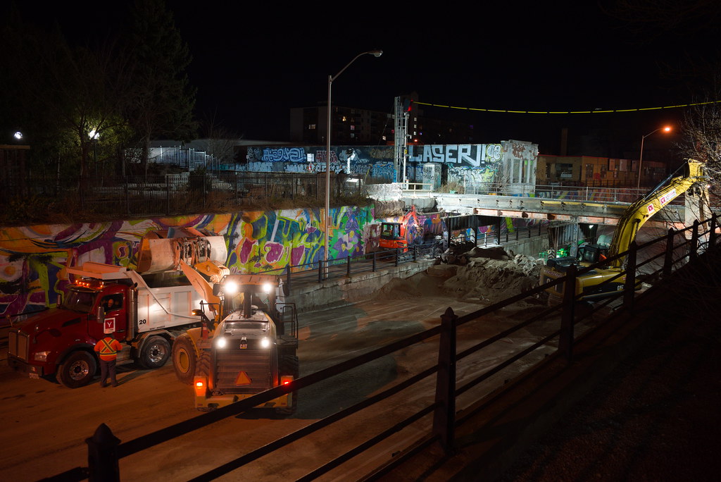
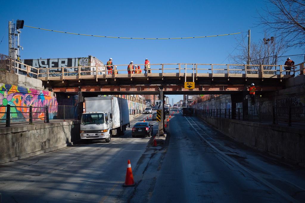
^ I assume the entire bridge is being demolished including the support columns in the median?

I expect so:
Metrolinx said:
The bridge will be demolished in two parts. The first is this weekend (Nov. 28 and 29) with the demolition of the west half of the bridge and then at a future date, when the west half is reconstructed, the east half will be taken down.
 
R0012952.JPG
R0012870.JPG

Saw a bunch of photos and videos from up above in the surrounding buildings via Facebook and Twitter. They seemed to make really quick work of taking the actual bridge span down. I went by around midnight to take some photos. There was also a drone flying around then.....not sure if that was Metrolinx's or someone else's, but maybe they got some good footage. I may post some more photos later.
 
Forgot to get off at Lansdowne to shoot the bridge going to Yonge, but did shoot on my way out today.

You can see the where the centre column and sidewalk ones were removed and where beams had to be cut from the other columns. Sidewalk railing is missing where the bridge was with fencing filling the gap. The same thing will happen when the other bridge is remove. What is the plan for replacing all the existing railing as it not in good shape at this time??

Concrete barrier blocks are being used to block off the RR Row where the bridge was.

Single span beams will replace the existing one like it was done up on Eglinton, Lansdowne and a number of locations. Once the tracks for the new overpass is in operation, the other bridge will be remove like the first one and replace by the new style for track 2.
 
Here's an interesting link...

The CNR’s Over/Under on Bloor Street


1892-TRC-Map.png

Detail of the Bloor-Dundas-Lansdowne area from 1892 Toronto Railway Company route map. As was the case with the 1893 Goad’s Atlas plate reproduced below, the area, while subdivided, had not yet become a hot spot for development. Source: Historical Maps of Toronto.

1893-Plate-41.jpg

1910-Plate-00062.jpg


f1231_it1299.jpg

Bloor Street’s “menace to life and limb” in 1923. Image: City of Toronto Archives, Fonds 1231 Item 1299, May 25, 1923.

f1231_it1327.jpg

Bloor’s “death trap” looking east. Image: City of Toronto Archives, Fonds 1231 Item 1327, April 23, 1923.

1924-05-10-Map-Page-14.png

Northwest Toronto was to be filled with grade separation projects and this map illustrates clearly one of the reasons negotiations between the City, CPR, and CNR spent 15 months in front of the Board of Railway Commissioners. The one I’m interested in is the one on Bloor at Lansdowne. Source: The Globe, May 10, 1924, p. 14.

s0071_it9181.jpg

Creator: Alfred J. Pearson. Date: April 23, 1932. Archival Citation: Fonds 16, Series 71, Item 9181.

Apparently, that entire section of Bloor Street West between Lansdowne Avenue and Dundas Street West had to wait for streetcar service only until the two railway underpasses could be built.

goingthedistance.png


1925-06-02-Nearing-Completion-Page-13.png

To the relief of many the subway was nearing completion by June 1925. Image: The Globe, June 2, 1925, p. 13.
 
Last edited:
Interesting how back in the day they set back the crossing arms so they covered both the road and sidewalk.
 
Single span beams will replace the existing one like it was done up on Eglinton, Lansdowne and a number of locations.
Does this mean that the existing centre support will be permanently removed, or just that it will support a different style of deck construction?
 
^ Great question. I had the same thought. I don't think I've seen any renderings/images of what the new bridge will look like.
 

GO Transit's Barrie Line Over Bloor St.
by Vic Gedris, on Flickr


GO Transit's Barrie Line Over Bloor St.
by Vic Gedris, on Flickr


GO Transit's Barrie Line Over Bloor St.
by Vic Gedris, on Flickr


GO Transit's Barrie Line Over Bloor St.
by Vic Gedris, on Flickr


GO Transit's Barrie Line Over Bloor St.
by Vic Gedris, on Flickr


GO Transit's Barrie Line Over Bloor St.
by Vic Gedris, on Flickr


GO Transit's Barrie Line Over Bloor St.
by Vic Gedris, on Flickr


GO Transit's Barrie Line Over Bloor St.
by Vic Gedris, on Flickr

A few photos from Saturday night and Sunday afternoon. I was too late to catch the actual removal of the bridge span.

@dowlingm - You'll notice all supports for the western part of the bridge were removed, including the centre support. I'm not sure what it will be replaced with, though I expect another centre support will be added (like they did with the new bridge between Railpath and existing bridges). Would be nice to have no centre support though, as it would allow for more room and flexibility with how the road gets used.
 
@dowlingm - You'll notice all supports for the western part of the bridge were removed, including the centre support. I'm not sure what it will be replaced with, though I expect another centre support will be added (like they did with the new bridge between Railpath and existing bridges). Would be nice to have no centre support though, as it would allow for more room and flexibility with how the road gets used.
I got an off-forum dm from someone who doesn't have an account here and they believe that there will be no centre support in future. I find this interesting because I wish center supports had been removed at Coxwell CN bridge during its recent lengthy refurbishment by means of a concurrent span replacement - I used to live in that hood and the 2 lanes to 1 arrangement used to make me quite anxious in winter when driving.
 
I got an off-forum dm from someone who doesn't have an account here and they believe that there will be no centre support in future. I find this interesting because I wish center supports had been removed at Coxwell CN bridge during its recent lengthy refurbishment by means of a concurrent span replacement - I used to live in that hood and the 2 lanes to 1 arrangement used to make me quite anxious in winter when driving.

Wow, that would be amazing if this happens. Thanks for the reply.
 

Back
Top