Where do you figure this would go north of Bloor? If it stays on Dufferin, it would get awfully close to the Spadina Subway.
Why are we afraid of that?

It only gets close to Spadina by the time Dufferin reaches Eglinton. At that point, it would be more egregious to not connect with the Crosstown, than it would to duplicate service.

If we sent it up north of Eglinton on Dufferin, that to me just says that we gotta up-zone all those lands along Dufferin, Yorkdale and Lawrence Heights for some of that delicious density. :p
 
Where do you figure this would go north of Bloor? If it stays on Dufferin, it would get awfully close to the Spadina Subway.

And if it goes to Dundas West, its too close to GO-RER on Kitchener and Barrie.

Honestly when you consider the GO-RER lines, the existing Spadina Subway, there is no need for this portion of the relief line to go north.

That area has tons of transit options already.

It should terminate at Dufferin and Bloor.

We dont HAVE to have every subway line continue to the ends of the earth.
Keele or Dundas West. I think RER-Kitchener should be fine.
 
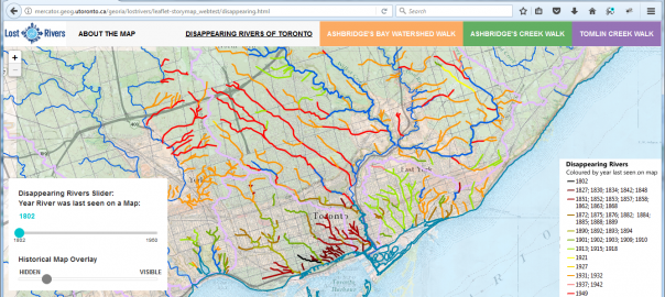
I would like to avoid the buried rivers and streams. They tend to show up every so often, usually after a big rainstorm.

http://mercator.geog.utoronto.ca/georia/lostrivers/leaflet-storymap_webtest/disappearing.html

See link on Lost Rivers of Toronto Web-mapping Pilot Project

Lost-Rivers-OS-site-604x270.png


800px-High_Park_1870s_map.jpg

From
link. (There's a river under Keele Street/Parkside Drive/Bloor Street.)
 

Back
Top