Very cool drone flyover in the latest WT email update; from it you can really get a sense of how far they've come on the excavation for the new river valley.

Digging the new Don River in the Port Lands
Excavation in the first section of the new river valley is over 75% complete. So far, we've removed more than 200,00 cubic metres of material – that's enough to fill more than 80 Olympic swimming pools!

The drone footage above was taken this month. From 0:35-0:46 it shows the naturalized shoreline along the Cherry Street Lakefilling Project and the completed foundations of the future Cherry Street Bridge. At 1:13 you can also see piles of reused soil where parks will line the river valley.

Watch as our Chief Project Officer, David Kusturin, explains our progress so far and what we're planning for the future of the Port Lands.

Screen Shot 2020-10-02 at 9.42.47 AM.png
 
I assume that the three concrete structures on the left are for soil remediation? I remember reading that they're going to be processing it on site using a system whereby they heat it up until the hydrocarbons decompose.
 
Those old ones were so rusted/dilapidated in appearance.............glad to see'em go.

The new ones looked like a wasted opportunity. Would be nice to jazz them up a little like:

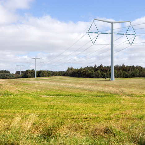
Mind you, ugly pylons doesn't have to be a default either:


I assume that the three concrete structures on the left are for soil remediation? I remember reading that they're going to be processing it on site using a system whereby they heat it up until the hydrocarbons decompose.

Not sure whether those structures are for the system (called STARx - see https://www.esaa.org/wp-content/uploads/2017/10/17-Scholes.pdf) - but it seem to involve a pad with air supply/heating system under the soil to be treated.

EDIT - ah, I think it is - see Image 4 in the PDF:

It looked exactly like those structures in @Jasonzed's pic.

AoD
 
Last edited:
Those old ones were so rusted/dilapidated in appearance.............glad to see'em go.

If I remember correctly all the ones along Commissioners, those rusted ugly pylons, are to be kept. For aesthetic reasons. I don't remember the doc that explained it, but I recall images showing a bioswale/channel down the middle of the road and vines growing on the rusty towers. And a brief explanation about the tower's non-electrical merits. Going from hazy memory here.
 
If I remember correctly all the ones along Commissioners, those rusted ugly pylons, are to be kept. For aesthetic reasons. I don't remember the doc that explained it, but I recall images showing a bioswale/channel down the middle of the road and vines growing on the rusty towers. And a brief explanation about the tower's non-electrical merits. Going from hazy memory here.

It's probably one of those Portlands road design plans (or even the Planning Framework itself). I don't recall new pylons going in at all - just the old ones staying around.

From the Framework, p. 52:

1602475136015.png


Note that's for the pylons along Commissioner's east of the Don Roadway, which are staying put.

The more recent WT DRP presentation on road design doesn't seem to suggest two rows of pylons along Don Roadway either:

1602475580017.png

1602475611365.png


AoD
 
Last edited:
I'd be interested to know what kind of decontamination work had to be done at the old Turtle Island waste disposal site. I worked a job years back where I was in and out of there most days of the week and, needless to say, it was a dump.
 
Why are those large hydro towers still around on those future renderings of Commissioners Road ?o_O
would it not make more sense to bury that crap and build that LRT overtop?
 
Why are those large hydro towers still around on those future renderings of Commissioners Road ?o_O
would it not make more sense to bury that crap and build that LRT overtop?

In a floodplain that is a bad idea. Underground wires can flood out in a storm and be hard to access. Better to keep them high and dry,
 
In a floodplain that is a bad idea. Underground wires can flood out in a storm and be hard to access. Better to keep them high and dry,

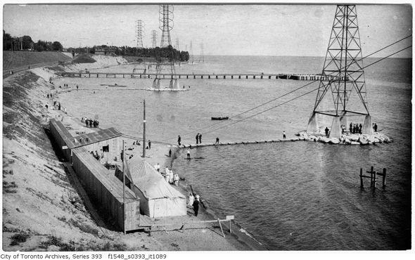
Sunnyside Beach, 1914. Before the Gardiner Expressway buried it. (The original sand was dumped there by the lake currents from eroding the Scarborough bluffs.)

2012417-sunnyside-1914-hydro-f1548_s0393_it1089.jpg


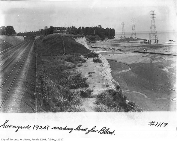
And 1920...
2012417-west-sunnyside-1920-f1244_it1117.jpg

From link
 
Do you guys think the development on this site will be bland glass architecture? Or do you think that mass timber developments as propelled by sidewalk labs will be more sought after? I am aware sidewalks labs pulled away but it'd be interesting to see some variety and excellence in architecture. Also the new Quayside development is having a public engagement section right now.
 
Lower Don Lands was never officially planned to be Sidewalk, though they were clearly gunning to redevelop a larger area than the initial Quayside lot. This is so far away from having any building designs that it's impossible to speculate about what the architectural expression might look like. The block plan has been laid out and the infrastructure and flood protection are being built, but we are years away from even having a specific developer or architect selected.
 

Back
Top