It wasn't all that long ago that there were extensive petrochemical storage works right at Commissioner and Cherry, too.
It was far worse than that even. In their later life, they were part of a 'fly-by-night' operation to turn solvents and used oil sludge into engine fuel (ostensibly a diesel analog) and the MoE was there chronically to address the frequent 'spills' (where pipes and tanks had ruptured, and banned substances were found in the effluent) and cases of other companies (one with "Kleen" in their name) actually burying waste on-site. (They were prosecuted and the company found guilty on multiple counts, but the individuals responsible, IIRC, got off with being slapped with a greasy rag).

Miraculously, the prior soil sample readings that deemed the area too toxic to excavate have themselves been laundered, and the reports purged.

Amazing what the laundering powers are when developers demand action on the soiled past. No problem! Just add the deep cleaning power of PR and renderings of pastoral beauty, and we'll all live happily in Nirvana ever after.

Someone's in for a hell of a shock when the reality of the clean-up actually hits.

Edit to Add: I see this one was too difficult to keep on the hush. The drivers kind of 'spilled the beans' in muted but careless banter at the then Knob Hills Farm restaurant. Some of the undercover Feds got wind of it (won't go any further on that one here) and it got back to their provincial counterparts, and the Province had to act:
PORT LANDS ENVIRONMENTAL RESTORATION UPDATE
Temporary closure of Portions of the Martin Goodman Trail and the East Parking
Lot at Cherry Beach
The Toronto Waterfront Revitalization Corporation (TWRC) and the Toronto Economic
Development Corporation (TEDCO) are now undertaking environmental restoration work
in the area of Cherry Beach as part of an
overall environmental m
anagement strategy for
the Port Lands.
From April - May, 2007, portions of the Martin Goodman Trail, as well as the entire east
parking lot at Cherry Beach, will be closed so the environmental restoration work can
take place.
A temporary fence will be set up in the eastern portion of Cherry Beach, securing the
area south-west of the former Safety Kleen facility at 115 Unwin Avenue to Lake Ontario.
The work is necessary to remove contaminants that are floating on the groundwater.
Proven technologies are being used to address the contamination. This involves digging
trenches and installing a pumping system to pump the contaminated groundwater to a
treatment station on the former Safety
Kleen site where the contaminants will be
screened, filtered, and treated appropriately. The contaminated material will then be
securely shipped to a licensed treatment facility on a regular basis.
A remedial action plan outlining this work has been submitted to the Ontario Ministry of
the Environment (MOE) for review.
During this work period, there will be no access to the beach parking lot east of Cherry
Street and there will be limited access to the waterfront and a portion of the Martin
Goodman Trail (south of Unwin Avenue between Cherry Street and Regatta Road).
Visitors to the Port Lands during this time can refer to the alternate trail routes outlined in
the attached map and provided on the TWRC website (
www.towaterfront.ca
).
Safety Kleen site clean-up
Once the Martin Goodman Trail and east parking lot area is re-opened in May, TEDCO
will immediately start addressing the issues directly on the Safety Kleen site, using
similar technologies. The entire process is likely to take from five to 10 years to
complete.
For more information, please contact Toronto Waterfront Revitalization Corporation at
416-214-1344 or
info@towaterfront.ca
http://www.waterfrontoronto.ca/nbe/...&CACHEID=82426b80-2794-48d1-9be1-bfb3b61fbdb2

Nothing to see here folks! Please, move right along, everything is under control....
 
Last edited:
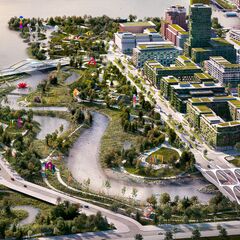
Definitely not what I would like to see happen. The Portlands represents a huge opportunity for Toronto to better itself. Alas, the devil's in the details.

One thing's for sure: the pressure to redevelop the area isn't going to miraculously subside.
 
This exactly illustrates the sleight of hand at work. Yes, this is a serious clean-up issu.....LOOK! Over there! Wonderful shiny, glistening and pure Nirvana! We have pictures to show you...now don't be spoiling it all by being so practical on how the costs of the Don Flood Remediation are going to be multiples of what's claimed. Concentrate on the wonderful vision that we will all live in, and the troubles of the world will just vaporize...

WHEN I see some actual serious beginning to the Don being set free, and some realistic assessment of how freakin' huge and costly this is going to be, I'll start taking the 'visions' seriously. Perhaps. The City is BROKE! How's that teleportation project to the Moon coming along? The Don River itself is still an open sewer, albeit not as bad as it was, but it stinks, only certain fish can live there (and not healthy ones) and pollution still pours into it.

So they clean out the ashtrays, put in a new smoking lounge, and lo and behold, the smoker is cured....of course he still smokes, but the ashtrays are going to be cleaned...

The Feds and Province have announced a degree of funding. Over a $B. Where's the action? How's ESSROC pier coming along there?

And yes, in some cases, it *is* deemed better to leave massive toxin deposits in situ. The cure is worse than the disease in some instances. I could present a litany of cases where that's been deemed best. Interesting you should raise the case of Chernobyl, or infer Fukushima, or some cases in Canada, where 'entombment' was deemed the lesser of the evils.

Some very serious decisions are going to have to be made on how to dig the 'trench' to allow the Don to flow down to Polson and the ship channels. So far, there's been no meaningful *public* dialog on that. (I'm sure there's been some very serious and heated debate behind closed doors)

Other nations doing this had to undertake massive coffer dam construction and very costly measures to contain toxins while digging them out, let alone what to do with them once dug-out.

Ahhh...but we have the dream! Not to worry...

Where's the dialog on what might have to be considered?
[...]
Despite the ability of some remedial technologies to remove substantial amounts of mass, at most complex sites contamination will remain in place at levels above those allowing for unlimited use and unrestricted exposure (see Chapter 4). This chapter discusses the potential technical, legal, economic, and other practical implications of this finding.

First, contamination from these sources must be contained on-site, by using either hydraulic or physical containment systems combined with institutional controls. Indeed, 65 percent of source control RODs from FY 1998–2008 included containment, and institutional controls are used at the vast majority of CERCLA source control remedial actions to enhance and ensure their effectiveness and protectiveness (EPA, 2010a). Because the failure of these systems could create new exposures, potentially responsible parties (PRPs) should weigh the robustness and potential for failure during remedy selection and implementation. Second, our understanding of the risk posed by contaminated groundwater is inherently dynamic. For example, toxicity information is regularly updated, and contaminants that were previously unregulated may become so, changing the drivers for risk assessment and cleanup decisions. In addition, pathways of exposure that were not previously under consideration can be found to be important, such as has happened with the vapor intrusion pathway over the past decade. Consideration of these new factors can change the overall protectiveness of a remedy that leaves contamination in place. Third, residual contamination necessarily reduces the amount of groundwater available for unrestricted use. Treating groundwater for drinking water purposes is very costly and, for some contaminants (e.g., 1,4-dioxane), technically challenging. [...]
https://www.nap.edu/read/14668/chapter/7

It may be the case that years of injected polymers are necessary to solidify the underlying saturated soils so that they can be removed more effectively. Freezing techniques can also be used by the injection of gases under great pressure. You can't just magically dig out a trench and lo and behold, the God of Remediation suddenly appears.

Where's the dialog on this?
 
Last edited:
Oddly enough, they said the same things about West Don Lands/Atartiri - and look at it now. You know, the old adage about the cost of everything and the value of nothing? As to the action - look up the most recent board report on the status of the Essroc project.

And we've been dumping hydrocarbons, PAH, PCBs, heavy metals into the environment in an uncontrolled manner for decades, are we are supposed to be worried about transient exposure now and use that as an excuse for doing nothing because "risk"? Give me a break - this is exactly the kind of BS that government loves because it washes their hands of having to do anything. It didn't kill you then - cleaning it up won't kill you now. St. Lawrence was built on contaminated lands - it ain't Love Canal, and anyone want to do an economic analysis of risk vs. reward in that instance, at what almost 40 years post-development?

The city isn't broke - it's an entirely self-inflicted fiscal condition used for political ends.

AoD
 
Last edited:
St. Lawrence was built on contaminated lands - it ain't Love Canal, and anyone want to do an economic analysis of risk vs. reward in that instance, at what almost 40 years post-development?
I didn't realize they had, or are going to dig a massive trench through there to allow the Don to flow as it should, or did at one time.
upload_2017-10-11_19-15-21.png


upload_2017-10-11_19-14-33.png

http://www.toronto.ca/legdocs/mmis/2008/te/bgrd/backgroundfile-12491.pdf

This is a case where it was deemed, as in many cases, that only the top (often 6 feet) of soil be removed for remediation or disposal (much of it wasn't remediated in the past, it's been dumped in areas often bordering or on the Oak Ridge Moraine and farmland, but that's a whole other issue). What's left under that six feet is left 'in-situ' since no watercourse is planned to flow through it. This is termed "capping", albeit that takes on different dimensions and methods depending on the situation and the nature of the soil.

I think it's safe to presume that the Don's flow will be "below grade"...it embraces the definition of 'flood prevention'.

Here's from the City's legal website on the excavation necessary to establish the new Don riverbed:

upload_2017-10-11_20-33-47.png
[...]
upload_2017-10-11_20-8-58.png

http://www.toronto.ca/legdocs/mmis/2016/ex/bgrd/backgroundfile-97555.pdf

A "unique and complex Project." They're being much more honest than their political masters. Again, I have to emphasize that this must be done. But take off the rose coloured glasses. This is a massive clean-up operation, likely to go way over-budget, and have many nasty surprises. It might take a generation alone of flow over the excavation for contaminant seepage to stabilize, and the plume likely released that will flow westward to also settle.

It's entirely possible that the new watercourse will have to be fenced-off from public access until such time as the back-leaching becomes acceptable. I haven't done an exhaustive search, but have done more than a cursory one to find out if the 'trench' is to be lined, and if so, what with? Clay? Concrete? Prays and Hope? Soil, even rehabilitated, and under mounds of cut stone will still leach and wash-out.
 

Attachments

  • upload_2017-10-11_19-14-33.png
    upload_2017-10-11_19-14-33.png
    18 KB · Views: 396
  • upload_2017-10-11_19-15-21.png
    upload_2017-10-11_19-15-21.png
    30.7 KB · Views: 422
  • upload_2017-10-11_20-8-58.png
    upload_2017-10-11_20-8-58.png
    360.3 KB · Views: 388
  • upload_2017-10-11_20-33-47.png
    upload_2017-10-11_20-33-47.png
    47.6 KB · Views: 412
Last edited:
This was in one of the docs posted back in Spring. I like looking at these kinds of cross-sections. Obviously this is more of a rudimentary overview of building a new river rather than a technical one. But it is still helpful for showing the basic idea.

I'd assume the "barrier wall" to be concrete, but with intermittent gaps to allow groundwater to flow more freely. At these select locations there may be some monitoring, or regular leachate extraction, or combining this with planned subgrade treatment silos? These are just guesses.

don-river-mouth-cross-section-png.106294
 
Excellent post. It's a start on discussing the hydrological engineering necessary for the *officially* stated purpose of this exercise. That cross-section tells a lot, albeit it's more than likely an artist's rendition rather than an engineering illustration. That's a very hardened structure, but I can't see how that can be avoided considering the nature of the challenge. Even though the "armour" is ostensibly for form strength, it appears to also 'cap' underlying contaminants. The "barrier wall" is indicative of a coffer to allow construction of the trench, and to stymie groundwater flow and underlying migration of shifting sand. I foresee problems on that staying stable over time, but again, it's time to address the engineering of this project more than the pretty pictures of Nirvana and butterflies.

Many US EPA Superfund projects I've just been reading up on have not turned out as expected, at all. Rather than detail the technical reasons for not achieving what they had proposed, *financially alone* many projects turned out to be black holes. The Hudson River cleanup is an ongoing disaster of sorts. At least the US is charging guilty parties and assessing costs against them. In the case of the Don River, it's the taxpayer.

Make no mistake, I and many others agree completely that the Don must be 'freed' (with provisos for safety), but this is to appease Nature, not developers. If developers want 'in'...then they can start paying for it, not the taxpayer. Or Nature.

If the taxpayer pays, then it should all be parkland.
 
Last edited:
Make no mistake, I and many others agree completely that the Don must be 'freed' (with provisos for safety), but this is to appease Nature, not developers. If developers want 'in'...then they can start paying for it, not the taxpayer. Or Nature.
If the taxpayer pays, then it should all be parkland.

The whole model of waterfront redevelopment is creation of communities along with public open space - plus it isn't like private developments doesn't generate tax revenues either. The whole "public pays (everything? not really), therefore all open space" is a non-starter - and someone is dreaming in technicolour if they think that it is desirable from a fiscal and city building perspective.

As to the notional cross-sectional diagram - one is making assumptions about what roles the armour and barriers serves - and relating it to contamination on the site. I'd say time for talk is over - let those responsible for project delivery to do their work. It's far more productive than monologues.

Also, re: St. Lawrence - I am talking about the neighbourhood as built 40 years ago, not recent developments that had to satisfy current MOE requirements. Dragging out a report for contemporaenous project missed that point - i.e. risk vs. reward that is almost half a century of usage.

AoD
 
Last edited:
The city isn't broke - it's an entirely self-inflicted fiscal condition used for political ends.

The whole model of waterfront redevelopment is creation of communities along with public open space - plus it isn't like private developments doesn't generate tax revenues either. The whole "public pays (everything? not really), therefore all open space" is a non-starter.
I'll allow others to address that. The term "Developer's Dream" comes to mind.

As to the pic, both 44 and myself commented on how it's an artist's rendition, not an engineering drawing. I don't buy concepts by the cover on the book. I want specs and drawings.

Until the flooding is addressed, there is no "redevelopment".
 
I wonder if removing the soil completely from problem spots (i.e. the river) and replacing it with cleaner soil might be one of the solutions rather than remediation, especially considering that nearly all the soil on site is fill.

They can put it elsewhere in the city and cap it for another artificial hilltop.
 
Also, re: St. Lawrence - I am talking about the neighbourhood as built 40 years ago, not recent developments that had to satisfy current MOE requirements. Dragging out a report for contemporaenous project missed that point - i.e. risk vs. reward that is almost half a century of usage.
OK, so since you're not comparing the contaminant factors, you must be comparing the *societal* ones?

upload_2017-10-11_23-0-33.png

[...]
upload_2017-10-11_23-3-34.png

[...]
upload_2017-10-11_23-5-41.png

http://www.ucalgary.ca/ev/designresearch/projects/2001/CEDRO/cedro/cip_acupp_css/pdf/st_lawrence.pdf

"Dragging out a report for contemporaenous project missed that point - i.e. risk vs. reward that is almost half a century of usage."

You're absolutely correct Alvin. Comparison to the development being planned for the Port Lands is radically different. I could certainly support this model since the taxpayer is footing the bill. The taxpayer should therefore receive the benefit of his/her investment.

That satisfies both Capitalistic and Socialistic bents in one fell swoop. I guess the developers will just have to wait their turn until the financiers (taxpayers) are ready to sell.
 

Attachments

  • upload_2017-10-11_23-0-33.png
    upload_2017-10-11_23-0-33.png
    46.3 KB · Views: 409
  • upload_2017-10-11_23-3-34.png
    upload_2017-10-11_23-3-34.png
    42 KB · Views: 400
  • upload_2017-10-11_23-5-41.png
    upload_2017-10-11_23-5-41.png
    17.8 KB · Views: 361
Last edited:

Back
Top