Honestly I would rather wait until the yonge extension is a go before this happens.

No I think it can go ahead now phased ... how is it different then the world on yonge dev ?
 
Are they connecting this development underground directly to the Finch subway station? When I lived with my parents, there was an underground link to Finch via one of the commercial buildings on the east side of Yonge, just south of Newtonbrook plaza. I wonder if they will connect to that.
 
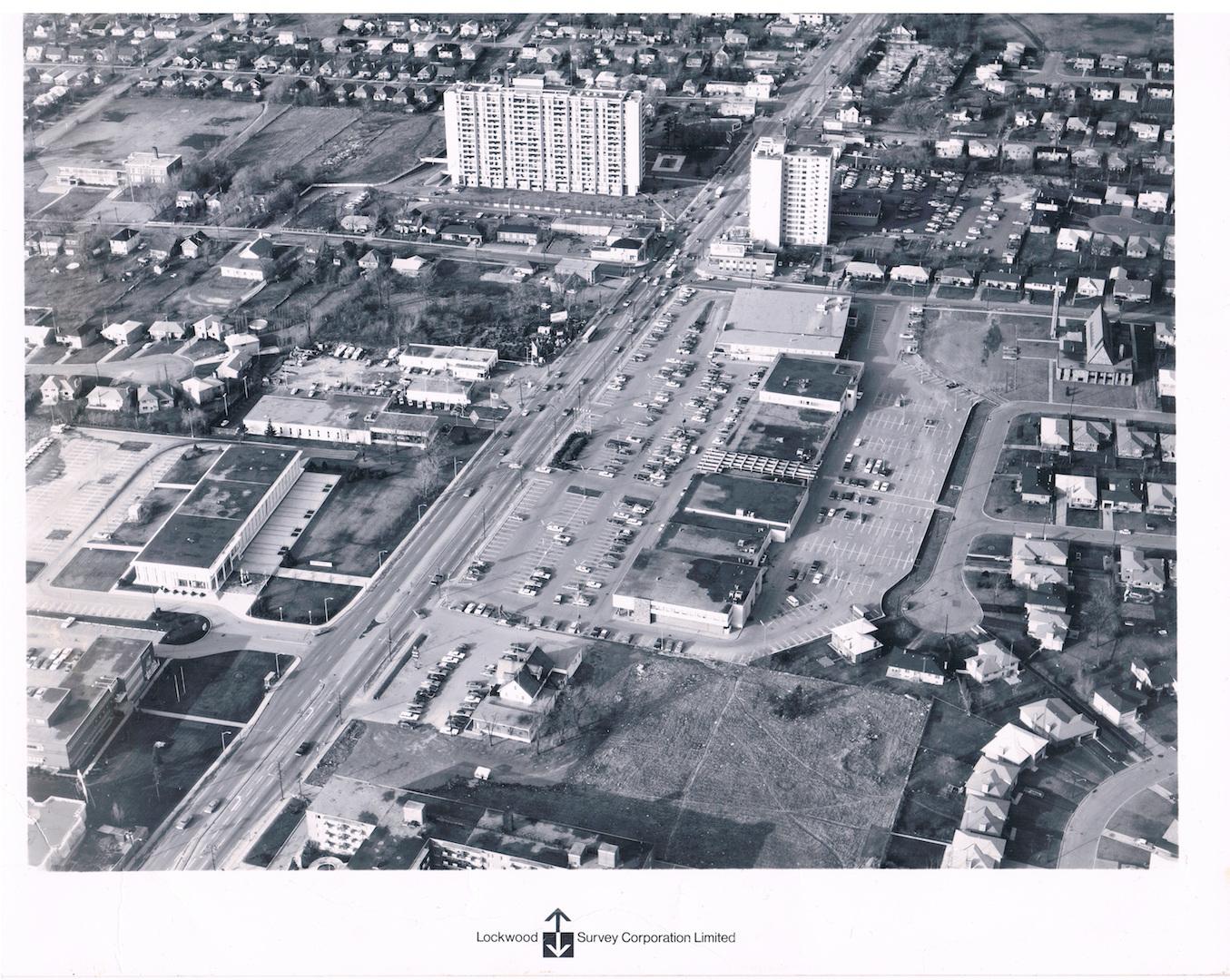
What it looked like in 1968.

attachment.php
 

Attachments

  • Yonge:Cummer1968 copy.jpg
    Yonge:Cummer1968 copy.jpg
    293.2 KB · Views: 1,946
Wow small world. When I lived with my parents in that house I was already at U of T. My parents' house is in the bottom right of that photo.
 
What it looked like in 1968.

attachment.php

Hmmm,... Toronto Archive has lots of photos along Yonge Corridor in North York from 1968,.... I guess Lockwood Survey Corp Ltd did them for TTC as they expanded Yonge Subway line from Eglinton to Finch (opened 1974); subway tail track goes up to Cummer/Drewry.

Anyways,... what it looks like more recently on GoogleEarth.

YongeCummerDrewry_GoogleEarth.jpg
 

Attachments

  • YongeCummerDrewry_GoogleEarth.jpg
    YongeCummerDrewry_GoogleEarth.jpg
    441.3 KB · Views: 1,981
This was the last item dealt with at the July 2015 City Council. Going to the OMB in the fall. Some things confidential at the moment. We should know more soon.

42
 
My old neighbourhood is growing up. I can see my parents home in Sunnyray's photo above.
 
My old neighbourhood is growing up. I can see my parents home in Sunnyray's photo above.

BTW, did anyone catch the error (bug) in that GoogleEarth aerial photo I posted in post# 39? I'm like,.. WTF!?!?!?

yongecummerdrewry_googleearth-jpg.43682
 
Yeah, Bloor St!!! How about try Yonge St. Google!!

Yeap,.... Bingo Benito!

At the bottom left of the GoogleEarth image, Yonge Street is labelled incorrectly as Bloor Street. And now I can't replicate that bug,...
 

Back
Top