Come on. They are not going to stop the Queen car 750 feet short of the subway. And in this plan, do the riders all hop out on the sidewalk at Queen and McCaul, to go down into the tunnel (or the reverse in the evening) or do they continue north to the actual loop, which is another 650 feet or so? So this entrance is now a quarter of a mile. The reason it's OK to have one subway stop on Queen between Carlaw and Yonge is that the streetcar service is staying.
 
After the opening of the DRL South, it might be possible to segment the 501 into two different routes. The western route would run between Long Branch and McCaul Loop (at Queen and McCaul). The eastern route would run on Queen Street between Victoria Park and King Street East, where it would then turn south to follow the current route of the 504 King.
That would leave no stops on the 1.3 km piece of Queen Street East. between Ontario (the eastern secondary entrance to the station at Sherbourne is at Seaton Street near the existing Ontario street stop) and Caroll. Now the River stop on Queen is not far from the River stop on King, and the Sumach stop on Queen isn't too far from the Sumach stop on King (and Sumach station). But that still leaves quite a hole in the Parliament/Sackville area.

I'd think it more likely, that there'd simply be continuous service along Queen Street. At least as long as the subway stops at University. Perhaps worth revisiting if the line is extended further west.
 
Bloor and Yonge used to have streetcars. Now they don't. Since the RL is not going to follow the 501 completely, can we expect that the 501 will not be removed?
There's only about 3 km where the 501 Queen and the DRL would share a route. Queen St is a lot longer than that.
 
Depends on whether Relief Line West continues along Queen St, or dips down to connect with Rail Deck Path and continues on through Liberty Village to Roncesvalles or something.
 
Depends on whether Relief Line West continues along Queen St, or dips down to connect with Rail Deck Path and continues on through Liberty Village to Roncesvalles or something.
Definitely could see that being the case, just as it dipped by the Port Lands (as there is a lot of density in Liberty Village). Unlikely, but curious to see when Relief West is studied they consider going up Dufferin.
 
Or at Liberty Village veer north westward to have a Parkdale stop at Queen and Dufferin, and then a Brockton stop on Landsdowne between Dundas and College to connect with both streetcars and then Dundas West.
 
Depends on whether Relief Line West continues along Queen St, or dips down to connect with Rail Deck Path and continues on through Liberty Village to Roncesvalles or something.

It would make a lot of sense for it to connect with the new Liberty Village GO RER station on King.

1544813524345.png


Dropping to King would allow it to intercept all the major GO lines before they reach Union. According to the Union Station capacity study, this would help offload ~20% of demand to Union station.

From a connectivity point of view, it would also be good to have more intermodal transfers between RER and the DRL. A stop at Roncesvalles and King/Queen would be a useful intermodal hub between the 504, 501, Lakeshore East GO, DRL, and Waterfront West LRT. Careful design could also help connect the King west neighbourhood to the waterfront trail, in the same way that Sumach DRL station is trying to "stitch together" both sides of Eastern avenue, or how East Harbour GO station is trying to connect both sides of the Don River.

1544813443752.png
 
It would make a lot of sense for it to connect with the new Liberty Village GO RER station on King.

View attachment 167385

Dropping to King would allow it to intercept all the major GO lines before they reach Union. According to the Union Station capacity study, this would help offload ~20% of demand to Union station.

...

After dipping down to King Street West and the Liberty Village Station, they could provide local stations at Dufferin-Queen (Parkdale), Dundas-Collage, and Dundas West Station by following the railway.
 
After dipping down to King Street West and the Liberty Village Station, they could provide local stations at Dufferin-Queen (Parkdale), Dundas-Collage, and Dundas West Station by following the railway.

I think it would be a huge mistake for a western RL to not have a station at Roncesvalles/King/Queen/Queensway.
 
... I still think Relief Line West should connect to Jane Station instead to avoid duplicating smart track services. And then Humber Bay can get a better transit connection to downtown.
 
... I still think Relief Line West should connect to Jane Station instead to avoid duplicating smart track services. And then Humber Bay can get a better transit connection to downtown.

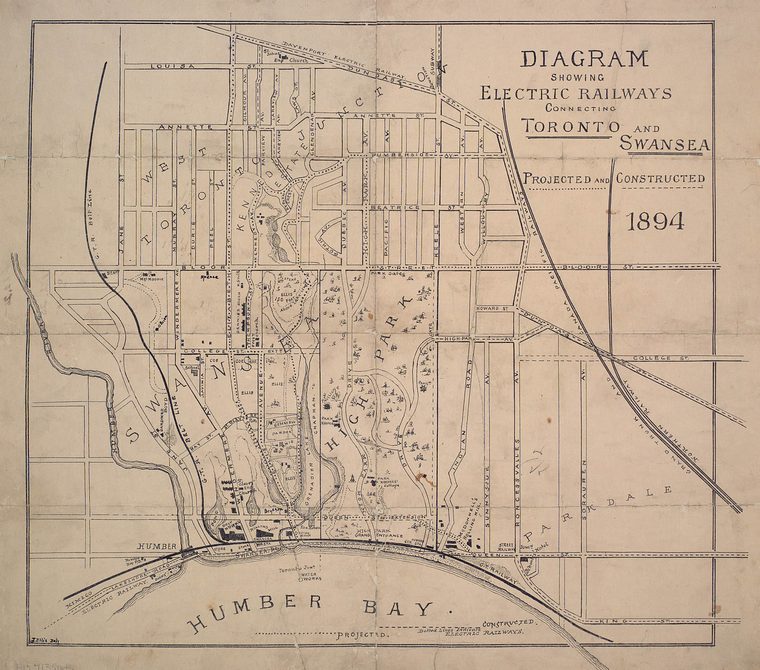
Returning to the days of yesterday?

TBL_map_Swansea_1894.jpg

like before 1910? Where the Belt Line Railway went up paralleling today's South Kingsway? From link.
 
If I were dictator, I would send the RL down to Exhibition Place then up to Dundas West.
If I was a dictator, I'd break Line 1 at Union, and continue the Yonge subway down to Queens Quay, across to the Island airport, then north to Fort York, east to Exhibition Place before turning north through Liberty to the Junction somewhere taking over a GO line - and letting the DRL stay on Queen. Meanwhile the University Line would head for the Portland before heading to Lesliveville and aim for Danforth Road before taking over the GO Stouffille line to Agincourt and beyond.

But if I was a dictator, then this would be the fantasy map thread ...
 
If I were dictator, I would send the RL down to Exhibition Place then up to Dundas West.

Why replicate grounds already covered by the GO network with a subway? Fare integration and more frequent train service would resolve these issues handily. Better to keep the DRL away from the GO corridors, it can intersect it sure, like at East Harbour and Gerrard Square in the east, like having an intermodal hub at Queen and Dufferin. However new grounds can be reached if we keep the alignment straight across Queen to Roncy/Parkside at least. I wouldn't mind seeing a branch of the DRL enter south Etobicoke from there with the mainline going up Keele/Weston to Mt Dennis.
 

Back
Top