ah yes... Pheonix... definitely not Seattle or anything I mean look at all that desert!
pheonix.PNG

Also Genton is the architect of reservoir station not the city, it's in Melbourne
 
And San Giorgio Bridge is an expressway (replacement for the failed Ponte Morandi - part of the A10 motorway), not a precedent as a transit guideway. Do they even know how to do their research? It's nice to aspire to that level of excellence, but it is simply can't be used as a precedent that it wasn't.

AoD
 
Last edited:
Hmm, at first glance, this increases the amount of quality forest that will be impacted.

The old route had a shorter cross-section of forest, and made use of an existing access road, this one does not.

New route can be seen below w/distance line; old route would be just to the right where you see an access road.

View attachment 331578

I'm guessing they couldn't come to an agreement with Hydro One or found it too technically challenging to navigate that route.

(speculation on my part)

That access road follow the hydro pylons visible here in streetview, looking off the Millwood Bridge:

View attachment 331579

The O/L will certainly have to clear wires on an overhead basis at the bottom the valley.

The White Lines below show most of the wires, but a further set exists along the access road in between.

1625101733450.png


This is the elevation of those wires once they reach Millwood:

1625101794239.png


At that point, you would really prefer to cut over before they reach that height, which is what they intend on either routing.


The new routing appears to have them cross Millwood pretty much at the lights at Thorncliffe.

While the previous version would have been slightly to the south (the extreme left of the picture below or just beyond.)

1625101959769.png


I don't perceive clearance to be a big issue ( I could be wrong)

I imagine the issue was where and how to build the columns on which the bridge/guideway will sit.

Again, that is speculative on my part.
 
Last edited:
what would be a better idea would be some kind of follow up to that plan metrolinx did in like 2006 right?

In any case, that map is the definition of "napkin drawing"
like look at this shit wtf is this?
first of all drawing arrows apperently counts as a map?
1625120801219.png

heres the legend:
1625120947262.png

So apperently that lakeshore west dotted line is some kind of "new higher order transit" 100% thats the ontario line
would be quite a waste if it ran like alongside LSW. whats the point ? mimico? other than that i dont see what else it can do that Go transit cant
on a similar note i think i see jane lrt in this map. Any other dead plans yall see in this
 
what would be a better idea would be some kind of follow up to that plan metrolinx did in like 2006 right?

In any case, that map is the definition of "napkin drawing"
like look at this shit wtf is this?
first of all drawing arrows apperently counts as a map?
View attachment 331750
heres the legend: View attachment 331751
So apperently that lakeshore west dotted line is some kind of "new higher order transit" 100% thats the ontario line
would be quite a waste if it ran like alongside LSW. whats the point ? mimico? other than that i dont see what else it can do that Go transit cant
on a similar note i think i see jane lrt in this map. Any other dead plans yall see in this
We've already discussed this in another thread and its likely the Waterfront West LRT, not the Ontario Line, considering the alignment is identical to WWLRT.
 
I thought that OL western extension would follow the GO corridor and via South Kingsway connect to Jane where it would continue north along Jane street.
But this looks like a Jane LRT revival with no connection to the Waterfront!?
Such a strange "napkin drawing"
 
I thought that OL western extension would follow the GO corridor and via South Kingsway connect to Jane where it would continue north along Jane street.
But this looks like a Jane LRT revival with no connection to the Waterfront!?
Such a strange "napkin drawing"
I don't think any of the Jane LRT plans call for a connection to the Waterfront. I'm not sure that it's a revival, given it was never removed from the RTP in the 2018 update, or TTC's long-range plans published since. I'd assume that the current document from the province is an early step in the next RTP update.
 
yeah that might not be the ontario line but the waterfront LRT

who knows, maybe the ontario government wants to go crazy and scrap the waterfront LRT between exhibition and humber bay shores and extend the ontario line... I would be absolutely excited for that.

So apperently that lakeshore west dotted line is some kind of "new higher order transit" 100% thats the ontario line
would be quite a waste if it ran like alongside LSW. whats the point ? mimico? other than that i dont see what else it can do that Go transit cant
on a similar note i think i see jane lrt in this map. Any other dead plans yall see in this

the only go transit spot on lakeshore is long branch GO. in between long branch and downtown, there's really only the 501 and a random mimico station that you have to travel a bit to especially if you're in lakeshore village.

while there isn't much here... it's a very underserved area for transit in general but the big thing would be connecting hurontario LRT to union with another high cadence train as opposed to GO which is only every half an hour (and will eventually be 15 minutes). it's an absolute pain going from lakeshore and islington to anywhere in the region. the only thing the go train really means for anyone in this area is something to look at as they go by off to places not named us.
 
Last edited:
The O/L will certain have to clear wires on an overhead basis at the bottom the valley.

The White Lines below show most of the wires, but a further set exists along the access road in between.

View attachment 331705

This is the elevation of those wires once they reach Millwood:

View attachment 331706

At that point, you would really prefer to cut over before they reach that height, which is what they intend on either routing.


The new routing appears to have them cross Millwood pretty much at the lights at Thorncliffe.

While the previous version would have been slightly to the south (the extreme left of the picture below or just beyond.)

View attachment 331707

I don't perceive clearance to be a big issue ( I could be wrong)

I imagine the issue was where and how to build the columns on which the bridge/guideway will sit.

Again, that is speculative on my part.

Thinking about the terrain in that specific spot.....

There is a gullly (for lack of a better term) parallel with the west side of Millwood - and about where the hydro access road in Google Maps is shown. (It has been also completely revegated since then, and it is almost impossible to identify at ground level.)

The move of the alignment slightly west may have been for ease of construction, with more high land available to build the piers on. Or perhaps, better soil conditions.

Dan
 
Last edited:

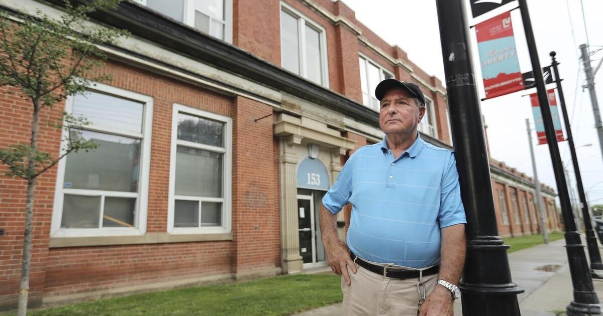
"Millionaire businessman vows not to give up Dufferin Street property for Ontario Line station without a fight"​

But his lawyer Michael Foderick doesn’t think Dominelli has many options.

“When there’s an expropriating authority — sometimes you can talk them out of it. Do they need all of this land, or just part of it? Or if the land is appraised at a high price, they sometimes will back off.
 

Back
Top