Dan416
Senior Member
I’m honestly scared to think of what names metrolinx comes up with for the Ontario based on the names they came up with on the Eglinton line
Well thankfully there are only 3 that need names, Science Centre, Spadina/Queen, and King/Bathurst; the rest are accounted for.I’m honestly scared to think of what names metrolinx comes up with for the Ontario based on the names they came up with on the Eglinton line
Though it isn't like there wasn't much less asphalt desert in the days of the old Exhibition Loop--or rather, it wasn't the moving of the loop in and of itself, but the demolition of such things as the Bulova Tower and the Flyer and Exhibition Stadium that *really* generated the desert as we know it today.
In any event, those arriving by way of the Dufferin Loop get (and got) the better deal.
Well thankfully there are only 3 that need names, Science Centre, Spadina/Queen, and King/Bathurst; the rest are accounted for.


By "Priority Travel Route", who will get the "priority"? Will it be the single-occupant motor vehicle, as it is currently? Or will it be public transit? Will the "priority" result in bunching of the streetcars and buses?April 13, 2023
Today, Deputy Mayor Jennifer McKelvie (Scarborough-Rouge Park) announced steps the City of Toronto is taking to balance critical transit construction with the needs of people and businesses who use Toronto’s roads.
To prepare for Metrolinx’s construction of an Ontario Line connection to the TTC’s Queen Station beginning this spring, the City is working closely with Metrolinx, contractors and the TTC to ensure that traffic congestion and construction impacts are reduced as much as possible by holistically reviewing capital construction plans, upcoming road restrictions and accessibility around all construction zones downtown.
The City will be launching Priority Travel Routes around Ontario Line construction zones that will be kept clear of as many road restrictions as possible – including non-emergency utility work – to ensure that there are alternative and parallel routes for people to get around.
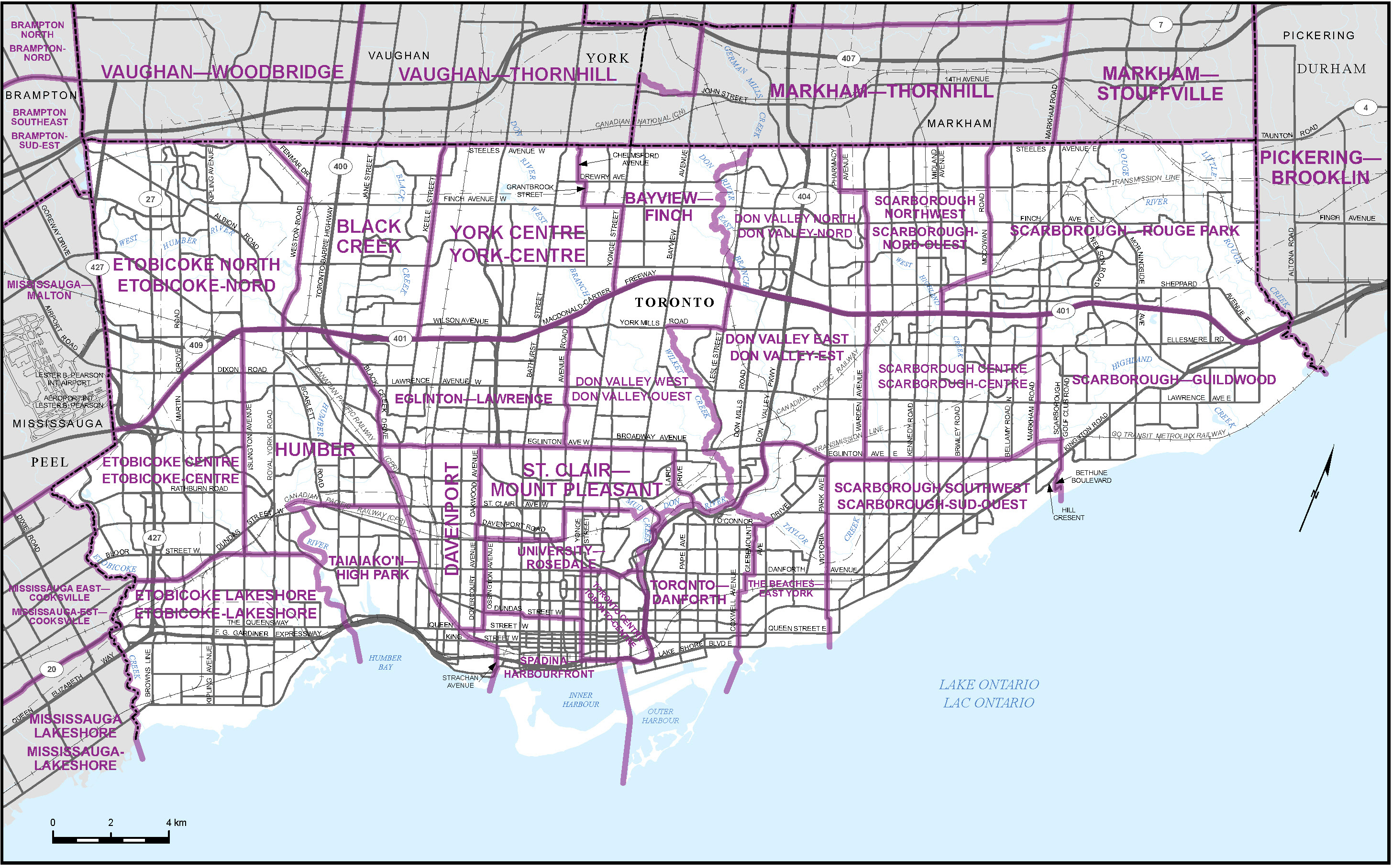
The City recognizes the vital need for the unprecedented transit expansion underway alongside the need to keep people – pedestrians, cyclists, transit riders, and drivers – moving within Toronto. Once completed, the Ontario Line will make travel within Toronto faster and easier by providing a 15-station subway line running from Exhibition Place, through downtown, to the Ontario Science Centre. The new subway line will also offer significant crowding relief within Toronto’s existing transit network.
Starting Monday, May 1, Dundas Street, from Jarvis Street to Bathurst Street, will be the first Priority Travel Route as Ontario Line construction will fully close Queen Street from Victoria Street to Yonge Street and Yonge Street to Bay Street. Until summer 2024, this stretch of Dundas Street will only have emergency work; on-street parking will be restricted and CaféTO Curb Lane cafes will not be installed to keep the roadway as clear of restrictions as possible.
More Priority Travel Routes will be identified as Ontario Line construction progresses. To keep traffic moving along these routes, some existing permits and bylaws may be cancelled or amended. Where necessary, these may include not installing CaféTO curb lane cafés, changes to on-street parking and deferring requested road closures for events.
Other ways the City is preparing for Ontario Line construction include actively assessing all construction permit applications and related Traffic Management Plans to minimize the overall disruption caused by construction. Staff will work to ensure plans promote the safety of people travelling in the area; reduce noise and parking impacts as much as possible; modify traffic signals to allow for the efficient flow of traffic; deploy paid duty Police officers and Traffic Agents to regulate and direct traffic; maintain access to properties; and identify key site access points and haul routes for construction vehicles.
City of Toronto Traffic Agents will be deployed to key intersections during the morning and afternoon peak traffic periods to actively manage the movement of all road users, reduce delays and improve safety. Traffic Agents will be placed where they are needed most based on evolving traffic demands. More about the Traffic Agents Program is available on the City’s Traffic Agents webpage.
Construction Hubs continue to play an important role in logistical planning of the right-of-way. The Hubs review Construction Management Plans, connect travellers with real-time information, collaborate with enforcement officers and communicate impacts and changes to businesses and communities in the neighbourhood. More about Construction Hubs is available on the City’s Construction Hub webpage.
All these traffic management strategies are supported by the City’s MoveTO Congestion Management Action Plan, which is managing congestion and building a more resilient, modern and safe transportation system. The full interim MoveTO report.
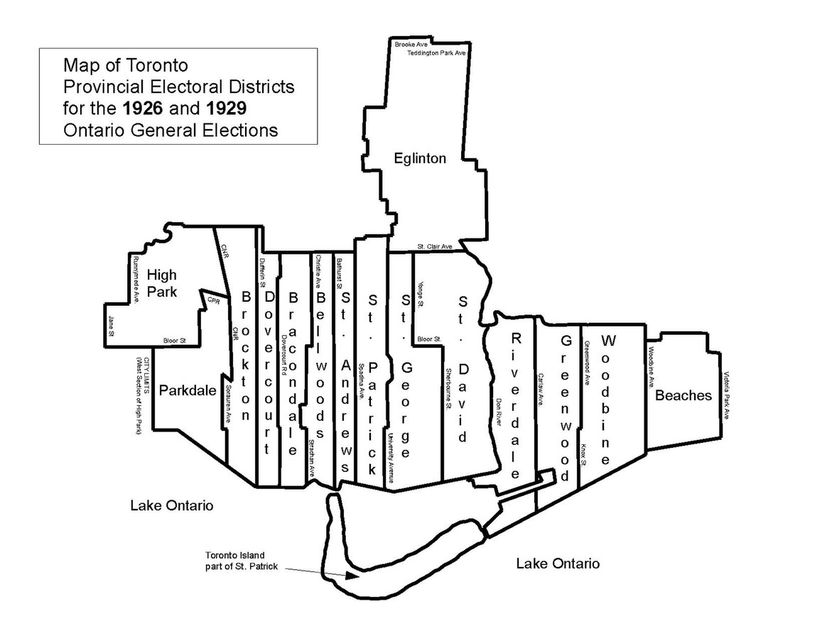
St Andrew Station and St. Patrick Station were named after old Toronto ward names. St. George Station was named at St. George Street.
It's easy to do in 5 years when labor/safety laws were a single page, and you could use cut and cover
And labour was cheap as well. Try finishing Empire State building in one year now.It's easy to do in 5 years when labor/safety laws were a single page, and you could use cut and cover
Imagine how much cheaper the fucking elevators would have been vs retrofittingAnd labour was cheap as well. Try finishing Empire State building in one year now.
i think most people living in Toronto at the time understood the 5 year pain of having their main street torn up was for everyone’s benefit.
In the 1950's, on the subway there were no elevators and only occasionally escalators going "up" only. Only pay phones. No CCTV's.Imagine how much cheaper the fucking elevators would have been vs retrofitting