Gather round the campfire, children and I will tell the tale of this area. Open up google maps and follow along:
Originally Albion Road crossed the Humber on the current alignment of Flindon Road. Wilson Avenue ended at Weston in an uncomplicated T-intersection.
In the 1950s, Albion Road was re-aligned to run to the south along a new bridge and a new street, Walsh Avenue, was built as a connector between Albion and Wilson. It was now possible to travel from Wilson to Albion without jogging on Weston.
A short new street called Blondin Avenue was built between Wilson and Weston, paralleling Walsh. Weston Rd. trolley busses turned around here at a loop called Blondin Loop. It was around this time that the area changed from rural in character, to suburban.
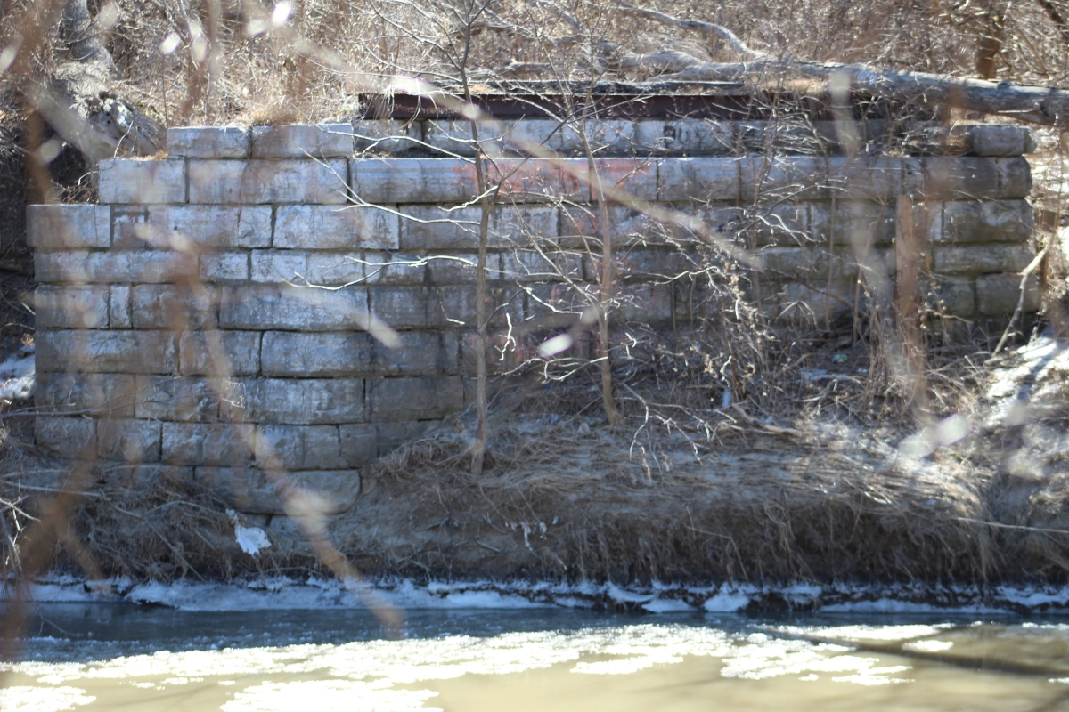
By around 1960, Flindon Road bridge was demolished, leaving Albion as the only crossing over the Humber in the area. The remains of this bridge are still visible today to those who walk to the end of Flindon Road.
In the early 60s, obnoxious slip lanes were constructed on three sides of the Albion/Walsh/Weston intersection, foreshadowing what was to come.
In the mid 1960s, the rail line to the east was grade-separated in the form of a flyunder for Wilson. This necessitated cutting off Ann Arbour Rd. from Wilson, which was the only way to access the neighbourhood to the north from Wilson.
Around this time, Highway 401 was widened to it's present width. The new highway ramps necessitated the destruction of Wilson between Blondin and Albion, along with the demolition of a few properties.
Around this time the obnoxious slip lanes were joined by an obnoxious jughandle on the northwest corner.
Four houses were demolished in the late 1960s to create a new road, Matthews Gate, to restore access to the neighbourhood to the north.
In the early 1970s, two major changes happened in the area. The first was the widening of Albion Road. Now, long ago a westward extension of Wilson had been planned. It would have crossed Weston, turned north paralleling Albion, then turned west along Berry Creek and met up with Bergamot Avenue. This would have allowed traffic from Wilson to continue west on Rexdale Blvd, and explains why Bergamot has such a wide right of way for a residential street. Ultimately it didn't happen due to pressure from local residents who didn't want the Berry Creek ravine destroyed. However, the bridge from this plan was eventually built, and used to accommodate a widened Albion Road. Albion would now split. Westbound traffic would continue over the existing bridge, and Eastbound traffic would dip south and travel over the new bridge. if you've ever wondered why Albion crosses the river at this angle, it's because the bridge wasn't planned for Albion at all, it was planned for a Wilson extension!
The second major change was the construction of the flyover monstrosity at the Albion/Walsh/Weston intersection, which exists to this day. I could write a fucking essay about how much I hate this thing. Anyways...
A candidate for Toronto's shortest street was built as an extension of Matthews Gate called Kelvin Avenue. This allowed Traffic from Wilson/Walsh to access the now orphaned western stub of Wilson.
In the late 70s, Blondin Ave was turned into a cul-de-sac to prevent traffic on Weston heading to Wilson from cutting through the street.
Around 1990 the entire block of homes between Walsh and highway 401 was razed to facilitate a new development, which we know never came. The lot has sat vacant ever since.
At some point, what was left of Blondin was either torn up or became overgrown. Toronto's aerial street photograph archive ends in 1992, and google maps street view begins in 2007, so I don't know when. The utility poles that once served the former street were removed between the 2009 and 2011 street views.
Around 2000, the eastbound Albion bridge was widened to accommodate all traffic lanes and the old westbound bridge was turned into a pedestrian path. For those keeping track, that means there have been four different arrangements of Albion crossing the Humber since the 1950s!
So yeah, that's the interesting and kind of depressing story of this intersection. Hopefully this new development is nice and brings something good to the area, which currently really sucks.
And I'd do unspeakable things to get that highway-style interchange ripped up.