News   GLOBAL  |  Apr 02, 2020
 8.5K     0 
News   GLOBAL  |  Apr 01, 2020
 39K     0 
News   GLOBAL  |  Apr 01, 2020
 4.7K     0 

I remember seeing people fishing from the river. I was curious, so I looked on the City of Edmonton website:

Water Quality and Fish​

Alberta Health advises that you should not eat fish from the North Saskatchewan River more than once a week, and pregnant women should not consume the fish at all.

Most mercury accumulation in Alberta fish comes from natural sources.
 
That is such a cool project. Would be absolutely fantastic to get something like this in Edmonton! Would love to see the river and river valley used and enjoyed on a level such as this.

It'd be cool for we could do something like this, but it'd be quite hard to maintain in our river compared to Calgary's for a few reasons. We can see the main reason right now in the winter, with the massive slabs of ice that crash, fold and break on the shoreline in our wild freeze-thaw cycle, inevitably damaging any type of wave machines or barriers built down there. I guess they could taken out for the winter but that'd probably be pretty tedious...
 
what is the water quality in the Saskatchewan River at Edmonton compared to Calgary? Does all the heavy industry upstream (Genesee, Drayton Valley, etc) affect the quality for swimming? I know you're not supposed to eat fish out of the river but I've swam in it closer to DV
Somewhat anecdotal, but my friend competes in triathlon at a high level and says plenty of people in that community train in the river. Locally, he says water quality varies greatly depending on which part of the river you swim in within the city.
 
The NS can be quite unpredictable. Last year was a good example. There are regular fluctuations of a meter or more every day. This is from the 2 hydro dams out west. I've have been using the river pretty much every summer since 1978. The river is quite silty most of the time. Very limited industrial effluent. Even dairy and cattle operations have tight restrictions up stream. No raw sewage since treatment is good upstream as well. The river is quite clean. When the river does go above 7 meters the silt and logs coming down are quite destructive. It multiplies in damage level ever meter increased.
 
there's natural sand bars and beaches near Fort Edmonton Park, Terwillegar, Under the Walterdale Bridge, and Accidental Beach. There's smaller sand areas everywhere. Honestly my favourites are by Oleskiw and under the walterdale, I saw people suntanning and swimming there all summer.
I plan on exploring a lot of those other sand areas of the river that you mentioned. I feel (like some here), that the natural sand bars and beach areas should be left (more or less) natural, with some improvements that simply adapt/conform with what nature will have. I do feel that maintaining/adding berms to Accidental & Walterdale is essential to build a better "natural" beach, but need some further research in that regard. If/when the beach is washed out one year, no biggie.
Next, what types of amenities can we add to said areas that are seasonal/removable by design; piers, docks, party boats, bumper boats, Lifeguard chair, zipline across the river, Bungie jump, water taxi's, equipment rentals, change rooms, bathrooms, waterslides, waterfalls, play structures, speakers corner, FIRE PITS, BBQ stands, picnic tables, firewood sales so people don't burn the picnic tables, EPS kiosk, alcohol permitted, outdoor "walk-in/roll-in" night theatre, restaurant/retail, fitness, what what what?
Then, I'll add that an area downtown could be transformed into a permanent beach (not in a flood plain), yup, away from our temperamental river - but right there. Many many examples across NA, I posted some before. What could Edmonton create that's genuinely engaging, supper amenity-rich, that ties in with other significant projects to provide the synergy we've lacked for far too long.

^ The family and I found the water quality really good this summer, crystal clear when wading closer to shore, and the same for sand. ^^ But for sure water would vary from location/conditions.
We frequented Walterdale & Accidental for a little swimming and lots of wading/beaching often. This coming season we plan on adding kayaking or canoeing to explore further.

Adding some shots from Walterdale from yesterday. (I know this is the Accidental thread)
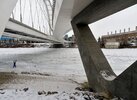
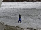
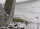
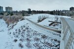
Markers for the 100year floods, amazing the extent when comparing the potential water level to the SUP or any infrastructure, such as the low rungs of the wood staircase in the first pic. Next pic, all those people would hypothetically be a couple of metres underwater. The next couple of pics 🐧🌊 - people still play down by the beach (or maybe he's frozen!) Threw in the promotional shot of some local's recent art installations. ) :
2021-01-02 169.JPG

2021-01-02 203.JPG2021-01-02 160.JPG2021-01-02 173.JPG2021-01-02 175.JPG2021-01-02 167.JPG2021-01-02 235.JPG2021-01-02 169.JPG

Lastly, the Urban Planning Committee's visions being discussed in another thread, Touch da Water - concerning daylighting Millcreek ravine near Connors and the Groat ravine, this bit kind of reminds me of Calgary's river surfing project being discussed above. Could more swim, surf, paddle, fish, etc, options be considered for our creeks? The areas of the creeks not concerned with the floodplains nor the Federal waterways acts? It all could flow together so nicely.
 
That 1986 mark is deceiving. The Spruce tree on the right side at the top of the slope was the high water mark. It rose that much in about 24hrs.
ERC_7336.JPG


As for amenities. The city installed a series of docks along the river a few years ago. They are supposed to ride up and down with the river. They have had the same issue that the rowing club has. They tend to gather floating logs. In the photo you can see the damage to the willows from the ice
 
hmm, I bet if the river keeps its cool this summer the beach could last for one last hurrah during Folk Fest!
that being said, the accesses are being reseeded for bank restoration, so getting down there is tricky and/or illegal now.
 
A new beach is forming below the Ft Ed foot bridge. Noticed it on Friday. It may be sections of the island just upstream migrating down. The last high water cut a new channel through it.
 

Back
Top