News   GLOBAL  |  Apr 02, 2020
 9.5K     0 
News   GLOBAL  |  Apr 01, 2020
 40K     0 
News   GLOBAL  |  Apr 01, 2020
 5.4K     0 

A different perspective posted on the TRCA's Facebook page:

View attachment 456741


That picture was posted in support of an upcoming event which some of you may be interested in:


View attachment 456743
View attachment 456744

Event Registration Link: https://us02web.zoom.us/webinar/register/WN_rTl_PHtRSjuR2kKc2MKrig

Don't know if any of you took in this presentation, which was recorded and can be streamed at your leisure, but the components that were on this project and the outfall project were really well put together, and have lots of great pics, I may take some time to extract a few later. Though if someone else would like to do so first, go for it!

Here's the link:


Total run time is 2 hours, covering 3 projects.
 
Pffft. LOL

Do I not post enough material? Some could have grabbed some stuff..........

But here ya go, cause I'm nice that way.......

1679767185181.png


1679767242936.png


1679767390835.png


1679767282697.png


1679767448366.png
 
My snippets of the two previously posted videos, as @Northern Light says, “for the click adverse”.
They had 100% completed 12 of the 50 risers to the main shaft to date as of end of February.
Very cool and mind boggling engineering and construction while presented so seemingly simple. Do drama TV. Edit. No drama TV.

ECA4EF5B-2317-41EA-9111-4CC7F8C196EF.jpeg


A0D2162A-1978-4047-9DCA-A814C7A0BE0A.jpeg


FC47E06C-67FE-478B-AC84-A7A56AAA4D16.jpeg


40841635-1E65-4C69-9793-CDCB258AB632.jpeg


80D07702-E5DD-44B4-9F04-AB373A3C25B2.jpeg


6E64904D-15AF-4457-8703-61D7B1B4FF41.jpeg


FBC006E6-5EC2-4F8D-952C-16BBEF0D006A.jpeg


C3F94B39-199E-4DAF-ACE9-654F3EF5C2B1.jpeg


13B9A5FF-760C-4A86-9305-7C62E235E83C.jpeg


87D1D192-176A-4E26-80FD-E22383249A09.jpeg


9F20E7CC-3EFB-4F10-8075-3679A093EF50.jpeg


B02551E3-9468-481B-8188-C06E5D8E43E8.jpeg


7600FBE2-2BD4-4BD4-87C9-3E48AEC82839.jpeg


CB938E2E-B55D-4E72-8C88-121C0A2638CE.jpeg


EC75B3C7-0E03-4E57-BF11-5E90AB7B9E39.jpeg
 
Last edited:
Pictures from the same two vidoes.

Divers will open the valve to fill the riser pipe and main shaft on completion of all the tunnel work.
They will add a concrete cap over top and a diffuser,
3FF86A2F-7E3B-4CBF-9E25-CE8E07D5D595.jpeg


Hopefully this opening lines up with the riser. I don’t know how they do it! 3.5 km away. I have trouble hanging a picture.
2AA74EE2-1E8D-4AA7-9184-E56F8E3CCDBA.jpeg


Drain the enclosed pipe.
27A3E29F-52CC-498F-88F1-5A46DE1F5D98.jpeg


If no green/yellow dye, start running!
20D442AA-6C41-4EAC-8C3E-E5904D4D8E79.jpeg


Pipe should be empty now.
C6545FE5-DB5C-41CC-B533-0A0EE1E6E432.jpeg


43B3E556-062A-4F98-8769-D80A18E2194E.jpeg


These pipes will be trimmed.
34916F9E-06A6-4E5C-92D5-119C4CC797D7.jpeg


5D4E3ED5-A093-4F9F-906C-923602C3752A.jpeg


A523EBFB-A019-4086-BB08-D68C9ACB2B7C.jpeg


3B499F0E-22E5-4231-AB78-DEB088092100.jpeg
 
There is an update to thisin: https://www.toronto.ca/legdocs/mmis/2023/ie/bgrd/backgroundfile-236773.pdf Coming to Infrastructure Committee next week.

The Project involves construction of a 22 km tunnel system (three integrated tunnels) running along the Lower Don River, Taylor-Massey Creek and Toronto's Inner Harbour, 12 wet weather flow storage shafts, 27 connection points, and a real-time control system. Additionally, three CSO offline storage tanks will be constructed to reduce sewer overflows from remote outfall locations that are far away from the tunnel system alignment. Four offline storage tanks will be constructed to relieve the overloaded Don River Sanitary Trunk Sewer system during heavy rainfall storms. Also included is a multi-purpose Integrated Pumping Station (“IPS”) at the Ashbridges Bay Treatment Plant that will convey flows from the tunnel system to a new High Rate Treatment (“HRT”) Facility. The IPS wet weather flow pumping is a significant component of the DR&CW project. The IPS project is intended to also address several additional needs. In particular, the Pumping station will serve to replace the two existing wastewater pump stations (‘M’ and ‘T’ Buildings) north of Lakeshore Boulevard, capture flows from four CSOs that currently discharge into the Coatsworth Cut, and provide standby power to allow both the CSO flows and the wastewater flows to continue to be conveyed during any power outages. The HRT Facility is to be constructed on the Landform being constructed on the water lot adjacent to the Ashbridges Bay Treatment Plant and will discharge to the new Ashbridges Bay Treatment plant outfall that is anticipated to be substantially complete by the end 2024.

and

(i) Ashbridges Bay Landform The Ashbridges Bay Landform Project is a joint initiative between the City and TRCA. The Ashbridges Bay Erosion and Sediment Control Class Environmental Assessment was completed in 2014. The EA recommended a new landform project immediately south of the Ashbridges Bay Treatment Plant (ABTP). As the City’s most significant shoreline management project currently under construction, the project will: • provide erosion and sediment control to improve passage for boats, eliminating the need for regular dredging in the Coatsworth Cut area of Ashbridges Bay • be the site of the high-rate treatment facility and a stormwater treatment wetland The high-rate treatment facility will provide treatment of CSOs intercepted by the integrated system of tunnels being constructed through the Don River and Central Waterfront Project. Construction of the high-rate treatment facility is scheduled to start in 2029 pending the results of engineering studies that will establish design criteria. In addition to the landform, the EA also recommended erosion and sediment control breakwaters (to reduce dredging needs at the mouth of Ashbridges Bay) and a SWM wetland facility. A subsequent planning assessment of lake elevations determined that implementation of SWM wetland facility is not feasible. Instead of connecting to the proposed wetland, the 4 outfalls at the head of Ashbridges Bay will be connected to the Don River and Central Waterfront tunnel system. Recent and upcoming project construction milestones are provided below: • Construction of the landform commenced in 2019 • The landform perimeter and east breakwater construction was substantially complete in December 2022, and • Work on the central breakwater structure is ongoing (70% complete), targeted for completion in 2024. • Continued landform grading and soil addition, planting, creation of cobble stone beaches and closing of headland will continue into 2024.
 
I haven’t noticed any equipment in this area in awhile.
_N8A1703.jpeg

I wonder if they are onto the stage of dealing with the caps and nozzles yet.
 
Was out on the Spit last week and then looked up the web and came across these updates from TRCA. - From December 2023. https://trca.ca/conservation/infras...-bay-erosion-sediment-control-project/#status

Toronto and Region Conservation Authority (TRCA) completed the perimeter of the Landform structure, effectively isolating it from Lake Ontario, in June 2021.

Since this time, construction crews have been filling the three confinement cells with shale material generated from three City of Toronto tunnel projects and approved third-party sites. Cell filling is now substantially complete with crews currently working on surfacing the cells to address any settling that occurred during compaction and to bring the cells to the final grade in preparation for topsoil placement.


Aerial view of entire landform including completed headlands and cell filling. Source: TRCA, May 08, 2023.

Concurrently with the cell filling operations, crews have been installing erosion control structures along the landform, in the form of armourstone headlands and cobble beaches, to provide long-term shoreline protection.

To date, four headlands have been constructed along the south shoreline of the landform and construction of the final headland at the southwest limit of the landform is currently underway.

In addition to the headlands, an armourstone and rip rap revetment was constructed along the eastern side of the landform which was completed in December 2022.

In July 2023, crews commenced cobble placement on the first of four beaches which will be installed between the headlands. Placement of cobble stone in the first cobble beach has been halted and will be completed in the spring when calmer lake conditions allow for fine placement of material. In the meantime, crews have moved on to the second cobble beach and began placing cobble stone in November of 2023.


Active construction on the Western Headland. Source: TRCA, November 29, 2023.


Completed construction of Central East Headland. Source: TRCA July 27, 2023.

Cobble stone placement in the first cobble beach. Source: TRCA, November 29, 2023.

Progress on the two breakwater structures also continues. The East Breakwater located on the southwest portion off Ashbridges Bay Park was substantially completed in December 2020. Construction of the Central Breakwater commenced in January 2021 and will continue through in the new year.


Construction progress of the Central Breakwater. Source: TRCA, August 02, 2023.

Construction of habitat components commenced with the installation of a sunken tree field along the Central Breakwater. Additional habitat features along the Landform and Central Breakwater will be constructed in 2025. These habitat features of the landform will bolster the ecological functions of the area through the addition of both land and aquatic natural habitat, and include:

  • 1,790 m2 of restored nearshore habitat.
  • 3,690 m2 artificial reef developed to ensure that there will be a net increase in restored fish habitat
Additional benefits to the fisheries include a reduction of wave energy which will make the area near the reef more hospitable to the fish community.


Excavator placing trees in the sunken tree field habitat component. Source: TRCA, November 28, 2023.

 
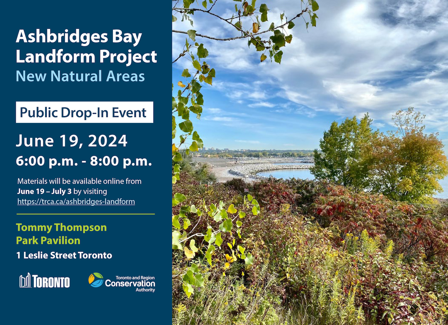
The meeting on this project was yesterday and the slides are now up:


From the above:

1718923990198.png


1718924083543.png


1718924198249.png


Direct Link to survey:

 
The meeting on this project was yesterday and the slides are now up:


From the above:

View attachment 574165

View attachment 574166

View attachment 574167

Direct Link to survey:

And here I thought the whole perimeter was going to be public access. That's a little disappointing...guess I have some updates to make to my datasets.
 
And here I thought the whole perimeter was going to be public access. That's a little disappointing...guess I have some updates to make to my datasets.
No, the public area is a (welcome) added benefit of the other parts of this huge project. Of course, I too would have liked more publicly accessible land but....

BTW The TRCA site appears to be having difficulties today - too many UTers trying to read full document?
 

Back
Top