A nice idea, Crowchild really is an impermeable barrier that needs to transition to less of one over time.

I still wish they put the BRT station on the south side of the interchange so the bus stop aligns with the existing density, retail and growth potential. I don't recall the rationale of why the north side was chosen back in 2018.

EDIT - actually on this, why did they put the BRT stop on the ramps at all? None of the other Crowchild stops are on ramps.
The plan for the Max Yellow is to have it run through Currie Barracks via Quesnay Wood Drive, which includes a new connection up to 33rd Avenue via a new roundabout intersection. So the bus will not be travelling on Crowchild between 50th Ave and 33rd Ave long term, which means the stop needs to be on the north side. At least that was the plan when the Currie Barracks outline plan was approved (2016ish) and the Max Yellow BRT implementation happened. Currie certainly hasn't built out as quickly as anticipated.
 
The plan for the Max Yellow is to have it run through Currie Barracks via Quesnay Wood Drive, which includes a new connection up to 33rd Avenue via a new roundabout intersection. So the bus will not be travelling on Crowchild between 50th Ave and 33rd Ave long term, which means the stop needs to be on the north side. At least that was the plan when the Currie Barracks outline plan was approved (2016ish) and the Max Yellow BRT implementation happened. Currie certainly hasn't built out as quickly as anticipated.
Ah that makes sense now, thanks!
 
@MichaelS Do you have a link to more info on that? I am curious
Unfortunately can't seem to find anything definitive about it. I just know from being aware of the plans when they were being prepared by Canada Lands, in conjunction with discussions with Calgary Transit at the time. The idea was that the BRT would be in the heart of the major node that Currie Barracks is planned to be (with the stop located at Quesnaywood Drive and Flanders AVenue), but that the bus would continue up/down Quesnaywood drive and utilize new roundabout to be constructed where the current entrance road into Richmond Green is with 33rd Avenue, and that road connecting with (or rather becoming the extension of) Quesnaywood Drive:
 
Cap or Cover Crowchild!
If I were a multi billionaire I would offer to pay half the costs so I could see Southwest Calgary evolve without Crowchild cutting it in half.
With Crowchild is covered, I would turn the previous footprint into a transit, cycling only pathway with the development mixed in.

We can dream can’t we 😊
 
If I were a multi billionaire I would offer to pay half the costs so I could see Southwest Calgary evolve without Crowchild cutting it in half.
With Crowchild is covered, I would turn the previous footprint into a transit, cycling only pathway with the development mixed in.

We can dream can’t we 😊
Crowdfunding!
 
Crowdfunding!
1700266419540.jpeg
 
If converting 33rd into something decent doesn't work out, another short term nice to have a pedestrian bridge that bypasses the 33rd ave interchange and widening the pathway build that connects connects from the BRT station to 33rd.

View attachment 520910
Interesting. There is a pedestrian overpass south of the interchange. I think it was put in place to connect Currie Barracks to the PMQs in the military days (anybody know different?). Not sure how much use it gets though.
 
1700967588756.png

Whats with Calgary's obession with having master plan designs where buildings are randomly oriented and placed alongside useless landscaping? Why can't we just follow the European model of a grid layout, with midrises creating a flanking wall along both sides of a street and then maybe a town square/park at an intersection? The sort of masterplan Minto is putting out rarely does anything to create a vibrant area. There are a countless number of these failed designs across our City.
 
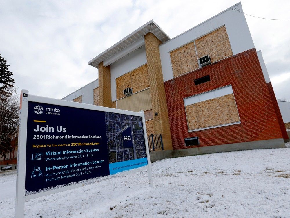
The land use application has been submitted:

This redesignation application proposes a development of 4.64 hectares of land in the community of Richmond/Knob Hill on the former Viscount Bennett school property. The application proposes:

  • - 2,500 dwelling units across a range of zoning districts on the site
  • - A Direct Control District based on the Multi-residential - High Density High Rise (M-H3) District, with a maximum height of 95 metres (about 30 storeys), is proposed in the northern and eastern portion along Richmond Road and Crowchild Trail
  • - Multi-residential - High Density Medium Rise (M-H2) District, with a maximum height of 50 metres (about 15 storey), is proposed in the central portion of the site
  • - Multi-residential High Density Low Rise (M-H1) with a maximum height of 26 metres (about 8 storeys) is proposed for the majority of the 25th Street SW and 30th Avenue SW frontage
  • - 0.73 ha of publicly accessible private parks.

An amendment to the Westbrook Communities Local Area Plan is required in support of this application.


NOTE: If this application is approved by City Council, the building design and site layout details such as parking, landscaping and site access will be determined later at the development permit stage.
 

Back
Top