


thecharioteer
Senior Member
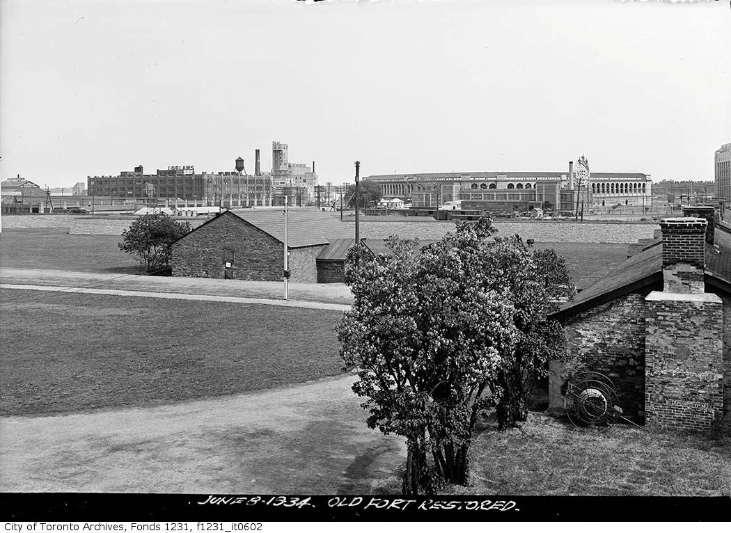
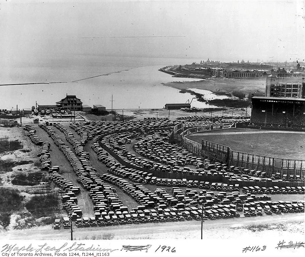
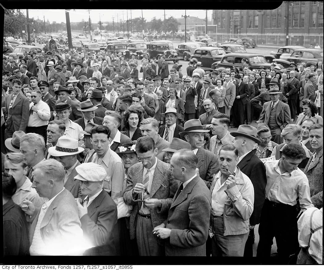
When Toronto had two baseball stadiums on the waterfront and no Island Airport

And no Gardiner. Great shot, Goldie.
Few more of the Stadium:
|
|
|
When Toronto had two baseball stadiums on the waterfront and no Island Airport

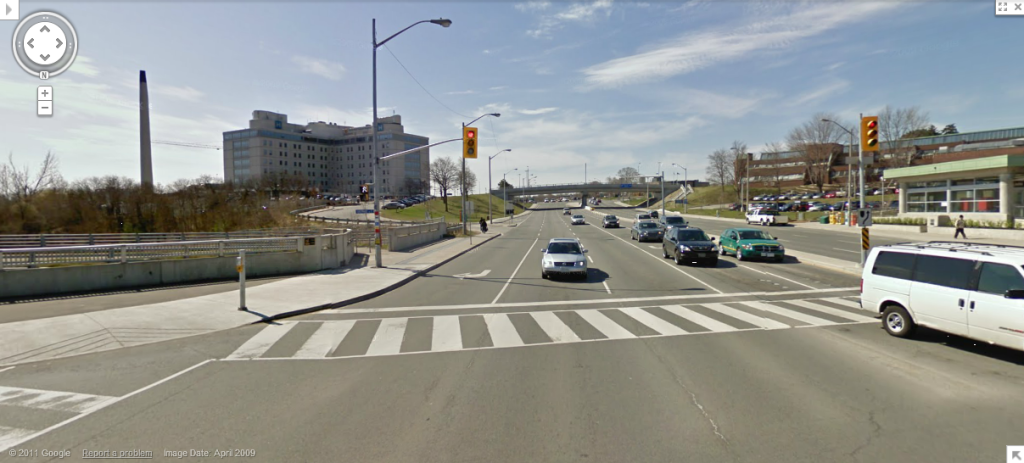
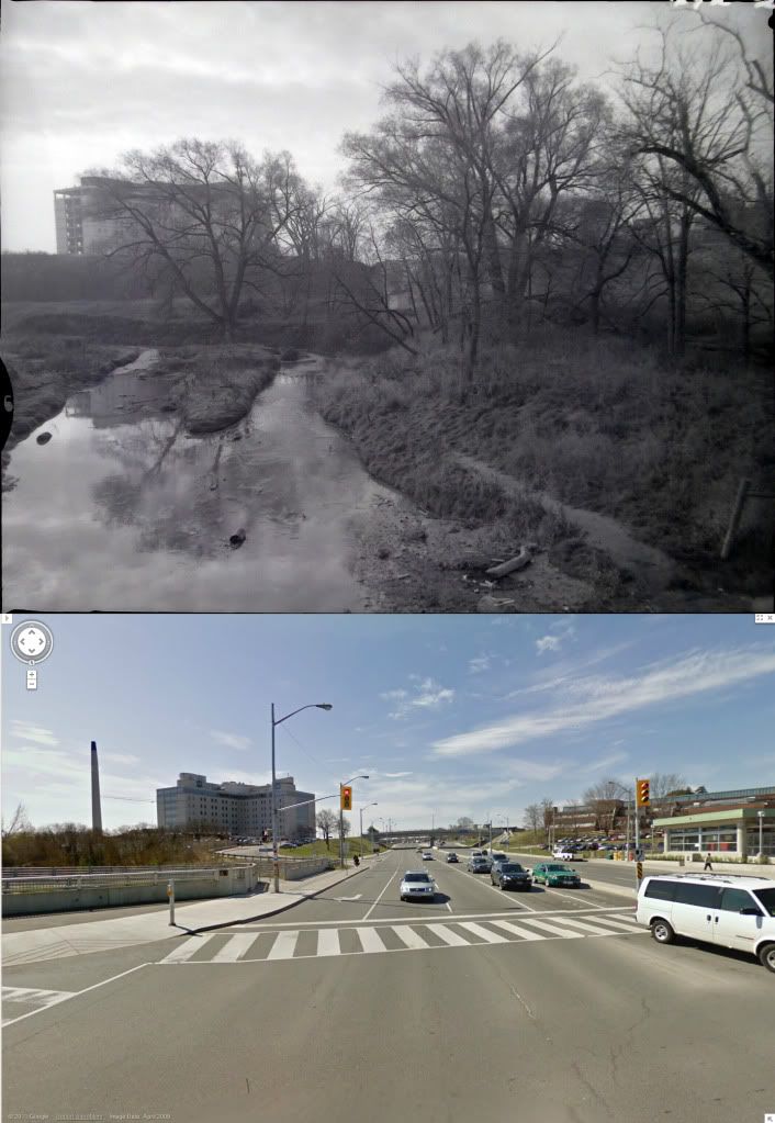
The building on the river is North York General, ca. 2003.
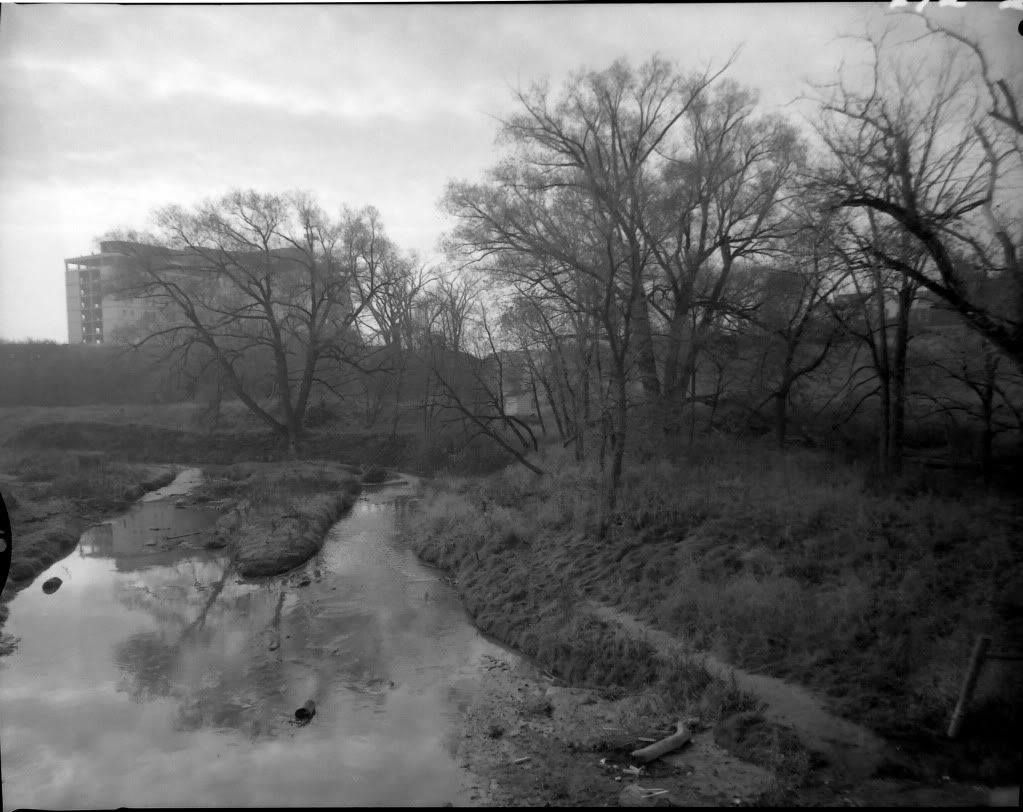
The building on the river is North York General, ca. 2003.
")
If so then this may be one of the shacks in the original picture. River flow and the angle of the building point here.
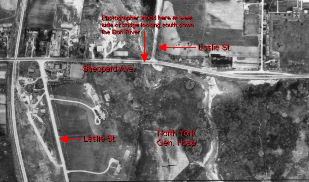
No, that view looks the wrong way. That building's on the northwest side of Sheppard and Leslie. This view looks south from Sheppard's bridge over the Don, which was a little two-lane at the time. I do have a shot of that area you're indicating, though. I don't recall there being any buildings in it, but I'd have to check. I can't say for sure. I'll dig some of the others up for you guys, they're really sweet.
This is the orientation for the shot. The aerial view dates to 1947, of course, but not much changed about the road layout in this view till 1968.
I remember when they rebuilt this intersection. There was a bailey bridge that took Sheppard over the Don northwest of the current intersection - the road curved around quite a bit.
When Toronto had two baseball stadiums on the waterfront and no Island Airport
 The first two shots aren't ones I could do this with because they're sufficiently off-road it just wasn't possible. Most of the others are close... within a few yards of the originals, though a few are lower than the original views simply because Sheppard was dug off its hill in '67-68 for the underpasses at that location.
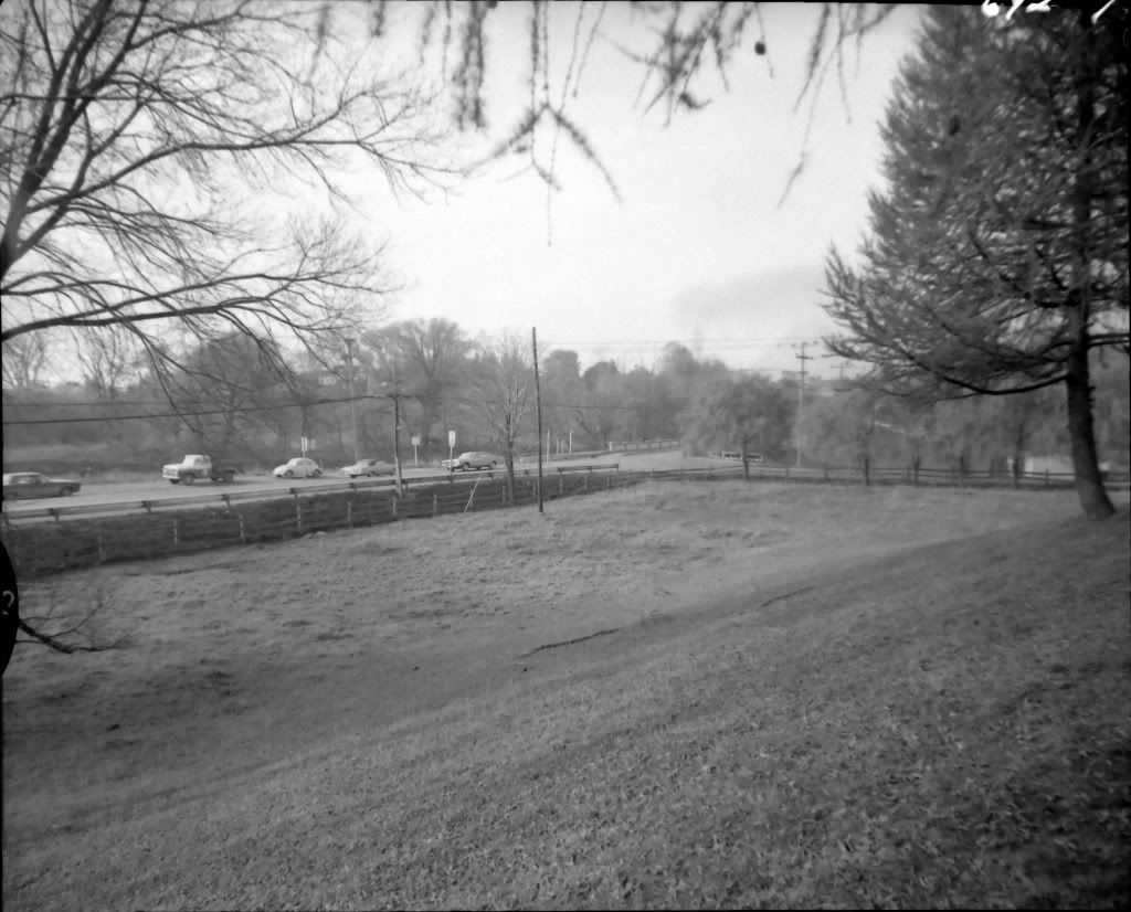
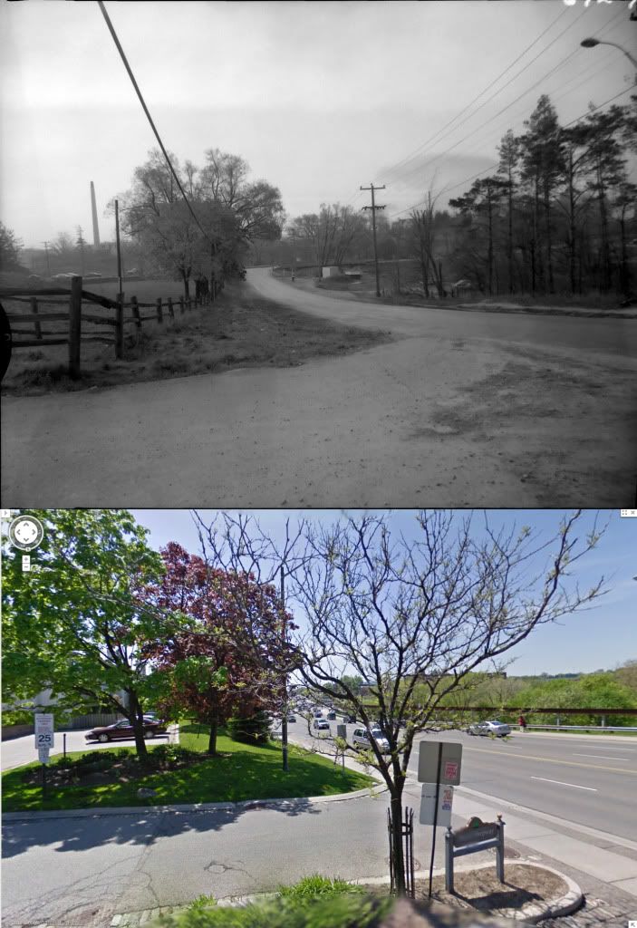
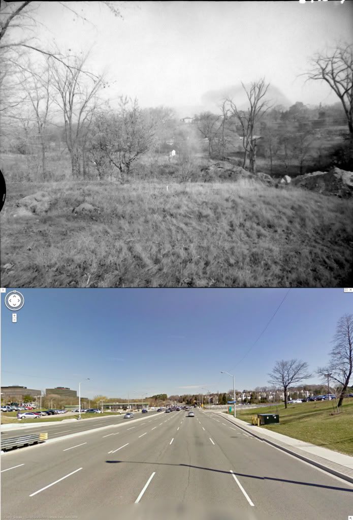
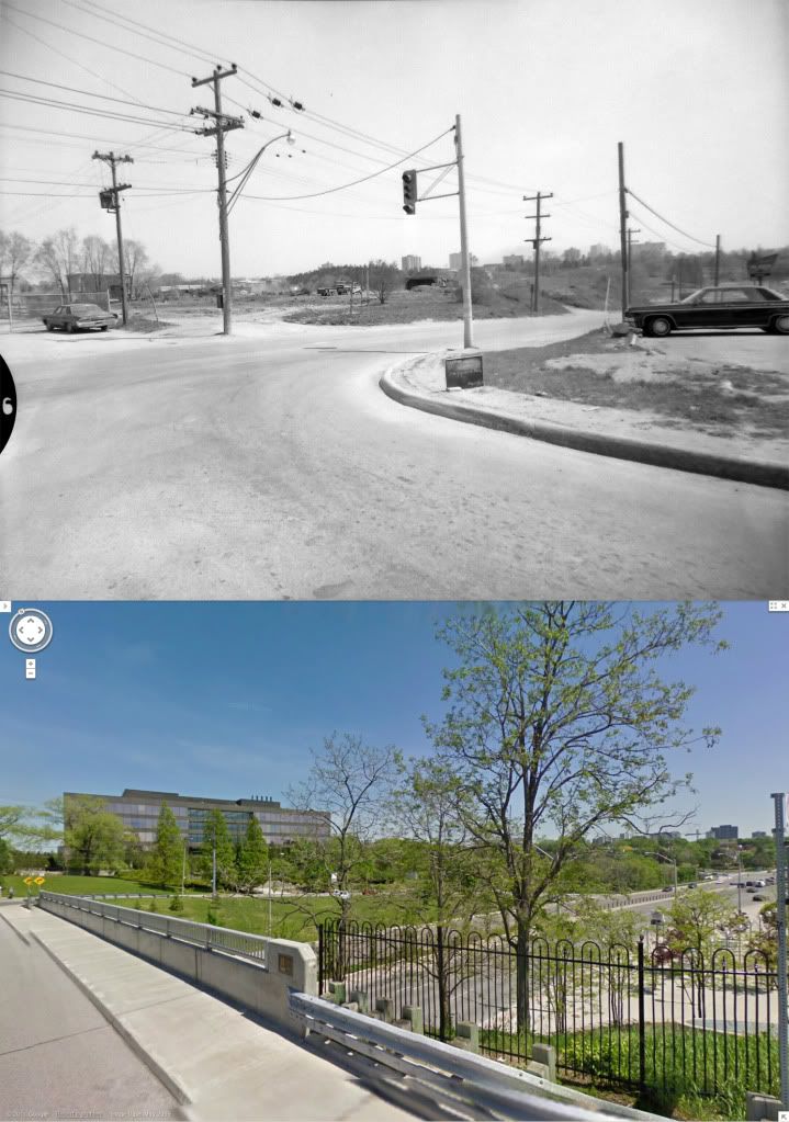
Up the hill, these are views around the old westerly intersection of Leslie and Sheppard, which was also a T-junction for Leslie. This part of Leslie is today Old Leslie street. Back then, it was how you got to the 401, and points south.
Here's a look south down (Old) Leslie from Sheppard.
Here's a view looking west along Sheppard from the same location.
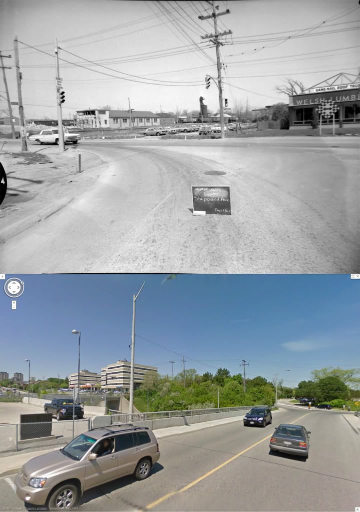
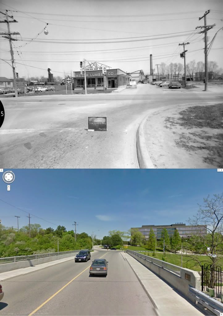
Here are three views looking the other way, north across Sheppard from (Old) Leslie. At the time, Welsh Lumber was across the street. Today it the road continues into a commercial area.
Looking northwest...
North...
And northeast...
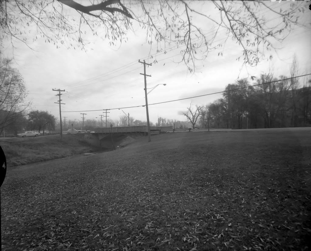
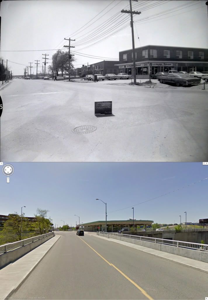
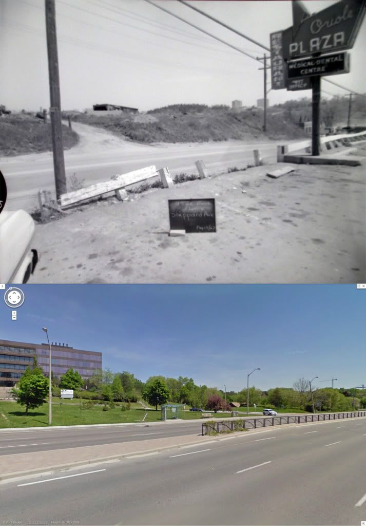
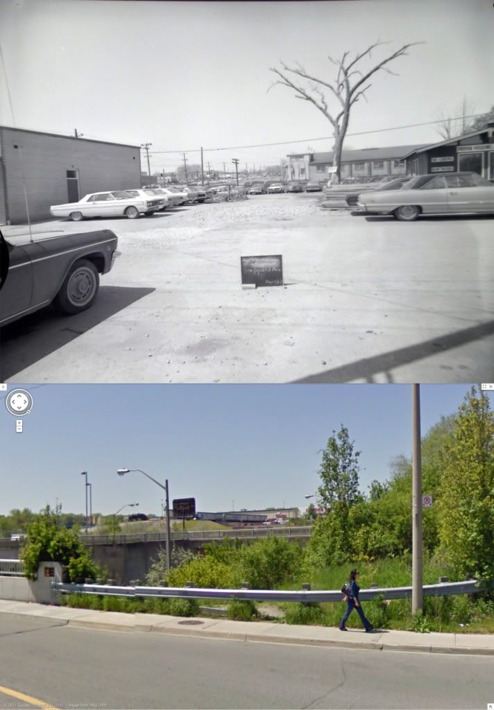
On the southeast corner of this intersection of Leslie and Sheppard, there was, for around a decade, a shopping plaza, called Oriole Plaza. Below is a view from its parking lot on Sheppard, just a bit above the Don River bridge.
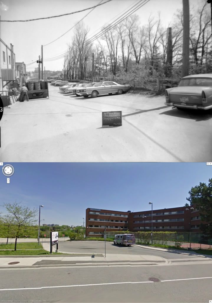
And this is the view of its back lot delivery area, just off (Old) Leslie.
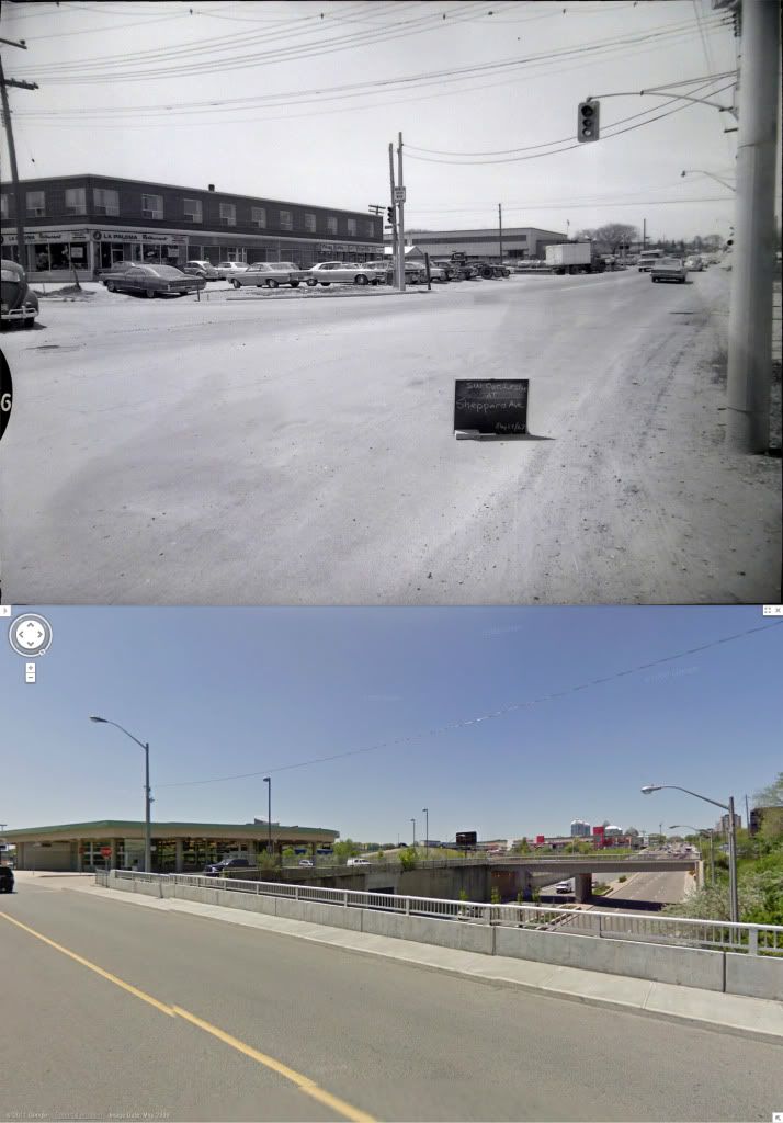
On the north side of the intersection, this is a view from the Welsh Lumber lot, looking west along Sheppard.
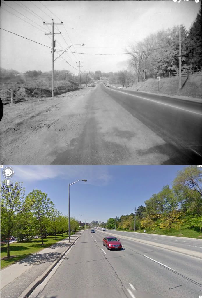
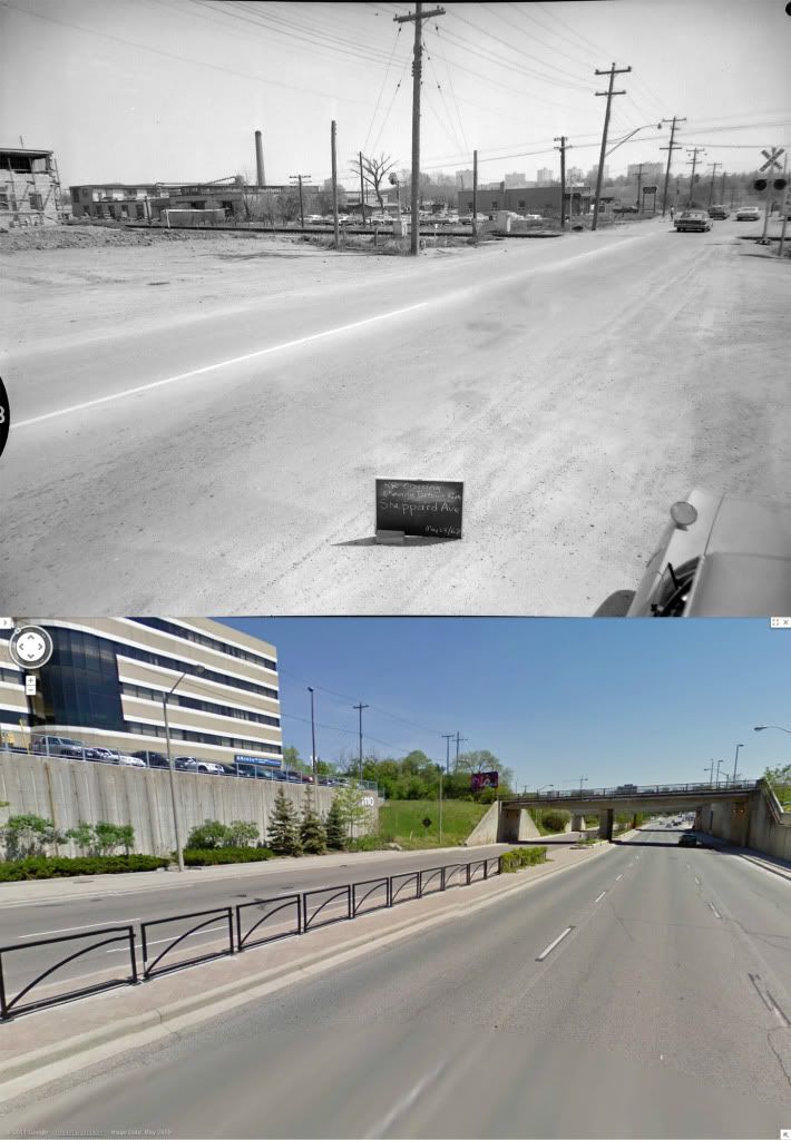
And finally, here's a view of the level crossing on Sheppard just a bit west of (Old) Leslie Street. This view faces east. The "after" view is, of course, necessarily several yards lower than the "before" view, but whattayahgonnado.
Excellent tour of the area Lone. La Paloma was all I remember. These were all from 1967? Major change to this intersection.
Tom Johnson's stuff I'm estimating to be March, 1967, because it's a spring thaw before the leaves appear, and because the NYGH is nearly completed, and one of my high school buddies was born there in the summer of 1968.The previous two shots, and the next few, were taken by a photographer named Tom Johnson. Tom, if you're out there, I'm grateful to you for saving for me views I could never have seen with my own eyes.
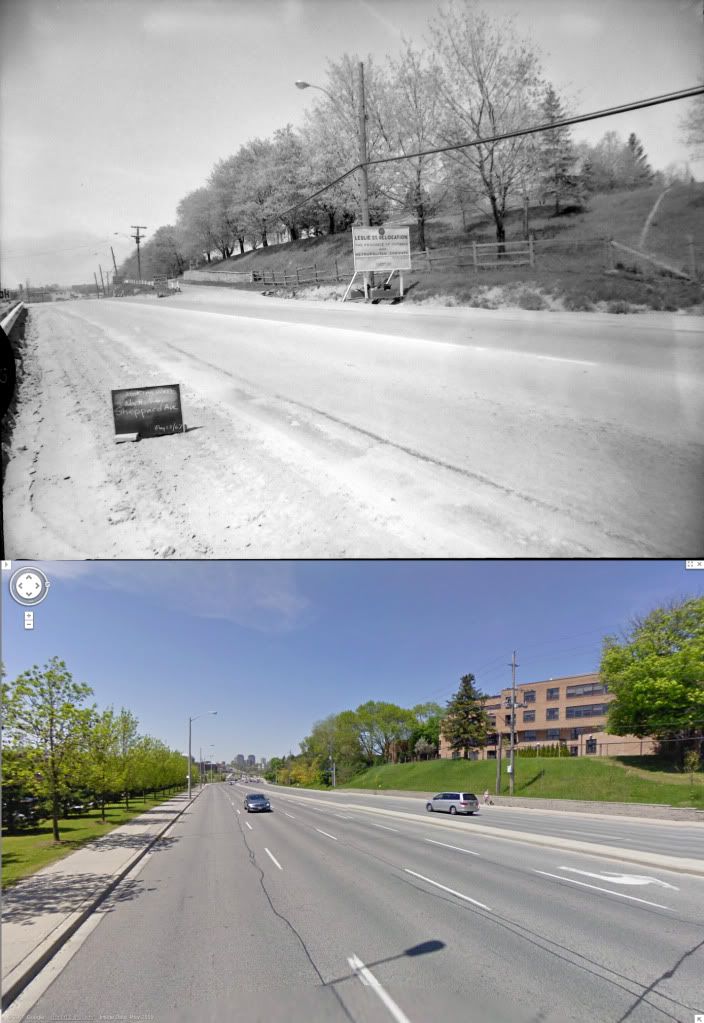
...Another view from just a few yards east, from the vicinity of the creek between Shaughnessy and Leslie, showing what was once someone's impressive driveway on the north side, as well as a sign announcing the Leslie Street relocation effort about to begin.