


Monarch Butterfly
Superstar
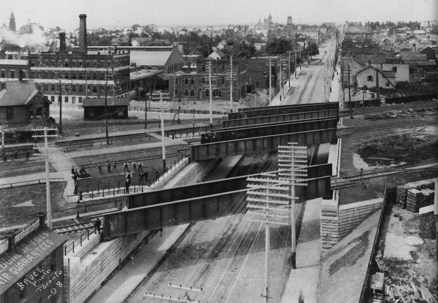
Photo from parkdale.to, along Queen Street west of Gladstone in 1898:
Happy New Year Parkdalians!
Queen Street looking west from Dufferin in this 1898 view by photographer Josiah Bruce As 2021 comes to an end, we want to thank you so much for supporting your community. This New Year’s Eve…parkdale.to
View attachment 379384
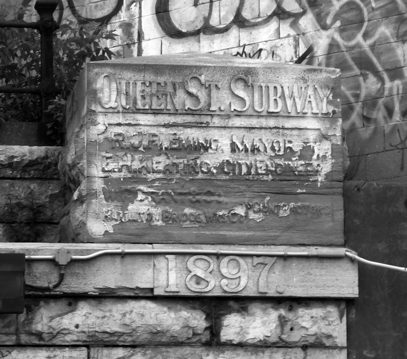
The Queen Subway has been completed...
link.
