67Cup
Active Member
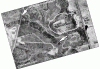
I just came across this thread and I want to express my thanks to all who have contributed these wonderful maps and photos. I grew up in North Leaside, and my wife in an older section of South Leaside. (I did not go to Leaside High. That might save a question or two.) In the aerial photo from 1947, you can see the street I grew up on, and maybe even the actual house, while under construction. Our house was on the edge of the Valley itself and it was possible to slip out from our backyard into the urban wilderness pictured in a number of those photos. I wandered and explored all through the areas that feature in these photos.
I can remember the bridge that finally carried Eglinton across the Valley being built and, as a small boy looking across from my bedroom into the farmland which is now Don Mills. What changes since then! Leaside was a great community to grow up in, especially when it was still its own municipality, the Town of Leaside. I think the Inspector of the Schools, Mr. Holmes, IIRC, knew the name of every child in the schools of Leaside. Whichever of the three elementary schools of Leaside we boys attended, we played baseball in Trace Manes and then Talbot Park and played hockey at the Leaside Arena, off Laird Ave. As an aside, I think Gary Switzer, the developer who is building the Massey Tower, must have been one of a pair of identical twins I played hockey with and against in those distant days. It was nearly possible at least to recognize all the kids more or less your own age in the town as a whole. Looking back, it was an almost intimate community in the heart of what was already becoming a metropolis. A friend, who also married one of the circle of girls of which my wife was a part, called it "The Shire."
Thank you all for this exercise in nostalgia!
")