News   GLOBAL  |  Apr 02, 2020
 8.4K     0 
News   GLOBAL  |  Apr 01, 2020
 39K     0 
News   GLOBAL  |  Apr 01, 2020
 4.7K     0 

^^^ I shot that video. :) I posted it in the Ontario highways thread.

Go on! That's yours? You're my hero. :) You didn't shoot any video of the highway just a little before that, showing the connection to Albion Road up Indian Line by any chance, did you? :)
 
^^^ Unfortunately, I didn't. Actually, I don't think I've ever been on that stretch at all. You mentioned in this thread back in 2007 that the 427 was extended to 7 in 1992. It was actually extended in 1990 or 91.

And BTW, a section of Indian Line still exists near the airport:

Untitled.jpg
 

Attachments

  • Untitled.jpg
    Untitled.jpg
    18.3 KB · Views: 1,376
Last edited:
^^^ Unfortunately, I didn't.

Ah! What a pity. What I wouldn't give to see that. :) I used to ride around with a buddy just after we got our licenses and he was fond of driving for driving's sake and exploring and I know we went up the 427 several times. I think I probably went along that stretch before the 427 was extended to Hwy 7 but I couldn't swear to it. But it's a real kick seeing that someone has video of the old stop light at Morningside. We had a buddy who lived on that street for about a year, so we must have turned there dozens of times.
 
I visited in August 2014 and took a bunch of pics.

This is my favourite. Underneath a small bridge. Hard to find.

2dulgmg.jpg


This is the full album. http://imgur.com/a/wP4Cj [82 images]

Note: I am not a photographer. The pics aren't anything special. Not all pics were taken on the same day.
 

Attachments

  • 2dulgmg.jpg
    2dulgmg.jpg
    347.3 KB · Views: 1,319
It looks like Indian Line Road is becoming less abandoned and isolated.

The Humber River recreational trail that formerly ended in a loop just north of Finch Ave now extends all the way past the 427 to join Indian Line near the dam. The extension is fully paved.

Another new paved access trail now joins Finch Ave (just west of the 427) to Indian Line.

Also, the bridge that goes over the train tracks (north of the dam) is being worked on. Looks like it was re-paved. Construction equipment was still there (Aug 2015).
 
Also, the bridge that goes over the train tracks (north of the dam) is being worked on. Looks like it was re-paved. Construction equipment was still there (Aug 2015).

I noticed that while driving on the 427 lately. Any idea what that's all about? I was wondering if they were actually taking the bridge out, but if you're saying they've repaved it, I have to wonder what they have in mind. Seems a bit over the top just for hikers, but I also can't imagine they'd be looking to reintroduce it into the road network... where would it take anyone these days?
 
I'm still looking for any photos of the Bailey Bridge over the Humber at Claireville. I can't find any photos and don't have any myself, although I used to drive over it regularly.
 
Alternate route to the dam?

The work on the bridge was to allow access for construction equipment to the Enbridge natural gas pipeline project. Enbridge had put a bailey bridge over the old bridge for the heavy equipment. I haven't been around there recently but I thought that the bailey bridge would be removed, the area cleaned up and naturalized and the old bridge returned to its un-improved self.
 
Indian Line Road formed the border between York County and Peel County... effectively, Metro and Mississauga for most of our recent history, from Eglinton Avenue north. Slowly, over the years, its course has been assumed by the 427, and what remains of it is now Hwy 50; access to the route usurped by Albion Road.

North of where Finch Avenue now crosses it (but didn't at all until very recently), it's had a varied and tortuous history... diverted, flooded, pressed into service to a vast superhighway, and finally abandoned, officially removed from the road grid after a service of over a century.

I had my interest in the road peaked about a year ago, and I went out to explore it twice... in December of 2006 and June of 2007, as well as trips to the City Archives to investigate what was, as seen from the air...

470872475_dd512a5ff7_o.jpg


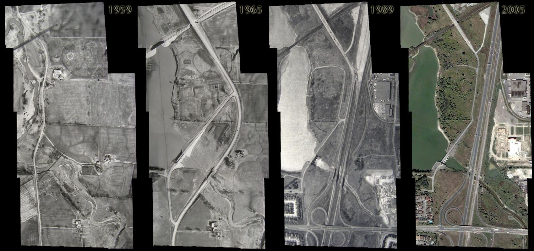
Changes in Indian Line Road, in the vicinity of the West Humber River (and eventually the Claireville Reservoir) over time.


470776675_bf7ee3d844_o.png


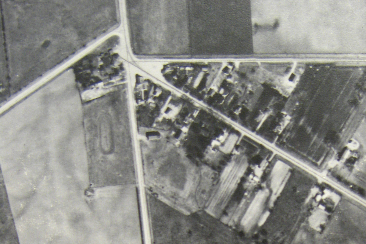
Here you're looking at the intersection... the rather complicated intersection... of Indian Line Road (north-south), Albion Road (diagonal from the lower right), and the dogs-legged Steeles Avenue of the day. This is, in fact, Claireville, 1959.


470850736_739564d6fe_b.jpg


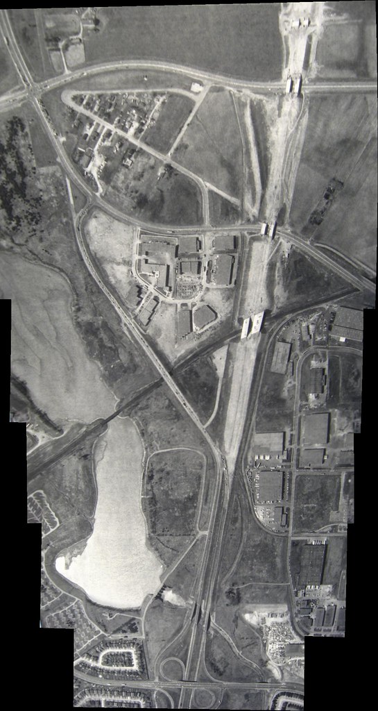
Thirty years later, in 1989, this is Indian Line Road at the height of its game. You can see how things have changed up at the top of the picture. Steeles is now contiguous, making a swoop north around Claireville. Albion Road, too, avoids Claireville, sweeping south around it. Indian Line Road has had its legs consumed by the advance of Highway 427 from the south, but even the mighty superhighway yields to the old road in the end, spilling its traffic out onto it, and gathering its first users from it. At the time, the 427 in the north used Indian Line to connect to the rest of the road system, ending up at the T-junction intersection of Indian Line Road and Albion Road that persisted up to about 1992 when the 427 was extended to Highway 7, abandoning Indian Line Road for good. It was more or less at that time that Indian Line ceased to be a going concern.


1187649916_92f1b8c1b7_b.jpg


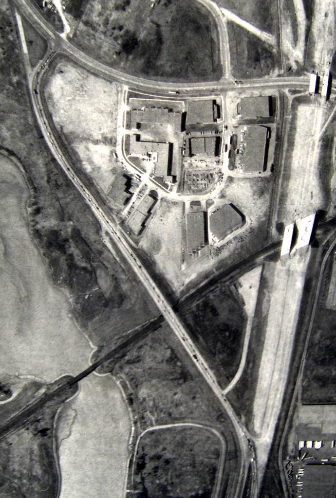
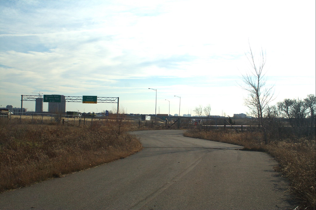
1989... the last couple of years Indian Line was employed. Look at the traffic on it, heading onto the 427, coming off of the 427 and lining up to turn onto Albion Road. It's hard to believe no one drives on this stretch anymore... it was so busy once, so integral to our city. I had once assumed that the lights at the intersection of Indian Line and Albion had been removed when Indian Line was closed to traffic in 1992, but I was astounded last week when I came across a recommendation from an Etobicoke citizens group last week that recommended, in 2002 (!) that the lights be removed because they no longer served any useful purpose and were, in fact, according to the testimony of a local fire captain, being routinely ignored by motorists. Such is the hold this road has had on us.


470787685_b24d833da5_b.jpg


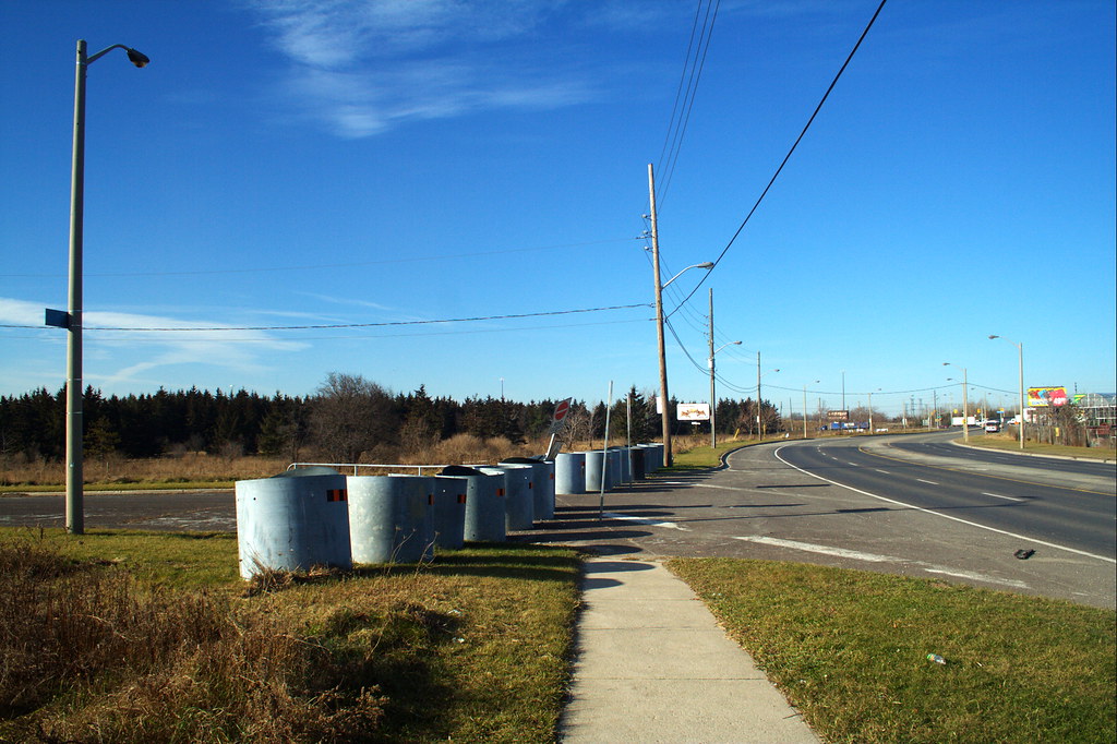
Indian Line at Albion Road, December, 2006.


470781608_d8979c6011_b.jpg


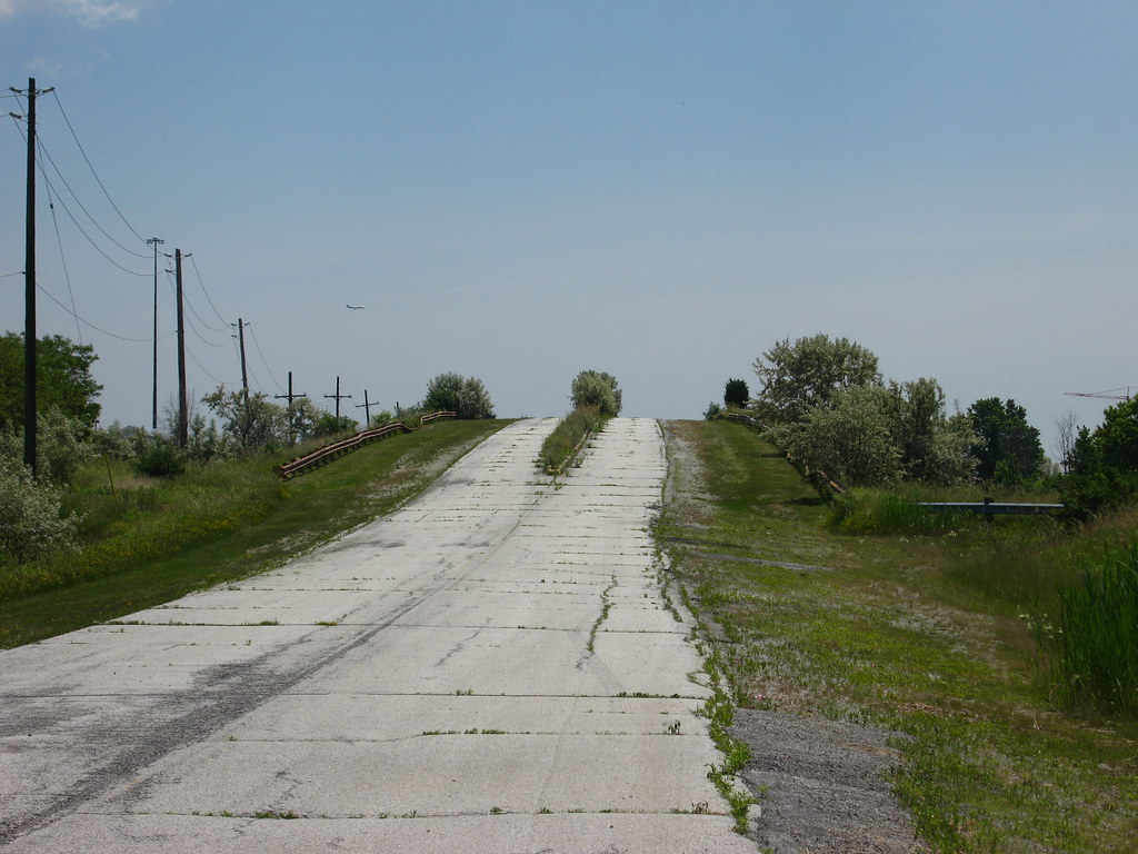
Approaching the Indian Line bridge over the railroad tracks, December, 2006.


583706319_2bf14bb3ef_b.jpg


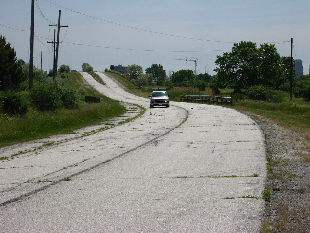
The same view in June, 2007... and look! Traffic! Indian Line rides again! This was a service vehicle.


584103160_b6f62fb42d_b.jpg


This bridge is enthralling. You can glimpse it from the 427 even today. It carried Indian Line over the railroad tracks. Built in the 1960s, it was clearly designed with a big future in mind... wide enough for four lanes, but it never got them. Even when Indian Line was effectively a stretch of the 427, even then... this bridge carried only one lane of traffic each way. What a sad waste.


584224850_62ad338ca9_b.jpg


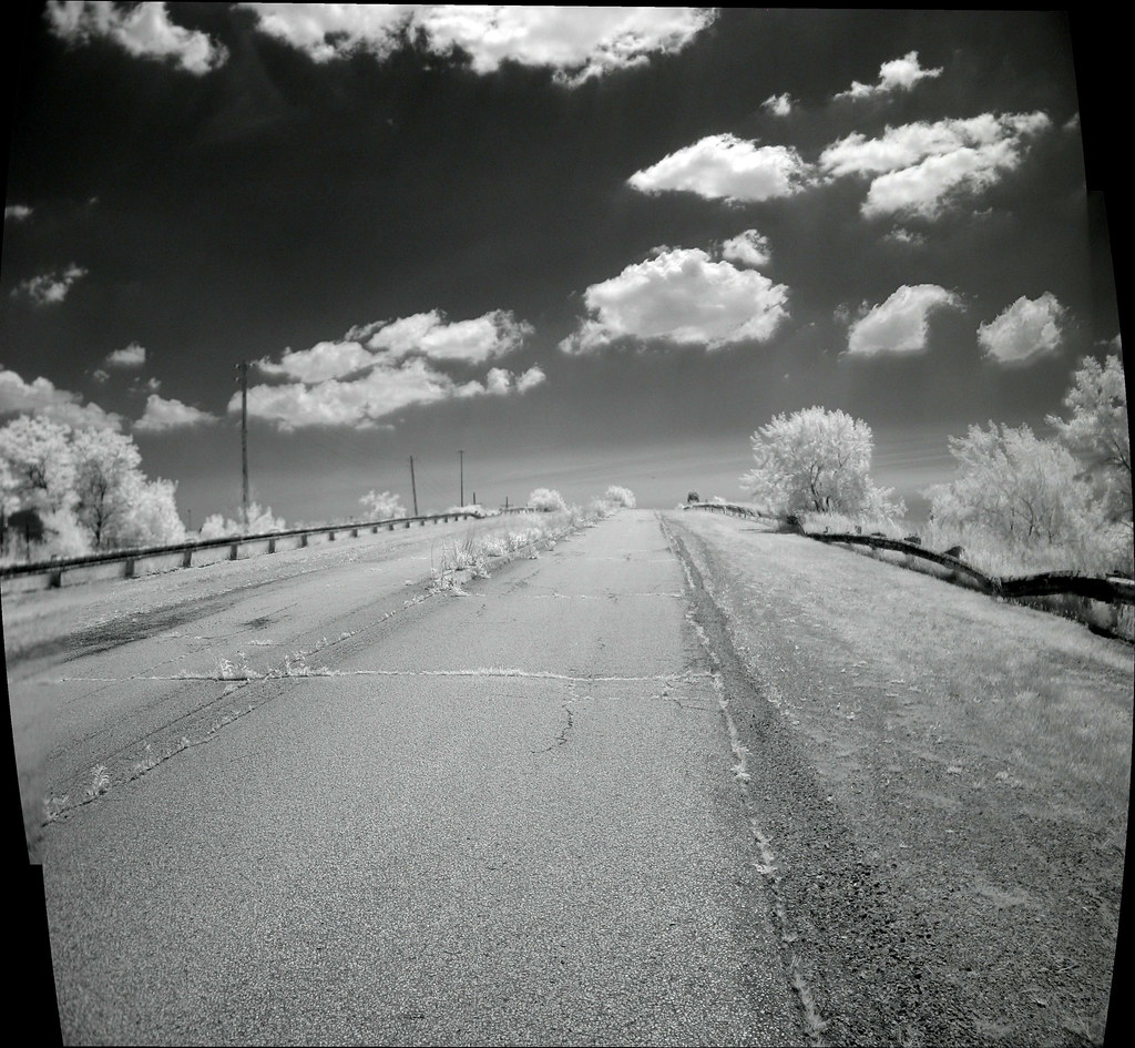
Heading up the bridge in infrared in June, 2007.


470866429_9044d69c19_b.jpg


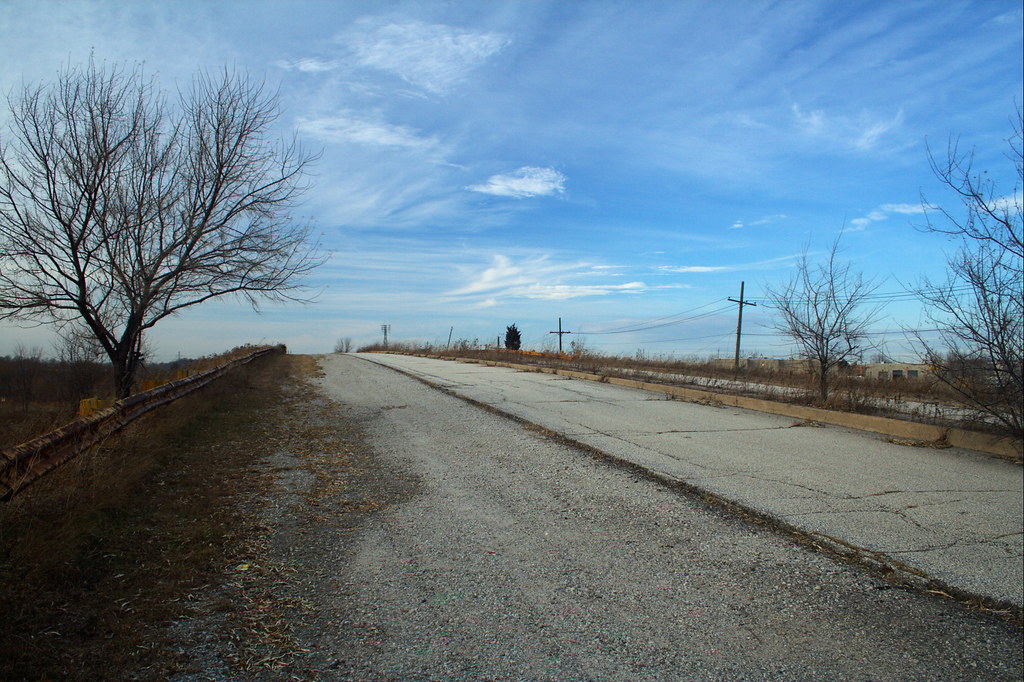
Looking back up the same bridge in December, 2006.


470813092_a5d3e1d493_b.jpg


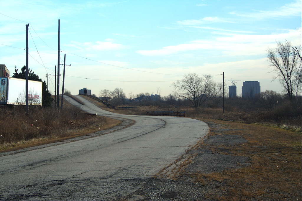
This view shows pretty much what you would have seen heading onto the 427 in 1990.


470836857_1959418211_b.jpg


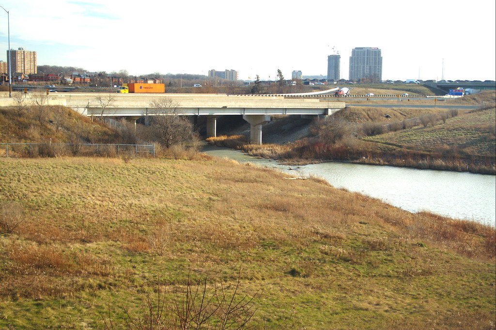
Heading towards the road that cross the dam, you can see the 427 bridge over the West Humber. Prior to its construction, that spot was essentially where Indian Line once made a wide sweep and had its own bridge crossing the West Humber in the 1960s.


470861267_b585c95d1a_b.jpg


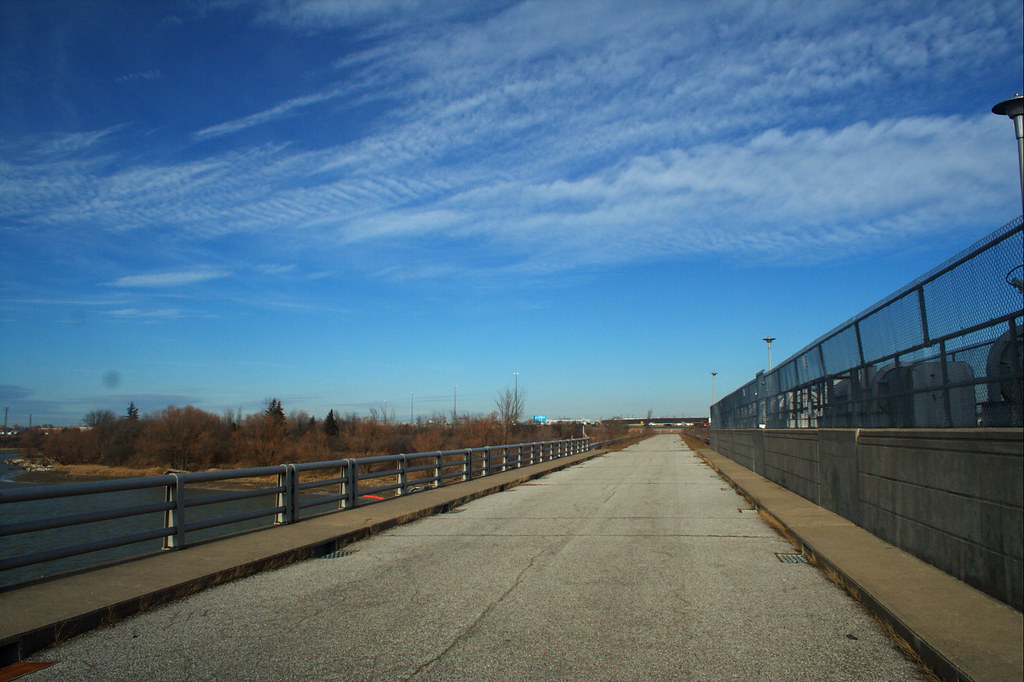
This is the road over the dam. It's a bit deceptive because it faces back towards the 427 from the far side. North is on the left in this shot.


470846269_f026e1f980_b.jpg


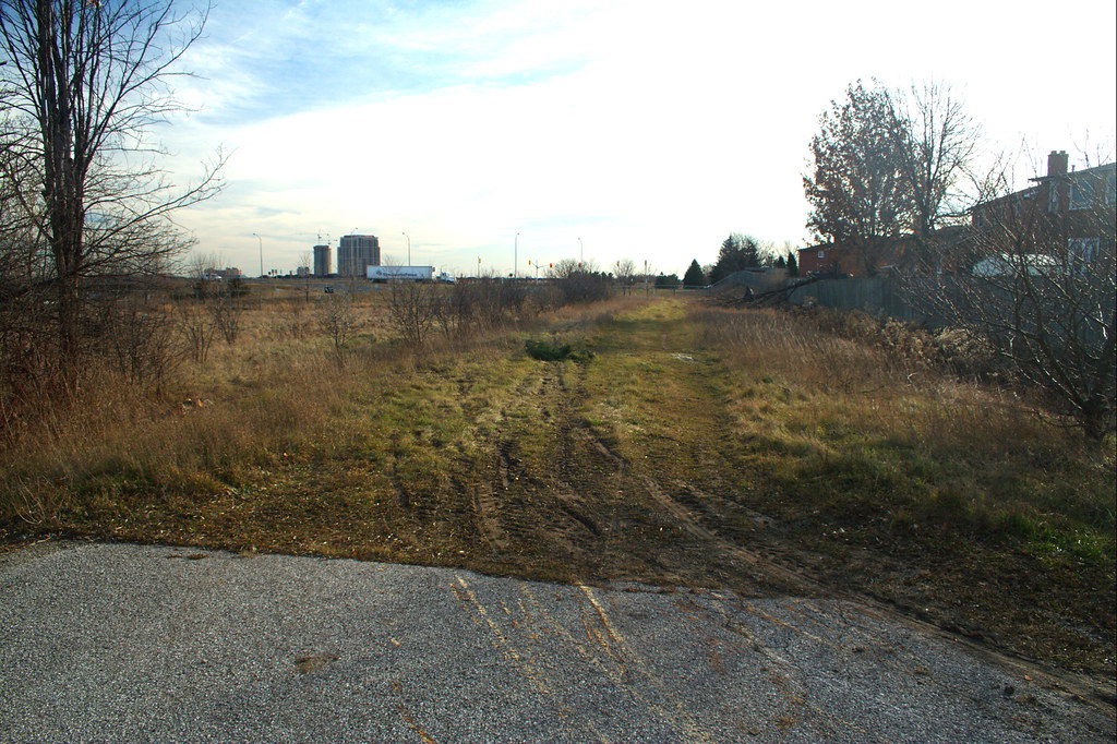
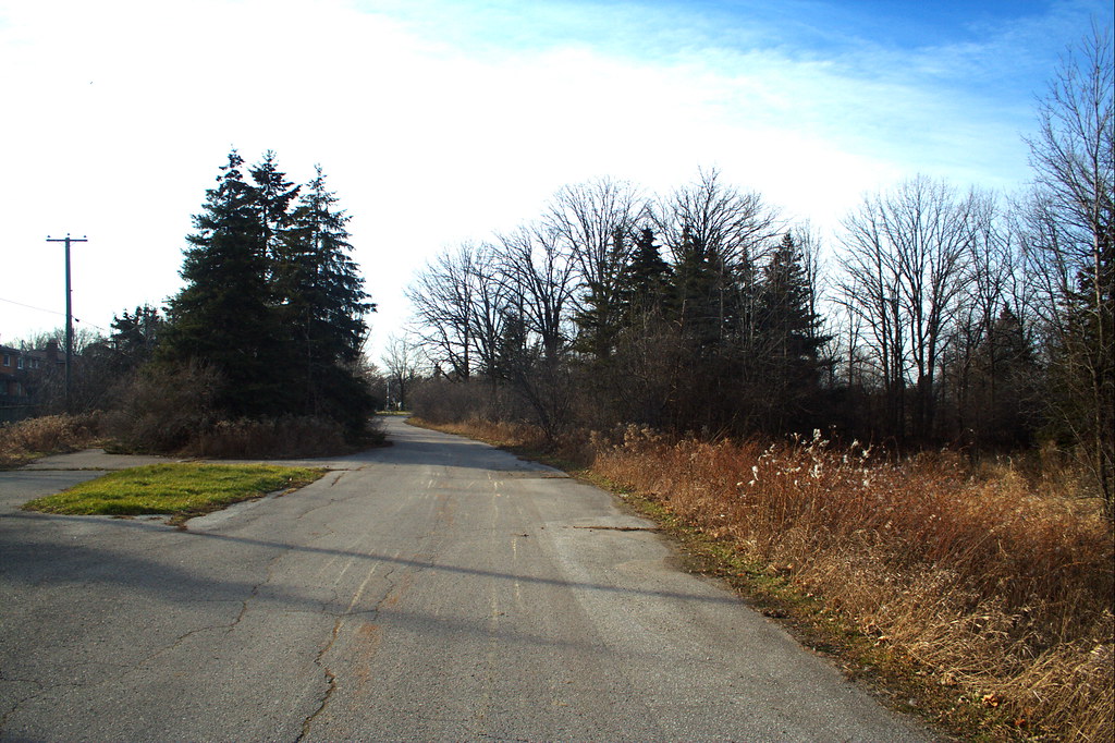
This is just a few dozen yards north of Finch Avenue. What you're looking down was once the arrow-straight south track of Indian Line Road. If you look really closely, you can see a guy cutting up a fallen tree just outside the fence of one of the back yards.


470849101_8f3b5cea78_b.jpg


Indian Line Campground is still a going concern. Thirty years ago, this was how you entered it... off Indian Line, aptly enough. Well, you can't enter the campgrounds this way anymore. Today, the entrance is off Finch Avenue... which didn't come anywhere near here thirty years ago. How times change.


583816163_9c82ee5159_b.jpg


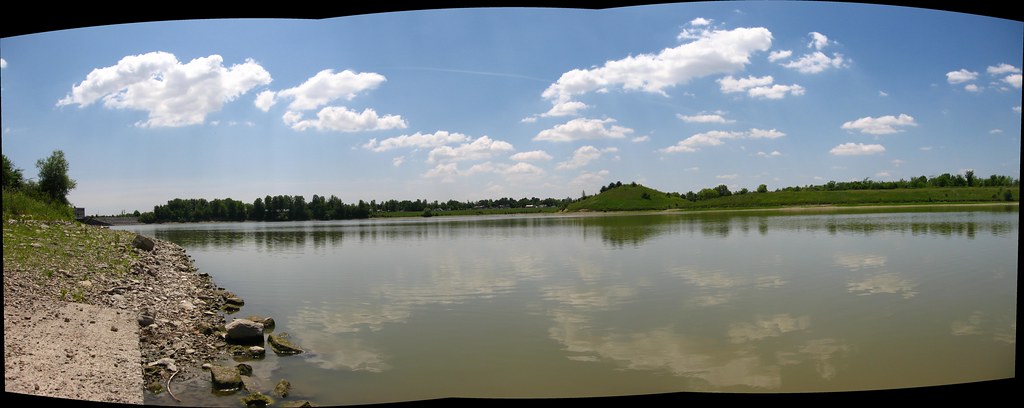
If you head towards the reservoir, you will find the original, 1800s route of Indian Line Road, skirting the very edge of the water (towards the dam, it's actually inundated by it). This is the view you find. On the far side is Indian Line Campground and Wild Water Kingdom.


583821091_844873d8d2_b.jpg


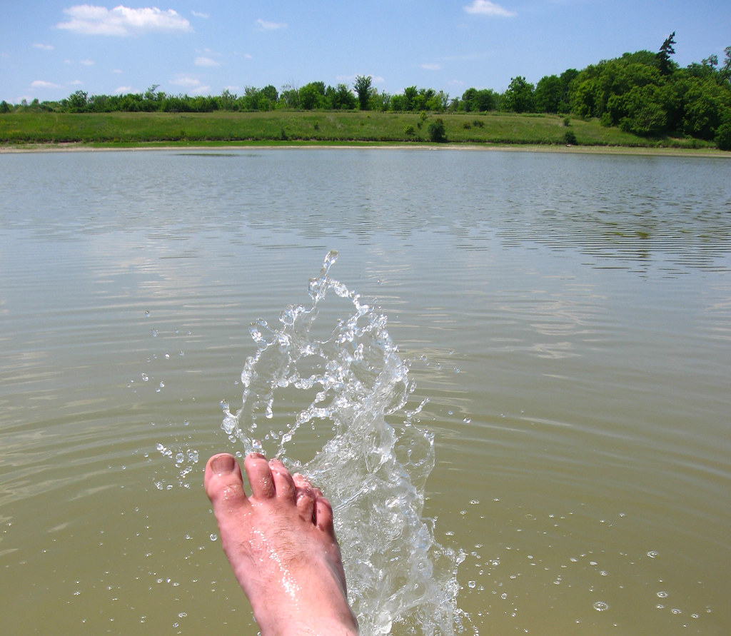
Splash! The reward for all my hard work. :)
Hey!... In the photograph where you state, "If you head towards the reservoir, you will find the original, 1800s route of Indian Line Road...", is this accurate? I checked aerial views of the area and that road that leads down to the reservoir wasn't built until about 1981-1983 it seems. http://jpeg2000.eloquent-systems.com/toronto.html?image=ser12/s0012_fl1983_it0042q.jp2 Compare to 1981: http://jpeg2000.eloquent-systems.com/toronto.html?image=ser12/s0012_fl1981_it0052.jp2 Any idea of the history of that road?
 
Indian Line didn't end at Steeles, it actually continued up Hwy. 50 towards Bolton, possibly continuing up Albion-Vaughan Rd:

County_of_Peel,_Ontario,_Canada_map_(1937).jpg
 

Attachments

  • County_of_Peel,_Ontario,_Canada_map_(1937).jpg
    County_of_Peel,_Ontario,_Canada_map_(1937).jpg
    347.5 KB · Views: 906
Last edited:
I'm still looking for any photos of the Bailey Bridge over the Humber at Claireville. I can't find any photos and don't have any myself, although I used to drive over it regularly.


Is this the bridge you're looking for? This pic is from Toronto Archives.
 

Attachments

  • clairville bridge.pdf
    398.4 KB · Views: 404
Sorry, having some difficulty. I think this might be the Bailey Bridge. I lived in this area for many years but memory fails me so not sure.
 

Attachments

  • clairville bridge.pdf
    398.4 KB · Views: 386

Back
Top