News   GLOBAL  |  Apr 02, 2020
 9.8K     0 
News   GLOBAL  |  Apr 01, 2020
 41K     0 
News   GLOBAL  |  Apr 01, 2020
 5.6K     0 

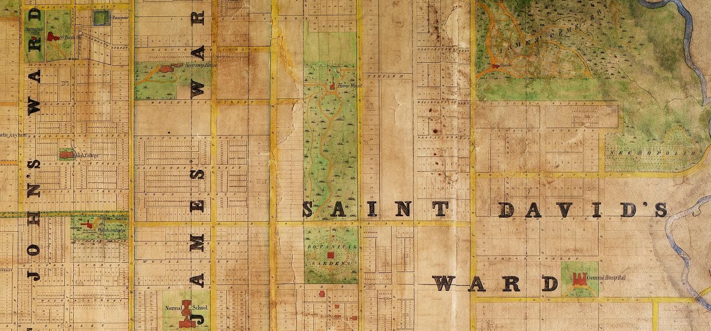
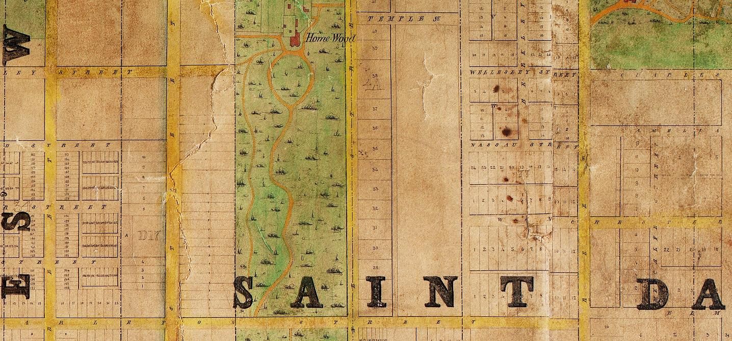
The Homewood estate in 1862 (prior to the extension of Wellesley eastwards):

homewoodmao.jpg
homewoodmap.jpg

Does anyone know why Wellesley was laid out with jog south (and thence back up north again) at the intersection of Homewood Avenue? Could it not have been extended without this curve?
 
Last edited:
Looking for Then scenes/images of Toronto's Chinatown for a media project. Full attribution/credit given. Please apply your faithful correspondent. Thank you. :)
 
"Wellesley was laid out with jog south (and thence back up north again) at the intersection of Homewood Avenue" QUOTE Mustapha.


There are a number of these, the one noted, one between George Street & Sherbourne, Walmer Road, north from Bloor;

makes things interesting.


Regards,
J T
 
From http://torontofamilyhistory.org/simcoesgentry/5

The curves on Wellesley Street (formerly Wellesley Crescent), and on Dundas Street (formerly Wilton Crescent), go from lot line to lot line of Park Lot 5. George William Allan’s developer would have laid out streets only within the Park Lot.

This is a quote from what is now a very short article on the Allan Estate, one of early Toronto's "Park Lots". The author is a friend who will expand it one of these days.
 
Interesting to note that Britain St., south of Queen, preserves the line of the "Meadow" area shown on the map.
There was a cemetery on the western section of The Meadow in the early days before York became Toronto. From http://torontofamilyhistory.org/projects/

The small cemetery was located on the north side of Duchess Street (now called Richmond Street East) roughly bounded on the east by Stonecutter’s Lane, and on the north by Britain Street. The west boundary was a third of the way to George Street, at about today’s 260 Richmond Street East. It was about a half acre in size. The boundaries of the graveyard were reportedly somewhat undefined as bodies were unearthed when both Caroline (now Sherbourne) and Britain streets were built.​

There's quite a bit more history of the cemetery in the article. It's a long way down the page.
 
Old Knox College should be lit up at night. It's amazing that the city's forefathers created these vistas as our own gestures of grandeur, yet those who maintain them became indifferent to their beauty. Each major terminating vista should be prominently lit up at night, with any trees trimmed or selectively removed to preserve the vistas. Osgoode Hall is York Street's terminating vista but trees have completely obscured it, while the same thing is slowly happening to Queen's Park.
 
Last edited:
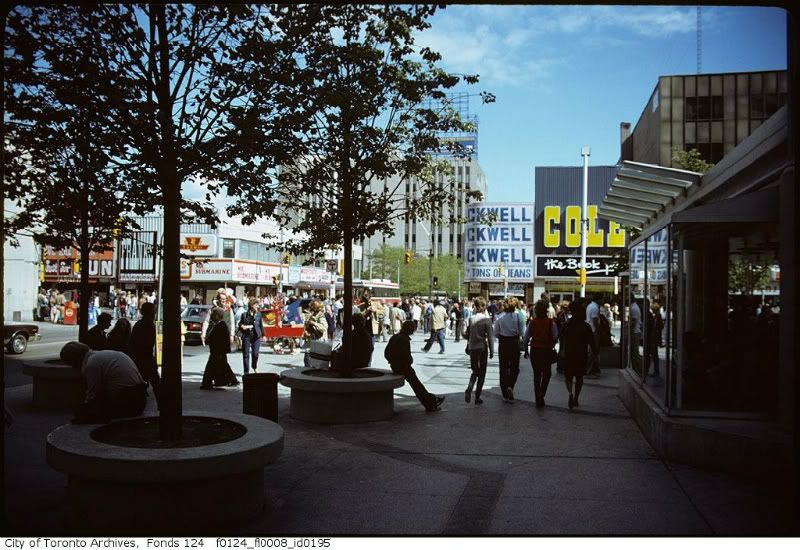
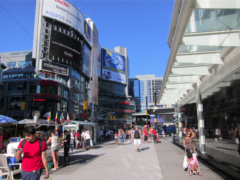
A couple outside the Eaton Centre, by the SW corner of Yonge and Dundas. Some change over the years:

Then:
eatonsf0124_fl0008_id0195-1.jpg


Now:
eatoncentreyongedundaslookingtonecorner.png


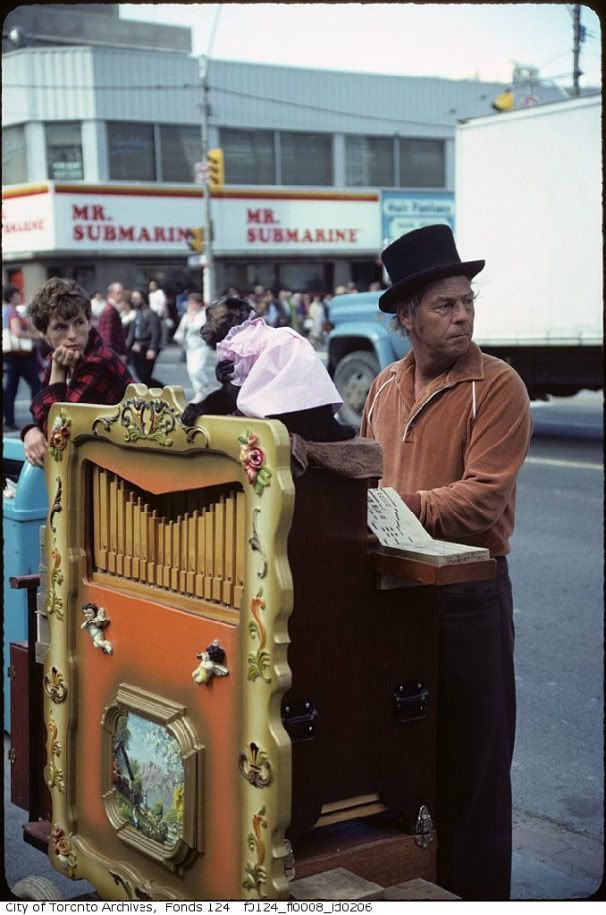
Then:
ydcornerlookingnef0124_fl0008_id0206-1.jpg


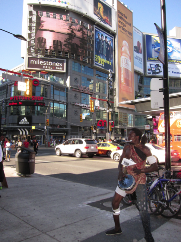
Now:
ydbuskerlookingneaug2011.png


Buskers still rule the corner. Do you think that the wastebasket location has stayed the same over the years?
 
There was a cemetery on the western section of The Meadow in the early days before York became Toronto. From http://torontofamilyhistory.org/projects/

The small cemetery was located on the north side of Duchess Street (now called Richmond Street East) roughly bounded on the east by Stonecutter’s Lane, and on the north by Britain Street. The west boundary was a third of the way to George Street, at about today’s 260 Richmond Street East. It was about a half acre in size. The boundaries of the graveyard were reportedly somewhat undefined as bodies were unearthed when both Caroline (now Sherbourne) and Britain streets were built.​

There's quite a bit more history of the cemetery in the article. It's a long way down the page.
It IS a long article but it's a fascinating read about the work they do. Uncared for/untended cemeteries and grave stones are a bit sorrowful. Many, like Victoria Square at Portland and Wellington, become a park - the grave stones are lifted up and leaned against a nearby wall, and park benches are installed. Not a bad thing that I think about it. I suppose this is inevitable - the remains of more us common mortals haven't the weight of history to commemorate them - our memorials will be more temporal.
 
"Victoria Square at Portland and Wellington " QUOTE Mustapha.


The grave of Governor Simcoe's young daughter is within that cemetery.


Regards,
J T
 
Old Knox College should be lit up at night. It's amazing that the city's forefathers created these vistas as our own gestures of grandeur, yet those who maintain them became indifferent to their beauty. Each major terminating vista should be prominently lit up at night, with any trees trimmed or selectively removed to preserve the vistas. Osgoode Hall is York Street's terminating vista but trees have completely obscured it, while the same thing is slowly happening to Queen's Park.

We can hope for that, but my prediction is they will tear it down or facade the front within a new building. Not right away, but within 10 years.
 
OBTW, Question, with an answer to a previous one:


What did Capt Cook have in common with Gov Simcoe & Toronto?


Re Previous unanswered question re Fran's Restaurant:

S/E corner Bloor & Dundas.


Regards,
J T
 
"Victoria Square at Portland and Wellington " QUOTE Mustapha.


The grave of Governor Simcoe's young daughter is within that cemetery.


Regards,
J T

There is a little known cemetery on the north side of York Mills Road between Old Yonge St. and Upper Highland Cres. It's no bigger than the house lots on either side of it.

A local blogger has taken the time and trouble to hop the fence and photograph it.

http://nouspique.com/2010/11/project-1400-photos-of-york-mills-baptist-cemetery/?show=gallery
 

Back
Top