News   GLOBAL  |  Apr 02, 2020
 9.7K     0 
News   GLOBAL  |  Apr 01, 2020
 41K     0 
News   GLOBAL  |  Apr 01, 2020
 5.5K     0 

no, but you may be excused for thinking so, because you got the location right

jane pitfield's book leaside says that the last of the airfield hangars was removed in 1971

the airfield was built in 1917 with 45 miles of field tiles to drain the area, which extended north from wicksteed across eglinton to broadway, and west from the don valley across laird to sutherland

see http://books.google.ca/books?id=zli...&pg=PT44#v=onepage&q=leaside airfield&f=false

That's exceptionally useful info, r937 - thank you.
I must get that book.
I wonder how much of the drainage system is still to be found under all that real estate.
 
no, but you may be excused for thinking so, because you got the location right

jane pitfield's book leaside says that the last of the airfield hangars was removed in 1971

the airfield was built in 1917 with 45 miles of field tiles to drain the area, which extended north from wicksteed across eglinton to broadway, and west from the don valley across laird to sutherland

see http://books.google.ca/books?id=zli...&pg=PT44#v=onepage&q=leaside airfield&f=false

Has anyone been over at the Island Airport of late? Is the old/former terminal still there? Now there's a bit, quite a big bit of tangible Toronto aviation history that you could walk up to, around and touch. It was to have been moved to Downsview Park, but I can't find the latest news.
 
Last edited:
another photo of Leaside Aerodrome

This photo (attached) of the Leaside Aerodrome area is in Jane Pitfield's book, Leaside.
I wonder if it shows any planes on the ground.
Does anyone know if a larger version is available on-line?
 

Attachments

  • CWC aerial.jpg
    CWC aerial.jpg
    55.1 KB · Views: 385
Last edited:
Thanks for that additional photo, Anna.
That particular area of Leaside has been altered so dramatically in recent years!
I'm curious to know if we can find ANY remnant of the airport today.
I may search again in the spring.
 
likely not above ground

check out this story from last year where a fuel tank was unearthed --

http://donwatcher.blogspot.com/2010/08/fuel-spill-in-don.html

Yes r937, it's a coincidence that you should mention that.
Just before reading your note, I remembered the tank spill story and accessed these photos.
The old aerodrome fuel tank was found in August of 2010.
I'm willing to bet that some evidence above ground can still be found!
 

Attachments

  • Leaside gas tank.jpg
    Leaside gas tank.jpg
    55.8 KB · Views: 310
  • Leaside gas tank map.jpg
    Leaside gas tank map.jpg
    81.3 KB · Views: 367
Yes r937, it's a coincidence that you should mention that.
Just before reading your note, I remembered the tank spill story and accessed these photos.
The old aerodrome fuel tank was found in August of 2010.
I'm willing to bet that some evidence above ground can still be found!

There's been quite a few changes in almost 100 years
North of Eglinton - houses

South of Eglinton
- Research Enterprises
- Corning/Phillips
- Townhouses & condo construction
 
I'm willing to bet that some evidence above ground can still be found!
in the aerial view that you attached, at the right edge of the picture, south of where vanderhoof makes a turn (to join leslie street) is a vacant lot that i wondered about, until last week, when i passed the corner on my way down the trail to e.t.seton park (the trail can be found as a northerly continuation of leslie), it had been paved over

research-and-leslie.jpg


that's the gonzo mega scenic condo rising in the background
 
Another view of the hangers from Toronto Archives , Valley Lands 1937-42. Can someone pinpoint where exactly was the train station , thanks.


I don't recall that any hangars have been identified in this aerial, have they?
 
Last edited:
Then and Now for Dec 22.

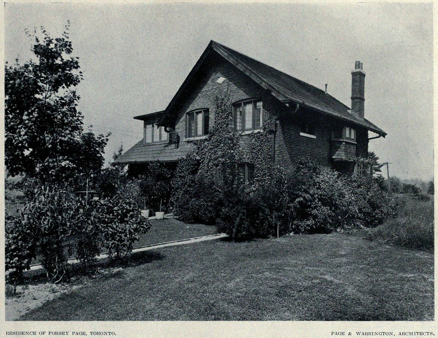
Then. 12 Weybourne Cr. c1920 This is in the Lawrence Park area of Toronto. A wwwebster picture.

12WeybourneCrc1920.jpg


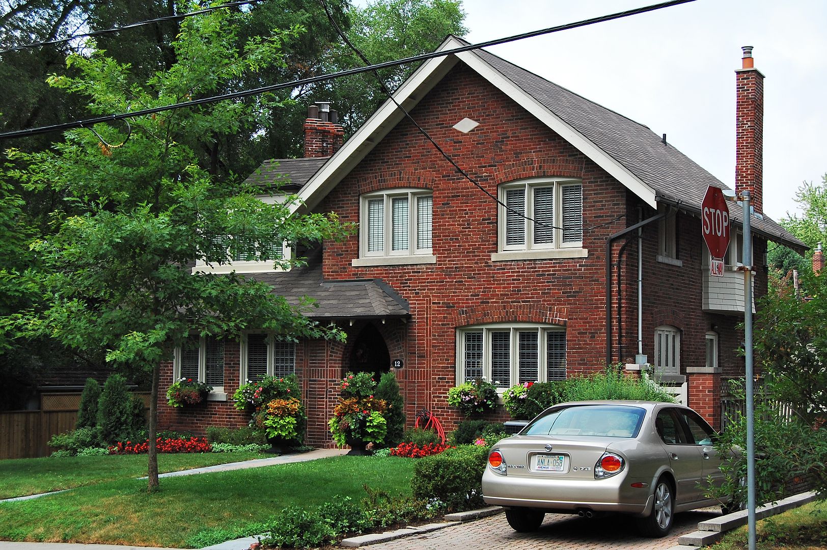
Now. July 2011.

CSC_0141.jpg
 

Back
Top