News   GLOBAL  |  Apr 02, 2020
 9.8K     0 
News   GLOBAL  |  Apr 01, 2020
 41K     0 
News   GLOBAL  |  Apr 01, 2020
 5.6K     0 

"I'm intrigued by the "Open 24 hours" sign--how many 24 hour stations existed in 1955?"
QUOTE: adma.

If memory serves, the old City of Toronto had very restrictive by-laws in regards to gas station hours. This would have been the first gas station outside of the city limits when heading north on Yonge, and would have probably seen a lot of business during hours that the city stations were forced to close.


worldlycanuck.blogspot.ca
 
I'm always drawn to the mailing address on old magazines, this one proved no exception.

In case you were wondering what area constituted Toronto 5:
7658830670_debbf0b95e_n.jpg
 

Attachments

  • 7658830670_debbf0b95e_n.jpg
    7658830670_debbf0b95e_n.jpg
    57.8 KB · Views: 943
If memory serves, the old City of Toronto had very restrictive by-laws in regards to gas station hours. This would have been the first gas station outside of the city limits when heading north on Yonge, and would have probably seen a lot of business during hours that the city stations were forced to close.


worldlycanuck.blogspot.ca
I was working for Bell Canada in the 1950's as a cable splicer, part of our gear was a portable electric generator and a water pump both of which ran on gasoline. We were required to buy gas at this station and no other, oddly the name of the owner (which escapes me) was the same as a very highly placed executive of Bell. A coincidence I guess.
 
Then and Now for March 12, 2013.


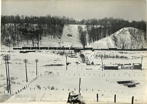
Then. Don Valley. Pre-Bloor Viaduct. Looking west. c1913. That hill on the right was 'Sugarloaf' Hill; removed for fill for construction of the DVP.

1915.jpg


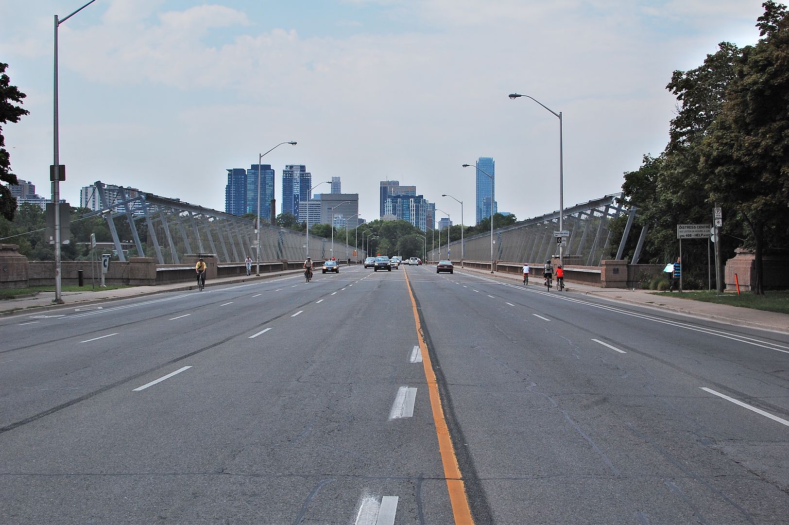
Now. August 2012.

CSC_0418.jpg
 
Last edited:
What Broadview Avenue used to look like in Toronto

See More: http://www.blogto.com/city/2013/03/what_broadview_avenue_used_to_look_like_in_toronto/

2013312-broadview-south-wolfrey-1920-s0372_ss0058_it0863.jpg


Single car truck on Broadview, 1897

2013312-broadview-single-truck-1897-s0071_it3365.jpg


Toronto Public Library at Gerrard and Broadview, 1912

2013312-library-gerrard-broadview-1912-f1244_it7084.jpg


Broadview and Danforth looking west, 1912

2013312-broadview-danforth-west-1912-s0372_ss0010_it0038.jpg


Looking towards Danforth and Broadview, pre-Bloor Viaduct (ca. early 1910s)

2013312-danforth-broadview-pre-viaduct-east-f1244_it7391.jpg


Riverdale Park, 1913

2013312-riverdale-park-1913-s0372_ss0052_it0157.jpg


Queen and Broadview, 1914

2013312-broadview-gerrard-track-1914-s0372_ss0058_it0329.jpg


2013312-broadview-gerrard-track-1914-s0372_ss0058_it0329.jpg


Boxing exhibition, Riverdale Park (Broadview in distance), 1915

2013312-riverdale-park-boxing-1915-f1244_it0971b.jpg


Snow removal on Broadview north of Gerrard, 1917

201312-broadview-1917-snow-s0372_ss0058_it0728.jpg


Looking east across Broadview and Queen, 1918

2013312-broadview-queen-east-1918-s0372_ss0058_it0742.jpg


Broadview looking north of Queen, 1920

2013312-broadview-north-of-queen-1920-s0372_ss0058_it0856.jpg


Broadview looking south from near Dundas, 1920

2013312-broadview-south-dundas-1920-s0372_ss0058_it0858.jpg


Broadview looking south from Gerrard, 1920

2013312-broadview-south-gerrard-1920-s0372_ss0058_it0860.jpg
 
Then and Now for March 13, 2013.


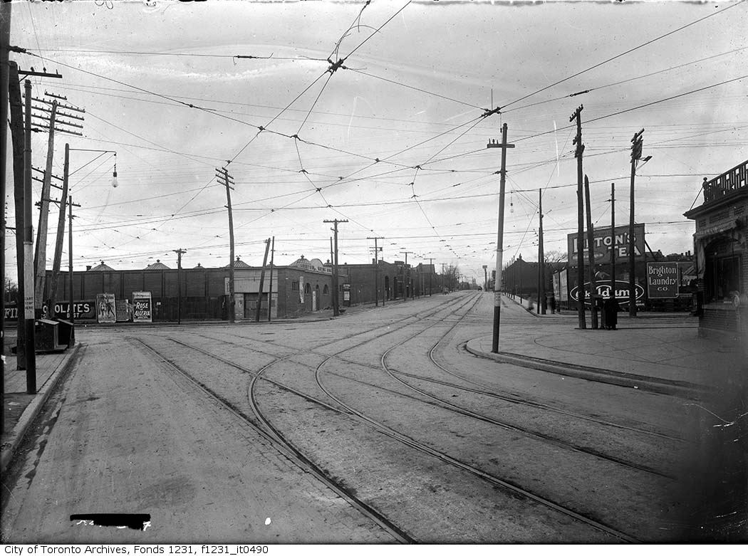
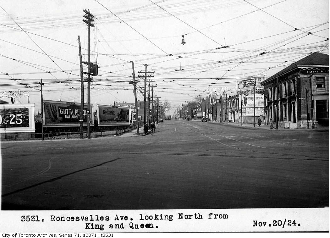
Roncesvalles, King and Queen down through the years. We are looking north.


1909
1009roncynfromqueen1909.jpg


1924
1010roncynfromqueen1924.jpg


2012.
1011.jpg
 
Last edited:
We needed one of the Edgewater sign, Mustapha.

1960:

26ef4347a6c609dfc7c3fea11ffdeb52.jpg


1957:


pictures-r-5626.jpg
 

Attachments

  • pictures-r-5626.jpg
    pictures-r-5626.jpg
    91 KB · Views: 877
Last edited:
Then and Now for March 12, 2013.


Then. Don Valley. Pre-Bloor Viaduct. Looking west. c1913. That hill on the right was 'Sugarloaf' Hill; removed for fill for construction of the DVP.

1915.jpg


Moose, are you sure this view doesn't face east? I would have thought the tracks and Sugarloaf Hill would have to be on the east side of the Don.
 
And that would be the Albert Kemp mansion on the left, the current site of Rosedale Heights School for the Arts.
 
And that would be the Albert Kemp mansion on the left, the current site of Rosedale Heights School for the Arts.

kemp.jpg


The "second Castle Frank", built by Sir Albert Edward Kemp and demolished in 1962. Kemp was Canada's Minister of Defence in 1916 and 1917, and Minister of the Overseas Military Forces during the First World War. He was elected five times to the House of Commons, representing Toronto East, and became a Canadian Senator in 1921.

http://torontothenandnow.blogspot.ca/2010/09/2-castle-frank-then-and-now.html

Regarding the construction of the Viaduct, there are a number of photos in the Archives dealing with the interface of the Viaduct piers with the Kemp property:

s0372_ss0010_it0716.jpg


1913:

9ffcc8a-522b-40d8-8b58-216ab6ef2401.jpg


1924:

7b5e48dd-b1bf-4708-8a0b-a54d8499f09f.jpg
 

Attachments

  • kemp.jpg
    kemp.jpg
    100 KB · Views: 942
  • s0372_ss0010_it0716.jpg
    s0372_ss0010_it0716.jpg
    98.6 KB · Views: 831
Last edited:
Then and Now for March 14, 2013.


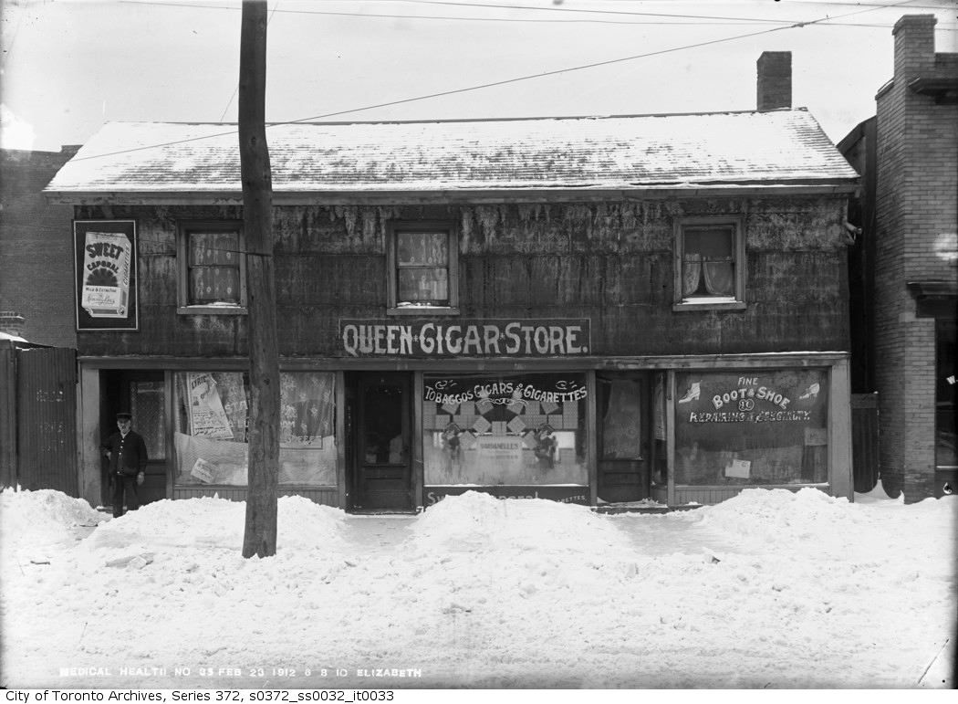
Then. February 23, 1912. 6 - 8 - 10 Elizabeth Street.

10156810elizabeth.jpg


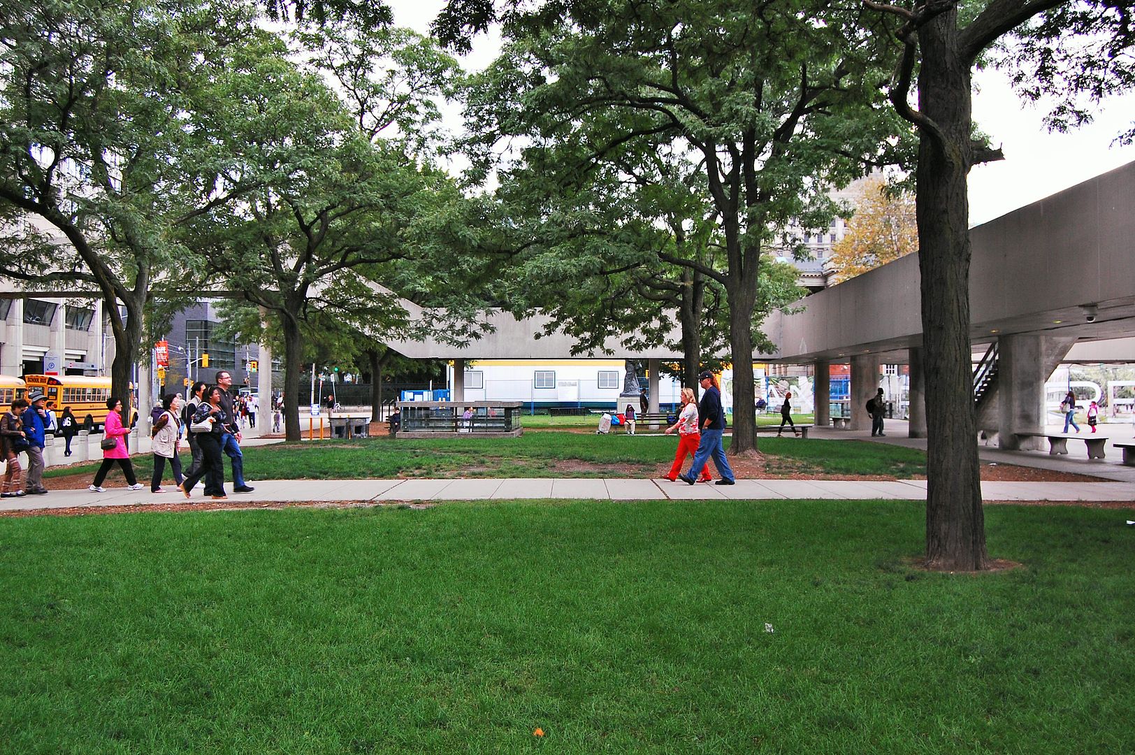
Now. August 2012.

1016.jpg
 

Back
Top