News   GLOBAL  |  Apr 02, 2020
 9.8K     0 
News   GLOBAL  |  Apr 01, 2020
 41K     0 
News   GLOBAL  |  Apr 01, 2020
 5.6K     0 

That is a great story! One thing about IBM/Celestica. I do not understand why no entrance was ever made right across from Wynford Dr. Right now you get cars almost flying out of the north entrance and crossing three lanes of traffic to make the left turn onto Wynford. I know Wynford did not always have a DVP on ramp, but it does now and it would make more sense to use the lights for an entrance and close up the one to the north.

That seems to be a fine suggestion, however I have a possible reason why IBM may have considered it impractical.
The north entrance to IBM is a 'private' road. It's closed once a year to maintain that distinction.
Any new road at the Wynford traffic light would appear, to many motorists, as a short-cut to Eglinton, west-bound.
 
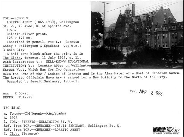
Then. Loretto Abbey. Wellington St. W. 1865 - 1930.

1056.jpg

Ha! My Grandmother was an alumni of the school, and I haven't seen it before (though I've never really looked for pictures).
 
That was the North East Drive In which was on Sheppard about a half mile west of Victoria Park & operated until about 1983/4.

"Was there not one at Victoria Pk. and Sheppard as well? The name of that one escapes me, a few other names for the memories, TeePee, Parkway, 400, and the 7&27."
QUOTE: mattelderca

The first three Drive - in Theatres (1951) within what is now The GTA:

AGINCOURT:
North East, 750 capacity, Park Drive - in Theatres Ltd.

MALTON:
North West, 900 capacity, Park Drive - in Theatres Ltd.

TORONTO:
Dufferin, 990 capacity, Dufferin Drive - in Theatres Ltd.


Regards,
J T
 
Last edited:

thecharioteer,

Interesting. According to your streetmap, in your postcard view the viewer is looking westward towards the eastern side of Loretto Abbey - a quite dignified aspect. But the building on Spadina blocks what would otherwise have been a fine view. I'm thinking the Abbey severed off the Spadina frontage at some point.
 
Then and Now for April 12, 2013.


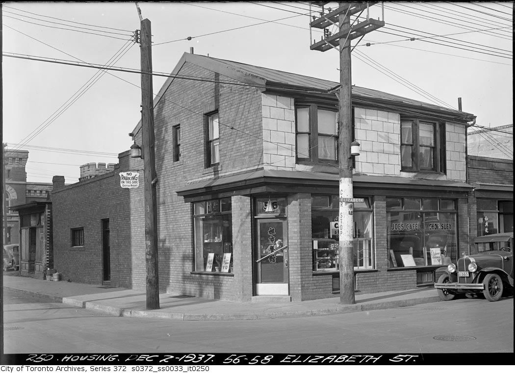
'56 and 58 Elizabeth Street. Dec. 2, 1937.,' it sez at bottom of this evocative picture. Joe's Cafe and Chop Suey. This charming cafe was on the NW corner of the now completely vanished Louisa and Elizabeth.

I'll go ahead and say it: as non-controversial as I like to keep my posts here; as beloved and iconic as our New City Hall is; it sacrificed a vibrant neighbourhood the citizens of which were given no choice in the matter. The truncated remainder of Elizabeth street Chinatown was never the same again.

It wasn't worth it. To me.

Imagine if half of Kensington Market were removed...

1058.jpg


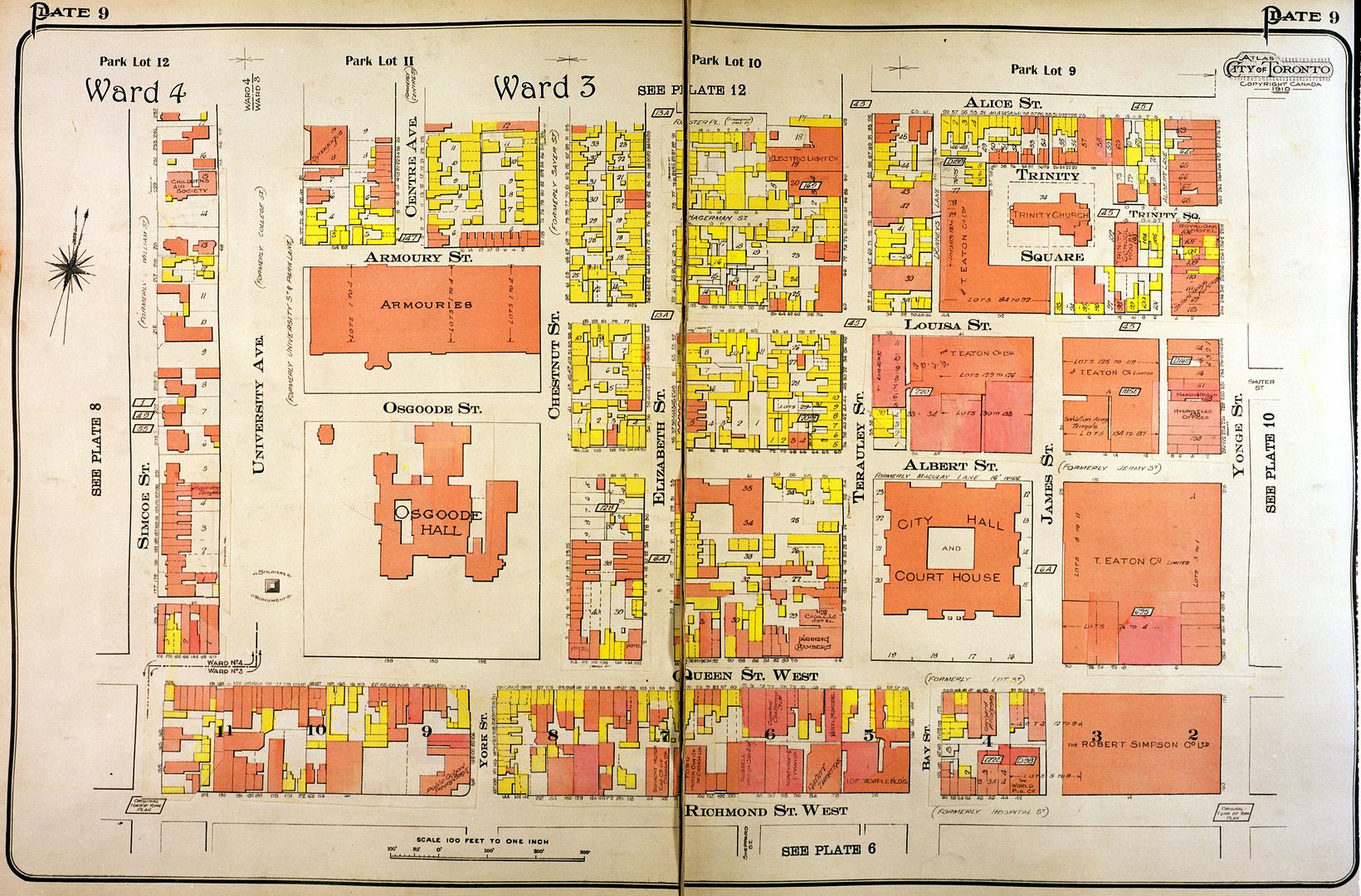
Here's a handy 1924 map so you can get an idea of the lay of the land. Also, to save thecharioteer the trouble. :)

00009_zps577c31d2.jpg


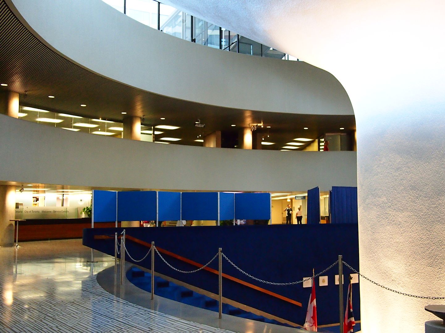
Now. September 2012.

1059.jpg
 
Last edited:
At the St. George subway station today. The electronic ding dong that the train guard uses to signal that he is closing the doors was being completely ignored. Then he pulled out a whistle and used it. Kind of takes one back...
 
An early street in East York;

TNAldwychEfromWoodycrestc1919_zpsc011242c.jpg

Mustapha's question: "The farm on the right... I wonder if the original homestead is still there in the neighbourhood?"


This appear to be the oldest home in the neighbourhood - on the left, far background - an original farm-house perhaps?

TN170Aldwychc1910_zps9bd31f7f.jpg
 
Mustapha's question: "The farm on the right... I wonder if the original homestead is still there in the neighbourhood?"


This appear to be the oldest home in the neighbourhood - on the left, far background - an original farm-house perhaps?

TN170Aldwychc1910_zps9bd31f7f.jpg

Goldie,

This is one of the most amazing Then and Nows I've seen here. The - ahem - transformation - of that home is amazing.

Whoever owns it, or it may have been a prior owner, wanted no evidence of that homes history.

Thanks too for your guesswork and legwork. :)
 
I agree that it's frustrating to use. When I click on a rectangle, a folder is downloaded with three unreadable files (Unix Executable File??) and a jpg. It's pretty well guesswork figuring out the rectangle that has the info I want; it helps to compare the aerials to Google maps (satellite view) to figure out where you are... but well worth it in the end!

This time when I went back the interface was different... slightly more user-friendly, and while it's still hard to figure out what you're actually going to get, boy, you weren't kidding! These things are fantastic. The detail is astonishing!
 
It's Friday. Happy Friday, everyone. Friday should be a day where everyone's in a sunny mood given the weekend is almost upon us. Everyone except the Brits that is - it's never sunny in Britain, so Canadian-style optimism is just not possible.

It isn't just the weather though: Brits have another reason to be distressed...

Witness Highbury & Islington station in central-north London. This is Boris Johnson & Tony Blair's neighbourhood; a classy address.

Beautiful, innit?

photo.jpg
 

Attachments

  • photo.jpg
    photo.jpg
    104.6 KB · Views: 873
Last edited:
That seems to be a fine suggestion, however I have a possible reason why IBM may have considered it impractical.
The north entrance to IBM is a 'private' road. It's closed once a year to maintain that distinction.
Any new road at the Wynford traffic light would appear, to many motorists, as a short-cut to Eglinton, west-bound.
Are there that many stupid people? (of course there are, I know!) It would be an entrance directly into a parking lot. I have driven around the property and while you CAN get to Eglinton, it is not easy and will take you longer than the 100 meters or so down Don Mills.
 

Back
Top