News   GLOBAL  |  Apr 02, 2020
 9.8K     0 
News   GLOBAL  |  Apr 01, 2020
 41K     0 
News   GLOBAL  |  Apr 01, 2020
 5.6K     0 

Evelyn Crescent at Fairview Ave. 1900

EvelynCres1900_zps7d0022ec.jpg


Evelyn Crescent 1954

EvelynCres1954_zpsd2d0ebad.jpg


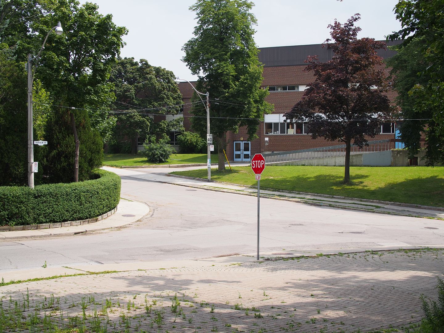
Evelyn Crescent 2014 - Western technical-Commerce

WesternTechnicalCommerce_zps59832ea8.jpg
 
So there's tracks coming down Fairview presumably from Annette, but it also looks like tracks or the remnants of them running east on Evelyn, perhaps the school had service from Runneymede at one point?

That addition on the school doesn't look great but I was by there last week and the original building is still very nice.
 
So there's tracks coming down Fairview presumably from Annette, but it also looks like tracks or the remnants of them running east on Evelyn, perhaps the school had service from Runnymede at one point?

It's certainly intriguing. I haven't found anything on maps yet, but there's this in the Toronto Archives:

s0071_it2769.jpg


Looking north on Fairview from Evelyn

http://goo.gl/maps/72viS


More of the Crescent Line (never heard of this until now):

s0071_it2809.jpg


ETA: https://groups.yahoo.com/neo/groups/transit-toronto/conversations/topics/23053

James Salmon's "Rails from the Junction" says that the TSR Crescent route
was discontinued on November 28, 1922, after the TTC's new Humberside bus
route, with its free transfer to the Dundas car, had drawn away most of the
Crescent line's customers. The track was lifted in 1923.

The Crescent line operated from Keele and Dundas via west on Dundas Street,
south on Gilmour Avenue, east on what is now called St Johns Road, and south
on Fairview Avenue to Evelyn Crescent.
 

Attachments

  • s0071_it2769.jpg
    s0071_it2769.jpg
    185 KB · Views: 1,411
  • s0071_it2809.jpg
    s0071_it2809.jpg
    193.9 KB · Views: 1,374
Last edited:
The number of streetcar lines within the city never ceases to amaze me, they were everywhere, just when you thought you knew them all a new one pops up.
 
Also the trees behind the streetcar in Mustapha's 1900 pic are still there in the 1954 pic and if I'm not mistaken 3 of them are still there in the google view of today.
 
Last edited:
For a detailed map of Toronto's current and historical street and inter-urban railways visit my website www.cermc.webs.com to download your free digital copy that runs on Google Earth.
 
For a detailed map of Toronto's current and historical street and inter-urban railways visit my website www.cermc.webs.com to download your free digital copy that runs on Google Earth.

I already had that downloaded and I've really enjoyed it, I should have checked it as it answers all the questions but for the wye down at the south end, I read somewhere that it was at Woodside but clearly there is track south of that in those pictures.
 
I already had that downloaded and I've really enjoyed it, I should have checked it as it answers all the questions but for the wye down at the south end, I read somewhere that it was at Woodside but clearly there is track south of that in those pictures.

Can you share any evidence you have of this wye? I am not aware of one on the Crescent line.
 
Last edited:
Evelyn Crescent at Fairview Ave. 1900

EvelynCres1900_zps7d0022ec.jpg


Evelyn Crescent 1954

EvelynCres1954_zpsd2d0ebad.jpg


Evelyn Crescent 2014 - Western technical-Commerce

WesternTechnicalCommerce_zps59832ea8.jpg

This had to happen sooner or later :) , I had this location as a Then and Now in the rotation to come up but Goldie beat me to it. Here is my Now. Not sure of the 'value add' to the knowledge here, but here is the Now pic I took this past July:

1287_zps781dd8c8.jpg
 

Back
Top