


thecharioteer
Senior Member
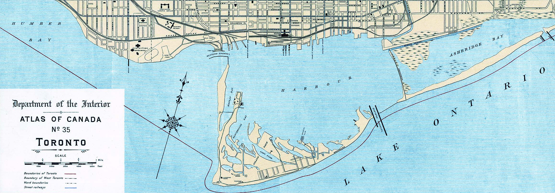
1906 Harbour Map:
Last edited:
|
|
|
Even better would be a site that has links to all Toronto scanned maps but ....
")
Sorry to bump this old (though still interesting) thread but I have a question.
For several years there have been discussions in St Lawrence about some sort of commemoration of the 'original shoreline' and there are currently two locations where this has happened. One is at the Distillery District and the other is the art piece on the Church Street side of The Berczy.
One question has always been 'which shoreline' but this appears to moving towards a consensus on the shoreline in the early 19th century. The City used to (and maybe still does) note the "Top of Bank" and "Waters Edge" in many plans - as shown on this (1973) street plan for the corner of George and Front that is part of a 1973 by-law about a lease of City land.
View attachment 416620
QUESTION; Do any UTers know of a map/plan of the area between Bay Street and Cherry Street that shows these lines? Who would have such a thing, the City's Geospatial Competency Centre says they have no such plan, but i suspect the information is coded somewhere in their files. HELP!!
As usual, very helpful maps but I am still hoping to find a City 'plan' or map (or plans/maps) showing the exact surveyor lines of the Top of Bank and Water's Edge for the whole area from Bay to Cherry - similar to the one I found for the Front/George intersection.Hmm, there's this, in the archives (but its not very clear); fetched from BlogTO:
View attachment 416622
The Star has a bunch of old maps:
View attachment 416627
from: https://www.thestar.com/news/gta/2013/06/26/wharf_a_reminder_of_torontos_transformed_shoreline.html
If you go to the article linked above you can scroll through several more.
**
I think this one from U of T might be the best:
View attachment 416626
from: https://maps.library.utoronto.ca/datapub/digital/NG/historicTOmaps/1855MagnusN.JPG
As usual, very helpful maps but I am still hoping to find a City 'plan' or map (or plans/maps) showing the exact surveyor lines of the Top of Bank and Water's Edge for the whole area from Bay to Cherry - similar to the one I found for the Front/George intersection.