News   GLOBAL  |  Apr 02, 2020
 9.6K     0 
News   GLOBAL  |  Apr 01, 2020
 41K     0 
News   GLOBAL  |  Apr 01, 2020
 5.4K     0 

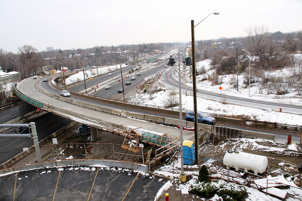
Oriole station is planned to move north as a part of the project. The station will be losing its parking under the 401 during construction and it can’t operate under bridges getting built so Mextrolinx is going to move it north to the subway since it has to be moved anyway.
 
Oriole station is planned to move north as a part of the project. The station will be losing its parking under the 401 during construction and it can’t operate under bridges getting built so Mextrolinx is going to move it north to the subway since it has to be moved anyway.

Will the parking eventually return at some point? They could just build a walkway from that parking lot to the new station to the north.
 
I take this exit all the time and when coming from the west, I exit express lanes one transfer before. It is dangerous to change that many lanes in around 700 metres. Earlier I used to take Kennedy exit and it was the same problem there. I had to switch to collectors one transfer before to make a safe exit.

I think the same thing occurs now at the new westbound exit to Mavis Road.
 
Oriole station is planned to move north as a part of the project. The station will be losing its parking under the 401 during construction and it can’t operate under bridges getting built so Mextrolinx is going to move it north to the subway since it has to be moved anyway.
Are you sure? I thought that wasn't approved/financed yet.

Also, the pictures on the previous page, show the new road bridge being build over the existing platform.

What's discussed on the GO website - https://www.gotransit.com/en/the-future-go/improvements/oriole seems to be about an interim platform extension to the north, but not a connection to the subway. Basically where the existing footpath is from the current platform to the south side of Esther Shiner Boulevard.
 
Nov 23
50670167331_ec60492080_b.jpg

50670167601_f953f4a2d2_b.jpg

50670246487_55779f8831_b.jpg

50670167831_8a3e6d5bfb_b.jpg

50670167976_a3df8422f5_b.jpg

50665322078_a5d2261f7f_b.jpg

50665321968_b2fa3e3617_b.jpg

50665321898_5f4ecb6430_b.jpg
 
QEW?

What are they doing here? Finally widening for HOVs between 403 and 427?
Right now it's primarily rehab work and replacement of the Etobicoke Creek bridge.

There is a second phase that will replace the Dixie Rd interchange with a modern Parclo interchange and add a westbound lane through to Cawthra to relieve the bottleneck there. Not sure on the timing of that though, It will probably follow the Etobicoke Creek work.

The HOVs are being accommodated for on the Credit River Bridge replacement project, though there is no funding for them right now. As the plans stand today there will be a fully widened road structure over the Credit River with temporary jersey barriers blocking it off until the HOVs are constructed, much like existed for years on the 400 at King Rd.

While the HOVs are a while off yet, the Dixie Rd interchange and Credit River bridge projects address the two primary bottleneck locations that are always the first to cause traffic issues, so it should help quite a bit for travel times across the corridor even without an added lane across the whole route.
 
Speaking of the QEW, what's happening on the 403/QEW interchange that's backing up traffic eastbound so terribly recently? It's the 403 ramps causing the issues for sure, because traffic is dead stopped on them and it is backing up all the way down to the QEW. I couldn't find anything specific about the working going on, only the HOV lane expansion work on the QEW.
 
I drove on Sunday night and it looked like they are working on the underpass of the 403 ramp under the QEW. They narrowed to one lane through there.
 
Speaking of the QEW, what's happening on the 403/QEW interchange that's backing up traffic eastbound so terribly recently? It's the 403 ramps causing the issues for sure, because traffic is dead stopped on them and it is backing up all the way down to the QEW. I couldn't find anything specific about the working going on, only the HOV lane expansion work on the QEW.

They shifted the location of the 403 off ramp. It used to be earlier on, combined with the Ford Drive ramp. on Sunday they switched it so that it has it's own exit further along the highway.

The problem is that they changed the signage about 2 weeks ago to reflect this, and just had the 403 ramp closed with pylons. So everyone learned to ignore the signs and just keep taking the Ford Drive exit to get to the 403.

Come Monday morning, everyone ignores the signs saying it's Ford Drive only, as on Friday the signs were wrong, getting off at the Ford Drive exit, which now only exits to Ford Drive, thinking they are going to the 403. And.... Traffic!
 
lol what this is ridiculous. Electronic sign to show where the exit is? Do they also need Elmo to jump out and teach them how to read? I get that this is a change of pace, but I watched the video, and despite often travelling that section of QEW, had no difficulty realizing that the exit wouldn't take me to 403...
 
I get things like 'habit' and 'muscle memory' but the signs looked pretty clear to me. I'm wondering how much is attributed to folks blindly following GPS and the database hasn't been updated. Sometimes the MTO gets caught up in its signage rules and protocols and forgets what they are dealing with. Perhaps a 'new' sunburst or adding 'only' to Ford Dr. sign would have helped.
 

Back
Top