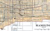
It looks like the roads mentioned are on the map - but as the site says, sometimes roads/subdivisions intended to be built but never built show up. The incline railways are also marked.
Mud Street @ Mountain Brow
This is not a Mountain Access, but rather a portion of Mud St that was closed off due it's proximity to the edge of the escarpment. The road is still intact if you ever want to check it out: http://www.bing.com/maps/default.as...dir=0&alt=-1000&phx=0&phy=0&phscl=1&encType=1
This was not lost due to The Linc. It was done WELL before any work began in this area!
Edit: (Addition) 'Old' King St, by Mt Albion. Replaced by a larger King St that was built to accomodate the yet-to-be-approved Red Hill Valley Parkway. http://www.bing.com/maps/default.as...dir=0&alt=-1000&phx=0&phy=0&phscl=1&encType=1
It's now used as a pkng lot for the Red Hill Valley Bowl (baseball diamonds) with an underpass under the new King St.
I actually live, and have so for 5 years almost, at the top of John St S and I have never realized there was an access there! I'm so checking it out when I get home 2nite!!
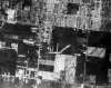
On today's view, if you follow the rail line/trail that runs perpendicular to those supports in a straight line through the warehouses and hwy. 20/Centennial Pkwy interchange you'll find another segment that meets up with the main rail line.
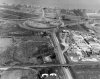
At one time (1938-mid1970s) the QEW-HWY interchange looked like this - with the rail line cutting right through the circle. This is a 1970 picture.
The two warehouses and the rail overpass in the foreground of the photo are still there today. Home Depot is in the lower right corner.
EDIT: Apparently Bing Maps is more current than Google Maps. Bing Maps shows the warehouse on the right is now a parking lot.
It looks like the roads mentioned are on the map - but as the site says, sometimes roads/subdivisions intended to be built but never built show up. The incline railways are also marked.
Looking at this map, I can see that St Joseph's Dr (lil street shooting east out of John St, just North of the Jolley Cut) was also a Mountain Access. It seems as though it cut across and up at the exact same spot that is now a trail! If this is the case, I have walked this path dozens of times without realizing it was once a road!
I can even see there is a cut in the rocky escarpment right below the mouth of this path!
Great info, Willyrover! I have seen old photos of the Beachfront community like that before, and it amazes me how it's transformed! THANKFULLY!
I've also found a couple dead end, or abandoned, rails in that business park area of Stoney Creek where that railroad once used. It's neat to see them upclose!
I have been doing some research on the development of the central mountain area. I spent the better part of the day at McMaster Library - specifically:
What an amazing resource! Aerial photos as far back as 1919!
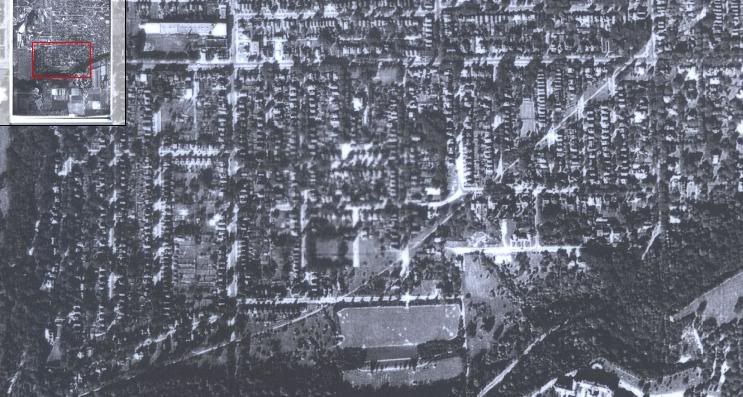
Anyway, here is a photo showing a "Back to the Future style" continuous stretch of Mohawk Rd. The main intersection shown right of center is Mohawk and Upper Wellington. (TOP = North) I also attached the full 1950 photo. Mohawk Rd. is at the bottom of the picture.
The left half of the picture is from the 1950 photo and changes to the 1978 photo on the right.
What's interesting is that it appears that the old road used to run parallel to the new one about 50ft further south until sometime before 1950. Up until at least 1978, ghosting of the road can be seen on the lawns of the apartments along Mohawk.
This belt line, from the old rail track, answers my curiosities about that lil parkette @ Queen & Aberdeen, and why some houses in this area are built during the 70's-80's!


 )
)