News   GLOBAL  |  Apr 02, 2020
 9.7K     0 
News   GLOBAL  |  Apr 01, 2020
 41K     0 
News   GLOBAL  |  Apr 01, 2020
 5.5K     0 

I found the "Plan" at https://www.toronto.ca/city-governm...gies/taylor-massey-sub-watershed-master-plan/ I could not see any City info on the actual work or when it may finish. Ideas?

As at the last capital budget I did not see any of the projects listed in the plan as freestanding items.

Though, some could be delivered through the Ravine Strategy.

The latter of which is languishing w/very little funding.

There are 2 major projects addressing erosion under way in the Park, the one noted above and another which we have some pics of below Stan Wadlow.

One of the issues here is that the park will be the subject of a major new stormwater interceptor (next phase of the Don River - Coxwell project); but the timeline on that has slipped quite a bit.

Some projects in the plan could be affected by Toronto Water's Project (the pipe) which at this point is likely to be in the 2030s.

There are other projects which should be able to proceed, if PF&R can find the money.
Thanks, but what is the schedule for the completion of the current work of which you just provided photos (just west of Dawes Road)?
 
Thanks, but what is the schedule for the completion of the current work of which you just provided photos (just west of Dawes Road)?

Just east of Dawes - December '23 LOL

They're running a bit late.

The structural work looks close'ish, they might be able to wrap in another month; but then they'll likely need to repave the bike trail, and then restoration crews needs to move in and plant.

Ideally that planting would be going on right now; but anywhere up to the end of May is acceptable. If they slip past that, then restoration should really be deferred to fall and/or spring '25 depending on the plant mix chosen.
 
Last edited:
A small missing link was recently remedied - the bridge over Taylor Creek from a path down from St Clair to the multi-use trail on the north side connecting Birchmount and Warden has finally been replaced and it is a dandy.
1000003529.jpg

I pass through on that trail regularly on a cycling route I have established which incorporates sections of the Taylor creek valley, the Gatineau Hydro corridor, Pine Hills cemetery, Hydro greenspace, Charles Sauriol, the Don Mills Rail Trail, and E. T. Seton Park.

From my observation the most jubilant benefactors of the bridge replacement might be a small crowd of beer-drinkers who gather at midday at a retaining wall just west of birchmount and who now have a more direct route to the beer store on st. Clair
 
The (as it was, before the recent construction) underpass at Dawes is an excellent example of how it could/should perhaps be designed for the underpasses at St. Clair and Birchmount and St. Clair and Warden. The latter being what I, an admittedly rather brave cyclist, would describe as a frightening intersection due to the volume and speed and size/composition of the vehicular traffic.

I cannot imagine what it would take to engineer a pedestrian/cyclist path along the culvert that channels the creek under that intersection, but it is nonetheless a great idea.
 
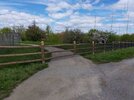
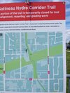
Someone at the works department must be following this thread, because I noticed today they have begun remediating the section of path washed out by Taylor Creek in the Gatineau Hydro Corridor.

2024-05-09-12-52-45-465.jpg2024-05-09-12-55-12-521.jpg
Acutally, from the looks of it it appears more as if they are abandoning the washed-out section in favour of improving what had been the bypass.
 
Just downhill from Stan Wadlow park again, this time showing the new trees:

View attachment 568824
View attachment 568825

Sigh.

I went and had a close look at this, and I have many issues.

1) This is a very wet site, and I'm dubious about the species selection which includes Sugar Maple and Basswood, and other species that aren't really keen on wet feet (roots)

* When I say wet, walking the fence line yesterday, my footware sunk completely below water.

2) The site is dominated by very expensive 10-12 ft hardwood caliper-sized plantings, which is not the way one would normally do a restoration site. There is enhanced risk of transplant shock at this size as roots are cut back a lot when moving trees of this size. I could understand mixing a few in..........but these trees are something like ~$800 a piece installed. Someone has public dollars to burn. This is a $100,000 planting (or more); for that kind of money, something much better could be achieved. As of writing, there is no sign of any shurbs or herbaceous plants (ferns/grasses/wildflowers) which means a high risk of non-native, invasive species occupying that bare ground. In fairness, maybe that's coming, but probably not.

3) There are at least 9 Cedars, great choice for the site, if they weren't 2 feet tall, in the shadow of 12ft hardwoods. They will likely all die within 5 years.

I'm grateful to see this site naturalized, but this does not look well thought out.

4) I would have preferred any of:

a) A wetland
b) A wet meadow
c) A swamp (forested wetland)

All of these would have made more sense.

5) Finally, they did all this planting before repaving the bike trail, and they placed the trees extremely close to where the trail will go. This means some real possibility of injuring the trees during the paving work. Wrong order of operations.
This question is born out of a lack of knowledge on my part, and it should be said I am someone who frequently overwaters plants:

Is there a knowledge gap in planning this or other projects, specifically recent research or strategies surrounding the type of planting described above? It seems like there is a high risk to many aspects that might force future dollars to be spent repair the area. As someone unfamiliar with this world, I would imagine the longevity of the planting is high on the priority list so future money isn't required.

Or is this more of a situation where there could be differing opinions on what will work and what will not work?

I don't know/haven't asked yet, which agency spec'ed the details.

So I won't slag anyone, as I neither know the responsible party, nor have I heard their reasoning.

On the species chosen, honestly, I've seen very suspect choices lots of times come from Forestry and the TRCA. Both have competent people who care, but both also have green staff w/o the requisite knowledge. They know what native is, may read off a list for sunny/shady plants.........but they're new, and just missing real-world knowledge.

Things like growth rates of different species. Many also don't take the time (in fairness may not be given the time) to understand the sites on which they are planting (ie. if someone walked this site in mid-August after 10 days w/o rain, it would be average moisture to slightly dry; much different than it is in the spring.

This is why you need to look at sites more than once, ideally, (old pictures may be fine), but you want an understanding of how a site behaves or changes nature at different times of year.

Species choice should not be, but may also be influenced by easy availability from a preferred vendor.

Toronto rarely spec's Bitternut Hickory or Buttternut, even though both are native and belong through much of Toronto. But they are slow growers and not all that widely available in the nursery trade. This may mean extra paperwork and ordering from a specialty vendor.

****

On the size of the trees........this is only a guess......but because they had to cut down quite a few trees to do the work on the creek banks, this is likely a 'compensation planting' which comes with a formula of 3 or 4 to one, typically.

The thing is, if you're trying to replace canopy, or shade, you may feel you should be planting trees with a head start that provide canopy more quickly. There is a case for that, I suppose, but the trade-offs are dubious in my opinion.

*****

In general, the City is getting a bit better at stewarding old planting sites, but its still a bit hit and miss in terms of a thoughtful, consistent approach. This site, is likely a one-off capital project funded by Toronto Water, and I doubt it will be stewarded much beyond the warranty period for the trees (typically 2 years)

Though maybe Toronto Nature Stewards could look into it.
 
Last edited:
Sigh.

I went and had a close look at this, and I have many issues.

1) This is a very wet site, and I'm dubious about the species selection which includes Sugar Maple and Basswood, and other species that aren't really keen on wet feet (roots)

* When I say wet, walking the fence line yesterday, my footware sunk completely below water.
Wait, they didn't fix the drainage in this section?!?

Dan
 
  • Sad
Reactions: DSC
Wait, they didn't fix the drainage in this section?!?

Dan

They made some minor grading adjustments, but otherwise 'no'.

Being fair though, this area is at the bottom of a very big slope, and would naturally be wet, wherever mowing has stopped some variation of wetland has emerged nearby. The water has to pool somewhere. Which is why I thought this would make a great site for a wetland, because you purposefully pool the water much deeper on a portion of the site, and then have the rest be a bit dryer. i also suggested letting the water drain under a small bridge (bike path), in the open, as opposed to a small catch-basin pipe, as it would be much less prone to getting clogged w/silt.

Ah well.
 
Last edited:
They made some minor grading adjustments, but otherwise 'no'.

Being fair though, this area is at the bottom of a very big slope, and would naturally be wet, wherever mowing has stopped some variation of wetland has emerged nearby. The water has to pool somewhere. Which is why I thought this would make a great site for a wetland, because you purposefully pool the water much deeper on a portion of the site, and then have the rest be a bit dryer. i also suggested letting the water drain under a small bridge (bike path), in the open, as opposed to a small catch-basin pipe, as it would be much less prone to getting clogged w/silt.

Ah well.
Right, but the path is also the reason why the water pools there. As you note, they could have elevated the path and built some manner of allowing the water to drain from there - they certainly have done that elsewhere, so it's not like it is a foreign concept.

I too could have seen a pond or marsh as an idea "feature" for that spot, which is why I'm a bit flabbergasted to see that instead nothing was done other than "hopes and dreams".

Dan
 

Back
Top