News   GLOBAL  |  Apr 02, 2020
 8.8K     0 
News   GLOBAL  |  Apr 01, 2020
 40K     0 
News   GLOBAL  |  Apr 01, 2020
 5K     0 

This storm is expected to bury Toronto under 25 to 30 cm of snow, breaking a 28-year-old snowfall record for the day and likely rivalling the largest-ever March snowfall, set in 1964 when 32.3 cm fell. Toronto had 171 cm of snow before the storm, which began with flurries Friday afternoon before revving up today with heavy snow and wind gusts of 40 to 60 km/h. The record set in 1939 was 207 cm. It looks like we could come close to 200 cm. The biggest snowfall so far this winter was Feb. 6 when 30.4 cm fell. It is great to see so many people out in the park today tobogganning, walking their dogs, cross-country skiing and one fella with snowshoes. Enjoy it while it lasts. :)
 
I was one of the many people out enjoying the snow with my dog this afternoon, she loves the snow. I lost my life long dislike for snow and winter a few years ago as her joy and enthusiasm for the season finally got the better of me. Full disclosure, I gave up my car years ago so I don't have to drive in it.
It looks like more snow on Tuesday so we may crack the '38/'39 record yet!
Jarvis & Charles area around 2:30pm Saturday -

PICT1318.jpg


PICT1320.jpg


PICT1322.jpg
 
It amazes me how different the weather can be sometimes...

DT: Good pics-your dog seemed to be enjoying the snow-again we get none
here near the Middle Atlantic Coast.

Everyone: The weather of just about 500 miles away turned out to be so different than what happened along the Middle Atlantic coast. Yesterday I was in Philadelphia-which had about 2 inches of rain yesterday. When the cold front finally plowed thru yesterday evening along with severe thunderstorms in spots-the temperature had reached 65 degrees F during the day-gusts of wind upwards of 70 mph were recorded knocking out power (my cousin's place lost power for 2 hours yesterday evening for example) and causing tree and other damage due in part to the damp grounds.

Today rivers such as the Delaware have come out of their banks in spots-but flooding will not be too bad with the river reaching or cresting at flood stage but not much above. Judging by the very heavy northeastern rain there may be flooding in New England because of heavy rain over snowpack. Many spots along or near the Atlantic Coast-including Philadelphia and Long Island-have had little snow(less then 10 inches total) this Winter season.

I watched the Weather Channel describe the snowstorm that hit Ohio hard. They had a meteorologist doing a live broadcast from hard-hit Cleveland where many people considered this storm worse then the Blizzard of 1978-which I remember hit Long Island with one of the biggest snowstorms that I can recall-between 2 and 3 feet of snow. They also mentioned that areas from Western NY down across Ohio and as far south as Tennessee were hard-hit by this weekend's storm.

It seems that about 4 to 500 miles seems to made all the difference in this storm-and others this Winter also. The Middle Atlantic Coast for the most part has not had a major coastal snowstorm (they are usually responsible for our biggest snowfalls) this year-all have been large rainstorms-for example if yesterday's storm had been snow we would have been digging out from around two feet of the white stuff.

This subject is one of the reasons I find weather fascinating and a great subject to study and be interested in. The weather affects everyone somehow in some way! LI MIKE
 
what a wonderful day it is today. everyone is out shoveling and talking to their neighbours. awesome atmosphere. it sucks that i have to write an essay today :(

what a beautiful day outside today.

my backyard
DSC06123.jpg

DSC06127.jpg


before i shoveled the walkway. where is it?
DSC06124.jpg


just some shots looking onto the street.
DSC06125.jpg

DSC06126.jpg

DSC06130.jpg

DSC06131.jpg
 
Post mortem from Environment Canada....


Special Weather Statements for Ontario
Weather summary for all of southern Ontario and The national Capital region
Issued by Environment Canada Toronto at 12:54 PM EDT Sunday 9 March
2008.


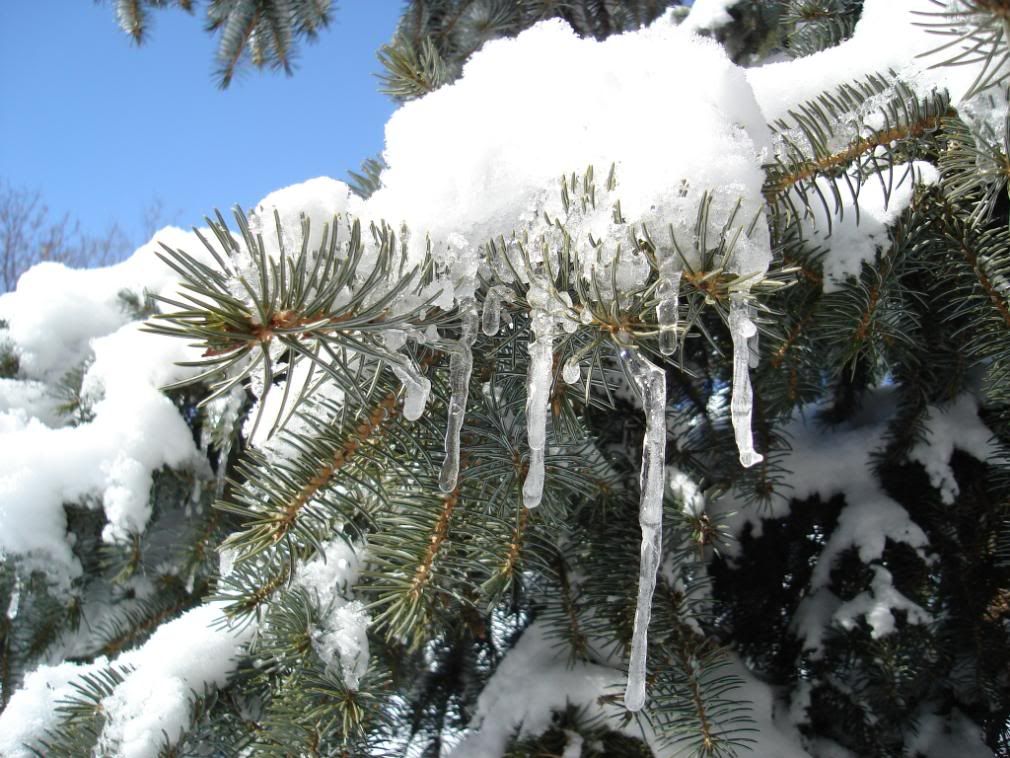
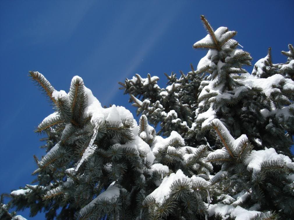
Massive winter storm which affected southern Ontario has ended.
-------------------------------------------------------------
==weather event discussion==

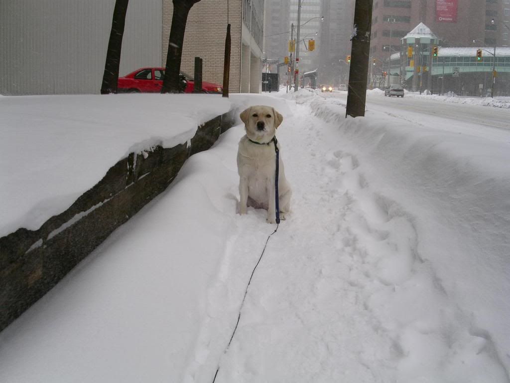
The major winter storm which has pummelled southern Ontario over the
last two days has moved out of the province. The snow began Friday
morning over areas north of the lower Great Lakes and across
Eastern Ontario by Friday evening. The second band of very heavy
snowfall started on Saturday during the day and lasted into the
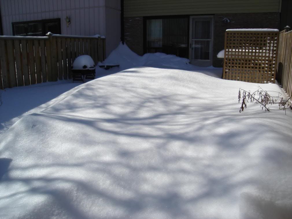
night. There has been a wide range of snowfall amounts across the
affected areas with estimates ranging from 20 to 50 centimetres
Of snow. The heaviest amounts of snow fell in the Niagara region to
eastern Ontario and lake effect snow behind the storm gave locally
higher amounts in Barrie.

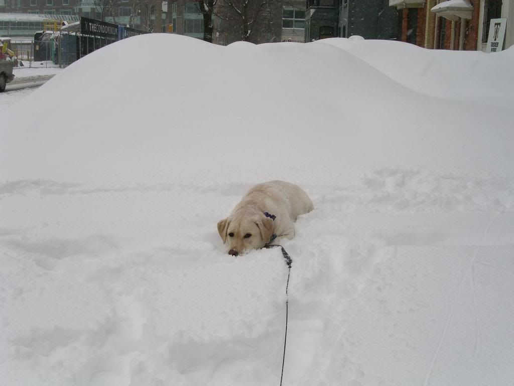
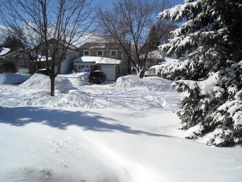
This storm has crippled many areas especially in eastern Ontario
where the Ontario provincial police has resorted to using
Snowmobiles for transportation and 7 foot snowdrifts have been
reported in the area.

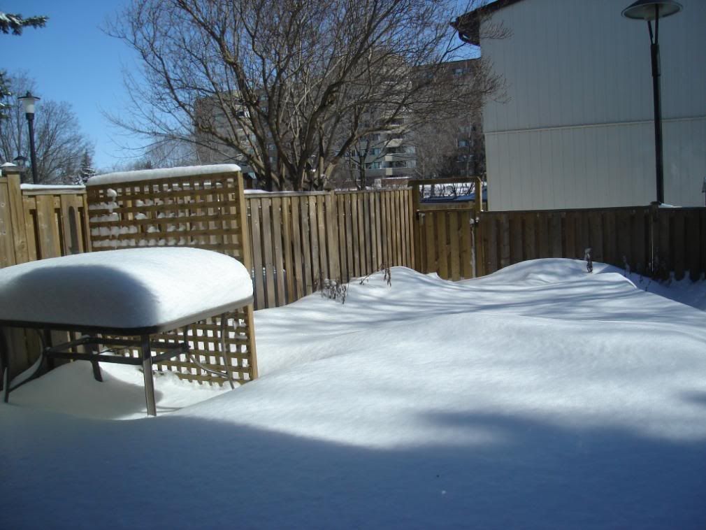
This continues to be the second snowiest winter recorded for Ottawa
with this seasons snowfall totals reaching 410.7 cm. The record for
Ottawa is 444.1 cm of snow set in 1970-1971. This could be the
Fourth snowiest winter for Toronto at Pearson airport with total
snowfall amounts of 189.6 cm. The record for Toronto Pearson airport
is 207 cm of snow set in 1938-1939.

The following is a updated summary of snowfall totals from the onset
of snow Friday until 9 AM today as received by Environment Canada.
Please note that obtaining accurate snowfall totals for this event
has been difficult because of the blowing snow which accompanied the
storm.

-------------------------------------------------------------
Location snowfall amounts (cm)

Toronto Pearson airport 15 cm + blowing snow (as of 4 AM sun)
Toronto High Park 30 cm + blowing snow (as of 1 AM sun)
Toronto Downtown - the annex 25 cm + blowing snow (as of 12 AM sun)
Toronto Riverdale 25 cm + blowing snow (as of 12 AM sun)
Toronto East York 27 cm + blowing snow (as of 1 AM sun)
Toronto Downsview 32 cm + blowing snow (as of 8 AM sun)
Toronto Buttonville airport 25 cm + blowing snow (as of 4 AM sun)
Brampton 33 cm + blowing snow (as of 8 AM sun)
Woodbridge 40 cm + blowing snow (as of 1 AM sun)
Thornhill 25-30 cm+blowing snow (as of 6 PM sat)
Sutton 29 cm (as of 8 AM sun)
Barrie 45 cm (as of 9 AM sun)
Ottawa 52 cm + blowing snow (as of 7 AM sun)

Follow the link for more snow totals in other locations.

Ottawa got pounded again, what a winter they've had these season. I've been lucky to miss those storms during my visits the past couple of months.
 
I just got back from Ottawa. The final tally was 56 centimetres of snow from Friday afternoon to early in the morning Sunday. The average monthly snowfall for March in that city is 40 cm. They had 87 cm over a five day period.

I went out for a walk in it and have to admit that it is really cool to see a city so buried in blizzard.
 
I was one of those fools driving on the weekend - from Cobourg to Georgetown on Saturday and to Collingwood on Sunday. There were snowplows in front of me across the city so it was slow but clear. As soon as I hit Mississauga they turned off and it got really hairy. I saw one car spin out at a transfer to the collectors and another go right into the concrete barrier. But I survived - the Accent got me through it!

The skiing on Sunday was interesting. I'm so used to the icy conditions of the east that I don't know how to ski in so much powder, especially as it got chewed up as the day went on. It was fun but exhausting.
 
I had two Big Digs on Saturday - at 2 pm and 7 pm - and a Little Dig on Sunday afternoon after the sun had melted a lot of it.

So bright everywhere, too.
 
Don't put away parka yet, chief weather watcher warns
Last Updated: Monday, March 10, 2008 | 9:12 AM ET
CBC News


Eastern Canadians shouldn't pack up the snow gear just yet because the winter that won't end isn't going away any time soon, the country's top weather predictor said Monday.

ottawa-snow-cp-4463782.jpg

A pedestrian walks along Wellington Street on Parliament Hill in Ottawa on March 5. (Sean Kilpatrick/Canadian Press)

"What a winter it has truly been," Environment Canada's senior climatologist David Phillips said Monday as people in Eastern Canada cleaned up from a weekend storm that dumped up to half a metre of snow on some parts.

He warned that the monster storm isn't likely the last big snowfall because 20 per cent of Eastern Canada's snow comes after the first day of March, while 15 per cent of that comes after the first day of spring.

"Don't put away the snow shovel. Don't put away the parka or the balaclava or the booster cables because winter is always slow to leave Canada and spring is reluctant to arrive," he said.

This winter has lived up to a prediction Phillips made in November, when he warned Canadians would face the worst winter in roughly 15 years.

Ottawa and Montreal are on track to break records set in 1970-1971, while Toronto could break a record set in 1939.

"I'm kind of hoping we break a record. It will give us a badge of courage … 'I survived winter 2007-2008,' " he said.

'Psychologically worn out'

One of his favourite stories of the winter has been the snowfall in Ottawa, which has the odd distinction of being the world's snowiest national capital.

pe-snow-feb13.jpg

Snow covers Charlottetown streets earlier this year. (CBC)

"I must admit I thought that record would never be broken," Phillips said of the 444.6 centimetres of snow that fell 36 years ago.

Phillips said while he takes no delight in the misery of a tough winter, he's pleased with the accuracy of his prediction because people usually only remember the failures of weather forecasters.

"When you kind of get it right, you wish people would reflect on it," he said.

While he joked that people in Eastern Canada are likely in great shape from all the shovelling, he said the winter is taking its toll.

"Psychologically, I think we're worn out. Not only [is it] the amount of snow we've had, it's the number of days with snow," he said. "Every time you look out, either it's collecting on the ground or it's just even a trace snowing in the air."

Some cities have seen snow collect three out of every four days this winter, he said.

Eastern Canada 'in their crosshairs'

Phillips said Eastern Canada's heavy snowfall can't be blamed on cold northern air.

"You don't get a lot of snow from Alberta clippers, Siberian air. They don't have a lot of moisture."

mtl-testsnow.jpg

Two men inch their way down De Maisonneuve Street in Montreal. (CBC)

Instead, the frequent and high snowfalls can be chalked up to slightly warmer temperatures and moisture-heavy weather systems coming from the southern United States — California, Colorado, Texas, Oklahoma and the Carolinas.

"It's almost as if they've got Eastern Canada in their crosshairs," he said. "They're like bowling balls on the rack — one after another. It's just relentless. And it's been that way probably since the third week in November."

A weather phenomenon called La Nina is also playing a role, he said. The mass of cold water off the southwest coast of South America typically brings colder air to Western Canada and more snow to the East.

Phillips warns warmer spring temperatures and high snowbanks could be a dangerous combination. There's almost a "perfect storm" of conditions for spring flooding across the East, he said.

"If there is a rush to spring and spring rains, there could be flooding in many rivers in Eastern Canada," he said. "We want a slow coming to spring with no rain."
 
Phillips said while he takes no delight in the misery of a tough winter, he's pleased with the accuracy of his prediction because people usually only remember the failures of weather forecasters.

"When you kind of get it right, you wish people would reflect on it," he said.


To bad his predictions for last summer were so off the mark.

There, I reflected on it.
 
Reading that article got me to thinking about weather's differences...

DK416: Good article on how hard eastern Ontario has been hit by this year's rough Winter weather-it has me thinking about how little the Middle Atlantic region has had this year-it seems that "bowling alley" effect has kept most snow away from this region but those in the path of the storm tracks have had particularly rough winters with a lot of snow. It shows weather's differences in just a roughly 4-500 mile area.

March can be a tough month-look at what has already happened so far. I cannot forget the 1993 Superstorm-the 15th anniversary is coming in a couple of days and I recall that the Middle Atlantic region was having a so-so Winter up until then. More reasons why weather can be quite interesting...
LI MIKE
 
When's the annual Running Of The Slush race up Yonge Street happening this year? Is it Friday, or Saturday? Anyone know?
 
Torontonians warned of flood threat as snow begins to melt
Last Updated: Tuesday, March 11, 2008 | 12:40 PM ET
CBC News


As snow from a particularly harsh winter starts to melt across the city, there's concern about what may happen when it all turns to water.

Ryan Ness, with the Toronto Conservation Authority, says it's too early to tell if it'll be anything more than small, localized flooding, but says people should be careful, especially since temperatures will rise to well above freezing toward the end of the week.

Highs are forecast to reach 7 C on Thursday and Friday.

"It's completely dependent, unfortunately, on where the snow is and whether or not it will block catch basins. It could pond up if there are some catch basins blocked. There will certainly be some melting this week. The City of Toronto will no doubt be monitoring the situation closely."

Ness says anybody noticing large pools of water on their street should report it to the city.

Meanwhile, authorities in Lake Simcoe are concerned about flooding in the Holland Marsh area.

The thaw in January significantly raised the water level in the lake.

The upcoming melt is a concern since it could cause ice jams, which could lead to flooding.
 

Back
Top