You are using an out of date browser. It may not display this or other websites correctly.
You should upgrade or use an alternative browser.
You should upgrade or use an alternative browser.
- Thread starter khris
- Start date
gabe
Senior Member
Yeah..sure NY Post.. Just ignore all the evidence of climate change and blame Canada like they were intentionally setting the fires.
AlvinofDiaspar
Moderator
It's New York Post, toilet paper with ink.
AoD
AoD
lenaitch
Senior Member
It's a go-to response for many. The great N/E blackout of 2003 started here (it didn't); the 9/11 terrorists came from here (they didn't).
AlvinofDiaspar
Moderator
It's a go-to response for many. The great N/E blackout of 2003 started here (it didn't); the 9/11 terrorists came from here (they didn't).
Well in this case it is true, but then it's just payback for their guns.
AoD
nfitz
Superstar
Wow - most of the conservation authority's weather stations are showing 60 to 70 mm of rain from this storm, at least on the east side. 78 mm at Rouge Creek.
The average January rainfall is only 70 mm.
Good news for the garden - the Don must be full!
The average January rainfall is only 70 mm.
Good news for the garden - the Don must be full!
nfitz
Superstar
Looks like Toronto (and Uxbridge) got the most rain from this storm. Here's the Environment Canada summary.
Weather summary
for Ontario and the National Capital Region
issued by Environment Canada
at 9:41 a.m. EDT Tuesday 13 June 2023.
Discussion.
A low pressure system originating over the USA tracked northeast
affecting southern and northeastern Ontario. Rain began Sunday
afternoon over southwestern Ontario, then spread northeastwards
across much of southern and parts of northeastern Ontario by Sunday
night. Rain moved out of southwestern Ontario Monday and moved out
of northeastern Ontario early Tuesday morning.
The following summary of weather event information received by
Environment Canada as of 9:00 A.M. on Tuesday:
1. Summary of rainfall amounts as of 8 A.M, EDT in millimetres from
weather stations:
Uxbridge West 74.5
Barrie-Oro 59.9
Ontario Storm Prediction Centre 56.8
Toronto City 56.6
King City North 56.6
Muskoka Airport 55.8
Billy Bishop Airport 49.6
Oshawa Airport 46.2
Bancroft 43.9
Algonquin Park East Gate 43.7
Beatrice 43.6
Hamilton Airport 41.7
North Bay Airport 41.3
Collingwood 39.6
Toronto Pearson International Airport 39.8
Parry Sound 39.4
Mono Centre 37.7
Sudbury Airport 34.7
Kitchener Airport 34.5
Peterborough Airport 33.0
Mount Forest 31.9
Vineland Station 31.6
Elora 31.4
Welland-Pelham 30.1
Egbert 26.2
2. Summary of rainfall amounts as of 8 A.M. EDT in millimetres from
volunteer observers:
Scarborough 64.9
Whitby 55
Orillia 56.4
Caledon 41.8
Kitchener 38.0
3. Summary of rainfall amounts as of 8 A.M. EDT in millimetres from
twitter:
Newmarket 62.7
Millbrook 56.0
Ingersoll 25.5
4. Summary of highest rainfall amounts as of 8 A.M, EDT in
millimetres from the Toronto and Region Conservation Authority
(TRCA):
Morningside Works Yard 77.8
Kennedy Pump Station 70.1
Brock West Landfill 69.9
Petticoat Works Yard 65.6
Bruces Mill CA 64.6
Northern Light
Superstar
Northern Light
Superstar
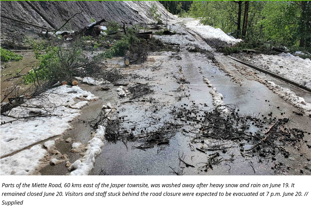
The Weather, on June 19th, 2023, in Jasper National Park in Alberta:

Source: https://www.jasperlocal.com/2023/06/20/visitors-stranded-miette-maligne-snow-storm/
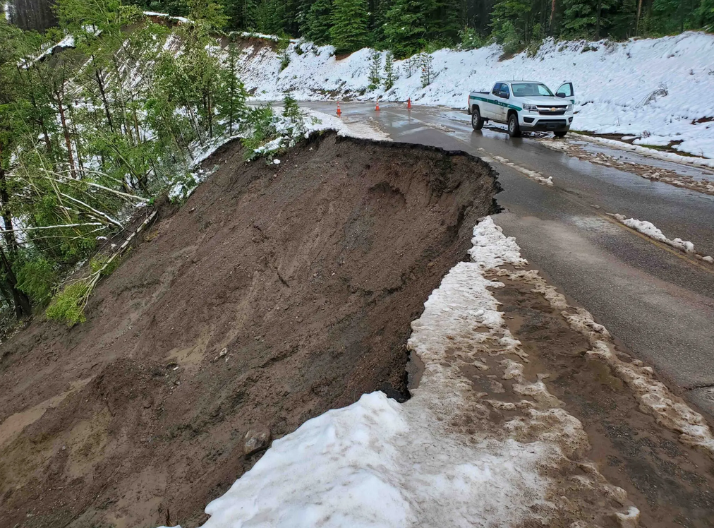
From same as above:

As you can see, deciduous trees are leafed out; and yes, this is very abnormal for this time of year!
Source: https://www.jasperlocal.com/2023/06/20/visitors-stranded-miette-maligne-snow-storm/
From same as above:
As you can see, deciduous trees are leafed out; and yes, this is very abnormal for this time of year!
gabe
Senior Member
Be careful if you have asthma, COPD or another respiratory illness.
Smoke from forest fires will pollute Toronto's air again this week
lenaitch
Senior Member
I truly feel sorry for the folks in some areas out west. Excessive heat and fires, then heavy snow/rain resulting in erosion. Can't catch a break.The Weather, on June 19th, 2023, in Jasper National Park in Alberta:
View attachment 487510
Source: https://www.jasperlocal.com/2023/06/20/visitors-stranded-miette-maligne-snow-storm/
From same as above:
View attachment 487511
As you can see, deciduous trees are leafed out; and yes, this is very abnormal for this time of year!
Towered
Superstar
Apparently our smoke has even reached Portugal now.
APTA-2048
Senior Member
Standing at one end of the GO station platform and looking down to the other end, the tracks just disappear in a haze of white. It’s bad today. 
just east of the creek
Senior Member
Reminds me a lot of being in China, almost anywhere in China. Constant haze, and on the worst days, your eyes and lungs protest the exposure, and you can taste the pollution on your tongue. The worst - Beijing in late winter/early spring.
If this is the new normal…..but I wonder just what the ‘message’ is that the unbelievers are hanging on to.
If this is the new normal…..but I wonder just what the ‘message’ is that the unbelievers are hanging on to.


:format(webp)/https://www.thestar.com/content/dam/thestar/news/world/2023/06/08/wildfire-smoke-from-quebec-ontario-has-americans-seeing-red-and-orange/nyc_smoke_embed.jpg)