Why not just run the entire LRT along Main st. and be rid of the two 90 degree turns? Or is it too late for that?
Way too late, by over a decade.
They made the definitive Main-vs-King decision in year 2011.

Hamilton 2011 B-Line Light Rail Transit (LRT) Environmental Project Report (EPR)

While the original document is no longer extant on Metrolinx's site, scattered references to it exist in Hamilton's city website
Link: https://pub-hamilton.escribemeetings.com/filestream.ashx?DocumentId=125166

Even after the LRT was cancelled and then resurrected, it still largely follows the 2011 plan!

...They did the Main Street studies a long ago, and the transit ROI was much better on King for many reasons (closer to downtown, Barton Street, Jackson Square, Tim's Field, and other factors). By running closer to the middle axis of Lower City, it brings more residents from major streets within walking distance of the LRT.

However, I also dislike the addition of two 90-degree turns. One way to make it worth it, is routing it down the west edge of an expanded Dundurn corridorwidth (between Main and King) by expropriating part of the mall parking lot, in a "public good benefitting" quid-pro-quo for letting the Dundurn Mall developers integrate the LRT stop directly into a future Dundurn Transit Hub plan. (See above post)
 
Last edited:
I agree, I can imagine that the east 1/3 of that parking lot is going to get taken by Metrolinx. Running the LRT along the west side of Dundurn (and north of Main) is the only way this is going to work out nicely. The updated design comes out mid December apparently, so we should find out shortly.
 
Here's my brief commentary.

GOOD: They are going to make Main and King 2-way permanent, including adjusting the offramps to accomodate that.

BAD: It adds 2 turns to an otherwise straight Hamilton LRT alignment. It will significantly slow down the LRT ride especially for McMaster students going to Hamilton downtown.

MIXED: It will require more expropriation on Dundurn street to produce enough corridorwidth to keep this efficient, but an opportunity to improve traffic/cars/LRT/pedestrians/bike lanes.

WILDCARD: Is this an actual beginning of Dundurn Transit Hub, where Dundurn Mall is replaced by one big building podium (underground car parking, main floor retail + bus + LRT stop) with a couple or three residential towers above? I wrote about this years ago, back when "GO Expansion" was called "GO RER". An opportunity to interchange GO, LRT, HSR, and 403 highway buses. In theory, for more space, Cathedral Park (a topping for a large sewage tank) could be raised to be flush with Dundurn Mall, and still host an under-park garage / bus station below the park (but above the sewer storage) for easy interchange between transit modes.
I like this idea, and a GO station here could provide an alternative to Hamilton GO Center if GO ever wants to pay for double-tracking the Hunter St Tunnel. Any kind of construction on that tunnel would likely mean suspension of service at Hamilton Go Center for a few years, so a Dundurn terminus with LRT transfer would provide a suitable alternative (West Harbour is also an option, but it is harder to provide easy bus transfers there). Overall, the re-routing isn't ideal for LRT speed but may lead to the re-development of that plaza sooner and will definitely have a positive impact on 2 of the most dangerous intersections in the city.
 
FYI-

B-Line Bus (today) takes 34 Minutes to travel from Eastgate Square to McMaster University.

B-Line LRT (previous route) was advertised as a 32-minute trip to travel that same distance.

With two 90-degree turns, this new routing will be either equal to or longer than 34 minutes.

This new routing makes this system obsolete.

It’s officially a Tram.
 
lets wait and see details before jumping to conclusions.

Metrolinx on other projects (i.e. Finch LRT and Hurontario LRT) has made changes to make the lines faster after taking it over from the local municipality, not slower. Hurontario got a flyover over the 403, skipping a few lights, and Finch had it's Humber College terminus dropped below grade underneath Highway 27 and Humber College Boulevard, eliminating 2 stoplights.

It may very well be that this is a change from the previous design, but one which has an LRT underpass under the King / Dundurn intersection or something which actually ends up saving time overall. We will have to see the final design.

If it's entirely at grade however, yes, this will end up being slower than the old design.
 
FYI-

B-Line Bus (today) takes 34 Minutes to travel from Eastgate Square to McMaster University.

B-Line LRT (previous route) was advertised as a 32-minute trip to travel that same distance.

With two 90-degree turns, this new routing will be either equal to or longer than 34 minutes.

This new routing makes this system obsolete.

It’s officially a Tram.
well.... An LRT train holds 350 passengers. A regular bus holds 50, and an articulated about 75. So I wouldn't call it obsolete.
 
Anyone know whether a light rail vehicle could climb 10% gradient that's about 650m long?
Wikipedia states that the maximum gradient for friction-based rail is 10% after that a rack-cog system is needed: https://en.wikipedia.org/wiki/Rack_railway
View attachment 519220

The plan for A-Line LRT here would be to close James Mountain Road to cars, and re-construct it to a grade LRT can climb.

I prefer this to tunnelling as the tunnel would have to emerge closer to Mountain (Walmart) Plaza Mall and miss Mohawk College completely.

Hopefully we’re still around in 2074 when the A-Line is operational.
 
well.... An LRT train holds 350 passengers. A regular bus holds 50, and an articulated about 75. So I wouldn't call it obsolete.

They can’t advertise it as Rapid Transit anymore then.

It’s a Tram, or a Streetcar, whatever you prefer. It’s what we’re getting.
 
well.... An LRT train holds 350 passengers. A regular bus holds 50, and an articulated about 75. So I wouldn't call it obsolete.

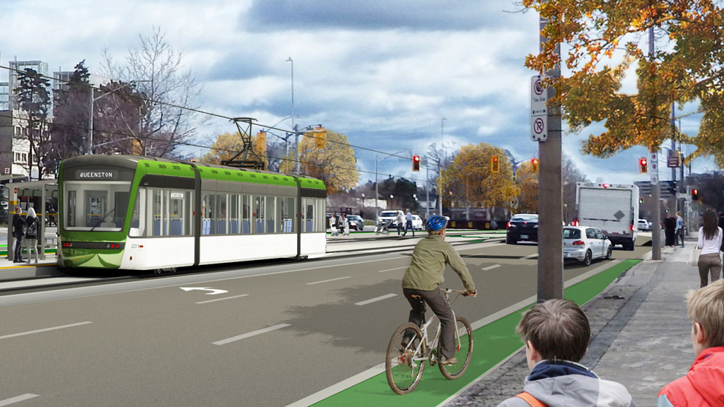
Apparently Metrolinx plans to use 30 metre LRVs which hold 130 people total.

If an articulated B-Line bus came every 3 mins vs one LRV every 6 mins, it would carry 20 more passengers in that same time frame.

And the bus would arrive to its destination quicker than the new LRT routing.
 
Apparently Metrolinx plans to use 30 metre LRVs which hold 130 people total.

If an articulated B-Line bus came every 3 mins vs one LRV every 6 mins, it would carry 20 more passengers in that same time frame.

And the bus would arrive to its destination quicker than the new LRT routing.
Where have you heard about this use of LRVs? The project hasn't gone to tender yet, so I don't think details of which vehicles will be used is public.

Furthermore, you can actually hook up two LRVs together to double capacity.

The stations are approximately 65m in length, so if they plan to use lower capacity LRVs they can easily expand to increased demand, or double up during peak periods.

The Ottawa and ION LRVs have a capacity of 170-370 dependent on configuration. The higher being their module option obviously.
 
Last edited:
Where have you heard about this use of LRVs? The project hasn't gone to tender yet, so I don't think details of which vehicles will be used is public.

Furthermore, you can actually hook up two LRVs together to double capacity.

The stations are approximately 65m in length, so if they plan to use lower capacity LRVs they can easily expand to increased demand, or double up during peak periods.

The Ottawa and ION LRVs have a capacity of 170-370 dependent on configuration. The higher being their module option obviously.

The LRV info is based on the last plan. I know there have been too many ‘plans’ to keep track of, so I get the confusion.

Previous Plan’s LRV
IMG_4204.jpeg


At the end of the day, this is still a streetcar (tram if you wanna be euro about it).

They have to stop calling it Rapid Transit.

Question: Will the LRVs have to go slower between Wellington-Mary in the pedestrian zone?
 
Last edited:
They are likely going to be identical to the Finch West trains, which hold 350 passengers. Also, people seem to forget that this project is yes a transit project, but it's so much more. It's replacing all of the old infrastructure along the route (roads, sewers, water mains, electrical, internet, phone, etc). Something this city will never be able to do alone. on top of that, it's going to attract a huge amount of residential development in the form of condos. This project is about city building.
 
The LRV info is based on the last plan. I know there have been too many ‘plans’ to keep track of, so I get the confusion.

At the end of the day, this is still a streetcar (tram if you wanna be euro about it).

They have to stop calling it Rapid Transit.

Question: Will the LRVs have to go slower between Wellington-Mary in the pedestrian zone?
I don't think there is a pedestrian zone technically. My understanding of the plan was always that it would be a a fully grade separated channel the entire length. The only mixing will be across intersections and pedestrian crossings.

I don't think it was ever not a tram line, but it's definitely not a streetcar, as it doesn't mix with Automobile traffic at any point, so it's technically not "on the street" it will have a separate guideway, could even theoretically be green track with grass and such.

In terms of what makes it "rapid" I think it depends.

1) Typical "rapid transit" is a metro typically, so Hamilton's LRT was never really "rapid" transit.

2) I'd suggest that the B-Line bus is already pretty rapid, so no time savings isn't a big deal in my mind because it's an investment in rapid Train service as an upgrade to rapid bus service. The LRT isn't just about speed, it's about accessibility and capacity and changing transit culture.

3) The LRT should be able to cut through traffic in a way that the bus currently can't. Sure the bus is 32 minute, but is that during rush hour? During Grey Cup? During an event at FOC? Likely not. LRY should smooth that out quite a bit.

4) Better signal priority should be able to speed it up. It just depends on how much we want to prioritize transit in the city over cars.

Not sure when you moved to Hamilton, but since 2007 this has always been sold as a Rapid Transit project.

The City started by examining Rapid Transit solutions, landing on BRT vs LRT.

After visiting a few US Cities with true LRT, Council landed on this technology.

It was decided that LRT was to be Hamilton’s Rapid Transit solution.

The plan was sold as being faster than the current B-Line Bus, yet equal to BRT, but LRT would spur more development so it was ultimately decided to be the best ‘bang-for-buck’ plan.

You can’t ’Mandela Effect’ this lol

We aren’t getting what we were promised.
 
I never expected any magic bullet that was going to traverse the city in 15 minutes. 32-34 minutes sounds just about right when you look at Finch West or Hurontario. The only way to get any faster across the city would be to tunnel, like Eglinton. Which obviously was never planned.

If we do see a tunnel along Dundurn or something, that would be amazing. But I highly doubt that. Likely just widening of Dundurn with a wide turning radius at Main Street with signal priority at King. Looking forward to seeing the plans though.
 

Back
Top