December 1st-most of the flights I had planned for today were cancelled due to wind. I did manage a few shots.
1733076405852.jpeg

1733076503171.jpeg

1733076522414.jpeg

1733076546155.jpeg

1733076586701.jpeg

1733076628607.jpeg

1733076684818.jpeg

1733076720951.jpeg

1733076785829.jpeg

1733076822472.jpeg

1733076844310.jpeg

1733076868541.jpeg
 
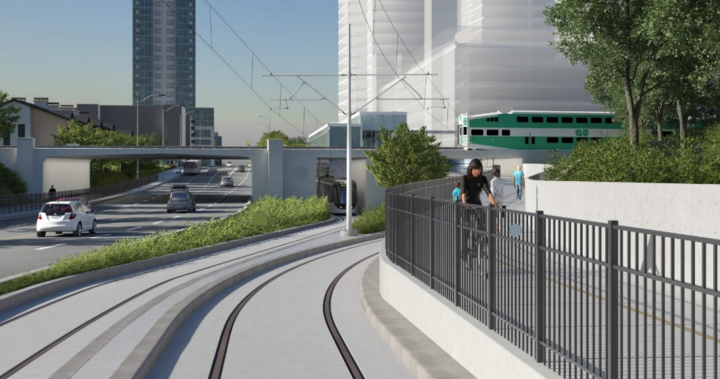
I had a meeting near Sq One today and afterwards I took the opportunity to drive down 10, sorry HO, towards 2, sorry, the Lakeshore , play kamikaze lane ownership with Miways F1 capable articulated buses, and look over the scenery that drum118 has been steadily reporting on.

In short, do they have a long way to go to substantially complete this project. And that’s not to say that much has not been accomplished, but the lack of rail in any substantial amount south of the 403 is a reminder of how much still has to be done.

Whoever schedules, manages, juggles working schedules and what happens where at what time…. The amount of planning that goes into that exercise, especially with all the other non transit construction taking place adjacent to this project (hospital etc), and the fact that this is a major arterial route without much adjacent capability to divert traffic load…...it would be very, very interesting to hear from that team and the process involved.

Hydro infrastructure. The road and project is framed by a double row of high capacity hydro towers each carrying a multitude of high kWh wire. Not exactly a scene that Cezanne or Monet would portray. This topic has been touched on before, but outside of cost, are their technical reasons why this infrastructure cannot go underground? It is as ugly as any man made intervention on the public realm as you can find. And in a ‘city’ aspiring to be a city.

I headed west on the Lakeshore, and I have noted this before, it is so disappointing to see the absence of any form of a bike lane, on the road or off. All the way to the border of,the old village of PC, so past Brightwater. Once again, this omission demonstrates the enormous amount of work left to be done to move the ‘car’ culture needle enough to make more space for those not in their private chariot.

It’s probably worse in Brampton. I was in the Airport Road/ Williams Parkway area looking at buildings previously and the needle is firmly in the car culture zone, with a bit of a tremble when a ZUM bus zips by.
 
Hydro infrastructure. The road and project is framed by a double row of high capacity hydro towers each carrying a multitude of high kWh wire. Not exactly a scene that Cezanne or Monet would portray. This topic has been touched on before, but outside of cost, are their technical reasons why this infrastructure cannot go underground? It is as ugly as any man made intervention on the public realm as you can find. And in a ‘city’ aspiring to be a city.
Cost is the big thing here. If we're looking more technically, there could be multiple utilities under the ROW that would need to be relocated again due to proximity to high voltage, and there may be codes that have to be followed, and those codes being followed would incur more cost. I.e. distance from house, distance from street, directional drilling, enclosures, location to adjacent utilities, and so on.

It’s probably worse in Brampton. I was in the Airport Road/ Williams Parkway area looking at buildings previously and the needle is firmly in the car culture zone, with a bit of a tremble when a ZUM bus zips by.

Depends on where you live. Airport / Williams is more of an industrial area so I'm not entirely sure if they would benefit from having cycle lanes around there, but it's anyone's guess. However, what I've noticed over the years is that with each Zum route that gets announced, there's active transportation that gets incorporated into the mix as well. For instance, the 505 on Bovaird has a multi-use path which covers the entire stretch of Bovaird from Mount Pleasant GO, all the way to Bovaird and Highway 50.

The incoming 504 will have active transportation tied in with multi use paths that will start from Chinguacousy / Sandalwood, which also already has existing multi-use paths tied into the design. They will update much of the sidewalk from Chinguacousy / Sandalwood to Chinguacousy / Steeles with traffic signalling for both pedestrians and cyclists, as well as install new signs, pavement markings, and so on. 501 on Queen, 502 on Main, and 511 on Steeles are exceptions to this, but they may have multi-use pathways, or other ways of cycling implemented in the future.

This link (redirects to a City of Brampton website) will show you what the cycle paths look like in Brampton as of 2022. I'm not aware if there are any updated maps, as this is the one I usually reference.
 
Dec 3
As it stands now, Wednesday will see the northbound curb lane open as well asphalt sidewalk from John St to where the northbound lane has been shifted about a month ago. Shifting of the lanes will take place tonight and may already happen as I post this. Not all the curb has been poured and rebuilt from the northside of the substation to the bridge with asphalt curb been place were there is no curb at this time. The centre of the road where the guideway is to go was being saw cut yesterday.

Depending on the weather for the next few days, paving of the southbound lane will take place from the CP bridge to Hillcrest as it is already mill and waiting paving. The south corner at Hillcrest and the north corner at Angins are ready for paving as well.

The northbound curb lane from the North Service Rd to the Queensway was being mill today and was supposed to done tonight to allow paving to be done on it after the southbound is done or a second crew brought in to do it subject to weather..

Asphalt in place between the guideway and the road between Paisley and King to allow 2 lanes of traffic in both direction. Core drilling is done as well pouring the OS poles foundation is completed with duct banks being installed in the centre of the guideway

Traffic is reduced to a single lane going south starting at the Queensway fire station to Serobee as crews are installing duct banks under the sidewalk between the Queensway and Sherobee

Subject to weather, there will be 2 lanes of traffic in both directions for the new curb lane from Fairview to the North Service Rd by the end of next week or sooner other that southbound at the Queensway and northbound at Dundas. Other than the north-west corner and block at Dundas, the centre area is ready for the guideway construction.
 
Looks like Guild has been going through and prepping all of the permanent traffic signals from what I've seen.

Around the 401 area, they seem to have two gantries off to the side with traffic signals mounted to them, hinting at a much more permanent solution for the traffic signals as opposed to having them strung from end to end. This is especially important if they are adopting priority signals along the line.

It’s strange that despite Mississauga re-adopting black signal heads for their traffic signals, the ones being installed along Line 10 appear to be all-yellow.

It’s interesting that work around Brampton Gateway is so behind – there was so much time to make the minor change to move the stop back to the north side of Steeles as requested many times by Brampton (once they got a sensible council again) and even RioCan.
Interesting, I had no clue. I don't think I've seen black ones anywhere in Mississauga.
 
The only black ones I have seen have been for bike paths. Is this a brand new thing? Not sure why you'd go for black. The yellow ones stand out, especially during the night if there is a power outage.
 
The only black ones I have seen have been for bike paths. Is this a brand new thing? Not sure why you'd go for black. The yellow ones stand out, especially during the night if there is a power outage.

A whole lot of black signal heads on Rathburn Road, Argentia Road, Matheson Blvd. in the Airport Corporate area, Lakeshore at the old Imperial Oil lands, Mississauga Road near UTM…

The backboards are still yellow. Frankly, I’d prefer all black except with the retroreflective border now common on signals. Better contrast.
 

Back
Top