I don't doubt your conclusions, but surely there are options? Since Obico is now abandoned, can't the CP Row be slightly realigned to give room for the TTC tracks? Moving the GO stop to East Mall/Cloverdale/427 would also free up some room, and the platform is roughly the subway ROW wide.

There are only two overpasses: Shorncliffe and East Mall - the former of which can be regraded (and backroads provided on the honeydale site if Shorncliffe exits become untenable), and the latter is already wide enough since there is an abandoned spur to one of the warehouses there.

There are transmission towers along the south side and will impact CP lines as will using Campa Sub. Hydro One land has an impact on CP east-west line now along with the sub.

Shorncliffe has a grade problem now and will be even more with the tracks on the north side being added. No problem with East Mall.

I have never supported the plan to take the subway to Sherway and then Dixie as it will miss the future ridership demand along Dundas.

You still need a station between Kipling and Cloverdale to service all the new development plan for the south side and would kick start plans for the north side as well being a shorter walking distance. If not, need bus service on it.

Mississauga Transit will still service Islington since a large number of riders work there as well pickup and drop off residents going to/from Mississauga. Also, they drop off Toronto residents late at night from Islington. Only 20, 26 and 1 would go to Islington. 3 by rights should go to Kipling.

If you want people to walk to transit, putting the subway in CP corridor will not cut it.

The Cloverdale station need to have provision to go west as well having an interline connection for future expansion.
 
I have concerns about the width of the roadway where it curves from Rathburn to the eastbound route along the 403.

In straight runs, buses don't need any more than a regular lane width but going around a curve, their length requires a slightly wider lane. Add in the fact that it's a somewhat blind curve and it's probably best to create a 3m or so painted median between the 2 opposing lanes, since buses hedge away from the outside curb in curves.

Call me paranoid, but I think they're asking for trouble and risking a head-on crash if opposing buses drift even a little bit towards the middle.

That is a very tight spot and the speed limit should be about 30km in this area. Been a ground zero under the bridge to see the issue first hand.
 
There are transmission towers along the south side and will impact CP lines as will using Campa Sub. Hydro One land has an impact on CP east-west line now along with the sub.

It does indeed seem difficult to get from the north side of CPR to the south side. Since Mississauga does not seem to keen on extending this subway, I have not really seen many good plans on extending it farther. What is on the table now is a Dundas BRT and 427 BRT. For both of these, a simple extension to East Mall would really be helpful and the cost savings from taking the CPR corridor are just too great to pass up.

Shorncliffe has a grade problem now and will be even more with the tracks on the north side being added. No problem with East Mall.

The new tracks could easily be located at a few metres higher elevation to avoid a grade change on Shornecliffe.

I have never supported the plan to take the subway to Sherway and then Dixie as it will miss the future ridership demand along Dundas.

You still need a station between Kipling and Cloverdale to service all the new development plan for the south side and would kick start plans for the north side as well being a shorter walking distance. If not, need bus service on it.

That is the first time I have heard of splitting the 1.5km between East Mall and Kipling with another station. Would the eastern edge of Mississauga become so developed that another station would be needed between 427 and Dixie?

Mississauga Transit will still service Islington since a large number of riders work there as well pickup and drop off residents going to/from Mississauga. Also, they drop off Toronto residents late at night from Islington. Only 20, 26 and 1 would go to Islington. 3 by rights should go to Kipling.

If you want people to walk to transit, putting the subway in CP corridor will not cut it.

The Cloverdale station need to have provision to go west as well having an interline connection for future expansion.

By the time this might be extended, there would be a BRT on Dundas. Maybe a few buses would continue to Islington, but I would guess that since it is in Toronto, it would be served by TTC.

What will be done with the Honeydale lands. They are within easy walking distance of a future Honeydale station. 600m is a touch far to get to Cloverdale, but if you look at Yorkdale, it is about 400m to the centre of that plaza. If the area is built up it may not be that bad with a PATH type connection. Or else, it is a short bus ride away.

An interline connection? Are you expecting one branch to continue on Dundas and another to go north to Pearson?
 
The trip between MCC and Kipling is 13km along Dundas in mixed traffic, or 19km along the Transitway and the 427. With the bus-only lanes on the 427, and no traffic on the Transitway, they should be able to have shorter trip times along this route, while also having the benefit of connecting to the Eglinton busses and pass close to the airport.

Thanks for the reply. I would guess that the route along Burnhamthorpe would be slightly shorter than Dundas, but still not much less than the Transitway route. I will try it out when it's open and see how quick it is.
 
The current cost for the Transitway as it stands now is $290m and that doesn't include the cost for the Renforth and Kipling Terminal. Cost in 2004 $ was $180m while I was calling for $325m. Still no work what going to happen and when for Kipling.

They have the frame up for the eastbound shelter at Sq One Terminal.

As it stand now, there will be no weekend service to Islington for the transitway on the weekend and that is dumb.
11075538315_82b6e9c684_b.jpg


11075647464_852fa2d109_b.jpg


11075644954_86518744a4_b.jpg
 
[FONT=&quot]Construction starts on west segment of the Mississauga Transitway[/FONT]

[FONT=&quot]No. H163/13
For release - November 29, 2013[/FONT]
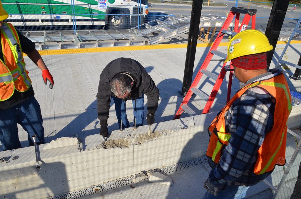
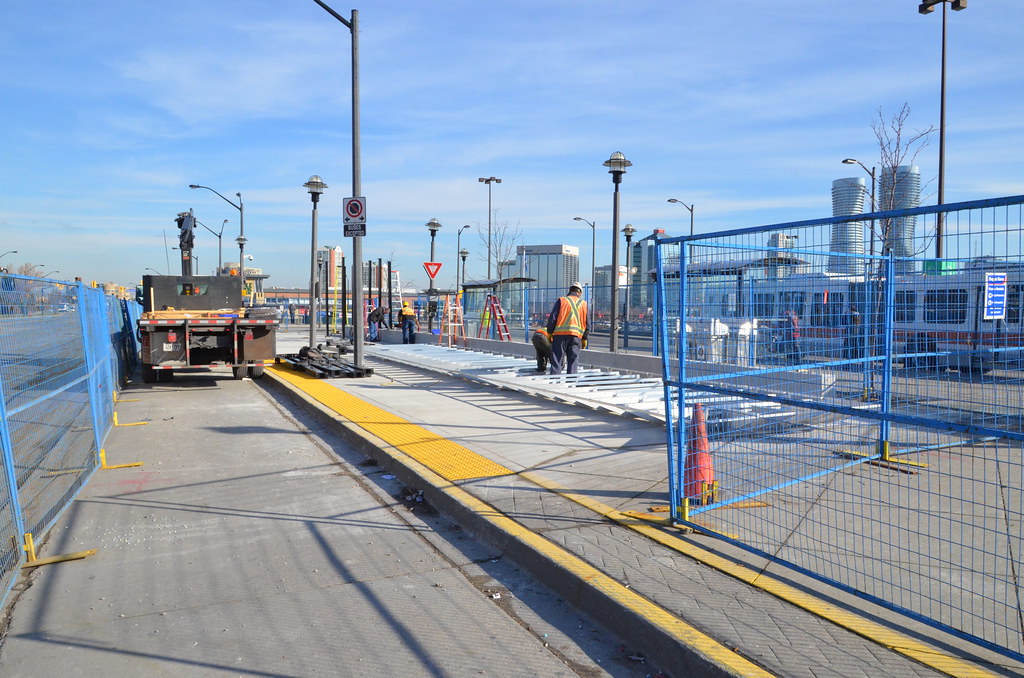
[FONT=&quot]MISSISSAUGA, ONTARIO —The Honourable Lisa Raitt, Minister of Transport, on behalf of the Honourable Denis Lebel, Minister of Infrastructure, Communities and Intergovernmental Affairs and Minister for the Economic Development Agency of Canada for the Regions of Quebec; Bob Delaney, Member of Provincial Parliament for Mississauga—Streetsville; Her Worship Hazel McCallion, Mayor of Mississauga; and Bruce McCuaig, President and CEO of Metrolinx, today marked the start of the west segment construction of the Mississauga Transitway.[/FONT]
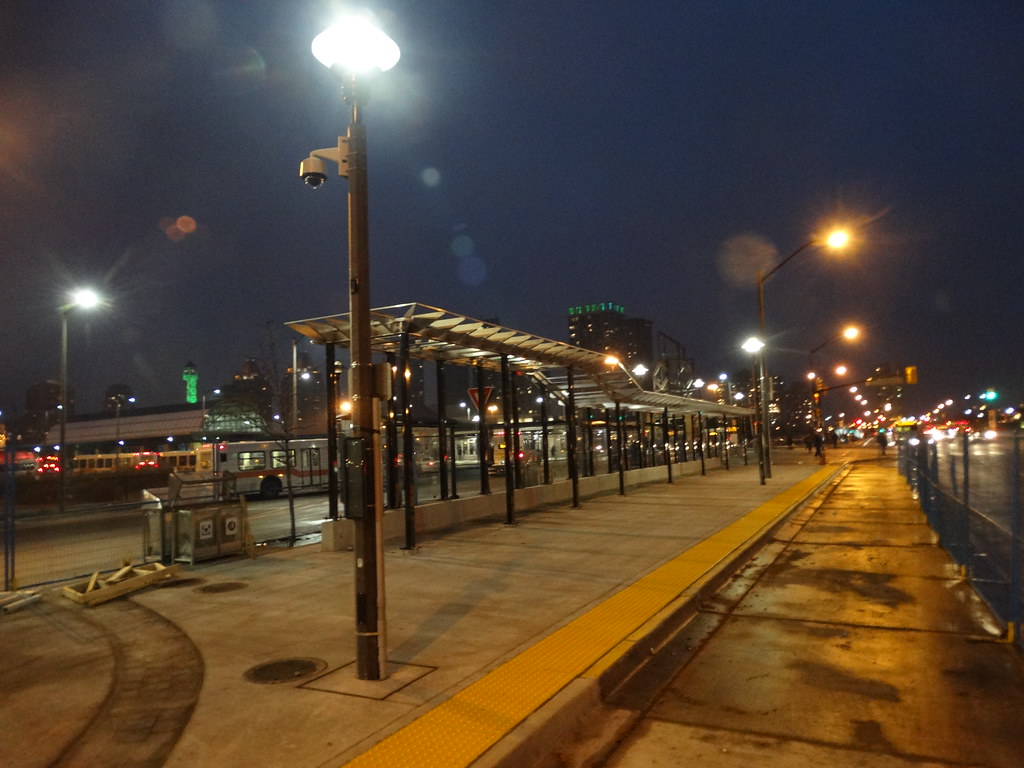
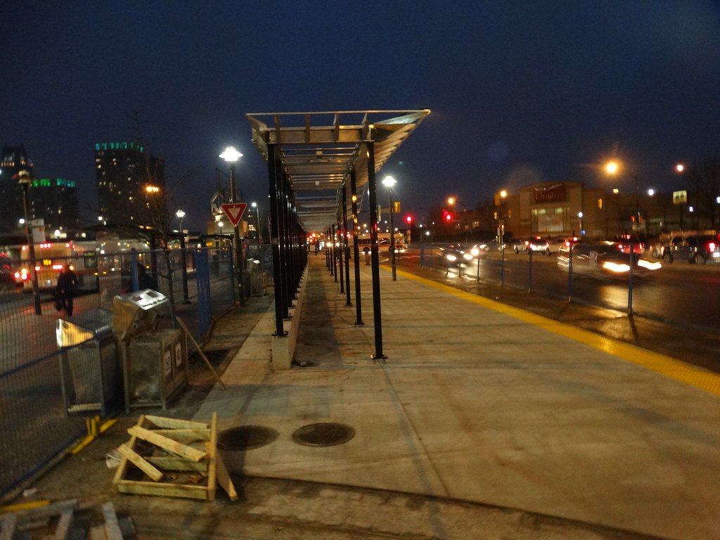
[FONT=&quot]Set to open in 2016, the Mississauga Transitway west segment will feature a two-lane, 1.5- kilometre bus-only road on the north side of Highway 403. It will also boast two new state-of-the-art stations at Winston Churchill Boulevard and Erin Mills Parkway. MiWay and GO Transit will service the transitway.[/FONT]
[FONT=&quot]“I’m pleased to see the Mississauga Transitway project continue to move forward,” said Minister Raitt. “Projects such as this one will help increase economic growth and improve the quality of life for residents in Mississauga by providing a more efficient transit option, while cutting commute times and taking more cars off the road.”[/FONT]
[FONT=&quot]“Building public transit helps create good jobs, cuts traffic congestion and gets us where we need to be, whether that’s work, school, or the mall,” said MPP Delaney. “Our support for this project is strengthening our community and boosting our economy.”[/FONT]
[FONT=&quot]“The Mississauga Transitway will provide better and faster transit service to the citizens of Mississauga and our neighbouring municipalities,” said Mayor McCallion. “Residents rate transportation as their number one concern. Our residents want less gridlock and better transit. This project is helping to deliver that.”[/FONT]
[FONT=&quot]“We’re proud to mark another significant step in developing a truly integrated regional transportation network,” said Mr. McCuaig. “Metrolinx is committed to implementing our regional transportation plan, The Big Move, and furthering our progress across the Greater Toronto and Hamilton Area. Starting construction on the west segment of the Mississauga Transitway is tangible evidence that real, meaningful change is already happening in Mississauga.”[/FONT]
[FONT=&quot]The west segment from Winston Churchill Boulevard to Erin Mills Parkway is being constructed by Metrolinx. The City of Mississauga is constructing the easterly corridor, a section of which will open in 2014 with stations at Central Parkway, Cawthra, Tomken and Dixie[/FONT]
[FONT=&quot]When fully completed in 2016, the 18-kilometre transitway will have 12 stations, beginning at Winston Churchill Boulevard in the west and ending at Renforth Drive in the east. From the west, passengers will travel on a dedicated transitway from Winston Churchill Boulevard to Erin Mills Parkway. Buses will then travel on existing bus-only lanes on Highway 403 from Erin Mills Parkway to Mississauga’s downtown core via Centre View Drive and Rathburn Road. The transitway then continues along a dedicated corridor that runs parallel to Highway 403 and north of Eastgate Parkway and Eglinton Avenue to Renforth Station. From there, buses will continue travelling to Pearson International Airport and the Toronto Transit Commission’s Islington subway station.[/FONT]
[FONT=&quot]The Mississauga Transitway project is a partnership between all levels of government. The Government of Canada is contributing up to $83 million to the project through the Canada Strategic Infrastructure Fund: $59 million to the City of Mississauga for the east segment and $24 million to Metrolinx for the west segment. The Province of Ontario has provided $65 million to the City of Mississauga to support the project and is contributing another $48 million to Metrolinx for investments in GO Transit assets related to the transitway. The City of Mississauga and Metrolinx will fund the remaining project costs.[/FONT]
 
Do you happen to have any links to the design plans for the Sq 1 Terminal and Transitway segments within the Sq 1 area? I'm curious to see the design.
It was originally supposed to be underground. No clue what is happening now.
 
The nightmare for this Transitway continue with the removal of the new shelter at Sq One Terminal

The New Transitway Shelter at Sq One has been removed due to design errors and structural issue.

The anchor bolts are too close to the edge to the point concrete is breaking way around the bolts.

Nice bill going to have to be pickup by someone and continue the nightmare for this transitway.

Look likes it will be Jan/Feb before this shelter can be use.

11193415994_7f35c97516_b.jpg


11193430946_524b58e2ac_b.jpg
 

Back
Top