Anything is possible, but one needs to know the ridership projection before entertaining a 'light' technology. We have been talking about DRL as justifying a heavy capacity line. I could see going to New York or Chicago style rail cars - shorter, but still heavy rail - as a way of addressing curvature.

If it turns out that all we need is light rail, then the case for a relief line changes. There might be appetite for an auto-excluded surface line on Queen, for instance, rather than tunnelling costing a couple billion or more across downtown.

I'm a big fan for LRT otherwise, but for DRL I would say, go heavy or go home.

- Paul

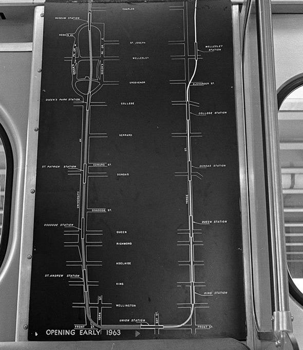
I think you and Metrolinx might be on the same page with regards to the type of subway vehicles, and that it's not guaranteed to see TTC subway rolling stock. For instance in the YRNS tech report the “Long Subway” they propose 8-car trains; for “Surface Subway” 7-car trains; and for “Short/U Subway” it’s 6-car trains. Although these trains may all end up creating a trainset of the same length, it could be the individual cars that are shorter (so as to address the unique curvatures of each individual route chosen).

I searched for capacity of SkyTrain adn am not sure if I fully believe everything I read.

http://www.greg-vassilakos.com/traindwg/lg_bombardier_innovia_300.gif
http://www.bombardier.com/en/transp.../transportation-systems/automated-metros.html

So what is believable.

Maybe 100 passengers per 12m long car (thats about 3 passengers per m2) x 8 cars per train = 800 passengers per train x 30 trains per hour (120 second headway) = 24,000 ppdpd (it also = 100m platforms).
With all door boarding at key busy and interchange stations, a headway of 100 seconds should be achievable which would give close to 30k.

Back to BurlOak’s and DVR’s points about vehicles/capacity (and apologies if this is a repost from my past trip to the reference library), but here are some numbers for individual modes/routes ID'd in that report. Sure they’re thirty years old, but considering Skytrain and light metro technology is still in existence, I think the info is still relevant. And I also think Mlinx is weighing the ideas of unconventional subway rolling stock or ART Light Metro-type technology in their YRNS.

So on p.46 onwards of the 1985 DRL report it gives us descriptions of the technology options. *Also note that on the top of p.46 in the first paragraph it says that the study used ICTS to provide the framework and geometric planning, but with limited changes subway technology could be adopted. And this info is +30 yrs old, and ATC and loading capabilities have probably advanced somewhat.

LRT
Vehicles and Wayside
24m vehicles operating singly or up to 4-cars​
Op Characteristics
Minimum headway of 120 seconds with capacity of 16,200 pph at Service Level E
*keep in mind that although it says it's for "exclusive right-of-way", it has at-grade crossings at local streets (not unlike YRNS' bs LRT idea)

Intermediate Capacity Transit System
Vehicles and Wayside
Advanced light rail similar to 13m SRT vehicles, or 22m (slightly wider) GO ALRT - operating in trains of 2-6 cars​
Op Characteristics
Operate at min 90sec headways w/ capacity of 18,000pph using six Scarb RT cars, or min 120 sec headways w/ capacity of 30,600 using six of longer GO ALRT cars per train. Both Level of Service E.
Subway
Vehicles and Wayside
23m cars (similar to existing subway) operating as 4-6 vehicles​
Operational Characteristics
Operate at min headway of 128 seconds with line capacity of 34,000pph Level of Service E
IMG_3901.JPG
 

Attachments

  • IMG_3901.JPG
    IMG_3901.JPG
    807.6 KB · Views: 250
I know I'm a pain in the ass for continually bringing it up, but Metrolinx's preliminary numbers estimate 19,200 on a long DRL (to Sheppard @ Don Mills), which is 8,400 more than the short DRL (Pape or Broadview to downtown). That puts it in subway territory.

J2KpLIa.png
It's a point worth repeating. Ridership projections have a history of being a little off, but if those numbers are accurate the long relief line would have ridership rivaling the Yonge and Bloor lines. We'd have 3 subway lines downtown with basically equal ridership between them, which would be a massive improvement to the network. You can justify a "light" technology on pretty much any new transit line in Toronto except this one.
 
Last edited:
I know I'm a pain in the ass for continually bringing it up, but Metrolinx's preliminary numbers estimate 19,200 on a long DRL (to Sheppard @ Don Mills), which is 8,400 more than the short DRL (Pape or Broadview to downtown). That puts it in subway territory.

J2KpLIa.png

Consider to that 19,200 pphpd is the ridership estimate, on opening day (2031ish). It takes years for land use, development and commute patterns to react around new transportation lines. It's conceivable that within 5 years of opening, the RL Long could add several thousands peak hour riders on top of the 19,200 pphpd on opening day, and very likely exceeding ridership on the Yonge Line without the Yonge North Extension (20,700), making the Relief Line Toronto's most used transit line.

So yeah, RL Long is well out the scope of any light rail technology.
 
An incident at Union creates a single point of failure for entire network - GO, YUS and Relief Line. That, and the difficulty of managing the existing volume of pedestrian flow to/from Union, makes an alignment no further south than King critical, to my mind. Anyone who wants to go to Union/Southcore can still use YUS, especially if Relief Line reaches Eglinton and chops a chunk out of what Crosstown feeds into the Yonge line.

The alignment should collect/disperse the maximum number of people without requiring any transfer to YUS for a one-to-three stop final leg. The further south you move it, the more transfers you will create. I would have thought that Adelaide and Richmond would be the best placed for that - serves the financial and entertainment districts well, still walkable to hospitals, Ryerson, etc as well as to the waterfront. Queen isn't bad, though. Part of the project ought to be some improvement/reconstruction of PATH to give the best possible walking routes to the new stations.

- Paul
 
It's a point worth repeating. Ridership projections have a history of being a little off, but if those numbers are accurate the long relief line would have ridership rivaling the Yonge and Bloor lines. We'd have 3 subway lines downtown with basically equal ridership between them, which would be a massive improvement to the network. You can justify a "light" technology on pretty much any new transit line in Toronto except this one.

Consider to that 19,200 pphpd is the ridership estimate, on opening day (2031ish). It takes years for land use, development and commute patterns to react around new transportation lines. It's conceivable that within 5 years of opening, the RL Long could add several thousands peak hour riders on top of the 19,200 pphpd on opening day, and very likely exceeding ridership on the Yonge Line without the Yonge North Extension (20,700), making the Relief Line Toronto's most used transit line.

So yeah, RL Long is well out the scope of any light rail technology.

The thing that gets me is the amount of relief provided and the opportunity that brings. RL LONG brings Lines 1 and 2 down to 20,700 and 21,400 pphpd. That's a way more comfortable ride, and much-needed capacity when growth projections aren't being met because the TTC is too full. This could provide for much more development opportunity along these lines. More mid- and high-rise developments.
 
An incident at Union creates a single point of failure for entire network - GO, YUS and Relief Line. That, and the difficulty of managing the existing volume of pedestrian flow to/from Union, makes an alignment no further south than King critical, to my mind. Anyone who wants to go to Union/Southcore can still use YUS, especially if Relief Line reaches Eglinton and chops a chunk out of what Crosstown feeds into the Yonge line.

If the Union second platform hadn't been built, I would ask if the idea of splitting the Yonge and University lines had been floated.
 
The thing that gets me is the amount of relief provided and the opportunity that brings. RL LONG brings Lines 1 and 2 down to 20,700 and 21,400 pphpd. That's a way more comfortable ride, and much-needed capacity when growth projections aren't being met because the TTC is too full. This could provide for much more development opportunity along these lines. More mid- and high-rise developments.

Not just crowding relief, but commute times benefits as well. When you run the numbers you see that the impact on commute times, even deep into Scarborough, is enormous. I can say without any hesitation that this is Toronto's most important infrastructure at least since Line 2 opened in the 1960s.
 
Queen (seconded by Richmond) seems to have the most potential and is far enough away from Union to dissipate crowding, yet still close enough to be easy walking distance of the CBD.

If they ignore any future west extension I'm pretty sure they will choose Queen. However, when you add King West to the mix (including Liberty Village) I think King has the edge.

However, the downside to King is how far down St Andrew station already is. It will be very deep and will need very long escalators/elevators to transport people to the surface (and we know how well the TTC can maintain escalators). We're talking almost 100 feet deep (proxy is 8 ft for the road and sewers, 12 feet x 2 for the parking garage under University, 20 ft for the University line, 10 ft buffer and then 20 ft for the DRL.

This will mean a station can be as wide as 250 meters (150m for the platform and 35-50 m for escalators on each). The King station can serve the Yonge line, an exit where the PATH goes between Commerce Court and Scotia, and Bay St. St Andrew can serve University (also connected to the PATH) and Metrocentre/Roy Thompson Hall.

Queen honestly is not in the CBD. It is on the north edge. Adelaide or maybe Richmond the end of the CBD and then Queen is the start of the tourist district. People working on King St will not want to walk all the way from Queen and the DRL will not have the effect of reducing traffic in rush how to the extent needed if it is on Queen. Great for the people who want to be downtown on the weekends but not so good for the everyday travellers.

And the other problem with Queen is that there are so many provincial and city gov't buildings. They are so scared of someone else's shadow that it will not morph into part of the CBD.
 
At north Toronto Wastewater Treatment plant. The line would have to loop around from the north to handle the grades and get into the valley. There is about 5 acres there (150m x 150m)

https://www.google.ca/maps/@43.7007721,-79.3558649,575m/data=!3m1!1e3

Are you kidding me? Half that area is a very steep forested slope with a 40m height difference from hilltop to valley bottom, the other half is...a wastewater treatment plant.

Best area IMO is here: https://www.google.ca/maps/@43.7054956,-79.35226,583m/data=!3m1!1e3
It's level, there's already a train yard adjacent to the site (so we can easily bring shipments in/out), and it's a hydro ROW (so it's already gov't land). It seems very optimal.
 
I know I'm a pain in the ass for continually bringing it up, but Metrolinx's preliminary numbers estimate 19,200 on a long DRL (to Sheppard @ Don Mills), which is 8,400 more than the short DRL (Pape or Broadview to downtown). That puts it in subway territory.

J2KpLIa.png

Relief Line LONG is the clear front runner according the data. Once the city report mirrors these numbers along with a similar cost including the preferred alignment, Tory can kiss his Smarttrack goodbye once City Council overwhelmingly pass the new subway line ahead of Smarttrack.

Even if RL Long cost at today's dollar was $9 Billions, it will easily be the preferred choice from all level of government. (TTC, City, Metrolinx including the Public+ Media) Tory's Plan won't stand a chance.

At this point he should save face by supporting RL Long. Since he's a politician and they always already are thinking about reelection I think he will do the following to compensate for not getting Smarttrack done.

Scarborough:
-Supporting the Bloor-Danforth Extension to the bitter end.
-He's not touching the "explosive Sheppard East topic", leaving it to the province

Etobicoke:
-Finally supporting Eglinton West Extension to Pearson
-ROW Queen Streetcar in that area

North York:
-Yonge Line to Steeles
-Sheppard West to Downview (Sheppard West Station)

Downtown:
-East Bayfront LRT perhaps reviving Waterfront LRT project

He could pick 1 for each part and he'd be fine, especially in an era where the feds are all in.
 
If they ignore any future west extension I'm pretty sure they will choose Queen. However, when you add King West to the mix (including Liberty Village) I think King has the edge.
Respectfully disagree. Queen is much better for western expansion between Bathurst and Sunnyside. A King Street alignment for the Relief Line should travel up to Queen via Niagara Street to a station at Trinity-Bellwoods, and continue on Queen from there. (Hitting West Queen West, a future GO-RER interchange station at Dufferin/Queen, Parkdale and Sunnyside)
 
Respectfully disagree. Queen is much better for western expansion between Bathurst and Sunnyside. A King Street alignment for the Relief Line should travel up to Queen via Niagara Street to a station at Trinity-Bellwoods, and continue on Queen from there. (Hitting West Queen West, a future GO-RER interchange station at Dufferin/Queen, Parkdale and Sunnyside)

Yes, a redesigned Waterfront LRT could help Liberty Village via Bremner, Front to Liberty Village taking care of City Place at the same time to then end on the western Waterfront via Dufferin (something like that)
 
Last edited:
As much as Queen or King might be desirable for direct connectivity to existing stations, the disruption to the two busiest streetcar lines in the City during construction of those station boxes would be huge. The below map from the 1960s that shows the downtown station boxes.
20131028-TTC-Map2.jpg


Wellington works with King Station, and although it's south of St. Andrew, remember that the whole tunnel south of St. Andrew is the Green P Garage....so some of that could be re appropriated to create a direct connection point. Lastly, the positioning of Clarence Square means there's a good place for a radius to take the tunnel south-west to the Bathurst Yard.

That said, Richmond would likely work two, as it appears both Osgoode and Queen's boxes stretch halfway along the block to Richmond. But Richmond effectively dead ends at Bathurst, meaning you'd need to go really deep at that point or find a wider ROW to transfer to in order to go further west.
 
However, the downside to King is how far down St Andrew station already is. It will be very deep and will need very long escalators/elevators to transport people to the surface (and we know how well the TTC can maintain escalators). We're talking almost 100 feet deep (proxy is 8 ft for the road and sewers, 12 feet x 2 for the parking garage under University, 20 ft for the University line, 10 ft buffer and then 20 ft for the DRL.

This will mean a station can be as wide as 250 meters (150m for the platform and 35-50 m for escalators on each). The King station can serve the Yonge line, an exit where the PATH goes between Commerce Court and Scotia, and Bay St. St Andrew can serve University (also connected to the PATH) and Metrocentre/Roy Thompson Hall.
If we go with a CBD station at King and Bay street with connections to both St. Andrew and King stations, I wonder if that would justify a station between Spadina and University at John Street?

Or alternatively, build the Relief Line station west of University with a direct connection to both St. Andrew station and the PATH system heading west towards Metro Centre.
 

Back
Top