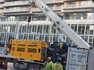
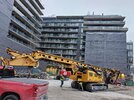
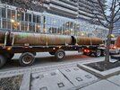
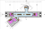
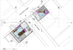
March 18 - The excavation activities on the south side of King Street appear to be close to being complete. Back fill and levelling the south side is ongoing. On the north side of King Street, breaking up and excavation of the final basement and foundation remnants in the south-east corner of the property is ongoing. The rest of the side is being backfilled - a steady stream of trucks, and levelled in anticipation of the start of shoring.

South Side of King Street:

1000003832.jpg


1000003834.jpg


North Side of King Street:


1000003833.jpg


1000003835.jpg


20240318_145044.jpg
 
A front page story about the TOC sites for this station has been posted here. At the same time, a new database file and thread has been created for the North TOC Site here, while the former 663 King West thread has had the South TOC Site database file attached to it... so as more info comes in for the TOCs, and once they get going on the TOC work, those threads are there for that.

For the next while though, work here is still going to be station-related, including initial excavation. Does anyone know what the construction timeline is?

First, each track is getting its own tunnel, right? Not combined like on the Scarborough Subway Extension? So, if I remember that correctly, then do the TMBs travel through here first, lining the tunnels with concrete sections, like any other piece of tunnel, and then…

Second, does excavation at this site removed the earth from around the tunnels, and then remove the tunnel lining here so as to build the larger station areas around the tunnels?

Is mining required for the bit under the intersection? I take it that this is so deep that we're not cut-and-covering the station box itself? I can bug Metrolinx about this, but does anyone know before we initiate that conversation (which could take weeks depending on how responsive they are)?

Anyway, carry on here with posting in this thread. Just please remember that when TOC-related info comes up to post it in the threads set up for it, and linked at the top of this post!

42

The SPA docs for this station will give you some of the answers you're looking for, I think.

I posted those here:


There are additional docs in the AIC, under the helpful file name 'linked document' LOL

Beyond that, i would imagine @AHK would be an excellent source of insight here.

Hold it..........found you something 42........

There's a construction liason Committee for this station, and its meeting minutes are online.


Here's the slide deck from December '23, lots of goodies there:

 
Last edited:
A front page story about the TOC sites for this station has been posted here. At the same time, a new database file and thread has been created for the North TOC Site here, while the former 663 King West thread has had the South TOC Site database file attached to it... so as more info comes in for the TOCs, and once they get going on the TOC work, those threads are there for that.

For the next while though, work here is still going to be station-related, including initial excavation. Does anyone know what the construction timeline is?

First, each track is getting its own tunnel, right? Not combined like on the Scarborough Subway Extension? So, if I remember that correctly, then do the TMBs travel through here first, lining the tunnels with concrete sections, like any other piece of tunnel, and then…

Second, does excavation at this site removed the earth from around the tunnels, and then remove the tunnel lining here so as to build the larger station areas around the tunnels?

Is mining required for the bit under the intersection? I take it that this is so deep that we're not cut-and-covering the station box itself? I can bug Metrolinx about this, but does anyone know before we initiate that conversation (which could take weeks depending on how responsive they are)?

Anyway, carry on here with posting in this thread. Just please remember that when TOC-related info comes up to post it in the threads set up for it, and linked at the top of this post!
Attach files
42

To answer some of Craig's questions - the basic approach to construction of the station is to excavate down from both the north and south sites, and dig out the station cavern from the bottom of the two shafts. The main station excavation will be on the south side of King Street, while the excavation on the north side will be an access shaft, approximately 15 meters in diameter, which after construction will ultimately be used for services and emergency exit purposes. The station itself is to be 42 meters or approximately 138 feet down - I do not know if that is the bottom of the excavation itself, to track level, or platform level, but whichever, it is pretty deep. With standard escalator gradients, that would work out to be an escalator travel distance of approximately 115 meters, or 375 feet of escalator to get between street and up from or down to train access level.

Given that (again, my understanding) the contracts for the TBM's have not been awarded yet, I believe that the station cavern is to be dug out prior to the TBMs drilling through to the site.
 
March 21: Some pictures from today. First, backfill and leveling of the south side, to prepare for shoring and excavation, is virtually complete. Second group of photos - Bathurst Street sidewalk has been reopened, and the final remnants of hoarding are being removed. Third set - still some excavation work being completed at the north end of the site on the north side of King Street - a lot of activity, with a number of dump trucks on site, being and waiting to be filled.

My understanding - the shoring equipment is anticipated to arrive on the south site on Monday, March 25, and the north of King Street side on Tuesday, March 26.

South side of King Street

1711034338625.png


1711034398003.png


Stewart and Bathurst Street Sidewalks, and in the first image, a side view of the recently delivered site office trailer:

1000003866.jpg


1000003867.jpg


1000003868.jpg


North Side of King Street - Lots of Activity, a constant stream of dump trucks arriving, being filled, and leaving:

1000003871.jpg


1000003873.jpg


1000003872.jpg


1000003874.jpg
 

Attachments

  • 20240321_083559.jpg
    20240321_083559.jpg
    422.3 KB · Views: 54
  • 1000003870.jpg
    1000003870.jpg
    431 KB · Views: 55
  • 1000003869.jpg
    1000003869.jpg
    350.9 KB · Views: 56
...I think that's one of those mobile retractable crane thingies though.
 
...I think that's one of those mobile retractable crane thingies though.

The yellow Bauer BG 42 is the shoring machine. For transportation purposes, the shoring machine and its drill equipment attachments are delivered on separate trucks. The mobile crane is there to lift the attachments into place for connecting to the BG 42 itself. Some on-site assembly required.
 
Last edited:
The yellow Bauer BG 42 is the shoring machine. For transportation purposes, the shoring machine and its drill equipment attachments are delivered on separate trucks. The mobile crane is there to lift the the attachments into place for connecting to the BG 42 itself. Some on-site assembly required.
Oh...I see it now! NM then. Sorry about that. And as you where. >.<
 
March 25 - PM: The rest of the shoring rig attachments have now arrived and are waiting on installation on the base Bauer BG 42 unit. Also, first a photo of the north of King Street site, almost ready for the arrival of its shoring rig.
20240325_115635.jpg


The front of the BG 42 unit itself, before adding the shoring attachments. Looks very incomplete without the attachments.

1000003889.jpg


Getting ready to lift and hook up the first attachment - the hydraulic mechanism that raising and lowering the drill mast.

1000003891.jpg


1000003888.jpg


The hydraulic mechanism for turning the drill piece

1000003885.jpg


The mast

1000003887.jpg


And finally, the counterweights

1000003886.jpg
 
Tuesday, March 26. More progress. The second shoring machine has arrived, this time to the north side of King Street. Setup of the shoring machine on the south side of King Street is continuing. Photos from the south side of King Street site show an interesting detail - a trench has been dug along the Bathurst Street side of the site, with template sections installed to mark where the shoring holes are to be drilled. An finally, the drill tube sections have arrived and were waiting to be off-loaded.

Shoring machine on the north site:

20240326_071721.jpg


1000003913.jpg


South Site

Drill hole template sections:

1000003911.jpg


1000003909.jpg


1000003910.jpg


Drill Pipe Sections

1000003908.jpg
 

Attachments

  • 1000003912.jpg
    1000003912.jpg
    387.1 KB · Views: 44
  • 1000003907.jpg
    1000003907.jpg
    391 KB · Views: 56
March 29: Interesting progress. Templates to facilitate locating the shoring drill hole locations have been installed both sites, north and south of King Street (south side still in progress). The location of the 15 metre in diameter shaft on the north side of King Street can be seen clearly - the rest of the site will be used for construction support until the surface related work, including the Transit Oriented Community development starts. The north side shaft is basically for support services and emergency exit - the main station building and access will be on the south side of King Street.

On the south side of King Street, the templating done to date shows the shoring and excavation will take over most, but not all of the site. Notably, the underground component of the station will not extend to the heritage Banknote Building wall on King Street. Further work will need to be done at a later stage for the main station entrance from King Street and the Transit Oriented Community redevelopment, which will presumably incorporate the historic King Street facade.

North side of King Street - template for the 15 meter diameter services and emergency exit shaft:

1000004010.jpg


1000004019.jpg


20240329_134058.jpg


South Side Templating: Two different technologies in use - straight stretches use metal form sections in held in place by a thin concrete layer on their sides. Curved (and some straight) sections have a styrofoam mold positioned in the ground, with concrete liner on each side to hold them in place.

1000004011.jpg


1000004012.jpg


1000004013.jpg


1000004018.jpg


Final photo, south side of the site - steel shoring beams, in the background some of the styrofoam molds waiting to be used, and in the foreground, the shoring machine drill bits.

1000004017.jpg
 
Would this mark the official Urbantoronto transition from Pre-Constrction to UNDER CONSTRUCTION?

Yes. Now u/c
 

Back
Top