Kitsune
Senior Member
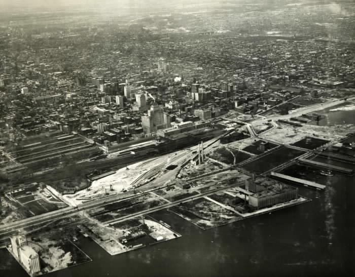
I found a 1929 view - at the mid right I believe thats the piers just starting to be buried.


Wow, just bad luck I guess:I looked over the geotech report agaim for the site, no mention of it, and it looks like the boreholes were all around the object.
is there a map or something on how lake shore east is going to exist once harbour becomes two way ? Or will just no longer exist and people will have to do a giant shuffle ?
For eastbound Lake Shore, instead of the driving through the intersection at Yonge (current set up), a left turn on Yonge or Freeland followed by a right turn will be required.
Wow ... that is going to be a pain getting into the beaches and other neighborhoods east. Cram 3 lanes of lake shore + gardiner offramp into 2 lanes of a local road and eliminate all on ramps east of Rees, and then have no dedicated left turn lanes to get back up to the new lake shore. The traffic jams are going to be long.
It won't be as bad as you would think - most longer distance trips on Lake Shore are better served by the Gardiner. Why if you are going to the beaches would you be on this stretch of road? You would be taking the nearest Gardiner on ramp (which are also scheduled to be reconfigured).
Also - left turning movements are spread across 6 intersections.. even without left turn lanes - that amount of dilution means traffic should be fine.