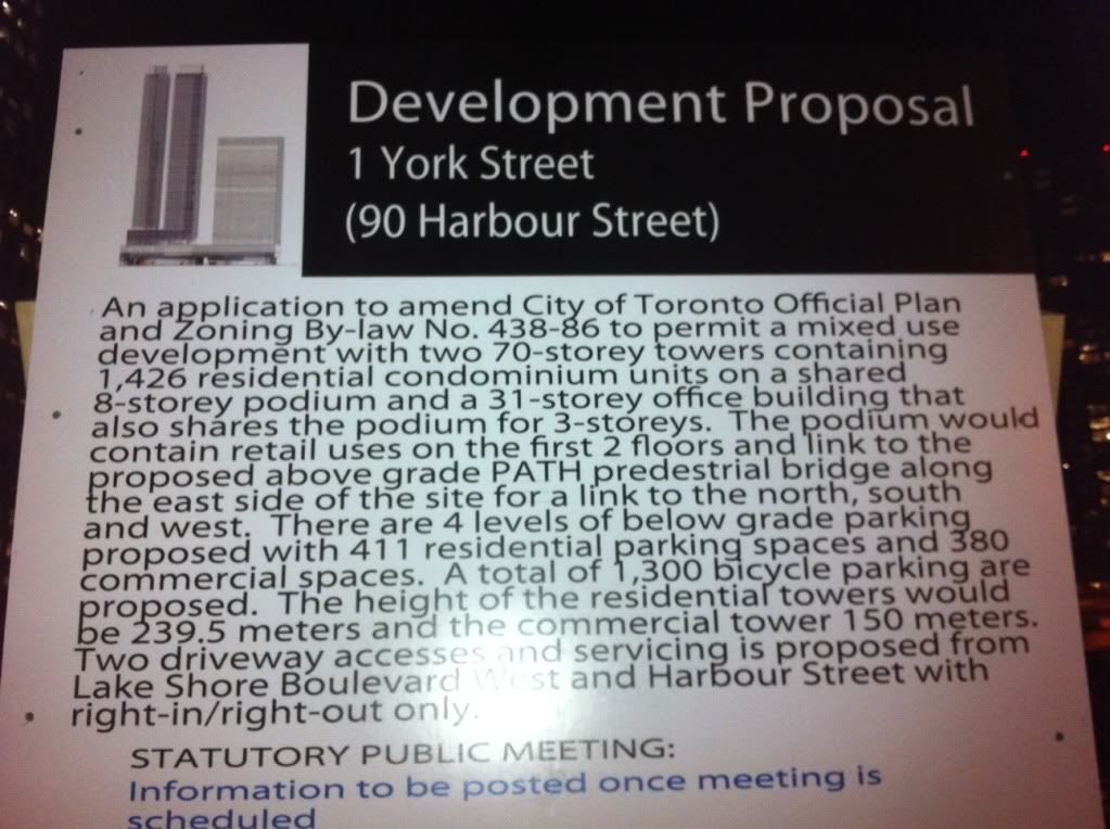
Also:
1) Is the Harbour commission building part of this development? Because I looked on Google Maps a second ago and I can't even imagine how they could fit two point towers and an office block onto just the west side of that parking lot that surrounds that building. They really should post an overhead view of these site plans when they post those development notice boards on properties.
Does this project go all the way to Bay Street or does the property just go from York Street east to the Harbour Commission Building?
2) What's happening to the facade from the old OPP building?
3) Where is that above-ground PATH connection connecting to? Maple Leaf Square? WaterPark Place?
4) Have we ruled out a bus terminal being included in the podium? I remember there were talks of the bus terminal being moved to this site, a few years back.
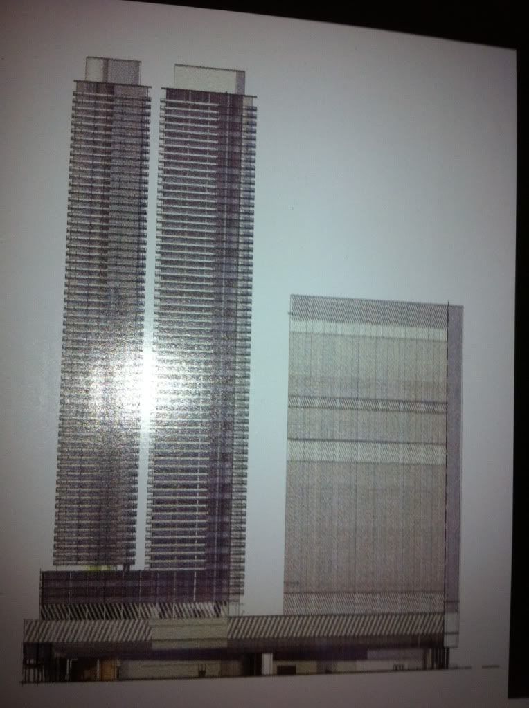
5) How do you guys know the shape of the towers? (One being like a peanut shaped floorplate, etc. etc... is there an aerial view of the siteplan posted?)
")