News   GLOBAL  |  Apr 02, 2020
 8.4K     0 
News   GLOBAL  |  Apr 01, 2020
 39K     0 
News   GLOBAL  |  Apr 01, 2020
 4.7K     0 

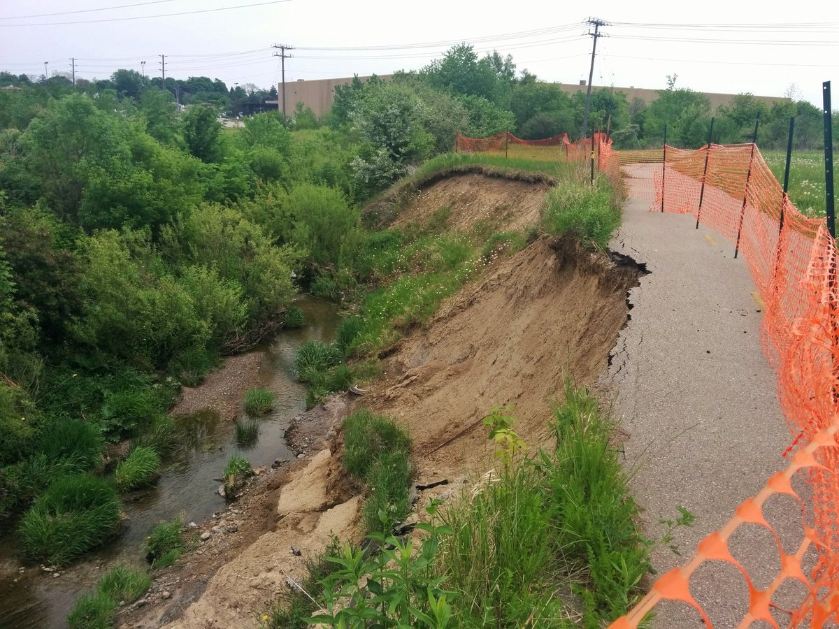
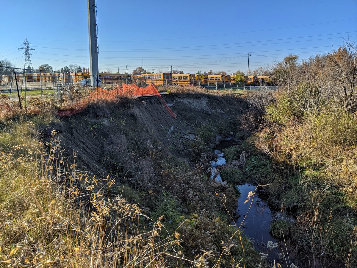
...and into the bush, where I discover yet more remnants of Toronto's lost concrete civilization:

Just in time for the Halloween season, some vaguely spooky speculations derived from certain findings of this very thread:

http://toruinto.blogspot.ca

...to be taken as seriously as the reader sees fit.


PS
In addition to the site above, please also take a moment to enjoy the apparent last few weeks of Urban Wilderness itself, as Google is planning to finally shut down Panoramio - the hosting site for most of the pictures in this thread - sometime in November.
 
Mother nature's wrath.

IMG_8518.JPG
IMG_8527.JPG
 

Attachments

  • IMG_8518.JPG
    IMG_8518.JPG
    175.3 KB · Views: 937
  • IMG_8527.JPG
    IMG_8527.JPG
    281.6 KB · Views: 873
Hey there. My name is Trevor Heywood. Some of you may be familiar with me from a certain bird site, and my work to document various ravines, hydro corridors, railways, highways and shorelines in the city through my project called Metroscapes.

I think I was just as devastated as everyone else that Google folded Panoramio, and broke EVCco's contributions here. It was an excellent resource for me when I planned my walks. But perhaps to partly make up for it, I wanted to nudge this thread and let you know I still have documentation of the City's urban wilderness, and (as far as I know), it'll be secure for some time. Thanks to the uncertainty and questionable future stability of the bird site thanks to a wanker billionaire, I've been working since May to fully migrate all of my walk content to my website.

I just finished all walks for Toronto. Still working on the rest of my catalogue for KW/Cambridge, Hamilton and Guelph. Anyway, you can find it all here: https://metroscapes.ca/walks/

I won't spam this thread with all that past content, but hoping it's a resource to you, and it can re-kindle discussion here. Cheers.
 
For those not familiar with @Metroscapes (Trevor's) site; its a really great resource, particularly for hiking natural areas in/around the GTA. Even the seasoned walker/hiker is bound to discover a few trails and routes, enjoy many of the photos and sometimes pick up an interesting historical note or two.

Trevor has also done a great job documenting barriers to walking (long sections of highway or rail corridor w/no crossings); and of property ownership along Lake Ontario (gaps to a continuous walking trail). I highly recommend checking it out.
 
Thanks for the kind words.

I wanted to post a couple pictures as a then-and-now, and maybe ask if anyone has a status update. The Gatineau Hydro Corridor / Meadoway intersects with Taylor-Massey Creek west of Birchmount. The creek has been eating away at the trail through there, and last time I went through there in November 2020, it hadn't been addressed. Does anyone have a status update?

December 2016
IMG_20161203_123442.jpg


May 2018
2018-05-26_31.jpg


November 2020
2020-11-08_65.jpg
 
Thanks for the kind words.

I wanted to post a couple pictures as a then-and-now, and maybe ask if anyone has a status update. The Gatineau Hydro Corridor / Meadoway intersects with Taylor-Massey Creek west of Birchmount. The creek has been eating away at the trail through there, and last time I went through there in November 2020, it hadn't been addressed. Does anyone have a status update?

December 2016
View attachment 447536

May 2018
2018-05-26_31.jpg


November 2020
2020-11-08_65.jpg

To the best of my knowledge, this section is mostly as you last found it.

The aerial photos for 2022 through google suggest as much:

1672306871640.png


That hint of orange is snow fence along the trail.

It is not listed on the 2023 work program so far as I know.

I think it will be one of the last components to get done.

The Bermondsey to Eglinton and across Eglinton segment are scheduled for this coming year.
 
To the best of my knowledge, this section is mostly as you last found it.

The aerial photos for 2022 through google suggest as much:

View attachment 447539

That hint of orange is snow fence along the trail.

It is not listed on the 2023 work program so far as I know.

I think it will be one of the last components to get done.

The Bermondsey to Eglinton and across Eglinton segment are scheduled for this coming year.

I didn't even think to look at the aerial imagery, good catch. Looking at the City map it's actually wild to see the progression over 17 years.

2005.png

2021.png
 
An update: looks like they've used the culvert for the old rail line.

View attachment 509282

Fascinating to see how clear bits of the old ROW(s) are to this day; though other bits have been erased.

Just went back to look at the 1960 aerial pics for this spot.

I remember the old CP line running beside the 'ditched' Taylor Massey Creek; I also remember the GECO sub (CN line to the south) being larger, more active, with more spurs.

But I did not realize that a second N-S CP line ran along Underwriter's road. Nor did I remember the CP Line running south of the Gatineau all the way to Eglinton.

s0012_fl1960_it0109.jpg
 
Fascinating to see how clear bits of the old ROW(s) are to this day; though other bits have been erased.

Just went back to look at the 1960 aerial pics for this spot.

I remember the old CP line running beside the 'ditched' Taylor Massey Creek; I also remember the GECO sub (CN line to the south) being larger, more active, with more spurs.

But I did not realize that a second N-S CP line ran along Underwriter's road. Nor did I remember the CP Line running south of the Gatineau all the way to Eglinton.

View attachment 509292

I was curious how that ditching of Taylor Massey affected the floodplain, and it's surprising how it makes a lot of spill downstream of that culvert. Mind you. that's from a Hurricane Hazel storm.

Untitled.png
 
I was curious how that ditching of Taylor Massey affected the floodplain, and it's surprising how it makes a lot of spill downstream of that culvert. Mind you. that's from a Hurricane Hazel storm.

View attachment 509299

So what the ditching (with concrete lining) does is speed up the flow-rate of the water; this, of course, creates a problem as soon as you reach any type of bottleneck where that increased flow rate can't be handled.

What you're really seeing above is a series of capacity constraint points; particularly, under Birchmount, under Eglinton, and then under the GECO sub (but over the subway).

The encroachment here is really bad, there are back yards within 10M of the creek in spots.......what could go wrong? Of course, when there was nothing much built up stream, it didn't matter as much because more water was absorbed into the ground; but as you harden the landscape, more of the water goes into gutters, sewers and creeks.
 
Interesting, all this time I had no idea I was walking on an old rail line. I work around here so I often go for a stroll along the creek channel and up to the hydro corridor; it's a brief respite from the concrete wasteland that is the Golden Mile. I have to say the meadow restoration work being done along the corridor is quite something. Also goes to show the amazing power of water and how it alters our landscapes, despite our attempts to tame it.
 

Back
Top