crs1026
Superstar
You seem to suggest that there are remote communities (i.e. without year-round road access), which are served by an active freight line but without passenger rail service. Can you name some examples?
You raise an interesting challenge.. Roads of some form extend a lot further than they used to, so when one fact-checks, one finds that many places that we think of as “remote communities” do in fact have a road connection.
For example, if one looks at the White River route, there are numerous road crossings along its length, and the route is parallelled by road for long stretches. Same with the Senneterre route. How much is winter-access I don't know.
I guess my point may be the inverse of what I wrote....some “remote services” aren’t as "remote" as they once were.
I would certainly put the Algoma Central route on the list. It had a solid volume of summer camps and remote dwellings that were adversely affected by the loss of the local passenger train. Similarly, I would contrast the Canadian’s route with the CP line.... while serving subdivision points, the Canadian does not offer “flag stop anywhere” service in the same way that the White River train does. The CN route has a solid volume of road crossings, so if it's road-serviced, the White River run is doubly so.
VIA in its early years did run "campers' specials" out of Winnipeg. It would be interesting to compare the population, average distance to roads, number of on-line camps and hunting/fishing businesses along these lines.
Other than perhaps the Churchill line, and perhaps the Moosonee train (which is traditionally a provincial effort) I'm not so sure we can talk about having a "Remote Community" passenger network in this country, so much as we can say that some routes have managed to retain service while others have lost it, and I'm certainly not about to argue for discontinuing what's left. But on an apples to apples basis, maybe there are winners and losers that don't make rational sense.
One does wonder if a more hard-nosed government would download remote services to the provinces. But... that might invite the option of a province seeking to add, or reinstate, a past service. We can't have the provinces telling VIA what they might want.... it might lead to VIA growing a business.
- Paul
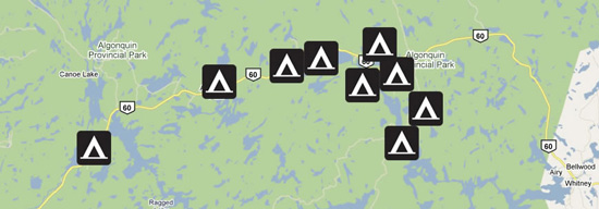
PS - without getting too much into a fantasy discussion, one hears almost as much angst about the over-use of Algonquin Park by campers and hikers as one hears about Banff. All of that Algonquin traffic comes into the park by car. Wouldn't it be nice if there were a local rail service across the park so people could leave their cars at the park gate?
")