News   GLOBAL  |  Apr 02, 2020
 9.8K     0 
News   GLOBAL  |  Apr 01, 2020
 41K     0 
News   GLOBAL  |  Apr 01, 2020
 5.6K     0 

Charles was completed in June at Benton, other than the track work when I was there and its still not open. All of Charles is finish north of there. Still months late opening than plan.

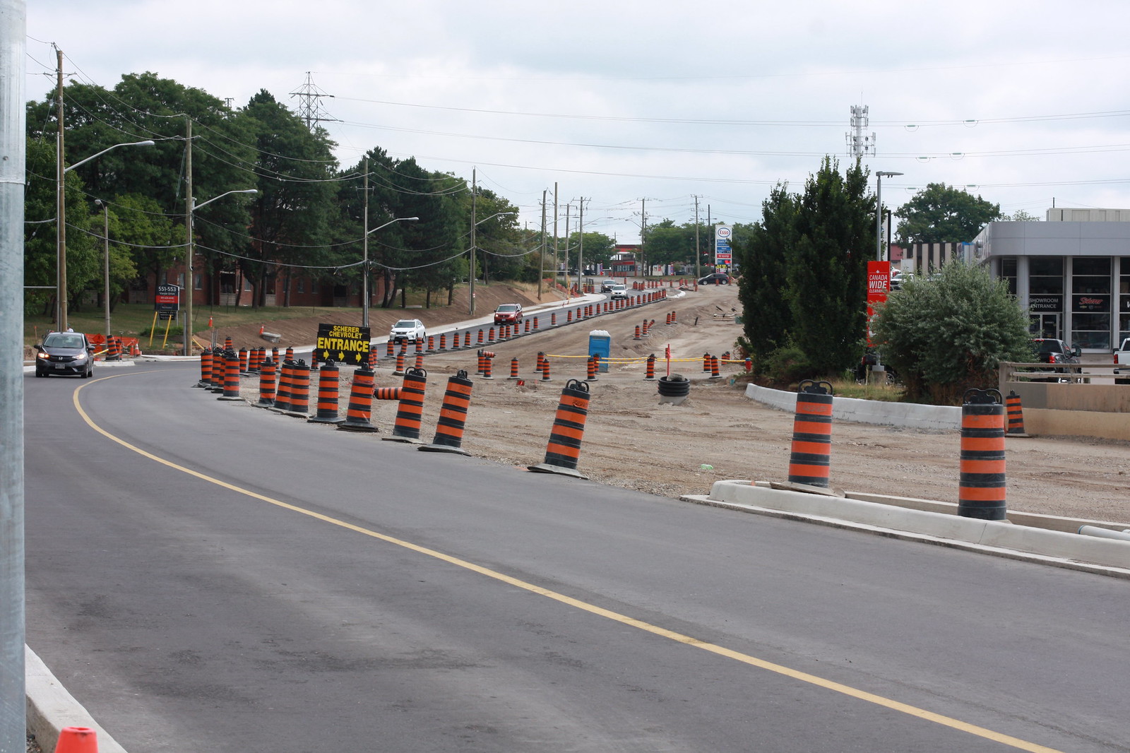
Courtland open to duel traffic is about right and the car folks must be driving with joy for using a new road and no detour.

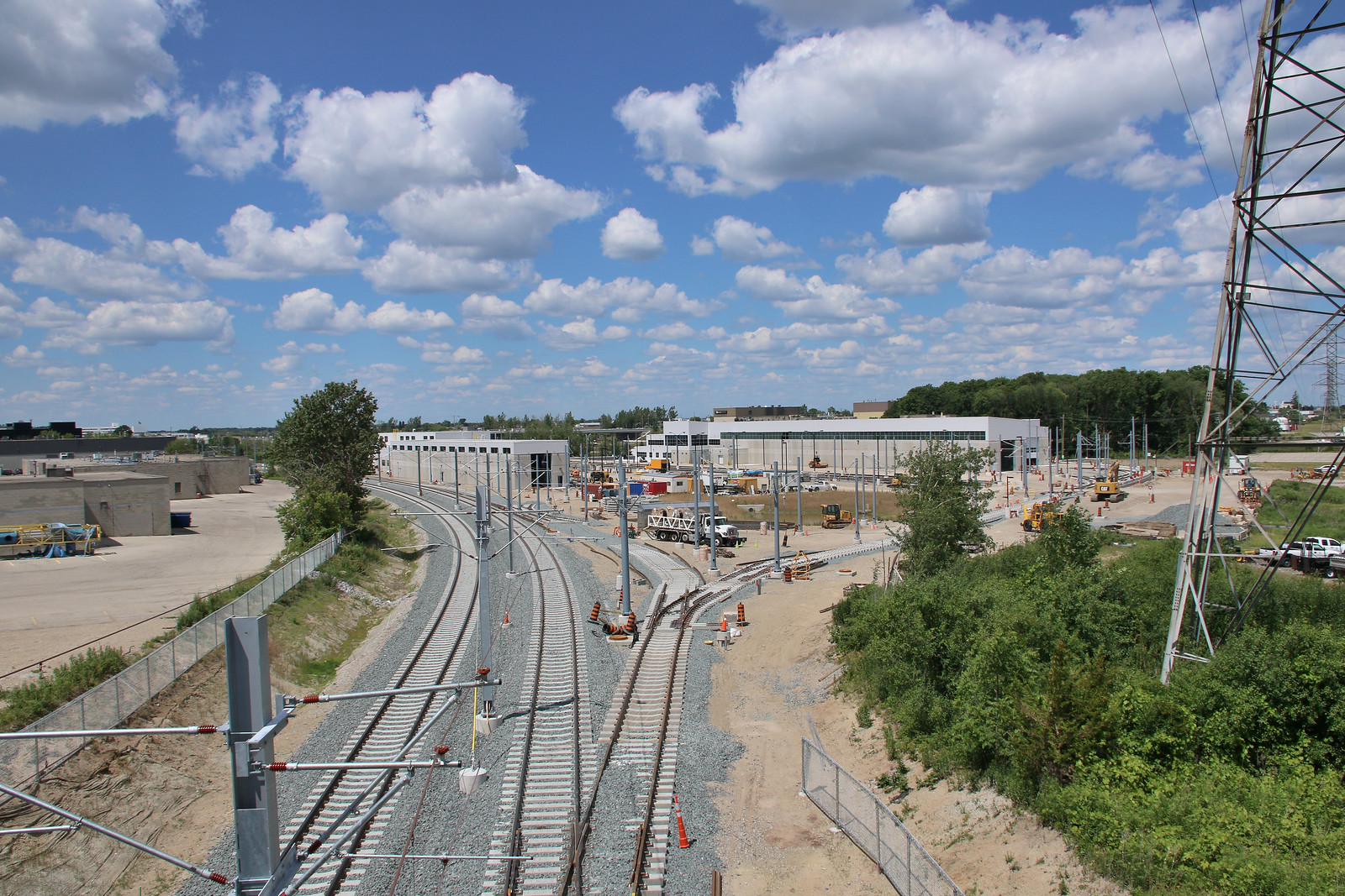
Still a lot of track work still to be done for the yard to make Oct date. They have the fence up now off to the right that wasn't there in June.

With the shifting of the tracks at Mills, lets see how long it takes to get the intersection reopen was well getting both LRT tracks laid.

Hard to say from the Waterloo photo if the old RR track is still in service, since the new track is not finish and until it is, no trains can use it. It was something that struck me to see a sharper curve here, but more so to do with the removal of tracks for the old station. The northbound LRT track will be on the south side of the new RR track and will join it to the west where the switch is to the left. There is another crossover switch by the station where the freights can crossover to the southbound track. I stand to be corrected, but this is the only location that freight can crossover to bypass the yard, since there isn't another crossover by the yard other than for yard use and the cut off for the freight from the southbound track before the station.

I guess GO will be using the west end to get into/out of the yard due to the grade being a lot higher with the new overpass compare to existing grade to use the east end tracks.

As for the connection to the Hydro, ROW, they must shifted the northbound lane further to the west to get all that track work in place and keeping traffic moving, other than closing it off 100% for a week. There wasn't any room to do this when I was there and the road was already shifted to the southbound lanes then. From both photos for Courtland, the LRT ROW will be on the west of the road like it is to the north or swing to the centre. Both ways will cause some traffic issues.

Anyone got a current shot of Conestoga Mall terminal, as it looked odd when I was there? Time to do part 3 & 4 write up.
 
Last edited:
Hard to say from the Waterloo photo if the old RR track is still in service, since the new track is not finish and until it is, no trains can use it. It was something that struck me to see a sharper curve here, but more so to do with the removal of tracks for the old station.

It is not currently in service. There is a temporary derail on Waterloo Spur just east of King St.

The northbound LRT track will be on the south side of the new RR track and will join it to the west where the switch is to the left. There is another crossover switch by the station where the freights can crossover to the southbound track. I stand to be corrected, but this is the only location that freight can crossover to bypass the yard, since there isn't another crossover by the yard other than for yard use and the cut off for the freight from the southbound track before the station.

There are two crossovers in Uptown Waterloo, in front of the Perimeter institute. Freight can move from NB to SB track here.
IMG_1392 by ION Construction, on Flickr

It's a bit tough to see in this picture, but there is a crossover from the SB track to the NB track just West of Weber St, which is just West of the track that leads into the yard. Not sure if freight can use it.
IMG_1385 by ION Construction, on Flickr


Anyone got a current shot of Conestoga Mall terminal, as it looked odd when I was there? Time to do part 3 & 4 write up.
As of yesterday...
IMG_1344 by ION Construction, on Flickr
 
Last edited:
As for the connection to the Hydro, ROW, they must shifted the northbound lane further to the west to get all that track work in place and keeping traffic moving, other than closing it off 100% for a week. There wasn't any room to do this when I was there and the road was already shifted to the southbound lanes then. From both photos for Courtland, the LRT ROW will be on the west of the road like it is to the north or swing to the centre. Both ways will cause some traffic issues.

Not sure what you mean by Northbound lanes being shifted West. You mean east? The ROW was widened on both sites. Here's before/after of this stretch of Courtland. On the east side, sidewalk and land have been removed. On the west side, utility poles are gone.
IMG_7411 by ION Construction, on Flickr

IMG_1457 by ION Construction, on Flickr
 
So they are going to side platforms after all at Conestoga Mall terminal. Seems odd to go from centre platform to side there, other than having wider platforms. What I saw in June said it was going to be side with deep foundation.

The other crossover wasn't there early this year and didn't look at it in June, otherwise would have saw it. Freight can't use that crossing since there is nothing north of it to get it back onto the southbound track before the cut off south of the platform. That crossover is to get cars out of the yard and into service.
28052535001_09330c1f00_h.jpg

28121222025_82d4f23882_h.jpg

27840765980_0e129f73d2_h.jpg

28082605772_c4ee86dbe1_h.jpg
 
Not sure what you mean by Northbound lanes being shifted West. You mean east? The ROW was widened on both sites. Here's before/after of this stretch of Courtland. On the east side, sidewalk and land have been removed. On the west side, utility poles are gone.
IMG_7411 by ION Construction, on Flickr

IMG_1457 by ION Construction, on Flickr

This is what I am referring to. The road would have to be shifted to the right (west?) to allow all that rail to be place and then have the concrete pour for the first haft of the new road crossing.
28018324302_1cc417a680_h.jpg

27506241494_fee1e3a4f8_h.jpg
 
Freight can only use the southbound track between Northfield and the crossover by the Clay and Glass Gallery, as the ties are spaced wider apart on the northbound stretch between those points. It's definitely light rail only.

Perhaps an exception will be made for the flatcars carrying the Ion vehicles, but then again, would they even clear the catenery to get there? If not, then perhaps they'll offload on the freight spur in Uptown just east of King.

I can't wait until December to see how it all goes down...
 

Thank you! This picture confused me at first:

IMG_1391 by ION Construction, on Flickr

I expected 'movable frog' switches to handle the different light vs. heavy rail wheel profiles where the freight merges onto the northbound Ion track (background, under the Cora sign), crosses over to the southbound track (behind the photographer), and where it diverges from the southbound track to continue on to St. Jacobs.

This location is not one of those, but I guess they still need it here for the freight that will be travelling straight through and the lighter Ion vehicles merging in or out. Be interesting to see if the switch at the southbound end of this cross-over will be movable or fixed frog -- guessing fixed.

Nice comments.

First is a close-up of the switch on the Northbound track where freight will diverge to continue on the reconstructed portion of Waterloo Spur.
IMG_1393 by ION Construction, on Flickr

Second, this is the crossover "behind the photographer" :) for NB to SB track, but it wasn't completed at the time.
IMG_1129 by ION Construction, on Flickr
 
Thank you! This picture confused me at first:
IMG_1391 by ION Construction, on Flickr

I expected 'movable frog' switches to handle the different light vs. heavy rail wheel profiles where the freight merges onto the northbound Ion track (background, under the Cora sign), crosses over to the southbound track (behind the photographer), and where it diverges from the southbound track to continue on to St. Jacobs.

This location is not one of those, but I guess they still need it here for the freight that will be travelling straight through and the lighter Ion vehicles merging in or out. Be interesting to see if the switch at the southbound end of this cross-over will be movable or fixed frog -- guessing fixed.

The profile of the wheel is the same for both equipment - it has to be. The only difference between the wheels of the heavy-rail equipment and the LRTs is in the size of the wheels and perhaps a slight difference in the thickness of the flange.

To be honest, I'm a bit surprised by the use of moveable-point frogs. They are a bit of a maintenance headache, and also introduce a potentially new failure location into the signalling system. I don't see any reason why they couldn't have used any sort of the "standard", non-moveable switch frog designs.

Dan
Toronto, Ont.
 
I notice that there are concrete ties under the switches. However, on the GO tracks between Pickering and Oshawa, the areas around the switches have wooden ties even though the rest of the track has concrete ties. Is there some reason that switches on concrete ties are more difficult/expensive/something than those on wooden ties?
 
I notice that there are concrete ties under the switches. However, on the GO tracks between Pickering and Oshawa, the areas around the switches have wooden ties even though the rest of the track has concrete ties. Is there some reason that switches on concrete ties are more difficult/expensive/something than those on wooden ties?

Isn't ion a DBFM project? Was concrete ties in the contract or did the private sector decide that the extra upfront cost was cheaper than maintaining wooden ties?
 
Isn't ion a DBFM project? Was concrete ties in the contract or did the private sector decide that the extra upfront cost was cheaper than maintaining wooden ties?

Likely the latter. I believe it was up to Grandlinq to make the choice.

Details of this are found at http://rapidtransit.regionofwaterlo...ch.15-2Article12TrackworkExecutionVersion.pdf on page 12-21:

(iii) Wood Ties for Standard and Special Trackwork
A. It is preferred that wood ties only be used in those locations which involve only freight railroad service tracks or LRT tracks in the OMSF.

and

(iv) Concrete Ties for Standard and Special Trackwork
C. All mainline ballasted special trackwork shall use concrete ties. Concrete ties for special trackwork shall be designed and supplied by the special trackwork supplier to ensure fastener position is correctly coordinated for each layout.
 
Just realized something.
IMG_1427 by ION Construction, on Flickr

The Northbound LRT segment in Kitchener on runs on the South side 0f Francis between Duke and King. None of the other one-way sections have the LRT vehicles travelling the opposite direction to traffic in adjacent lanes. Seems like a bit of a risk to me - if I were driving at night East on Francis and I see an LRT vehicle coming at me on the right-hand side, I might not react well. I guess the curve from Francis to Northbound on King would have been too tight?
 

Back
Top