News   GLOBAL  |  Apr 02, 2020
 9.8K     0 
News   GLOBAL  |  Apr 01, 2020
 41K     0 
News   GLOBAL  |  Apr 01, 2020
 5.6K     0 

BTW, I love the date plaques to show when the pictures were taken. Especially this one.

f1231_it1876.jpg


and this one
f1231_it1897.jpg

I used to take the GO Train though there in the 1990s, and while by then the span over the tracks was long gone, those concrete-pillared approaches were still there. I used to see them just about every day and wonder about the bridge they obviously had once carried. I actually got out on the south approach one weekend; there was a tree growing in the middle of it, which made it clear the road hadn't been used in a couple of decades. I never did make it to the approach on the north side... that's where I was trying to get to when I took the photos on Flickr back three or four years ago. Delightful to see photos of it when it was under construction. Would be interesting to see it in colour near the end of its life, too, say in the 60s or 70s.
 
IIRC the concrete approach ramps survived some time into the 1980s, maybe even longer...

Oh, yeah... well into the 90s, if not beyond. I can tell you they were gone by January, 2006. :) But I saw them almost daily at least till 1997.
 
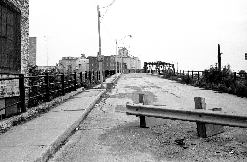
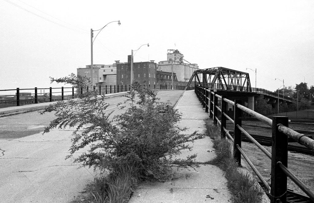
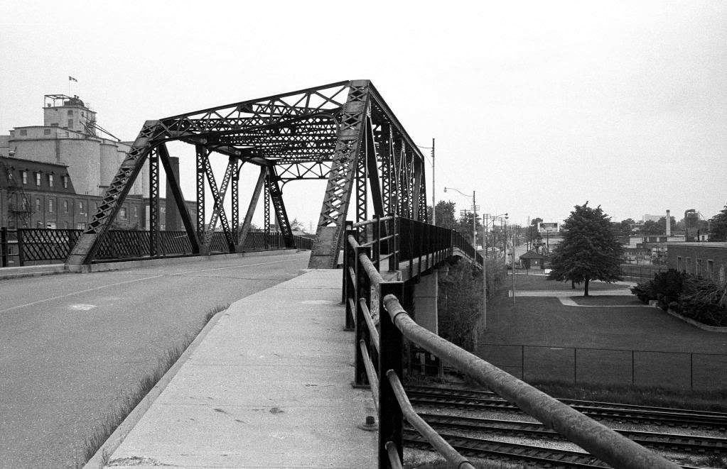
Some photos of the bridge on Weston Road that I took in May of 1981. The bridge was closed at that time, but one could still walk across it. Shortly thereafter, the bridge was removed, but the approaches remained for years to come.

004-023-n018v2.jpg


004-023-n019v2.jpg


004-023-n020v2.jpg
 
Some photos of the bridge on Weston Road that I took in May of 1981. The bridge was closed at that time, but one could still walk across it. Shortly thereafter, the bridge was removed, but the approaches remained for years to come.

004-023-n018v2.jpg


004-023-n019v2.jpg


004-023-n020v2.jpg

those are fantastic images! its amazing to think the bridge lasted into the 1980's.

its amazing how tonally consistent your images are with the earlier ones. i gather the concrete silos and adjacent Victorian factory/warehouse far right in the 1920 image is the same one visible upper left in your shot. you can see a bit of the mansard roof in both.

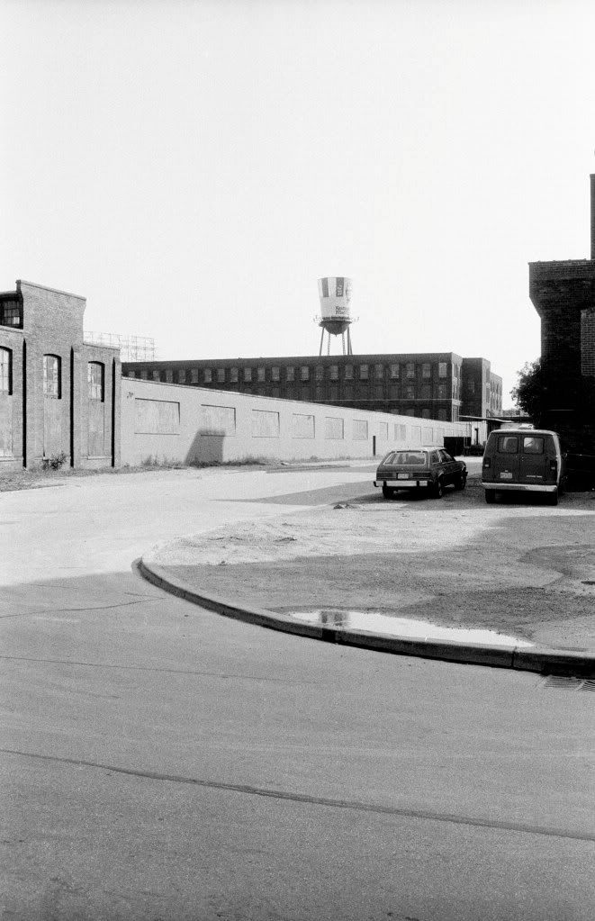
(i like the big bag of Cream of Wheat ad in the early one. it reminds me of the big KFC bucket painted on that water tower on Jefferson Ave that used to be visible from the Gardiner....)

f1231_it1618.jpg

004-023-n020v2.jpg
 
Some photos of the bridge on Weston Road that I took in May of 1981. The bridge was closed at that time, but one could still walk across it. Shortly thereafter, the bridge was removed, but the approaches remained for years to come.

Those shots are fantastic! What I wouldn't have given to have seen the bridge and crossed it. I went back too late to even shoot the approaches, but I remember them.

Does that sign in the first shot actually say "Please keep off the sidewalk"? What the hell did they want folks to do, walk up the centre line? :)
 
Amazing thread! Thanks so much to all those involved.

On a tangentially related note, I was looking at the old plans for the 400 extension on the Get Toronto Moving website (that guy's got some really interesting new stuff up there) and it's amazing to see how much of the land was already cleared for the project. Most of the corridor is either now parkland or has obviously been developed in the last 20 years or so.
 
Last edited:
Does that sign in the first shot actually say "Please keep off the sidewalk"? What the hell did they want folks to do, walk up the centre line? :)

Well, if you notice, the sidewalk beyond said sign was buckling rather dangerously. And because it was no longer a vehicular thoroughfare, it no longer mattered whether people walked on the roadbed. (Funny, though--I always thought the bridge was closed to *all* traffic, never knew that pedestrians could cross it)
 
On a tangentially related note, I was looking at the old plans for the 400 extension on the Get Toronto Moving website (that guy's got some really interesting new stuff up there) and it's amazing to see how much of the land was already cleared for the project.

I agree, a great site at http://www.gettorontomoving.ca Worth a look for sure!
 
Well, if you notice, the sidewalk beyond said sign was buckling rather dangerously. And because it was no longer a vehicular thoroughfare, it no longer mattered whether people walked on the roadbed. (Funny, though--I always thought the bridge was closed to *all* traffic, never knew that pedestrians could cross it)

As I recall, on my visit to the bridge at that time, there was a barrier impeding vehicular traffic, which can be seen in one of my photos, but there was no signage at all regarding pedestrian traffic, other than the signs warning about the sidewalks, also visible in the photos. Here's a shot I took from the bridge on that day ...

004-023-n023.jpg
 
What all this reminds me of is how different an era it was 30 years ago--an era before the kind of guerilla urbanism that led to phenomena like the Railpath and urban exploration in general. Back then, the Old Weston bridge was taken by most to be pretty much sealed-off and rather frightening, and not nearly the kind of creative-spirit urban idee fixe it'd be today...
 
Too bad that the city couldn't build a pedestrian/bicycle bridge following the alignment of the Old Weston Road bridge. Or a tunnel.
 
Too bad that the city couldn't build a pedestrian/bicycle bridge following the alignment of the Old Weston Road bridge. Or a tunnel.

You mean, today, as opposed to 20-30 years ago? Back then, I can't see there having been the "demand"--though today, who knows, esp. as some kind of creative side-shifting continuation of the Railpath. (But I really don't know about a tunnel--something this long in this location would probably be vetoed for safety reasons. More likely a bridge, and probably milking the "overhead view" angle for all it's worth.)
 
I found those photos interesting because they showed what the Maple Leaf Mills site on Junction Road looked like at that point. It was an impressive complex to its end, with bridges spanning the two silos. The silos are still there and a small warehouse but by comparison the site looks empty today. It's too bad that office building with the mansard roofs wasn't spared. Even the loss of the 1960s office building closer to Keele was regrettable because it hasn't been replaced with anything.
 
Yeah - like the old Heintzman building - historic brick to current salmon pink stucco! Yuck!
 

Back
Top