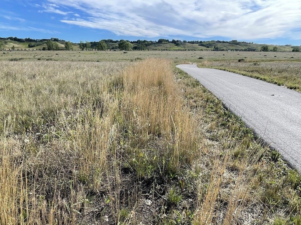
News   GLOBAL  |  Apr 02, 2020
 11K     0 
News   GLOBAL  |  Apr 01, 2020
 43K     0 
News   GLOBAL  |  Apr 01, 2020
 6.7K     0 
It's hideous, but I guess it delineates the passenger side door zone, and redoing all of the curbs and driveways would be a silly expense. I wonder if the aesthetics can be mitigated somehow.
 
That seems to be the model in a lot of new suburbs. Basically a bikelane sidewalk that won't function better than a typical sidewalk. Asphalt should crack less, but will deform when people drive on it to load stuff at a house.
 
That seems to be the model in a lot of new suburbs. Basically a bikelane sidewalk that won't function better than a typical sidewalk. Asphalt should crack less, but will deform when people drive on it to load stuff at a house.

They tend to be much wider, which is a pretty massive function upgrade. We could make wider concrete sidewalks but that would be much more expensive.

For a lot of their lifespan, asphalt is smoother, which is really noticeable pushing a stroller or grocery cart or riding a bike. 15 years in asphalt will probably be a bit bumpier, but concrete isn't immune to big cracks/heaves.

The black colour is probably a benefit in how it encourages melting (of course there's also heat island effect, but MUPs are incredibly minor compared to road lanes). I imagine it would be less annoying to shovel as you'd never get jammed in a drainage channel.

It's also more forgiving on human joints. I hate running on concrete, but I think it would even apply to walking/standing.
 
Has anyone been down to Weaslehead in the last few days before this snow? Curious how far the melt progressed (or if they ever plowed it)?

I posted this on Feb 3:
Considering the forecast it would be really nice if they could run that through with a plow.
So we could have had about 2 weeks of bare pavement and then probably shaved another week or two off the final spring melt by starting this snowfall from a bare baseline
 
Has anyone been down to Weaslehead in the last few days before this snow? Curious how far the melt progressed (or if they ever plowed it)?

I posted this on Feb 3:

So we could have had about 2 weeks of bare pavement and then probably shaved another week or two off the final spring melt by starting this snowfall from a bare baseline
I did the loop on the 14th and the weaselhead section was super icy. The small hill on the far west point was impassible even with studs, but that was the only part I had to walk.

Basically from the pedestrian bridge to that hill was a sheet of ice with a few bare sections
 
The engagement for the SW Bikeway is now open:


1773777029088.png
 
The engagement for the SW Bikeway is now open:


View attachment 722711
A lot potentially being done here.

This project includes three separate routes:

  • North-South Connector: This route extends approximately 8 km from the Elbow River Pathway to Anderson Rd SW mainly via 5 St SW, Haddon Rd SW, and Sacramento Dr SW. The goal is to enhance the route to be Always Available to All Ages and Abilities, while facilitating east-west connections to transit hubs (LRT stations) and major activity centres (Chinook Centre Mall).
  • East-West Connector (89 Ave SW): This route was identified by the community to address the need for additional east-west connections in southwest Calgary. This route connects the North-South Connector to the 14 St SW pedestrian bridge at Glenmore Landing.
  • Horton Rd SW: Horton Rd is scheduled for reconstruction as part of The City’s Pavement Rehabilitation Program. The project presents an opportunity to improve mobility for all users on the road (not just vehicles).

I live right smack in the middle of this area (89th and Elbow). Doing something with 89th Ave would be nice but I wonder how they'd connect it to the network at Elbow Drive. When I was at the phase 1 engagement the map showed the poorly maintained sidewalk that goes between St. Gerards Church and Woodman Jr High and dumps you into a gravel alleyway as the link between 89th Ave and Haddon Rd. This sidewalk is completely impassable in winter.

For North-South I wonder if they just couldn't widen the sidewalk on one side of Elbow Drive and make it a shared use pathway?

Horton Road is an absolute disaster for pedestrians and cyclists, I'm glad that's on the list for improvement, especially with all the development happening.
 
Rode the Glenmore Reservoir loop today on my gravel bike with stock 40mm tires. Again the problem area is Weaselhead Flats. The rest of the park is basically clear save for some wet sections. I did the loop clockwise and entered the park at Glenmore Landing. The hill from South Glenmore down into Weaselhead Flats is pretty clear but the rest of Weaselhead Flats is a slush fest until you get to the pedestrian bridge. From there on the rest of the loop is also clear with just some wet spots. Hopefully in a couple weeks the whole loop will be clear barring anymore big snow dumps. I've included some pics:

The hill from South Glenmore down to Weaselhead:

IMG_0735.JPG


The next few pics are from down into the Weaselhead Flats:

IMG_0740.JPG


IMG_0741.JPG


IMG_0745.JPG
 
Does anyone here ever take their bike on the C-train during peak hours? I know they got rid of the time restrictions for bringing your bike on the train, but I wonder how really feasible it is considering how crowded the trains can get during weekday rush hours, especially the Red line/201.
 
Does anyone here ever take their bike on the C-train during peak hours? I know they got rid of the time restrictions for bringing your bike on the train, but I wonder how really feasible it is considering how crowded the trains can get during weekday rush hours, especially the Red line/201.
I see people do it from time to time, yesterday being the most recent time. There was literally no room to fit all waiting passengers, but some dude was trying to ram his way in with his bike.
 

Back
Top