News   GLOBAL  |  Apr 02, 2020
 9.8K     0 
News   GLOBAL  |  Apr 01, 2020
 41K     0 
News   GLOBAL  |  Apr 01, 2020
 5.6K     0 

Freaking LOL, back alley is the main vehicle access but it's "too small and congested with parking". You can't make this sh*t up if you tried.
My wife used to work there and I can tell you that the residents complain about any kind of change, no matter what it is. One time they painted the main level bathroom a different shade of white and residents complained lol.
The only concern I would have is ambulance parking, and that can easily be resolved. They can have have a section of cement curb open for wheelchair/stretcher access between the front sidewalk entrance and the road. Not super complicated.
As for the complaint about visitors not having a place to park...they've always had that issue. Nothing will change in that regard.
 
Why are they moving the bike lane to the other side of the street? is it a protected lane and parking is going to be eliminated? I think the painted lanes on 14th and 15th are fine as is, those roads are narrow and slow already.
 
This isn't hard.
Do this.
Screenshot 2024-10-29 094243.png

Here.
1730216671328.png


It works on second street. As a cyclist I always have to be aware of my surroundings, being aware of a loading zone out of a seniors home is just another thing. 15th Ave is so wide you may not even need to cut into the boulevard.
Screenshot 2024-10-29 094205.png

Screenshot 2024-10-29 094113.png

DO NOT MAKE THEM CROSS THE BIKE LANE. I HATE WHEN PEOPLE NEED TO CROSS THE BIKE LANE ON SECOND STREET!
 
I'm always looking for people in cars when I ride on 14 & 15th, never had an issue and I use both every day I ride. If someone is blocking or standing in the bike lane part it's easy to get around them.
 
The amount of cyclists that use a route is positively correlated to its perceived safety. While you and I might feel safe and comfortable navigating a vehicular miasma, many others don't.

The normative question is what types of road users do we want to encourage. Road use is very much a zero-sum game.

I'm of the opinion that it's worth it to make driving and parking in the beltline more difficult if it encourages walking and cycling.
 
Sure, for cyclists that don't feel safe on 14th or 15th Aves, there is a fully protected lane on 12th with light timing set up to reduce risk. 12th is the focus of the network, 14th and 15th are really only needed to go a block or two to reach a destination.
 
I like that they are upgrading to protected bike lanes, but I wish they were keeping both 14th and 15th as one ways.
I agree. I think Calgary really needs to start thinking one-ways on side-streets in urban contexts, they are great way to reduce conflicts and can work to traffic calm a whole area, instead of a single spot like a speed bump. They have to be thoughtfully design of course, by the main game is narrow with parking. Give back any excess room to sidewalk, corner bump-outs and street trees over time.

The narrow 14/15th Avenues have little in common with the far more negatively impactful mega-wide downtown arterial one-ways. We shouldn't be afraid of them.
 
Sure, for cyclists that don't feel safe on 14th or 15th Aves, there is a fully protected lane on 12th with light timing set up to reduce risk. 12th is the focus of the network, 14th and 15th are really only needed to go a block or two to reach a destination.

This won't make me popular, but reducing parking availability is a goal in and of itself.

No one at City Hall will admit this, but a guiding principle for many young planners is to decrease the car population.

Reasonable people can disagree of course, but I'd suggest that "what about parking availability" isn't a meaningful counter argument to mobility changes like these. Reducing parking availability is the whole point.
 
Here's the area in question:

Screenshot 2024-10-29 at 12.11.50 PM.png

Why not a loading zone on the south side of the street?

It is a bit interesting the way they've done the green parking graphic there...the word 'PARKING' is actually a driveway (also note the car parked closest to the intersection is right in front of a hydrant on streetview)
Screenshot 2024-10-29 at 12.19.27 PM.png


More interesting to me is the 11 St intersection. NB-EB, SB-EB, EB-SB, and EB-EB movements all become a bit clumsy to me if you are rolling up on them for the first time...hopefully they can figure out good wayfinding.

I prefer the one-way couplets. I'd actually rather have no paint or curbs - just single-file sharrows and a couple speed bumps per block - there's no reason for a car to exceed 20 kph on these roads


This plan also seems to kill any bike lane running further west as the street goes from current 1-way with 1 bike lane configuration to 2 car lanes

Screenshot 2024-10-29 at 12.24.22 PM.png

Currently, I'm really not sure what the sign above the bike stop sign here is trying to say (diagonal arrow to upper right?)
Screenshot 2024-10-29 at 12.35.05 PM.png
 

Attachments

  • Screenshot 2024-10-29 at 12.15.58 PM.png
    Screenshot 2024-10-29 at 12.15.58 PM.png
    1.5 MB · Views: 27
This won't make me popular, but reducing parking availability is a goal in and of itself.

No one at City Hall will admit this, but a guiding principle for many young planners is to decrease the car population.

Reasonable people can disagree of course, but I'd suggest that "what about parking availability" isn't a meaningful counter argument to mobility changes like these. Reducing parking availability is the whole point.
Where did I say anything about parking availability?
 
I wonder what this area adjacent to the LRT Station would look like.

View attachment 607978

I would put the east sidewalk as one of the Top 5 most woefully designed and undersized sidewalks given the context and demand for space given the thousands of LRT users walking through on an less than a metre sidewalk with tree wells and crappy concrete falling apart, in a vehicle splash zone. And a bus stop on top of that - imagine if there's snow here!

As usual, the big space hog is for vehicles. The LRT and the avenues add a bunch of complexity here, so essentially as a driver or pedestrians you are guaranteed to wait for a long or super long red light somewhere between 9th and 6th Avenue. This creates a pretty substantial congested feeling, but it's only made up of a dozen or so cars - probably the long signal times is triggering engineers to want more queuing space for idling vehicles Meanwhile, strollers and LRT uses are jostling and waiting to pass single file for a block nearest to all to wait for 4 minutes to cross 9th or 6th Avenues. All this is complicated by the volumes of the E-W avenues being their highest in the area, therefore giving 11th such a low priority in comparison, therefore long signals, therefore larger queue lanes, therefore no space for acceptable sidewalks ... etc.

The street has other quirks too. This SB turn lane onto 9th Avenue is wild - a full block queue for one of the least likely turn movements in the city. The LRT arm is for some reason in the middle of the road, making the area with the smallest sidewalk also have an in-ordinately large median space to protect the arm mechanism.

All in all, the movements of vehicles connecting to Beltline is pretty low on the list for me - it's a nice-to-have, but not a need and there's several other areas of the street (the sidewalks) that are so deficient that they should take significant priority over the other issues. Although cars to the Beltline also don't seem to be the materially significant issue here either - there's plenty of other design trade-offs that screw over pedestrians on the corridor, with or without 11th connecting to the Beltline.
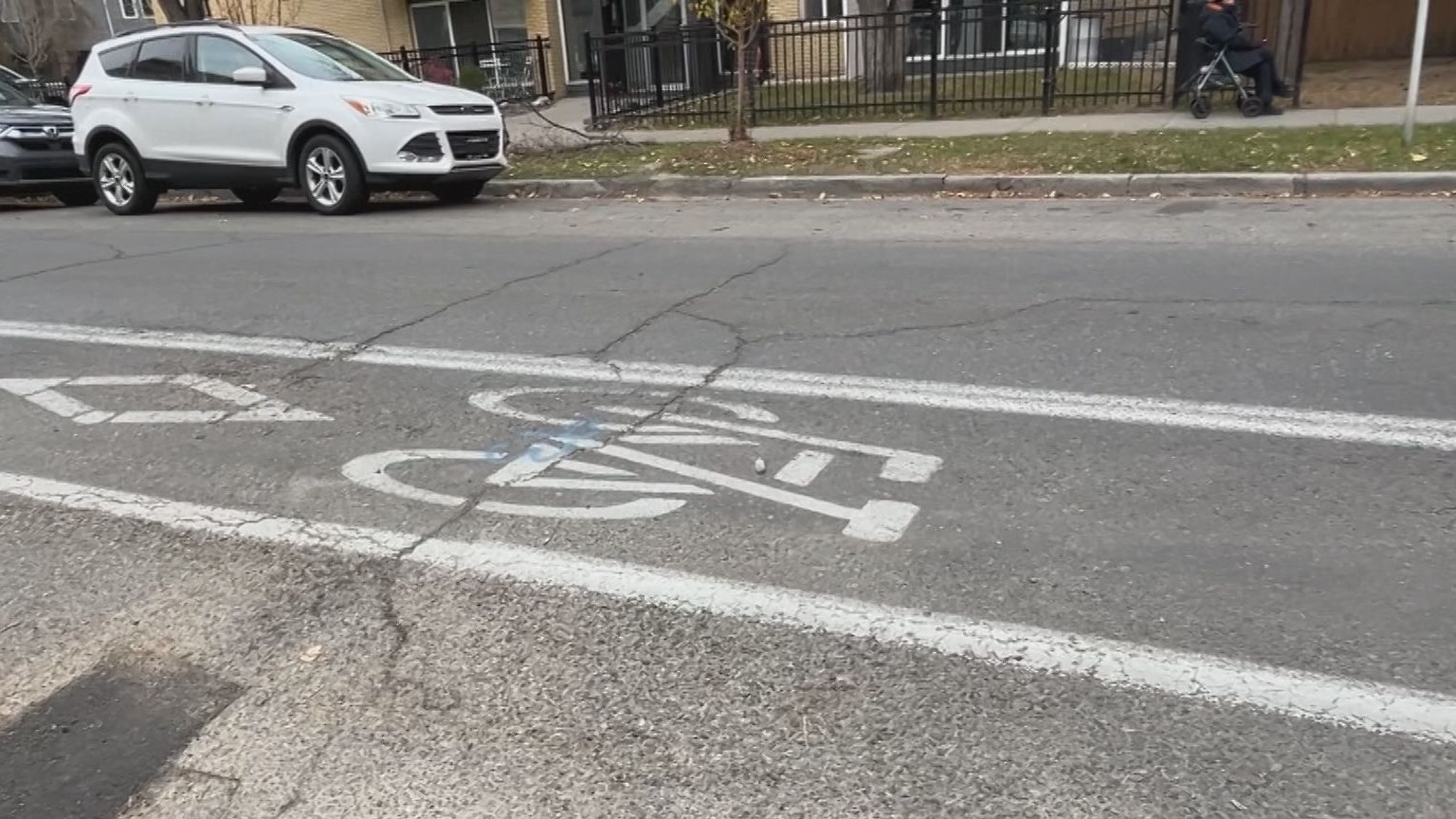
I'm not sure if it's just the vehicles in the streetview but these lanes can definitely be narrowed. There looks to be enough space to maintain the lanes (narrowed) and expand the sidewalk/add a proper bike lane. It's the main N-S route on the West side of the city and we have painted lanes doubling as a bus stop.
 

Back
Top