News   GLOBAL  |  Apr 02, 2020
 9.7K     0 
News   GLOBAL  |  Apr 01, 2020
 41K     0 
News   GLOBAL  |  Apr 01, 2020
 5.5K     0 

The Island Airport - before any suggestion of jets.
Note: Maple Leaf Stadium, two roundhouses in rail lands, only 'skyscraper' -Bank Of Commerce Building

IslandAirport1940_zps7018b8e9.jpg
 
Last edited:
A versatile business on Bathurst, north of Dundas.
Samuel Davis Cigar Store - 1935

SamuelDavisCigarStoreBathurstNofDundasc1935_zps0785b369.jpg
 
The Island Airport - before any suggestion of jets.

IslandAirport1940_zps7018b8e9.jpg

In looking at this aerial, one sees there's something odd about Toronto. The city doesn't seem to 'originate' by the lake because all the infill meant newer districts have emerged south of the city's historical starting points in the St. Lawrence area and Fort York. The empty waterfront lands look strange--you'd expect some of the oldest areas of the city to be by the water's edge where the settlers first arrived.

Montreal, on the other hand, clearly originates in the Old Port by the river and becomes newer as you move further inland in what seems like a more logical development pattern. Imagine the Distillery District, St. Lawrence area and Fort York right at the water's edge, the pre-skyscraper Financial District intact with all its ornate heritage buildings, and Union Station, the modern skyscrapers and all the rail lines in the Yonge and Bloor area. That would be a more picturesque city, but we have to make the best of what we have--we're capable of some spectacular things like the CN Tower built in the infill lands.
 
Last edited:
"A versatile business on Bathurst, north of Dundas.
Samuel Davis Cigar Store - 1935"
Prof Goldie.

There will be some users of this forum who will not be surprised that I knew Sam Davis during the

1960's when I was working just up the street from the pictured store and on

occasion do see his son and grandson(s) downtown.

Sam, a Great Kibitser and A Good Man, now gone.


Regards,
J T
 
Last edited:
At one time we could see the Royal York Hotel from this viewpoint.

FlatironandRYHotelNeg-167_zps2f36a058.jpg
 
In looking at this aerial, one sees there's something odd about Toronto. The city doesn't seem to 'originate' by the lake because all the infill meant newer districts have emerged south of the city's historical starting points in the St. Lawrence area and Fort York. The empty waterfront lands look strange--you'd expect some of the oldest areas of the city to be by the water's edge where the settlers first arrived.

Montreal, on the other hand, clearly originates in the Old Port by the river and becomes newer as you move further inland in what seems like a more logical development pattern. Imagine the Distillery District, St. Lawrence area and Fort York right at the water's edge, the pre-skyscraper Financial District intact with all its ornate heritage buildings, and Union Station, the modern skyscrapers and all the rail lines in the Yonge and Bloor area. That would be a more picturesque city, but we have to make the best of what we have--we're capable of some spectacular things like the CN Tower built in the infill lands.

Your comparison with Montreal is an interesting one, junctionist. I'm not an expert on Montreal, but perhaps the main difference was the location of the stations and the rail-lines, which were more inland and were subsequently covered. Toronto's waterfront was the easiest and most available location for the various stations and rail-lines, which resulted in the massive landfill and separation.

Montreal Central Station 1930:

Fosse_du_Canadien_National_Montreal_1930.jpg


This was the result of a long process, detailed in the following website: http://havremontreal.qc.ca/en/index.php/le-harve/histoire

1895:

Vue-vers-l'ouest-de-la-rue-des-Commissaires-et-des-installations-portuaires,-en-1895.jpg


Vue-Nord-est-depuis-la-cheminee-de-la-centrale-de-la-Montreal-Street-Railway.jpg


Vue-vers-lEst-du-bassin-Peel-des-installations-portuaires.jpg
 

Attachments

  • Fosse_du_Canadien_National_Montreal_1930.jpg
    Fosse_du_Canadien_National_Montreal_1930.jpg
    62.4 KB · Views: 854
  • Vue-vers-l'ouest-de-la-rue-des-Commissaires-et-des-installations-portuaires,-en-1895.jpg
    Vue-vers-l'ouest-de-la-rue-des-Commissaires-et-des-installations-portuaires,-en-1895.jpg
    46.4 KB · Views: 774
  • Vue-Nord-est-depuis-la-cheminee-de-la-centrale-de-la-Montreal-Street-Railway.jpg
    Vue-Nord-est-depuis-la-cheminee-de-la-centrale-de-la-Montreal-Street-Railway.jpg
    65.3 KB · Views: 883
  • Vue-vers-lEst-du-bassin-Peel-des-installations-portuaires.jpg
    Vue-vers-lEst-du-bassin-Peel-des-installations-portuaires.jpg
    95.9 KB · Views: 818
Last edited:
Your comparison with Montreal is an interesting one, junctionist. I'm not an expert on Montreal, but perhaps the main difference was the location of the stations and the rail-lines, which were more inland and were subsequently covered. Toronto's waterfront was the easiest and most available location for the various stations and rail-lines, which resulted in the massive landfill and separation.

Montreal Central Station 1930:

View attachment 21718

This was the result of a long process, detailed in the following website: http://havremontreal.qc.ca/en/index.php/le-harve/histoire

1895:

View attachment 21719

View attachment 21720

View attachment 21721

Small nitpicky points:

I am pretty sure the rail line depicted in the 1895 photo led to Viger Station, built as part of the grand Hotel Viger on Place Viger. That domed building is the Marche Bonsecours.

More images here, on a great Montreal site showing architecture.

The 1930 Photo: Windsor Station, part of the same CP network, was built around the same time. The domed building there is Mary Queen of the World.

While it's true that the city developed from the port up -- much more so than Toronto as I assume the St. Lawrence was more navigable up to Montreal, and probably didn't freeze as often as Lake Ontario. I don't know. It's just a guess. Also all the CP robber barons lived in Montreal so we had a much better rail system. The whole enclave called Montreal West was built essentially to house CP employees around the little station there.

The mayor of Montreal, Raymond Préfontaine, strongly encouraged its construction in an area central to the French Canadian élites, in contrast to the rival Windsor Hotel to the west, which was perceived to cater to the city's anglophone classes. The rail station served as the terminus of the CP passenger rail lines running into downtown Montreal from the north and east. It replaced the older Dalhousie Station. Its counterpart terminus for CP passenger rail lines running into downtown Montreal from the south and west was Windsor Station.

Both were designed by the prolific Bruce Price who also was the architect of the Chateau Frontenac, the Banff Springs and other CP Hotels.


Central Station (formerly owned by CN) came later.
 
Surely the big difference between Montreal and Toronto is/was that in Montreal they could not really extend the City out into the river (at least not much) whereas here in Toronto they could reclaim land and build rail lines etc on it with virtually no limit.
 
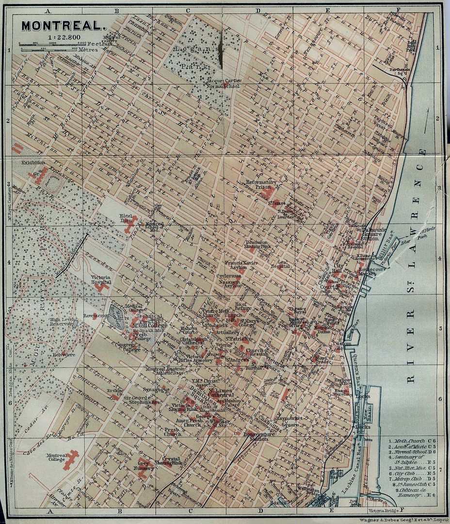
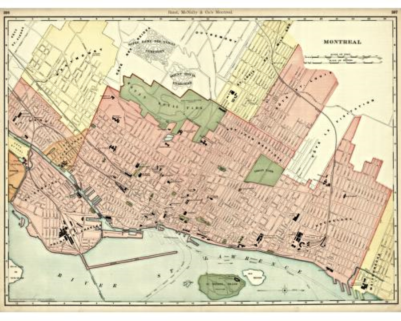
Thanks, Ex-Montreal Girl! What a great city. Looking at some of the historical maps, one point that emerges is that the series of train stations on the perimeter of downtown (similar to Paris or London) avoided the creation of a barrier along the waterfront, notwithstanding branch lines feeding into the various stations. This 1894 map illustrates the point:


1901:


Last edited:
Montreal Central Station 1930:

View attachment 21718

If I'm not mistaken, this 1930 photo shows Central Station.
Windsor Station is out of sight (on St. Antoine St. W. at Peel) behind the cathedral (Mary Queen of the World).
The open-cut was amazingly covered over mid-century and became the site for new buildings (Queen Elizabeth Hotel, Place-Ville-Marie, etc.).
 
"Flatiron Building 1977"
Prof Goldie.

What we are really looking at is the East Wall of the Previously Positioned Westerly Building

and Belongs to The City of Toronto; the windows being installed during the Restoration

of The Flat Iron (Gooderham) Building!


Regards,
J T
 
Were there ever buildings there before it was a parking lot and then a park, or has it always been an oddly shaped vacant lot?

This photo (1898) shows the buildings that once occupied that space to the west of Flatiron.

Flatiron 1898.jpg
 

Attachments

  • Flatiron 1898.jpg
    Flatiron 1898.jpg
    42.2 KB · Views: 735

Back
Top