News   GLOBAL  |  Apr 02, 2020
 9.6K     0 
News   GLOBAL  |  Apr 01, 2020
 41K     0 
News   GLOBAL  |  Apr 01, 2020
 5.4K     0 

Interesting points. This makes me wonder why we bothered making a rail line to Moosonee in the 1930 and maintained to before the beginnings of the tourist train era. Passenger service alone was likely not viable.
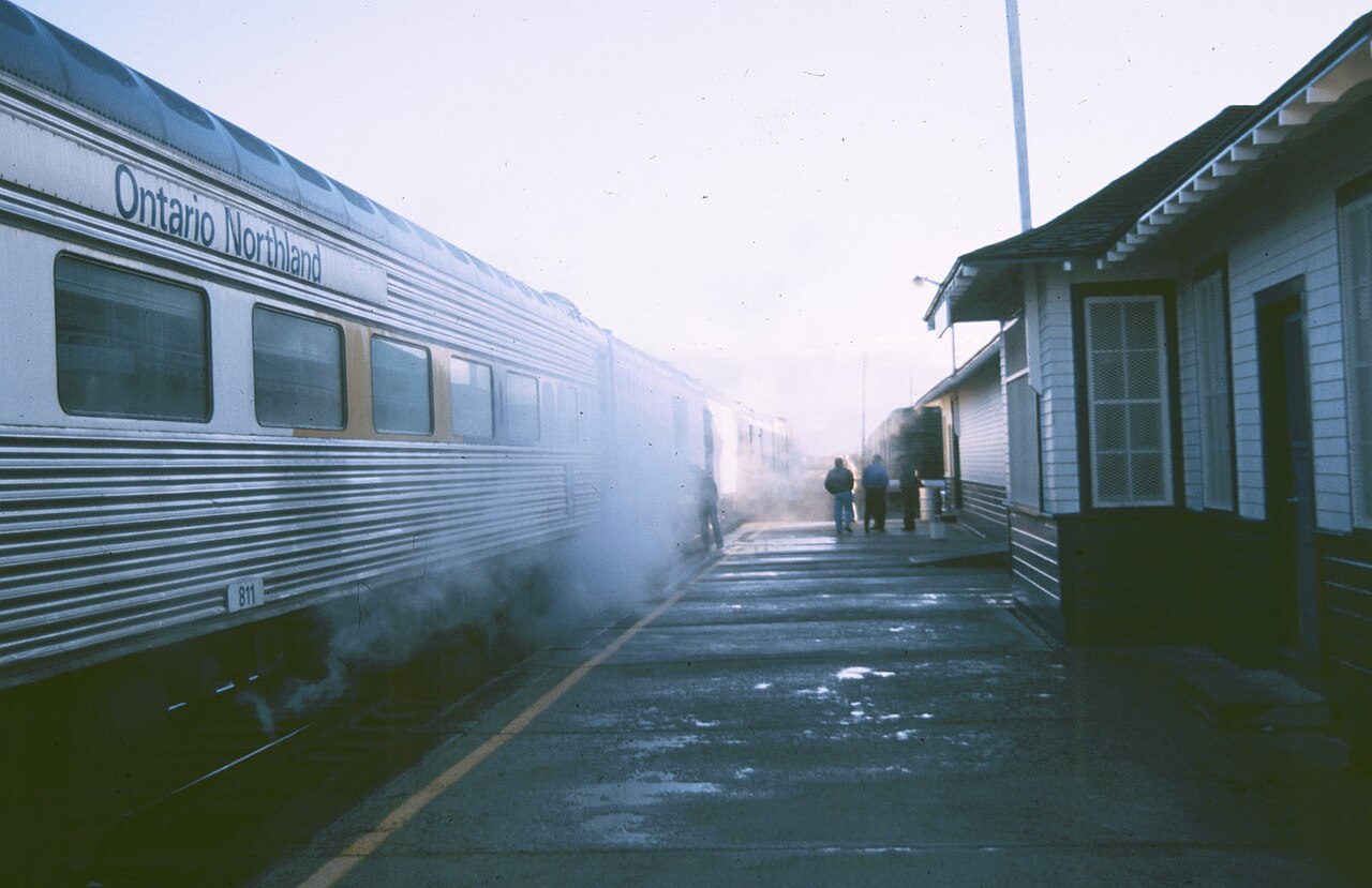

"The first station in Moosonee was built in 1932 by the then Temiskaming and Northern Ontario Railway."

But why?

People often forget that Ontario has a direct connection to the sea via Hudson’s Bay. Before the St. Lawrence Seaway was constructed, Ontario was seriously considering building a seasonal deep sea port at Moosanee. Here’s a New York Times article from 1960 outlining the details.


With the Northwest Passages thawing out, Ontario will be directly connected to the ocean year round. They could potentially revive the project. A few local MP’s have been pushing the idea.


A pair of railway lines extends north toward Hudson Bay at the Port of Churchill and to the south at James Bay, to the town of Moosonee on the Moose River that could realize economic benefit from trans-Arctic container shipping. The railway line at Moosonee connects south into Canada’s biggest market for international container trade as well as to major American Great lakes cities such as Detroit and Chicago. If a future Canadian trans-Arctic navigation would last for six months from early in May to late in October, there may be merit in developing a container port near Moosonee. The railway distance from Moosonee to Chicago and Toronto is much shorter than the railway distance from Pacific Coast container ports to these cities, with the prospect of lower per container transportation costs from East Asian ports. During a future Canadian trans-Arctic navigation season, a container port on James Bay near Moosonee would compete with other Eastern Canadian container ports located along the Lower Saint Lawrence River and at Cape Breton. That shipping season would coincide with the peak movement of containers carrying international trade between East Asia and North American warehouses.


This is where Moosanee beats out Churchill IMO. It would transform Northern Ontario if this goes through.
 
Haven’t heard much from Ontario, but Quebec is interested in this as well. The difference is they don’t have any rail connections to the north, which Ontario already has.

In 2020, Quebec and the James Bay Cree made a deal to extend road and rail infrastructure into the James Bay/Hudson’s Bay region. Whether or not it actually gets done is another matter.

Manitoba is actually considering building a brand new port a bit south of Churchill at the mouth of Nelson River - this is from last year.


Ontario meanwhile seems to be watching and waiting. If Trans-Arctic trade picks up, they are potentially sitting on a goldmine. The basic infrastructure is there already. Wouldn’t take much to develop upon it.
 
Interesting point about the bathymetry back then vs. now. Also, I don't know how much, if any, the impact on hydro-electric development on the Moose River system has had on the flow and sedimentation.

You can pretty much create anything with enough money. The river and 'port' would require significant and regular dredging and I'm not sure it would be viable for ocean-going cargo without being heavily subsidized. I've been across to Moose Factory Island via motorized canoe and the operator was constantly sounding with a paddle (at full throttle!) and a lot of times he was hitting bottom. Even with his knowledge of the river, the channels move constantly. Keep in mind that the river and delta is tidal, so any depth considerations would have to take that into account.
Fascinating! I believe it was similar issues at Port Nelson (near York Factory) that lead to moving the port there to Churchill.

I don't know the area personally, but it's sounding as if at Moosonee you'd have to build a terminal sticking into James Bay, similar to the Tsawwassen ferry terminal and nearby cargo port in Delta. The key question would be how far! It's hard to find detailed bathymetry for James Bay - it's incredibly shallow - probably only a 20-metre drop for the first 60 km. The tidal flats must be amazing at low tide.
 
Haven’t heard much from Ontario, but Quebec is interested in this as well. The difference is they don’t have any rail connections to the north, which Ontario already has.
Manitoba is actually considering building a brand new port a bit south of Churchill at the mouth of Nelson River - this is from last year.
Ontario meanwhile seems to be watching and waiting. If Trans-Arctic trade picks up, they are potentially sitting on a goldmine.
There’s a lot of potential for rail in the Arctic. Building track on permafrost is tricky, as the Churchill line has shown, but feasible. Indigenous opposition may be strong if not co-opted or embraced.

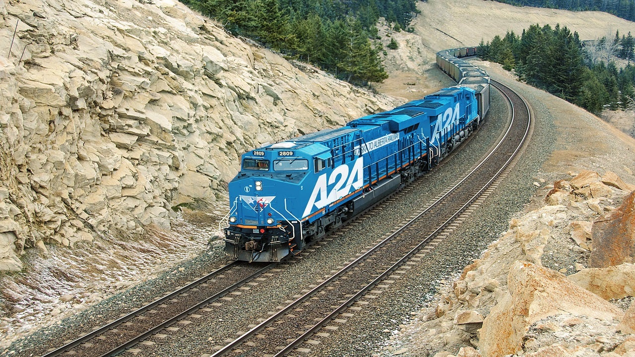
Then there’s the idea of a rail link from Alaska to Alberta, connecting the state to the rest of the continental US.


Last edited:
Fascinating! I believe it was similar issues at Port Nelson (near York Factory) that lead to moving the port there to Churchill.

I don't know the area personally, but it's sounding as if at Moosonee you'd have to build a terminal sticking into James Bay, similar to the Tsawwassen ferry terminal and nearby cargo port in Delta. The key question would be how far! It's hard to find detailed bathymetry for James Bay - it's incredibly shallow - probably only a 20-metre drop for the first 60 km. The tidal flats must be amazing at low tide.
They are. (And rather spectacular if not foggy, snowing etc.) And you are not wrong in your assessment of water depths. I think much more information needs to come forward before anyone gets overly excited about deep water shipping facilities in either of these two locations.
 
Fascinating! I believe it was similar issues at Port Nelson (near York Factory) that lead to moving the port there to Churchill.

I don't know the area personally, but it's sounding as if at Moosonee you'd have to build a terminal sticking into James Bay, similar to the Tsawwassen ferry terminal and nearby cargo port in Delta. The key question would be how far! It's hard to find detailed bathymetry for James Bay - it's incredibly shallow - probably only a 20-metre drop for the first 60 km. The tidal flats must be amazing at low tide.

I have 2 charts 5860 and 5861 They are too big to scan, but they have all the detail you would need to see the bathymetry. They show from Moosonee to the end of the approach to the river. Some parts of the Moose River are less than 100m wide at low tide.. The other challenge is that Moosonee is 20km inland. And then you have the fact of it being a largely ignored part of the province, and country. The push back from the FN about making it a working port would be hard politically.

 
In my mind I was trying to equate both ports(although Port Nelson I do not remember as well) with Savannah - inland, river based container ports (for the most part) with rail connections. It’s a bit tricky. I think FN would be very agreeable and probably partner in a job and wealth creating economic zone. But outside of the sea approaches to any port to be established (container and (?) bulk cargo’s ) the rail connections are of a very light load nature and millions would have to be spent to upgrade across the James Bay Lowlands. Building a road is a thought as well, but the same technical challenges as upgrading rail would be in place. And then the real question is cost, return on this level of investment, environmental concerns, and whether we really need a port in James Bay? So a subject with much to unpack and no off the cuff answers.
 
In my mind I was trying to equate both ports(although Port Nelson I do not remember as well) with Savannah - inland, river based container ports (for the most part) with rail connections. It’s a bit tricky. I think FN would be very agreeable and probably partner in a job and wealth creating economic zone. But outside of the sea approaches to any port to be established (container and (?) bulk cargo’s ) the rail connections are of a very light load nature and millions would have to be spent to upgrade across the James Bay Lowlands. Building a road is a thought as well, but the same technical challenges as upgrading rail would be in place. And then the real question is cost, return on this level of investment, environmental concerns, and whether we really need a port in James Bay? So a subject with much to unpack and no off the cuff answers.
The only off the cuff answer is: it is not feasible yet. Once it does, we will hear about it.
 
The difference is Quebec does not have any rail connections to the north, which Ontario already has.
Per https://rac.jmaponline.net/canadianrailatlas/ CN has a line to the town of Rouyn Noranda, QC that connects Quebec traffic to the Ontario Northern line to Moosonee.

Quebec.jpg
 
Last edited:
Those other lines even north of it are ones that could be extended. The question would be where to extend it to?
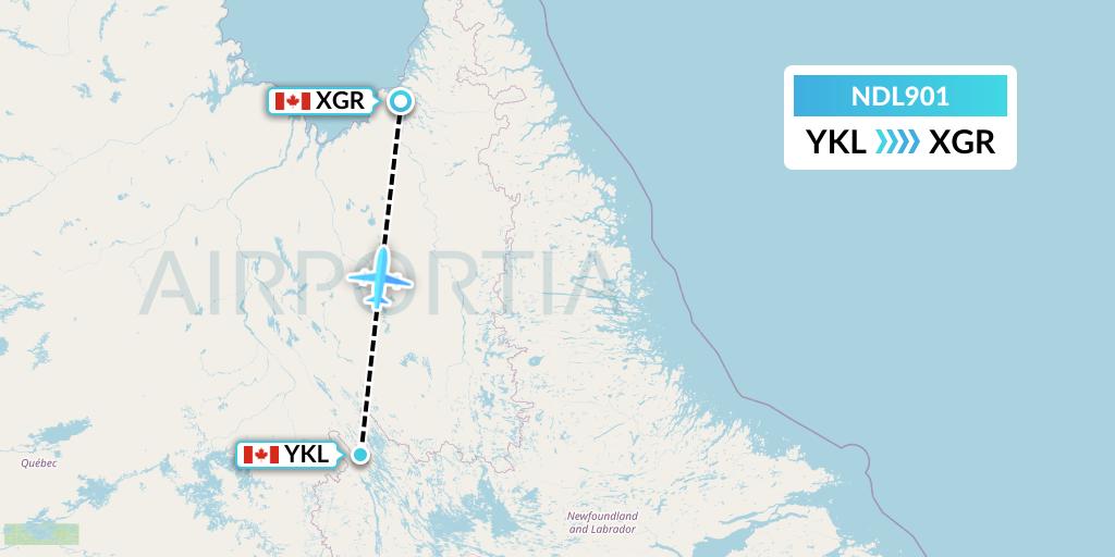
If Quebec natural resources are appropriately located, the line from Schefferville, QC could be extended to Kangiqsualujjuaq, where a port could be constructed to serve vessels in the Ungava Bay.

ndl901-ykl-xgr--ndl.jpg


quebc.jpg
 
In my mind I was trying to equate both ports(although Port Nelson I do not remember as well) with Savannah - inland, river based container ports (for the most part) with rail connections. It’s a bit tricky. I think FN would be very agreeable and probably partner in a job and wealth creating economic zone. But outside of the sea approaches to any port to be established (container and (?) bulk cargo’s ) the rail connections are of a very light load nature and millions would have to be spent to upgrade across the James Bay Lowlands. Building a road is a thought as well, but the same technical challenges as upgrading rail would be in place. And then the real question is cost, return on this level of investment, environmental concerns, and whether we really need a port in James Bay? So a subject with much to unpack and no off the cuff answers.
Absolutely. A deep water port at Moosonee would require massive and ongoing subsidy to make it viable. Charts in the area have a caution that, due to changing conditions, buoys may be moved to take advantage of the best channel, which should be an indication that the entire Moose River delta and southern James Bay area is a shallow, constantly shifting sand and mud flat. Additionally, CHS cautions that "many of the Arctic charts contain minimal or insufficient information to support safe and efficient navigation." The money that it would cost to build, mantain and service this area as an international shipping port would, in my view, be better spent in the St. Lawrence estuary or Maritime area.

The Quebec side is different, although not to say it would be a walk in the park. The west side of James and Hudson's Bays is typical Canadian Shield with a topography that approaches mountainous (that's how they created the James Bay hydroelectric projects. Also, their economic interest is exploiting minerals that are believed (or proven - I don't know) to be in the immediate area.
 
If Quebec natural resources are appropriately located, the line from Schefferville, QC could be extended to Kangiqsualujjuaq, where a port could be constructed to serve vessels in the Ungava Bay.

ndl901-ykl-xgr--ndl.jpg


View attachment 591897
Both CN and the province of Quebec both looked at extending or creating line in the Quebec/Labrador area in the early 2000s and it seems all have died. I don't know if shipping to a northern port was part of the plan or just to bring resources south.

I don't know the topography in the Ungava region other than to suspect it is rugged. I do know that it has tides that rival the Bay of Fundy.

Infrastructure development in the Arctic is painfully slow, complex and expensive. Iqaluit finally got a deepwater port after multiple decades and millions and the CAF is still trying to get its seasonal re-fueling station operational that dates back to the Harper era.
 
I don't know the topography in the Ungava region other than to suspect it is rugged. I do know that it has tides that rival the Bay of Fundy. Infrastructure development in the Arctic is painfully slow, complex and expensive.
Here's the world ship tracker. http://www.shiptraffic.net/marine-traffic/bays/Ungava_Bay

arctic.jpg


Nothing with a transponder in the Arctic beyond Greenland's shores and the North Sea today whatsoever. We clearly have a long way to go before we can justify railways to the north.
 

Attachments

  • arctic.jpg
    arctic.jpg
    43.5 KB · Views: 35
Haven’t heard much from Ontario, but Quebec is interested in this as well. The difference is they don’t have any rail connections to the north, which Ontario already has.

In 2020, Quebec and the James Bay Cree made a deal to extend road and rail infrastructure into the James Bay/Hudson’s Bay region. Whether or not it actually gets done is another matter.

Manitoba is actually considering building a brand new port a bit south of Churchill at the mouth of Nelson River - this is from last year.


Ontario meanwhile seems to be watching and waiting. If Trans-Arctic trade picks up, they are potentially sitting on a goldmine. The basic infrastructure is there already. Wouldn’t take much to develop upon it.

That second port idea may not have legs since it was mentioned by the previous PC government. It's a 2023 article.
 
Last edited:

Back
Top