News   GLOBAL  |  Apr 02, 2020
 9.7K     0 
News   GLOBAL  |  Apr 01, 2020
 41K     0 
News   GLOBAL  |  Apr 01, 2020
 5.5K     0 

Interesting bit from the GO Capital projects update/Union Station:

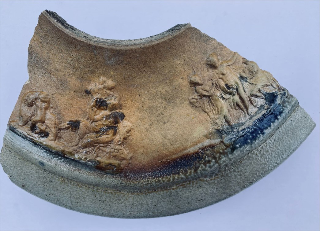
It was another busy quarter for the Union Station Enhancement Project (USEP), where Metrolinx is using Alliance contracting to deliver a suite of improvements to Union Station. During excavation over the winter, significant archaeological findings were unearthed between York and Bay streets along the historical Lake Ontario shoreline, specifically the remnants of the original Toronto wharf. The wharf’s materials were catalogued in detail and successfully removed, allowing the project construction to continue. East of the station where the Alliance is adding approach tracks, temporary shoring at both Jarvis and Sherbourne Streets started in March and continues into the spring in preparation for the substructure work of both bridge extensions. The civil underground duct bank between the Esplanade substation and the Don Fleet Junction was also completed, which is a critical precursor to future works, such as the installation of the utility bridges.

AoD
Far more detail on this:
 
In short, yes, they want to do a flyover between the Credit River and Mount Pleasant. Here's the latest:


Metrolinx is pursuing it appears option 3 for the long term. Visualization here created not by Metrolinx, but by the Brampton Board of Trade from this file:

View attachment 588436
Wait, does this mean that GO will only have a single track to work with between Bramalea and Georgetown, or is this just a poorly coloured in diagram?
 
It is the latter. They'll have at least two tracks unless this is another planning disaster (again).

GO will not have two dedicated tracks throughout. There will be only three tracks through Brampton - only one track is being added (for now). The tail track at Bramalea will likely become a passing track (similar to recent changes at Aldershot) and there may be a fourth track in places further west.

- Paul
 
Far more detail on this:

A few of the recovered archeogloical items, from the link above:

1723742905509.png


1723742941451.png


1723742963015.png


1723742988529.png


1723743022803.png
 
GO will not have two dedicated tracks throughout. There will be only three tracks through Brampton - only one track is being added (for now). The tail track at Bramalea will likely become a passing track (similar to recent changes at Aldershot) and there may be a fourth track in places further west.

- Paul
If this is the case, I don't see how more than 30 minute of service to Kitchener can be implemented. This is a very important corridor for CN.
 
If this is the case, I don't see how more than 30 minute of service to Kitchener can be implemented. This is a very important corridor for CN.
Ottawa's line 2 is single tracked and it runs every 12 minutes. More frequent passing tracks enable more frequent service.

The number of km of track added according to the press release indicates that the corridor will have a considerable amount of quad track (i.e. 2 tracks for GO and 2 tracks for CN), albeit with some triple track pinch points (presumably Brampton station and the Credit River bridge). There have been actual Metrolinx track maps posted in this thread.
 
Last edited:
Ottawa's line 2 is single tracked and it runs every 12 minutes. More frequent passing tracks enable more frequent service.

The number of km of track added according to the press release indicates that the corridor will have a considerable amount of quad track, albeit with some triple track pinch points (presumably Brampton station and the Credit River bridge). There have been actual Metrolinx track maps posted in this thread.
Understood, thanks, just as long as there is more capacity.
 

Back
Top