News   GLOBAL  |  Apr 02, 2020
 9.5K     0 
News   GLOBAL  |  Apr 01, 2020
 40K     0 
News   GLOBAL  |  Apr 01, 2020
 5.3K     0 

So Gladstone was initially planned to go through the park and then they changed their mind.
Good point! I took a look on Google Maps, and see that there is a short stub of Gladstone heading north from Sylvan Ave into the park to a few houses where the road ends and it turns into a path north through the park. At the north end, Dufferin Park Ave is a bike/pedestrian path between Dufferin and Gladstone.
 
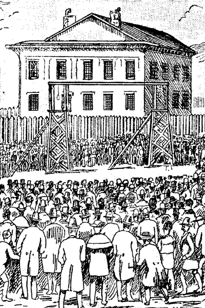
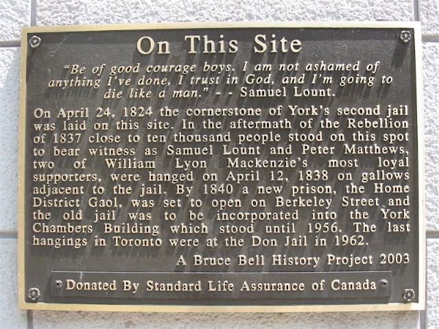
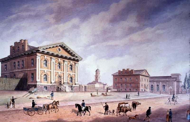
April 12, 1838: Hanging of Samuel Lount and Peter Matthews, two of the rebels from the 1837 Rebellion (corner of King and Toronto Streets):

The old jail on the left:

1978_41_40_watercolour_m.jpg


The gallows:

1838jail.gif


Plaque on Toronto Street just north of King:

Samuel_Lount_and_Peter_Matthews_Pla.jpg


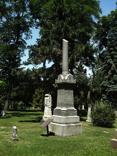
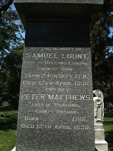
Their gravestone in the Toronto Necropolis Cemetary:

gravestone2.jpg
gravestone.jpg
 
Last edited:
April 12, 1838: Hanging of Samuel Lount and Peter Matthews, two of the rebels from the 1837 Rebellion (corner of King and Toronto Streets):

Thanks! Interesting to note the last hanging was "Ronald Turpin and Arthur Lucas on 11 December 1962. Turpin and Lucas had each been convicted in separate murders, and their executions were Canada's last before capital punishment was abolished." (from Wikipedia)
 
April 13th: a photo of the falling apart but ornate (by today's standards) Earlscourt Park Clubhouse veranda 76 years ago, in 1934:

s0372_ss0001_it1271.jpg


Does anyone know if this building is still there? Its been a while since I've been in the park, and from Google Maps I can't tell if the building mid-park has a second level. There is also a photo from 1924 of a brick 'shelter' being built, but the windows are very different. Maybe today's building was along St. Clair and now gone? I don't see it in the 1931 photos in that area either.
 
Not still there; and in fact, it appears to be a pre-Confederation farm/manor house (that which gave Earlscourt its name, perhaps?)--the crisp Classical detailing and Regency awning give it away...
 

That makes a lot of sense! I'll update my map, and the details in the database... from the link:
"In March 1920, Colonel [George Cooper] Royce sold the 32-acre (13-hectare) estate, including Preston Villa to the City for $330,000. Earlscourt Park was officially opened on October 23, 1920. Preston Villa became the Earlscourt Park Community Clubhouse . The clubhouse building, considered dilapidated and a fire hazard, was closed in 1955 and subsequently demolished. ... The space was redeveloped for recreation." Excerpt from St. Clair West in Pictures, 3rd ed., 112.
 
April 16: Here's a 75 year old photo from 1935, standing in the middle of King Street West, looking east to where King Street bends north along the lakeshore at Wilson Park Road. The scene is quite similar today... same buildings, same streetcar tracks. The fence along the far end of the Beaty Parkette has been replaced with cheap chain-link, and there are more trees along the south side of King St. The wrap around porch and roof is also gone from the building in the top centre.

I assume the houses on the top right were torn down when they put in the Gardiner Expressway.

s0372_ss0100_it0144.jpg
 
Interesting to note that Wilson Park is an early case of a street being renamed out of "duplication" (i.e. with the arterial Wilson)
 
These pictures are so awesome. Thanks for the share.

My pleasure, and it is great to see others helping out, too.... welcome to UT.

April 17: A photo from 1935, 75 years ago today ( well, yesterday now ), of the T.J. Clark ferry run by the Toronto Transportation Commission.

s0071_it10845.jpg

Wikipedia says it was acquired in 1911, retired 20 years later in 1931, and:
Wooden screw ferry with engines by Polson Iron Works and built by Clark Limited. Named for Tom (T. J.) Clark, co-operator of wooden screw ferry that began service in 1890. Operator as ferry from 1911 to 1927; sold to City of Toronto and operator by the TTC. Decommissioned 1959 and sold to Toronto Drydock Company Ltd, scrapped by 1961

I'm not sure where this photo is taken, I've placed it here, but would anyone know for sure? Has the city expanded south since 1935?
 
Well, tomorrow's a big day, historically, for Toronto... Before then, though, could a couple of you that use RSS readers give my RSS feed a try? It is a RSS XML file, even though it ends in 'php':

http://wholemap.com/historic/rss-toronto-today.php

If there are any problems ( or improvements ) let me know, please. I've tested it in Google Reader and already found the following problems:
  • I'm using the day of the month for the month name, and the month # for the day of the month. Ooops.
  • My "what day of the year is it?" code doesn't deal with leap years, like 1904, which are a day late
I'll try and get this cleaned up over lunch.
 
Last edited:

Back
Top