News   GLOBAL  |  Apr 02, 2020
 9.8K     0 
News   GLOBAL  |  Apr 01, 2020
 41K     0 
News   GLOBAL  |  Apr 01, 2020
 5.6K     0 

April 19: First the mundane... Back in 1927, photographer Alfred Pearson took a number of photos along Pape Ave, where the subway station is now. Some of the houses are still there, 83 years later, but a large block of them are of course gone. Here Mr. Pearson, and a couple of girls, are standing on Pape Ave. looking north to Lipton where on the corner is H.Smith Tailor and J. Murphy. The house on the far right is still there, with a very different front:

s0071_it4830.jpg


You can see the other photos from the same visit around here on the map.

thumbnailImage
thumbnailImage
thumbnailImage
 
April 19, 1904: Great Toronto Fire of 1904: 106 years ago tonight a fire broke out just north of Bay and Wellington:

"The weather in Toronto on the evening of 19 April, 1904, was cold and blustery. The air temperature was below freezing (24° F) and snow flurries were occurring accompanied by strong winds from the northwest at 30mph. All was quiet in the heart of Toronto's mercantile area. Few people were on the streets as almost all the buildings in the area had been closed since 6 p.m. At 8:04 p.m., a police constable patrolling his beat in the area saw flames shooting skyward from the elevator shaft of the Currie Building, 58 Wellington St. and immediately turned in an alarm. Before the resulting conflagration was extinguished, it would destroy approximately 100 buildings, causing a property loss of $10,350,000."

Toronto Fire of 1904
G. W. Shorter
Fire Study No. 13
Division of Building Research
National Research Council
Archives of Ontario, Pamph 1964 #55​

banner_fire_600.jpg


There aren't a lot of photos OF the fire, many to come in the next few days of the aftermath, but there is film footage available on the City of Toronto Archives website

The Archives of Toronto has a few pages on the fire, including:
  • How could it happen?
  • Slide show of images from the fire and its aftermath
  • An animated map showing how the fire spread
  • Photos of a model showing the progress of the fire
  • Two Success Stories
  • Sources and Resources


Your RSS feed works for me.
Thanks Ed, for checking.
 
April 19, 1904: Great Toronto Fire of 1904: 106 years ago tonight a fire broke out just north of Bay and Wellington:


Toronto Fire of 1904
G. W. Shorter
Fire Study No. 13
Division of Building Research
National Research Council
Archives of Ontario, Pamph 1964 #55​

banner_fire_600.jpg


There aren't a lot of photos OF the fire, many to come in the next few days of the aftermath, but there is film footage available on the City of Toronto Archives website

The Archives of Toronto has a few pages on the fire, including:
  • How could it happen?
  • Slide show of images from the fire and its aftermath
  • An animated map showing how the fire spread
  • Photos of a model showing the progress of the fire
  • Two Success Stories
  • Sources and Resources


Thanks Ed, for checking.

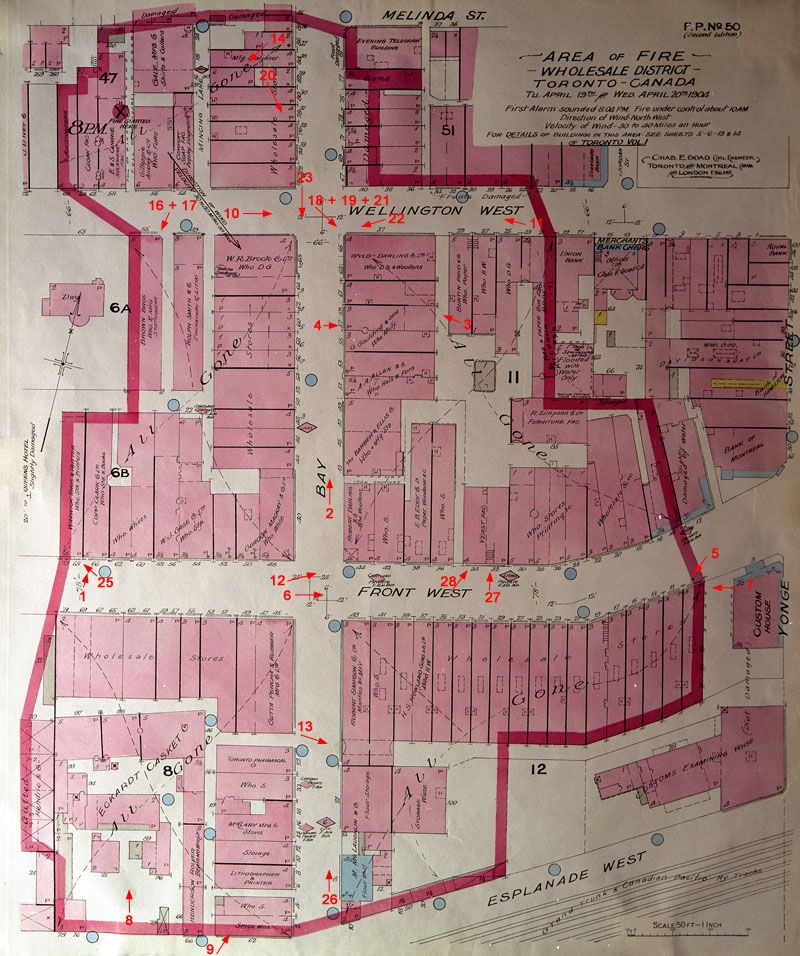
The area:

torontofire.jpg


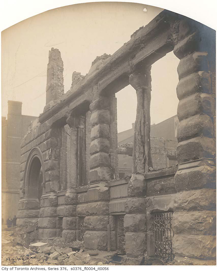
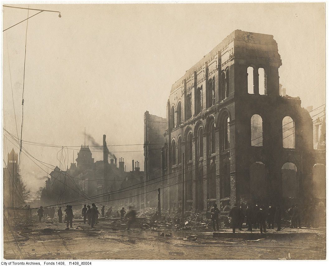
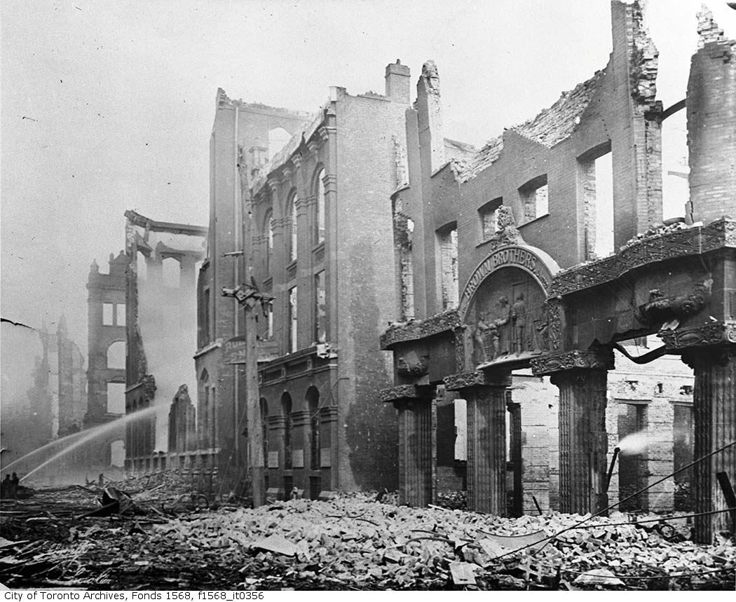
The day after:

fire.jpg


fire2.jpg


fire4.jpg


fire3.jpg
 
Last edited:
It's amazing that one of the landmark businesses in the area, The Toronto Evening Telegram newspaper (SE corner - Bay and Melinda), survived by a hairs-breadth.
 
April 20: Thanks thecharioteer for the photos from the aftermath of the 1904 fire. Here's a view similar to your last photo, looking up Bay street to (old) City Hall:

f1244_it0002.jpg


If you're looking for more photo's, I've geotagged them all on my historic photos map here under Great Toronto fire of 1904.

But lets fast forward to 1924, 86 years ago today, to the traffic at Bloor St. and Avenue Road, before the Church of the Redeemer had a modern backdrop, and police were on traffic duty:
f1231_it0349.jpg
 
April 20: Two more photos from today, 72 years ago in 1938 at Eglinton and Spadina showing McRonald property and Beltline tracks:
f0207_s1251_it0041.jpg


The bridge over what is now the Beltline has been replaced a couple of times, and the house to the right has been replaced with an apartment building, but the apartment on the south side of Eglinton, in the distance, is still there, likely with the SAME windows.

And here's another view, this time looking east along Eglinton where the 1st photo was taken, with a view of the north side of the street this time:

f0207_s1251_it0045.jpg


The photo's were taken around here
 
I was in the Church of the Redeemer a few weeks ago, admiring the N.T. Lyon stained glass windows, most of which were installed around the time that photograph was taken. The church will be removing the dropped ceiling just inside the south entrance, restoring the building to its former glory.
 
April 20: Two more photos from today, 72 years ago in 1938 at Eglinton and Spadina showing McRonald property and Beltline tracks:
f0207_s1251_it0041.jpg


The bridge over what is now the Beltline has been replaced a couple of times, and the house to the right has been replaced with an apartment building, but the apartment on the south side of Eglinton, in the distance, is still there, likely with the SAME windows.

And here's another view, this time looking east along Eglinton where the 1st photo was taken, with a view of the north side of the street this time:

f0207_s1251_it0045.jpg

Interesting to see the Pringle & Booth photo credit on those images.
I worked at P&B when the studio was on George St., 55 years ago!
 
April 21: Here's a photo from Moore Park, 95 years ago, of the St. Clair Avenue bridge. I'm not sure if we're looking north, or south. I don't see the building in the photo on a quick look on Google Map street view... It also looks like a late spring in 1915, as the trees through the ravines in Toronto this year have a lot more colour.
f1231_it1976.jpg


But then there is a photo from a year before, labeled "Bridge at Moore Pr. at Avoca Vale" which looks different... maybe it is the angle? Maybe one is mislabled?
f1244_it1259.jpg


Was there a bridge further east on St. Clair over the ravine that runs down to the Brickworks?
 
Last edited:
I think it is the same bridge. The old bridge crossed Avoca Vale at the end of Pleasant Blvd.

Here is a picture showing where the old bridge was located.
f1231_it1548.jpg


Here is a picture taken from the old bridge, looking west.
s0372_ss0060_it0009.jpg


Here is a picture of the construction of the new bridge over St Clair, showing the old bridge to the right.
f1231_it1924.jpg


And here is the old bridge being demolished.
f1231_it1926.jpg
 
Last year I went on a Heritage Toronto walk in that area and as Anna says, the original "St Clair" bridge actually ran across the ravine from the end of Pleasant Blvd. If you now go to Avoca Avenue just north of Pleasant Blvd on the ravine side of the road there is a metal fence. This fence was apparently the railing of the old bridge and it looks exactly like the one on the bridge pictures.
 

Back
Top