News   GLOBAL  |  Apr 02, 2020
 9.7K     0 
News   GLOBAL  |  Apr 01, 2020
 41K     0 
News   GLOBAL  |  Apr 01, 2020
 5.5K     0 

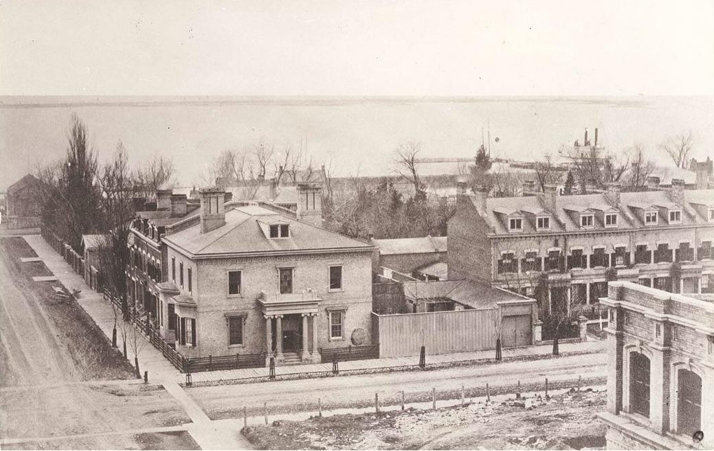
March 20th: Two photos today as listed on the Historic Toronto Photos from March 20 page, starting in 1913, Looking south at the water at the foot of Church Street 3:10PM just south of St. Lawrence Market

s0372_ss0100_it0043.jpg


The a slightly newer picture - just a year old today, to be exact, of a house built about 130 years ago in Huron Sussex
- 31 Sussex Ave as photographed by Collations:
4449499924_b742b82599_b.jpg

The house to the left is owned by the family of a very good friend of mine. The sad thing about this photograph is that this house, owned by the U of T, is empty and has been empty for quite some time. The question that we have is whether or not the U of T plans to maintain this house or if it is going to allow it to decline into dereliction and eventual destruction?

It would be a shame as this particular house still has its tower and hat.

Let's hope it is not slated to be neglected by the PTB's at U of T.
 
It would be a shame as this particular house still has its tower and hat. Let's hope it is not slated to be neglected by the PTB's at U of T.

Indeed! It is interesting that the University still owns houses like this...

March 21st We start back in 1916 with a couple of 95 year old photos, name and all. The first, from Little Italy is John Connolly, 55 Caledonia Avenue:

s0372_ss0032_it0436.jpg


And then to Fanny Kombloom, with such character in those eyes staring straight back at us through almost 100 years - sitting in her ragged clothes with dirty face and unkept hair, on the porch of 6 Baldwin Street in Grange Park. Is that her mother in the background? Grandmother?
s0372_ss0032_it0434.jpg


Then in 1923 we have two photos from The Junction of Dundas Street bridge at Sterling Road:

f1231_it1585.jpg


Then looking north
f1231_it1628.jpg


I thought we discussed that building in the distance previously on this forum, looking at the map I assume it was at Bloor and Sterling, but I haven't geo-tagged any tall buildings there... perhaps I'm thinking of a similar picture from more mid-town.

Finally, in 1932 we have the Teck Theatre at 700 Queen Street East at Broadview Ave right next to the Broadview Hotel, which was originally called Dingman's Hall, although the sign looks like "Hotel Lincoln"? I've added this photo to my Historic Toronto Theatres page, but not the hotels page yet...
f1231_it0641.jpg


As always, locations and links to the City of Toronto Archive entries for these photos is available on the Historic Toronto Photos from March 21st page.
 
Last edited:
I thought we discussed that building in the distance previously on this forum, looking at the map I assume it was at Bloor and Sterling, but I haven't geo-tagged any tall buildings there... perhaps I'm thinking of a similar picture from more mid-town.

Google "Tower Automotive".
 
f1231_it1628.jpg


I thought we discussed that building in the distance previously on this forum, looking at the map I assume it was at Bloor and Sterling, but I haven't geo-tagged any tall buildings there... perhaps I'm thinking of a similar picture from more mid-town.

I recognize this picture almost immediately. This is DEFINITELY on Dundas and Sterling because of one reason: Bloor doesn't have a street angle like that when heading down Sterling from that end. Plus, I pass through this part of Toronto twice a day on my way to work and back. The tall building is not on Bloor and Sterling either, besides its still standing and safe from demolition for some time. Its surrounding area, not so lucky.

-edit- Did a Google map search, its just right on Sterling Rd, directly nwn of Dundas.
 
Last edited:
"If I am looking at the same sign it looks like LUNCH to me and belongs to the "lunch counter." QUOTE DSC.


MIGHT'S TORONTO CITY DIRECTORY, 1925.

Teck Theatre.
700 Queen Street East.

Broadview Hotel.
702 Queen Street East.

Vacant.
704 Queen Street East.

Broadview crosses.


MIGHT'S TORONTO CITY DIRECTORY, 1933.

Lincoln Hotel, (N/W corner.)
106 Broadview Avenue.

Teck Theatre,
700 Queen Street East.

Roxy Cafe,
702 Queen Street East.

Warbutton's Toggery,
704 Queen Street East.

Broadview Avenue crosses.


MIGHT'S TORONTO CITY DIRECTORY, 1942.

Broadview Hotel,
106 Broadview Avenue.

Riverdale Jeweller,
698 Queen Street East.

Vacant,
700 Queen Street East.

Broadview Hotel,
702 Queen Street East.

Broadview crosses.


Regards,
J T


TAKE NOTE: YEAR OF PUBLICATION IS FOR PRECEEDING YEAR.
TENANT/OWNERSHIP IS SUBJECT TO CHANGE.
 
Last edited:
If I am looking at the same sign it looks like LUNCH to me and belongs to the "lunch counter".

Right, so there are two signs - both of the photos have the Lincoln Lunch sign, hanging over the smaller door on Queen Street, but in the 1st photo looking north across Queen street there is a larger sign, on the far right, partially covered - on the top all we see is "HO...." horizontally, then a larger word vertically "...INCOLN".

And as J T found from the Might's Toronto City Directory of 1933 that was indeed the name of the hotel for a time - I'll have to update my Historic Toronto Hotels page.
 
March 22nd: We start the list of Historic Toronto Photos from March 22 back in 1930 down in
The Beach with a view of the Homes on Lee Avenue north of Lake Ontario
s0372_ss0066_it0030.jpg


and also Leuty Avenue north of the beach with a horse drawn delivery wagon:
s0372_ss0066_it0031.jpg


Then in 1934 we head over to Bickford Park for a view of the north-west corner of Hepbourne and Ossington, looking east. A view that really hasn't changed much at all in 77 years, even the ornate woodwork over the store window has survived almost unchanged...
s0071_it10183.jpg


*** Edit *** I had to fire up The Gimp for a remarkably similar before-and-after shot:
hepbourne-ossignton-1934-2010.jpg
 
Last edited:
March 13th: Just one photo today, from 1931, of 121-123 Wellington Street West as part of the planning for the University Avenue Extension. Looks like a beautiful old building, and of course the exposed fireplaces add even more interest to the photo.

s0372_ss0003_it1146.jpg

I would suspect that these survivors are from the same terrace shown in the SW view of the Rossin House 1857 panorama:

485e171c.png
 
Last edited:
Right, so there are two signs - both of the photos have the Lincoln Lunch sign, hanging over the smaller door on Queen Street, but in the 1st photo looking north across Queen street there is a larger sign, on the far right, partially covered - on the top all we see is "HO...." horizontally, then a larger word vertically "...INCOLN".

And these days at the Broadview, the "HO" is sufficient;-)
 
I would suspect that these survivors are from the same terrace shown in the SW view of the Rossin House 1857 panorama:]

Amazing, and I would agree! Not sure why the two dormer windows at the far end of the 1931 photo were fused together, but other than that things really seem to match.

March 23rd We start in 1915 with a relatively new view for Toronto - Spadina Road - Dupont Street subway looking north to Casa Loma which was only completed the year before:

f1231_it1362.jpg


Then in 1949 we head west to Beaconsfield Village and a view north on Gladstone Ave, with the
Gladstone Hotel on the right, before the street was widened:
s0372_ss0058_it1881.jpg


(Details on these two City of Toronto Archive photos on the Historic Toronto Photos from March 23 page.)
 

Back
Top