News   GLOBAL  |  Apr 02, 2020
 8.9K     0 
News   GLOBAL  |  Apr 01, 2020
 40K     0 
News   GLOBAL  |  Apr 01, 2020
 5.1K     0 

I wonder if George Ignatieff attended the countess' funeral. I don't know if anyone else with a wikipedia article is buried there. Casa Loma's Henry Pellatt's tomb is in Forest Lawn Mausoleum, whose location I've always found odd because it predates so much of Willowdale. Maybe Pellatt just wanted to stand out even after death, which wouldn't have been as easy in a downtown cemetery site more crowded with well-known Torontonians.

I know many people who grew up along Yonge in North York, but I find it can sometimes be difficult to extract much useful information from them about what buildings were where. A big problem is that so many blocks/sites are completely unrecognizable today - including some of the road grid - that even the local landscape as it existed in the 90s is fading fast. People that post on this forum have a much easier time with names and dates and places and spaces and it shows with all the detail they're able to dredge up out of their memories or out of archives.

A new monthly/weekly "Then & Now" thread featuring various neighbourhoods or themes (churches, plazas) would be interesting, though this thread's stream of historical consciousness is great.
 
cedarvaletitle-1.jpg


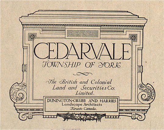
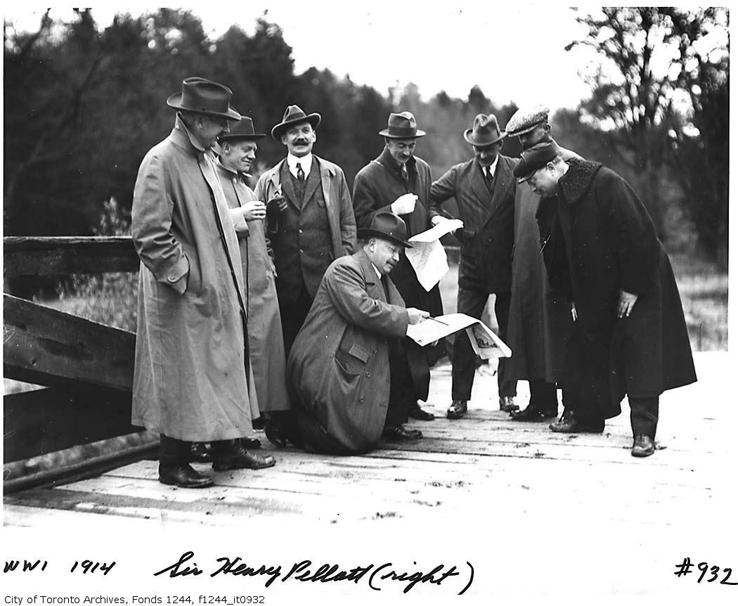
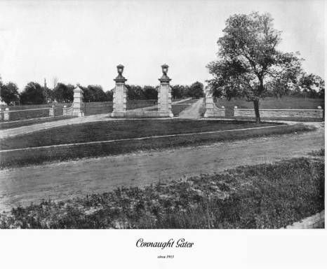
Following all these pictures of North York, I'm impelled to post some pics of Cedarvale, my childhood neighbourhood. Bounded by Eglinton to the north, Bathurst to the east and the Cedarvale Ravine to the south (and west), Cedarvale was conceived as an upscale subdivision by none other than Sir Henry Pellatt just before World War I. The gates at Claxton Blvd. were part of his vision.

From http://clara.asdi.ca/CLARA/Contacts.nsf/ConnaughtGates!OpenPage:

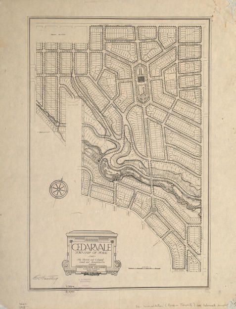
“These stone and iron gates, a developer’s folly, were placed here in 1913 by The British and Colonial Land and Securities Co. Ltd., a creation of Sir Henry Pellatt, the lord of Casa Loma. The gates were to be a grand entrance to an immense subdivision named Cedar Vale, that was to stretch from Vaughan Road to Eglinton Avenue, and about half as far west. This boulevard, to be named Connaught Drive after the Governor General of the day, was to progress majestically to a rather ornate circle, then veer right to cross Cedarvale Ravine and march proudly all the way to Eglinton Avenue. Large lots, expensive homes, parks, public squares and civic buildings were part of the company’s ambitious plans.
Like much of Sir Henry’s life, things didn’t work out that way. There was a recession on, and too many subdivisions like this on sale around the city. Then, in 1914, war broke out. People invested their money in war bonds rather than in real estate and for many years not much happened in this part of town. Finally the Home Bank went bankrupt, and with it most of Sir Henry’s investments. He gave his home, Casa Loma, to the city and moved into the carriage house. He died in 1939, a poorer man, but still immensely popular.
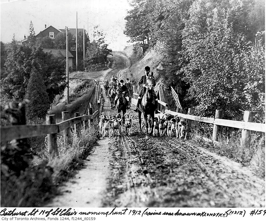
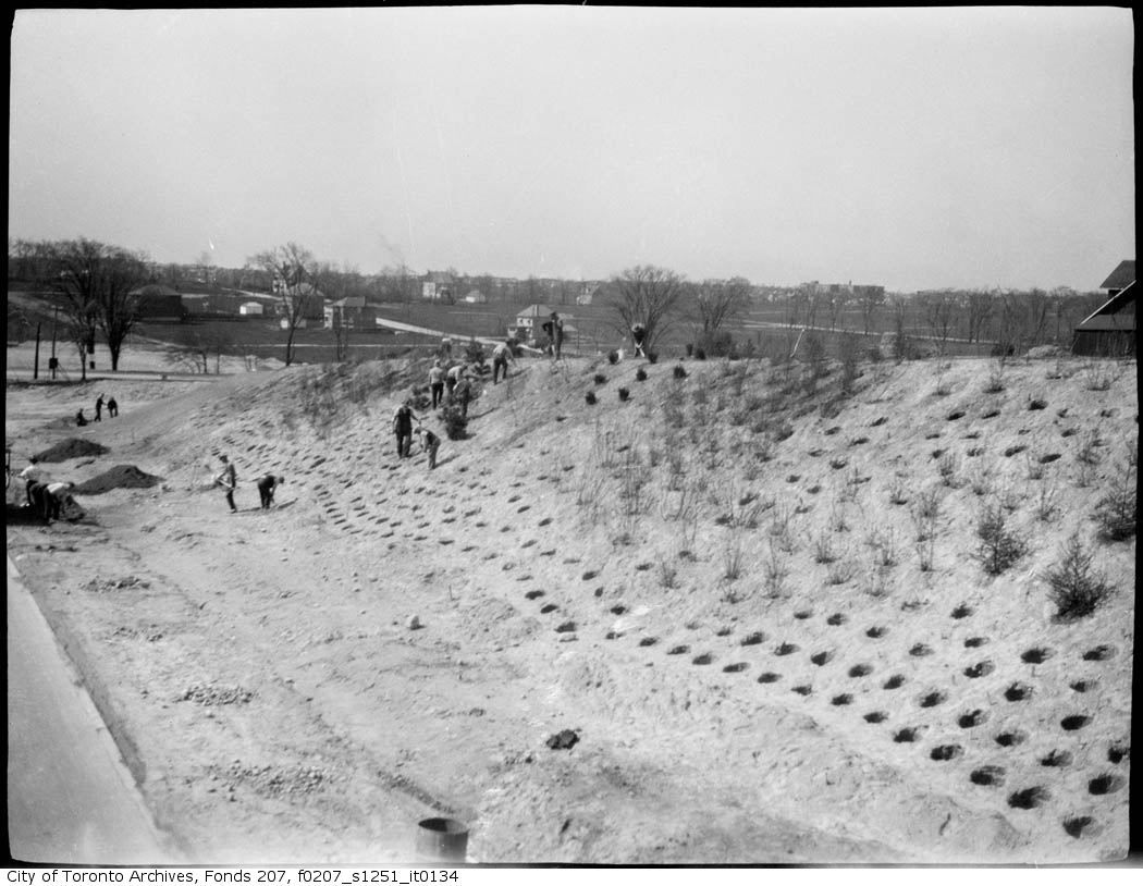
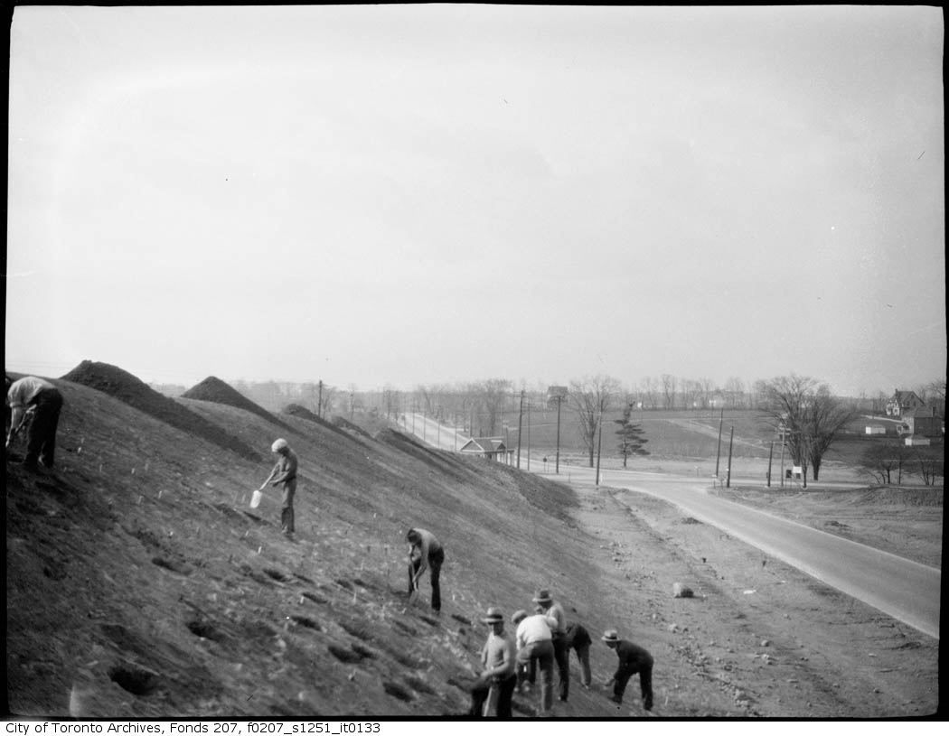
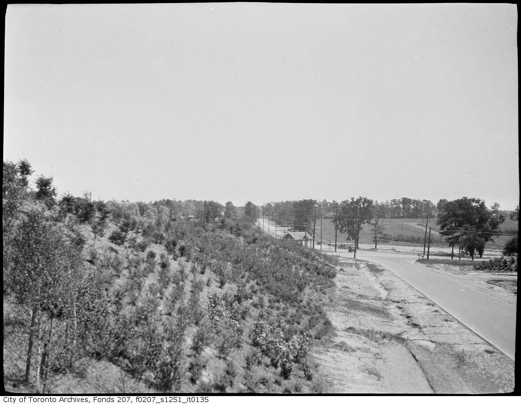
Some houses were built here through the twenties and thirties but much of the area north of the ravine was not fully developed until the 1950s. One of the reasons for this delay was the fact that the paving on Bathurst Street ended just a block north of here. From that point a muddy dirt road slid down the ravine and crossed the Castle Frank Stream on a rickety single lane bridge.
That is what this area was like in 1923 when Ernest Hemingway rented an apartment just up the street from here. He first came to Toronto in early 1920, hired by the Connable family as a companion for their disabled son while the rest of the family went to Florida for the winter. Ralph Connable, president of F.W.Woolworth Ltd., got Hemingway his first writing assignments with the Toronto Star.
Three years later Hemingway, now working for the Star in Paris, returned to Toronto with his wife Hadley, who was eight months pregnant. They moved to a tiny one-room apartment here, and a month later their son was born. However, unhappy with both the city and his job at the Star, the Hemingways returned to Paris just four months later.
It wasn’t until 1927 that the first high level bridge was built, carrying the (Bathurst) street smoothly across the ravine. Only then did building begin in earnest on the lands north of here. The neighbourhood that evolved here is a far cry from the plan Sir Henry had in mind in 1913, and perhaps we can be grateful. What we have today is more varied, more spontaneous, and probably more livable because the developer’s plan was forgotten.”
Terry McAuliffe Local Historian

pellatt.jpg


The following is the exquisite original map, remiscent of Ebineezer Howard's "Garden City":

cedarvalemap2.jpg


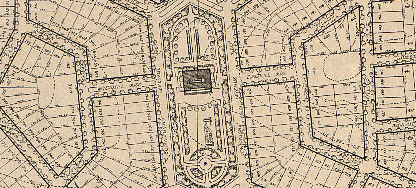
A detail showing the central gardens (a concept which morphed into Cedarvale Public School):

cedarvalecloseup.jpg


Certain elements of the plan did come to fruition, like some of the road alignments, and the gates at Claxton Boulevard and Bathurst:

connaught.jpg


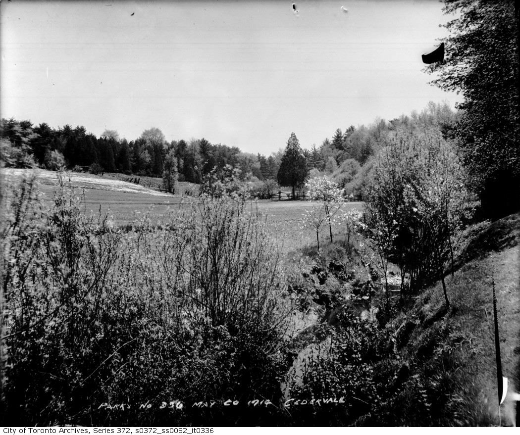
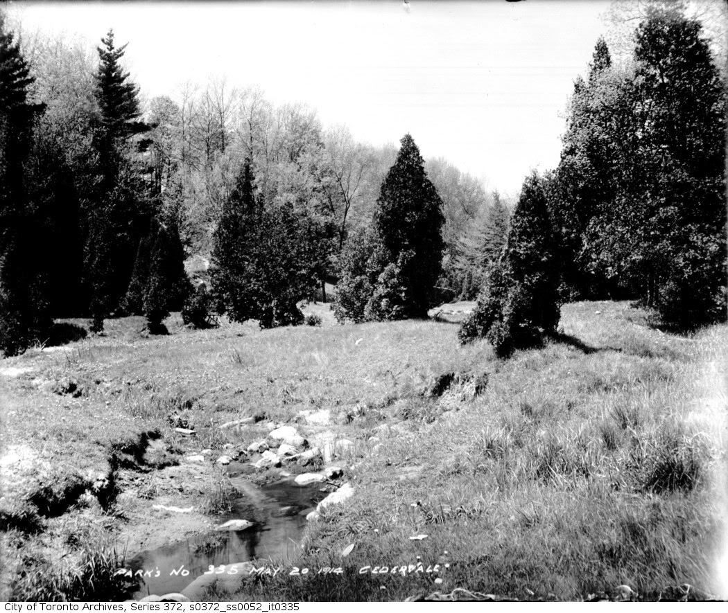
The area at the time was a mixture of farmland and the ravine:

cedarvale4.jpg


cedarvale3.jpg


Bathurst at this point was still a muddy country road:

bathurstbridge.jpg


The Pellatt plan got modified and some residential development began in the late 1930's. Many of the original street names remained a mixture of UK references (Chiltern, Peveril, Camberwell) along with some post-WWI names like Menin and Flanders. Holy Blossom Synagogue relocated to Bathurst and Ava in 1938, as the area was becoming the new post-Kensington Market home of the Jewish community.

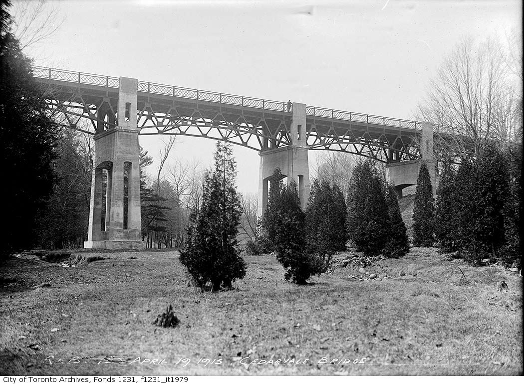
The GlenCedar bridge:

cedarvale5.jpg


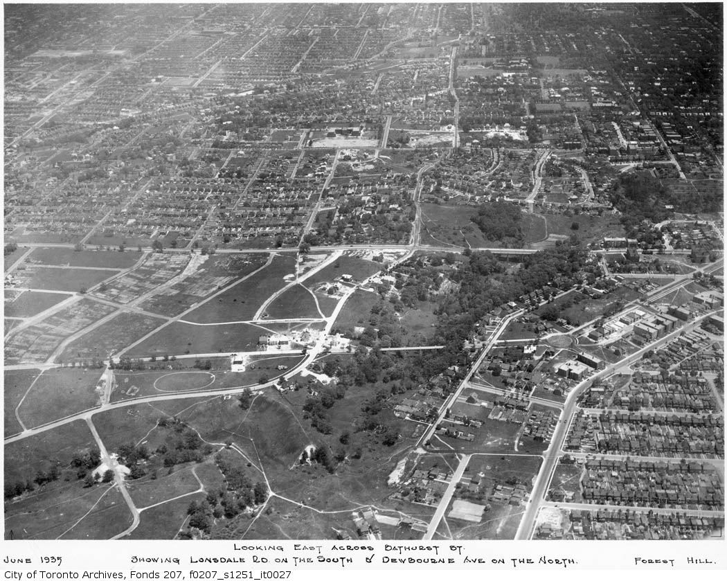
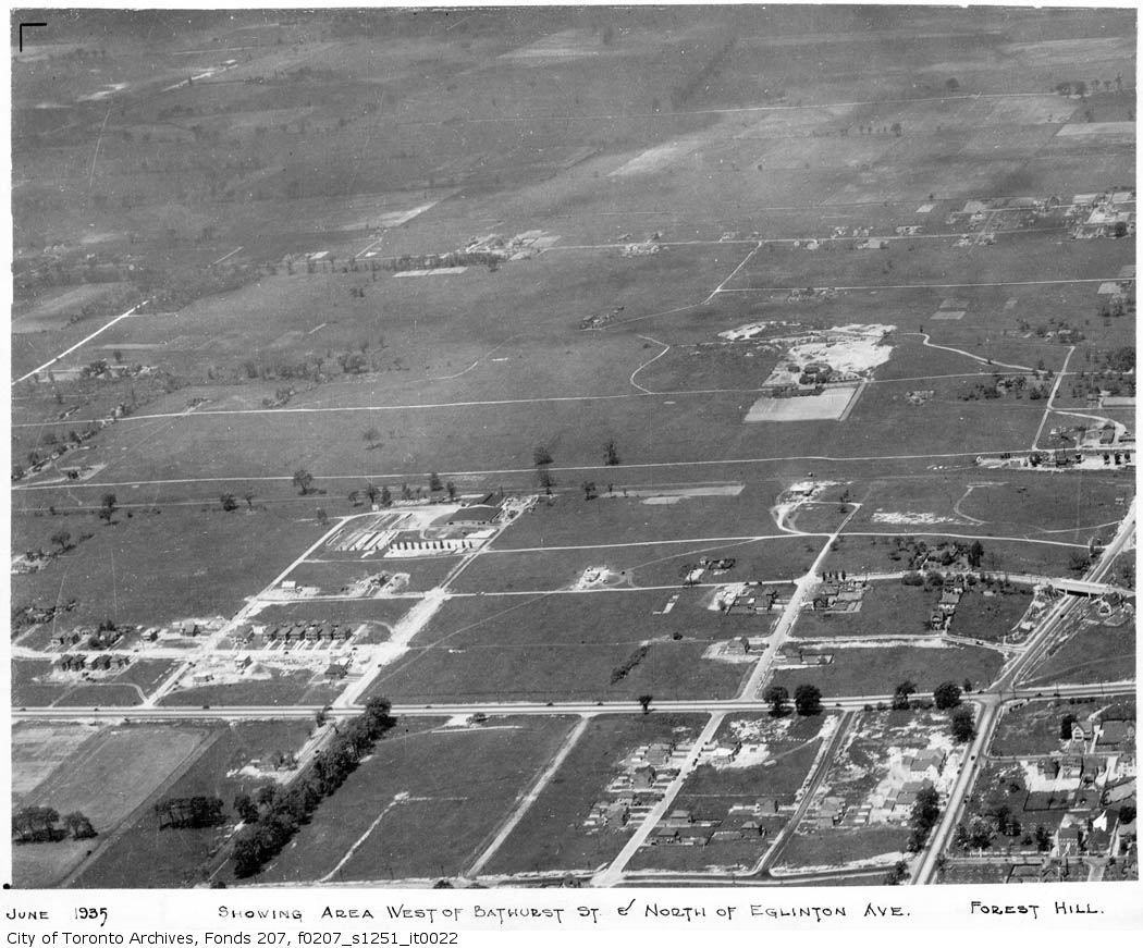
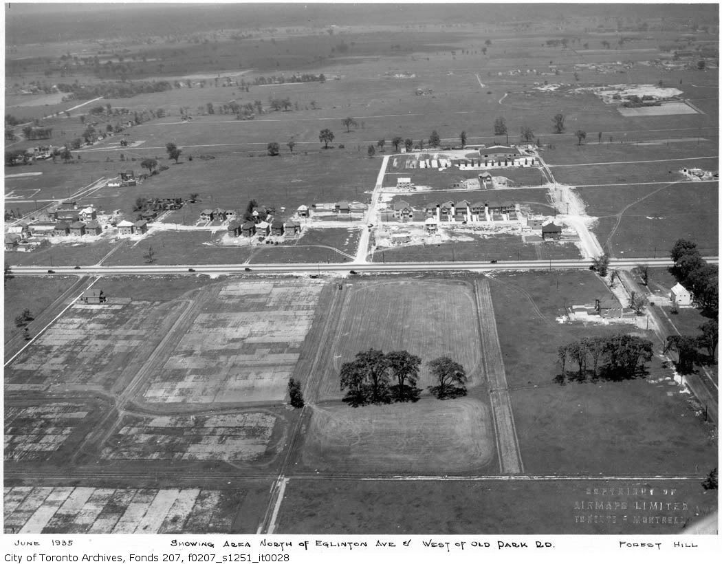
The following aerials from 1935, show a still laregely undeveloped Cedarvale:

cedarvale.jpg


f0207_s1251_it0022.jpg


cedarvale2.jpg


Looking south on Bathurst from north of Eglinton:

cedarvale7.jpg


bathsouthtoeglinton.jpg


bathsouthtoeglinton2.jpg


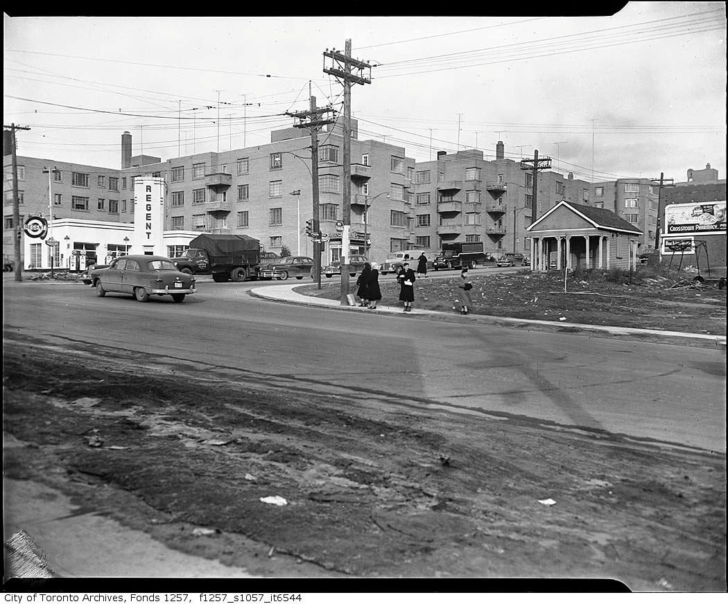
Post-war, Eglinton began to develop as a major retail street (east of Bathurst it was primarily residential and was still part of the Village of Forest Hill):

1945 (NE corner of Bathurst and Eglinton):

f1257_s1057_it6544.jpg


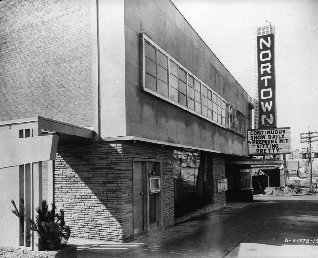
The Nortown Theatre at Eglinton and Peveril 1948:

2007-09-02-1126-11_edited.jpg


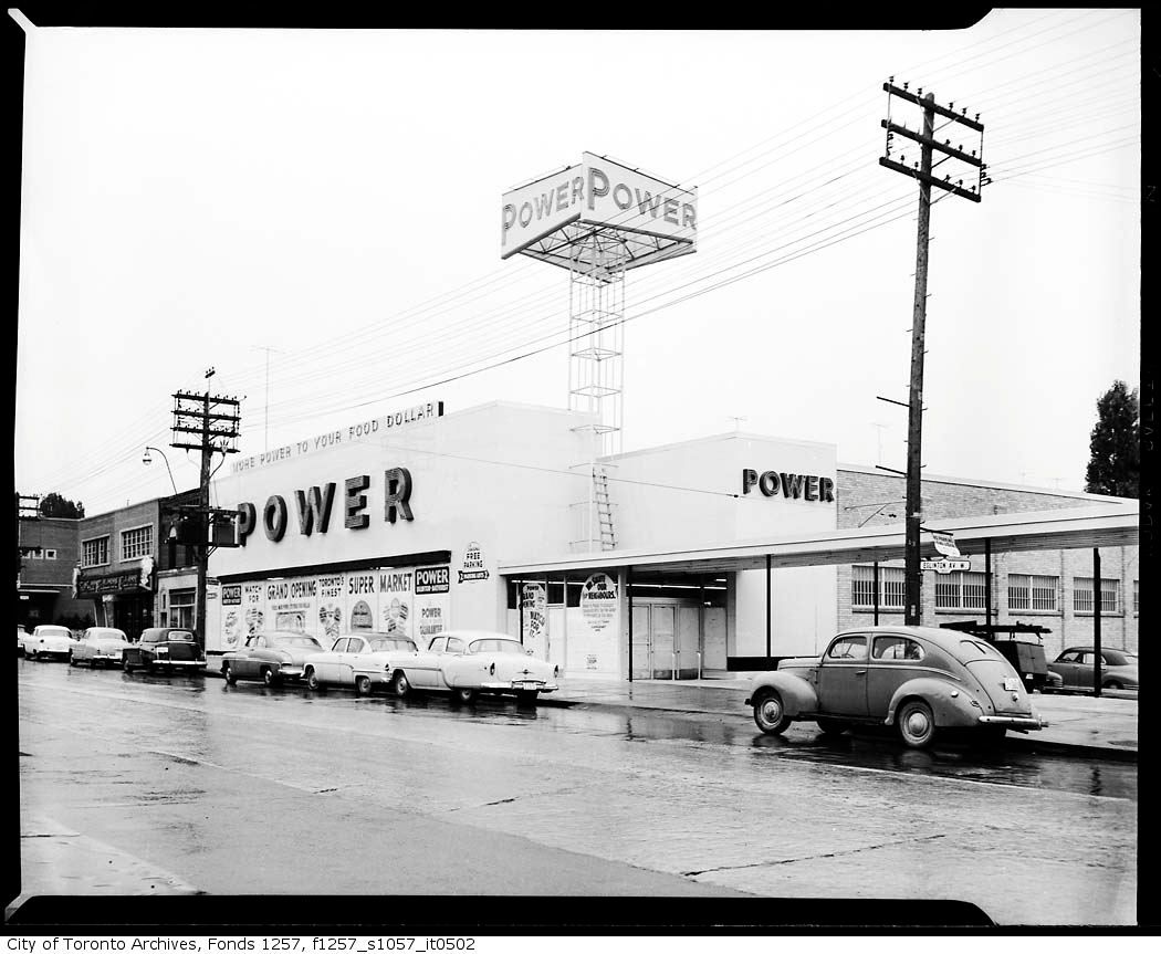
Power store Eglinton and Chiltern 1950's:

f1257_s1057_it0502.jpg


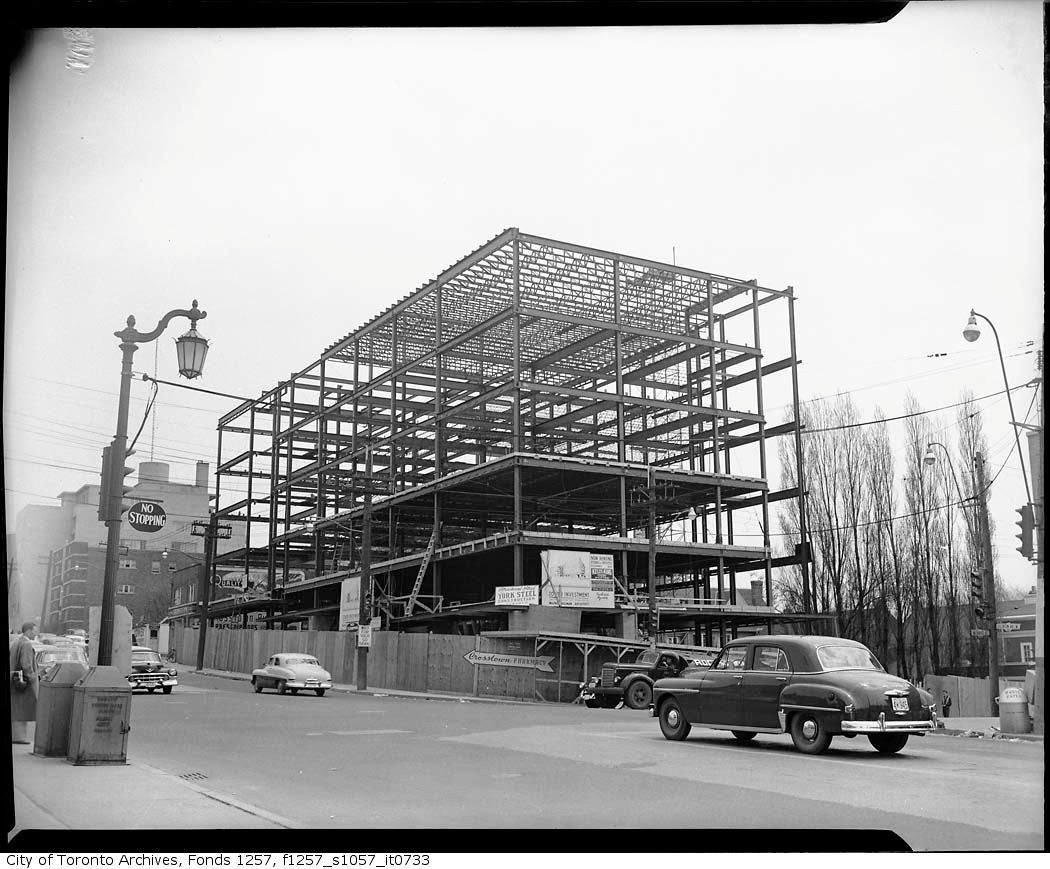
SE corner Bathurst and Eglinton 1953:

f1257_s1057_it0733.jpg


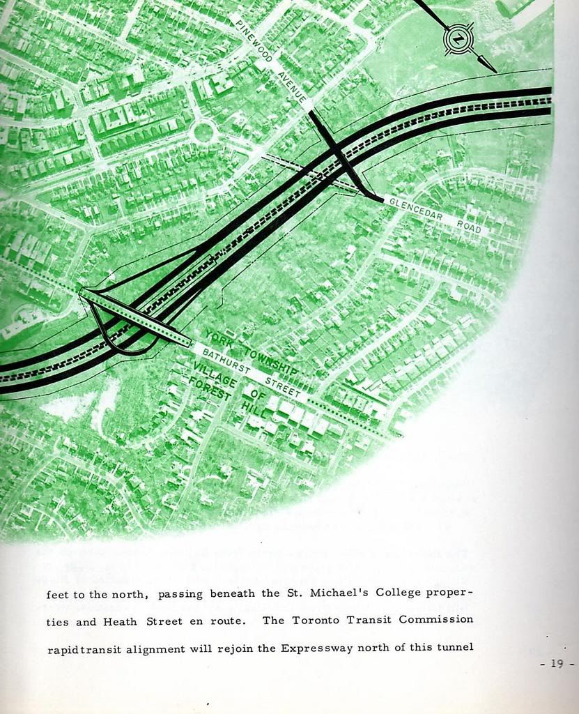
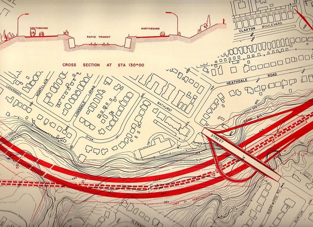
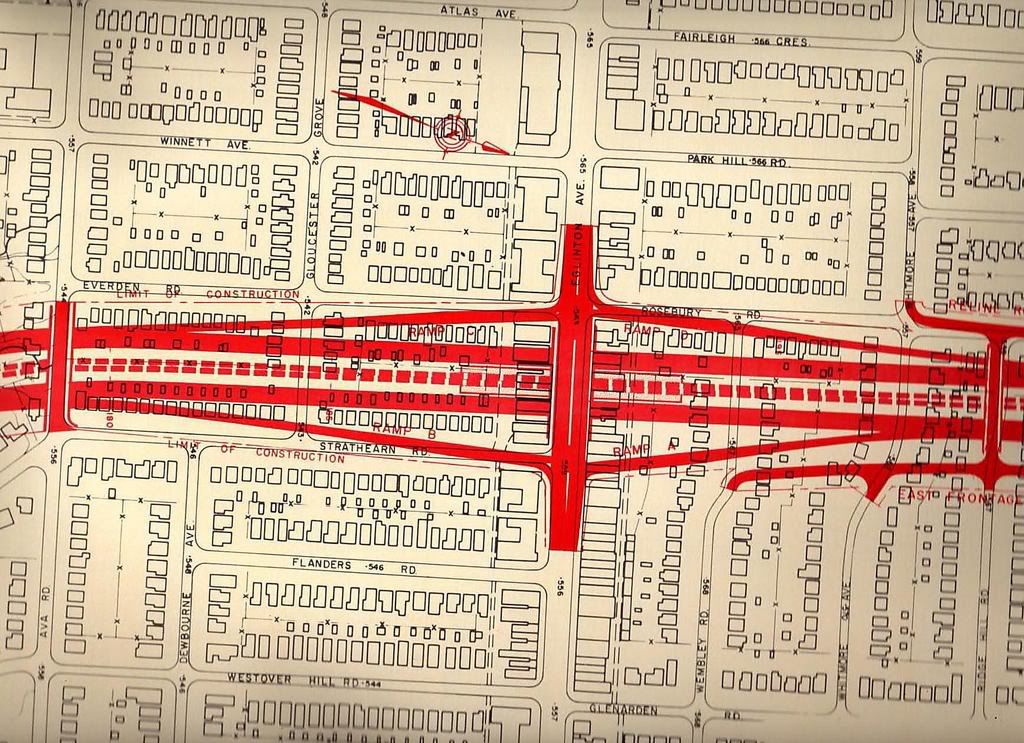
The Spadina Expressway would have gone through the Cedarvale Ravine and was vigorously opposed by the Cedarvale ratepayers:
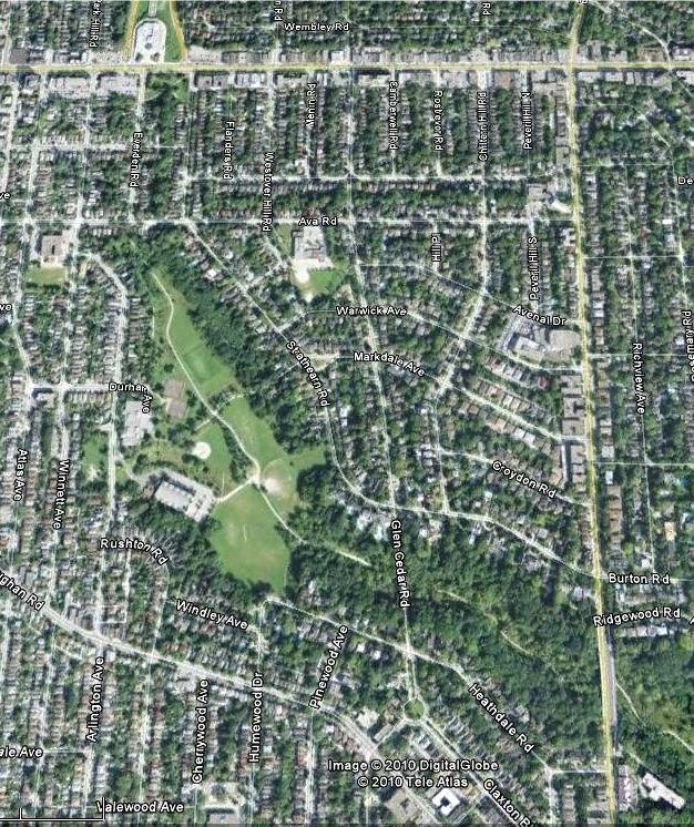
2007-09-30-1559-11_edited.jpg


2007-09-30-1517-06_edited.jpg


2007-09-30-1526-59_edited.jpg


Today:

cedarvale-1-1.jpg
 
Last edited:
A pretty ravine and neighbourhoods would have been destroyed for sure...but my god that highway would be handy.
 
Wow, that must be one of the only comparisons I can think of in this thread where the current picture looks better than the past one.

I myself have felt that Queen East and West were "gritty" streetscapes right up until at least the mid 1990s when spotty gentrification started.


...
However, back in the recesses of my mind I recalled my first summer office job at the still flourishing Victory Building on Richmond St. W. Sure, it's relatively young at 80 years, but more exquisite examples have been demolished well before their time....

Rolex Canada was located in that building from at least the 40s up until 1994 or so when it moved up to St. Clair a few hundred metres west of Yonge. Rolex left behind a quite beautiful wall clock in the lobby; at least it was still there when I peeked in in 2006 or so.


A new monthly/weekly "Then & Now" thread featuring various neighbourhoods or themes (churches, plazas) would be interesting, though this thread's stream of historical consciousness is great.

Is this directed at me? :) If so, Iv'e mulled with the idea of developing a series of in depth articles for weekly posting but Torontoist beat us to that. Nothing stopping anyone here doing that; but the real reason is that for me, I don't have the time. I did something like that over a year ago (Sully Crescent), but it took me 4 days to write up :) and scared me off from doing something like it again.

thecharioteer's Cedarvale article above is obviously his latest example of your suggestion. I find your term "stream of historical conciousness" interesting; I wasn't even concious of it. :) I'll continue to post my daily picture to keep things churning - sometimes to comment, sometimes not - and our little "water cooler" group will chime in with their own picture locations or research or corroboration or something tangential - as you did re: York cemetery.


February 7 addition.


Then: NE corner of Yonge and ?? :)


ser381_s0381_fl0308_id12103-47.jpg


Now: December 2009.

DSC_0030.jpg
 
Yonge and Jackes (or Farnham con't. in my mind).

Correct, thanks. I think it's an elegant little place myself.

Maybe I shouldn't have been surprised, but I would never have guessed we had fox hunts in Canada.

I'm guessing the folks that took part in it weren't transplanted Brits but local people with the resources to do so emulating the Mother Country.


February 8 addition.


Then: Yonge and Alexander NE corner. "192-?" according to the archival citation. The citation also states this is Yonge and Alexander, not Bathurst and Queen as someone has written in white grease pen has written on the top margin.

NEYongeandAlexander192----.jpg


Now: December 2009.

DSC_0027.jpg
 
Then: Yonge and Alexander NE corner. "192-?" according to the archival citation. The citation also states this is Yonge and Alexander, not Bathurst and Queen as someone has written in white grease pen has written on the top margin.

NEYongeandAlexander192----.jpg


Now: December 2009.

DSC_0027.jpg

thanks for that--i have often wondered what stood in that spot before that hideous Viceroy Homes barnboard monstrosity was built. ugh.
 
Yeah, the present strip is strange, indeed--is it 70s, or a retrofit of something much older? But keep in mind that the block was IIRC originally wiped out for the Yonge subway (which swerved away from Yonge at this point)...
 
Yeah, the present strip is strange, indeed--is it 70s, or a retrofit of something much older? But keep in mind that the block was IIRC originally wiped out for the Yonge subway (which swerved away from Yonge at this point)...

a few more shots of the block on the NE corner of Yonge and Alexander

6490fa67.jpg

1851d812.jpg


the building on NW corner of Yonge and Grosvenor is still there, as is much of the block immediately north of Grosvenor, somewhat worse for wear, stripped of its elaborate ornamental top, and partially obscured by the Mad Men Syd Silver facade...

86f58dbc.png


said building on NE corner of Yonge and Alexander being demolished in 1950. caption says: "Looking north from Alexander Street, Eaton Memorial"

460489c8.jpg


present side view along Alexander. looks like the remains of a 50's/60's little office block...

10728a35.png
 
Is this directed at me? :) If so, Iv'e mulled with the idea of developing a series of in depth articles for weekly posting but Torontoist beat us to that. Nothing stopping anyone here doing that; but the real reason is that for me, I don't have the time. I did something like that over a year ago (Sully Crescent), but it took me 4 days to write up :) and scared me off from doing something like it again.

thecharioteer's Cedarvale article above is obviously his latest example of your suggestion. I find your term "stream of historical conciousness" interesting; I wasn't even concious of it. :) I'll continue to post my daily picture to keep things churning - sometimes to comment, sometimes not - and our little "water cooler" group will chime in with their own picture locations or research or corroboration or something tangential - as you did re: York cemetery.

Not directed at you, just a comment thrown out there. I was thinking a bit along the lines of if Urban Toronto became more of a blogazine, "then and now" posts like the ones you and others create would/could be a terrific feature. Yet, while it would be convenient to have separate historical photo threads for various subjects, it would splinter apart a thread like this...and, yes, it does take a lot of work. Even if someone decided that March will be old Etobicoke photo month, or old church photo month, there may be no one interested in searching for photos, taking current ones, doing research, etc., on those topics at that exact time. The randomness in this thread - the discovery of new photos, the tangential memories - is great as is. Hell, even if people were paid for creating "then and now" threads, I'm sure the quality and care and attention to detail would be higher in volunteer posts like the ones we see today.
 
Yeah, the present strip is strange, indeed--is it 70s, or a retrofit of something much older? But keep in mind that the block was IIRC originally wiped out for the Yonge subway (which swerved away from Yonge at this point)...

One wonders what led to the decision to shift the subway line east of Yonge at Alexander: civic frustration with the seemingly endless disruption to Yonge, for both motorists and merchants; the relatively cheap land acquisition costs (primarily houses); or the need to line up with the mostly open line that would emerge between Bloor and St. Clair (at which point it then shifted back to the west side of Yonge, perhaps because of Mt. Pleasant Cemetary?)

In any case, it was unfortunate the Alexander block had to go. Similarly, the block between Dundonald and Gloucester: why did it get replaced by such a banal building?
 

Back
Top