andrrea
New Member
This is fantastic!!!!
|
|
|
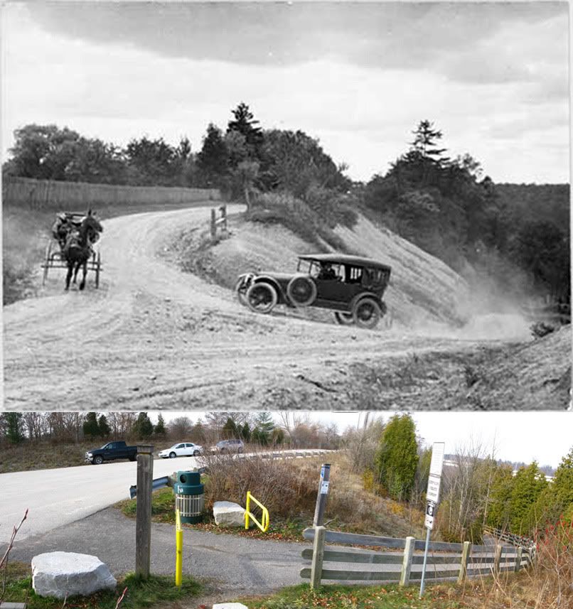
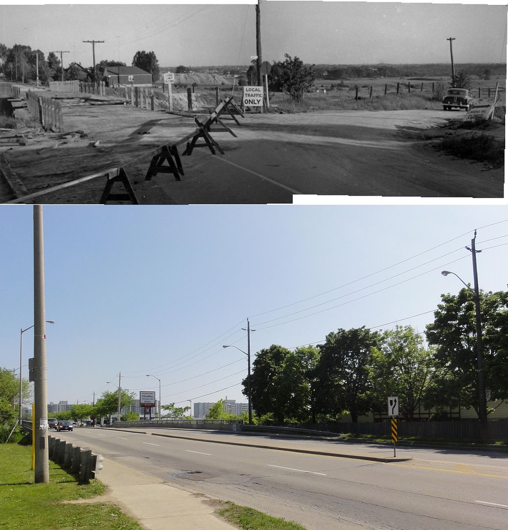
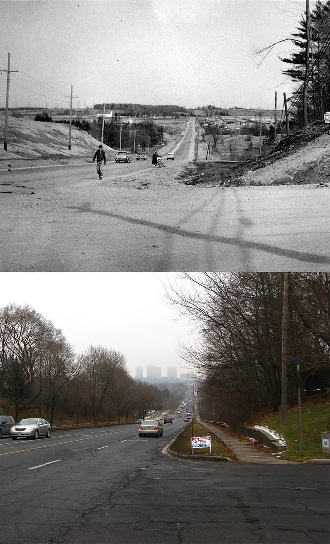
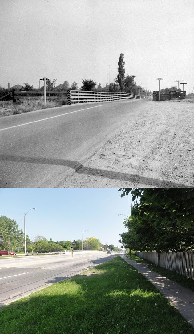
Woodbine looking south down to Kingston Road.


Which also says something about how mapmakers deemed townships to be unimportant--if you notice, there's no indication of East York, York, North York, Etobicoke, or Scarborough. (I suppose it's because townships were undifferentiated land masses rather than "places"--and of course, "places" are where the early motorists and travellers could expect to get "services", or something.)

") . A Happy, Healthy and Prosperous New Year to Everyone. See you all again early next Monday morning, January 2nd.
. A Happy, Healthy and Prosperous New Year to Everyone. See you all again early next Monday morning, January 2nd.
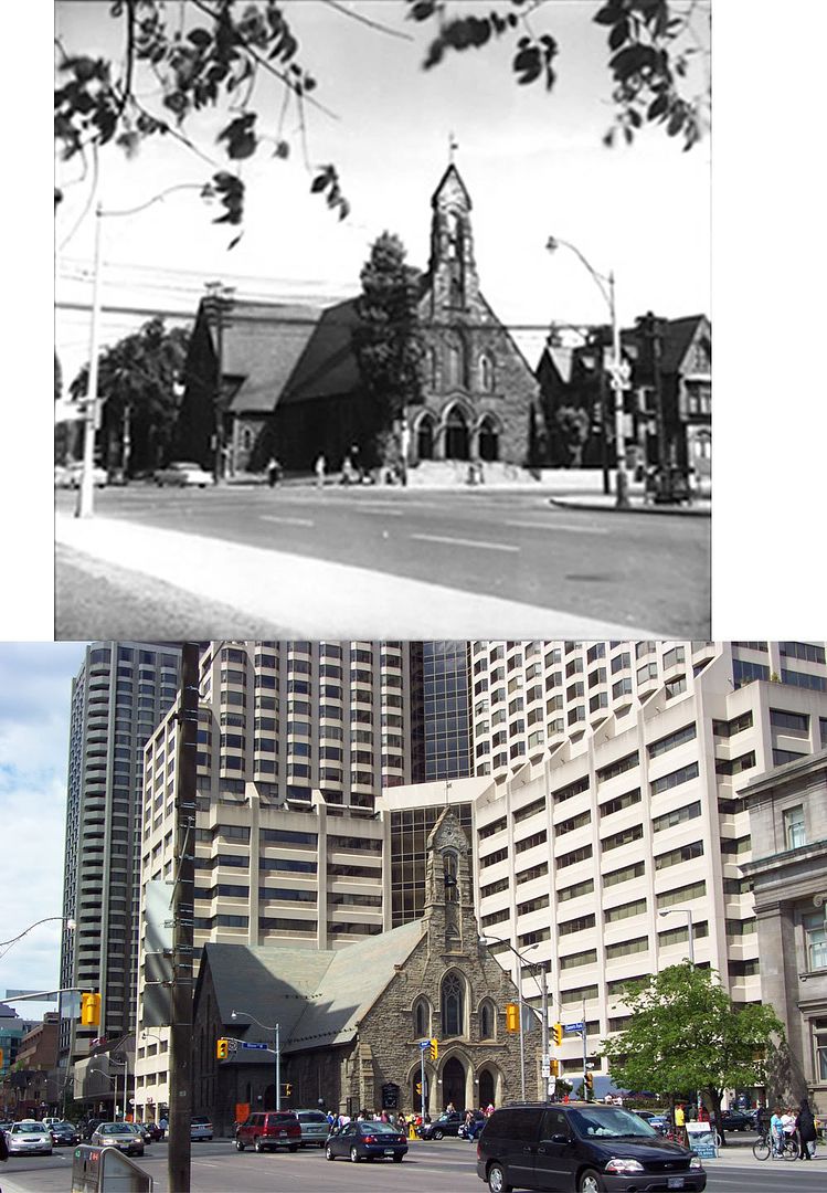
(7) Did Avenue Road really veer to the east to meet Yonge (presumably around where the 401 runs now)?
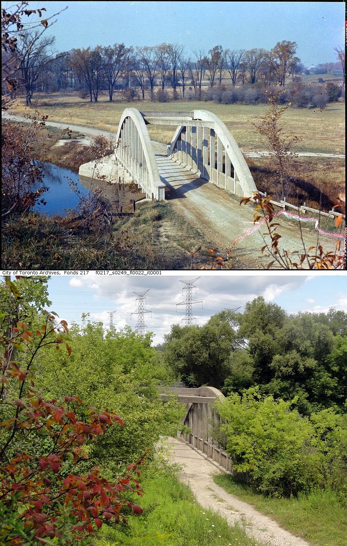
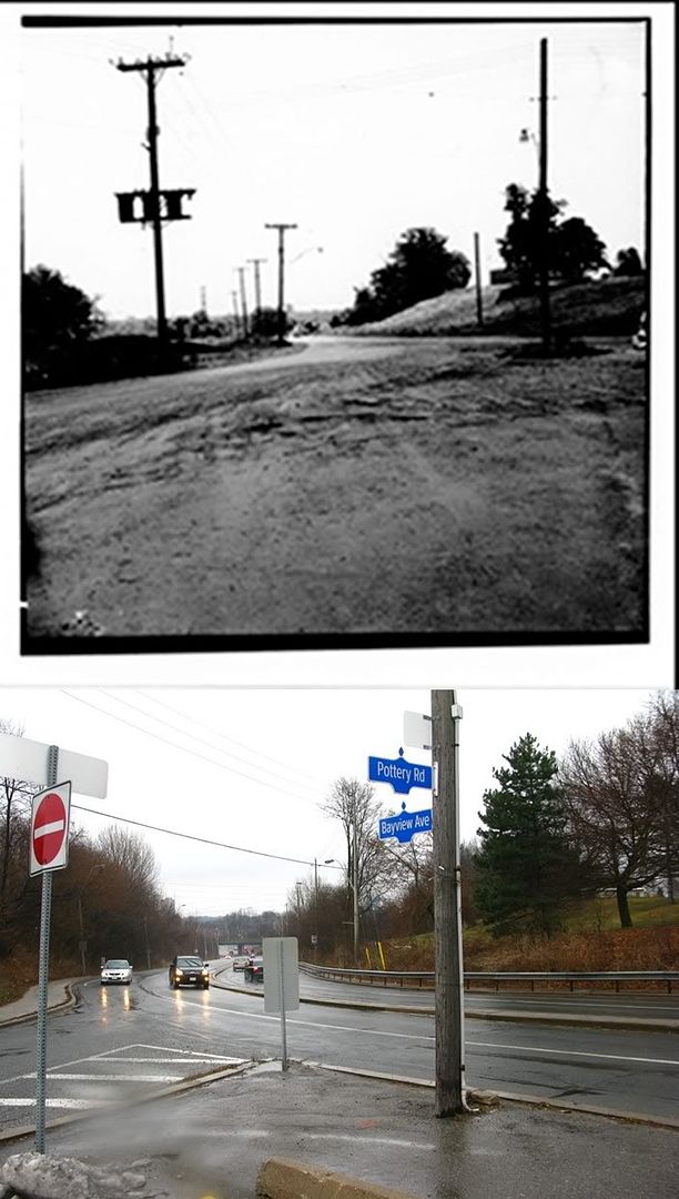
Same bridge. Or at least the 1928 built bridge.
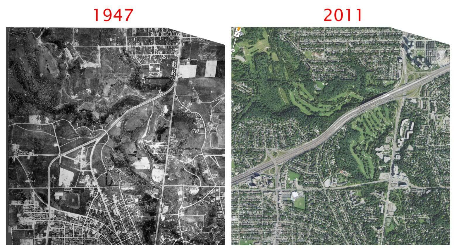
http://en.wikipedia.org/wiki/Hogg's_Hollow_Bridge
Here's an old UT thread on the subject. http://urbantoronto.ca/forum/showthread.php/4693-Saved-Bridge-Hogg-s-Hollow
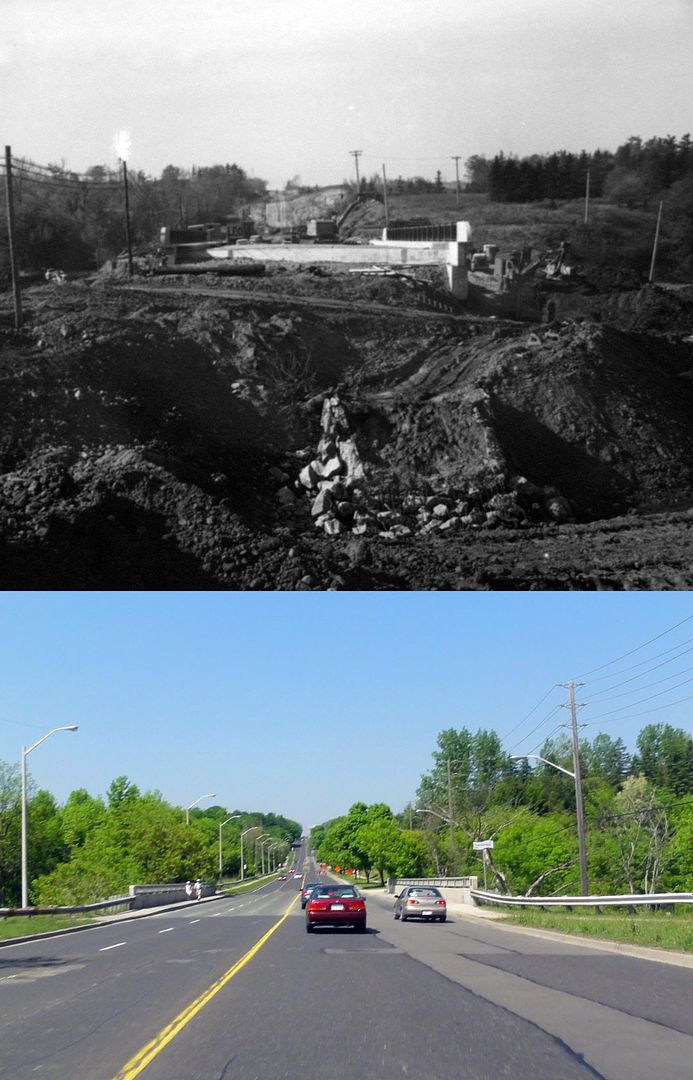
For (2) you mean Queensway, not QEW. Queen still does segue into Queensway, though I think it used to change somewhere west of High Park instead of at Sunnyside. There is still a North Queen Street in the vicinity of Queensway and Kipling which I've never figured out.
(7) Did Avenue Road really veer to the east to meet Yonge (presumably around where the 401 runs now)?