|
|
|


You are using an out of date browser. It may not display this or other websites correctly.
You should upgrade or use an alternative browser.
You should upgrade or use an alternative browser.
- Thread starter Mustapha
- Start date

thecharioteer
Senior Member
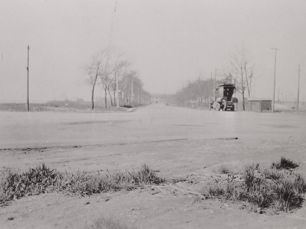
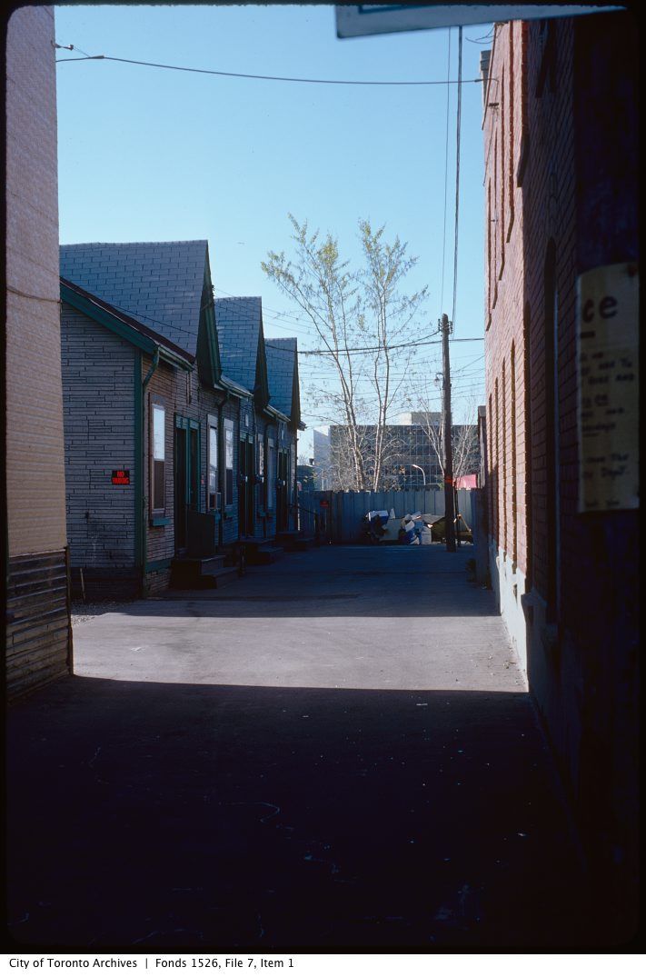
Garrison Road 1927, looking SW from west of Strachan to the New Fort (TPL):
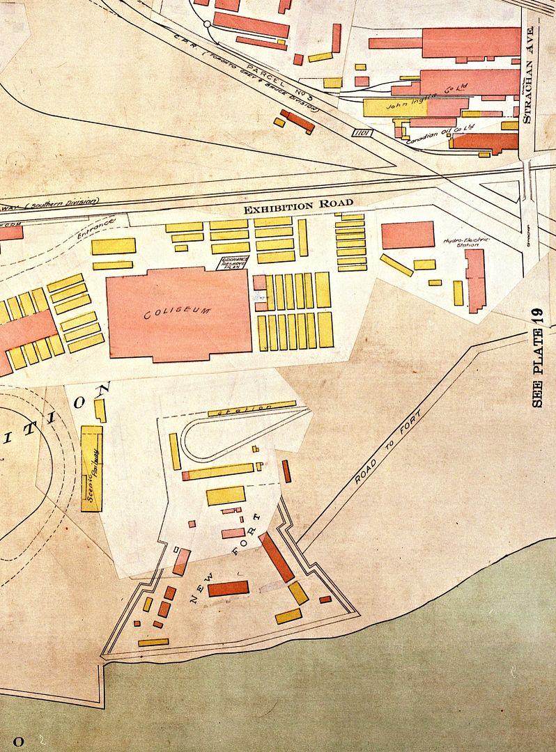
1924 Goad:
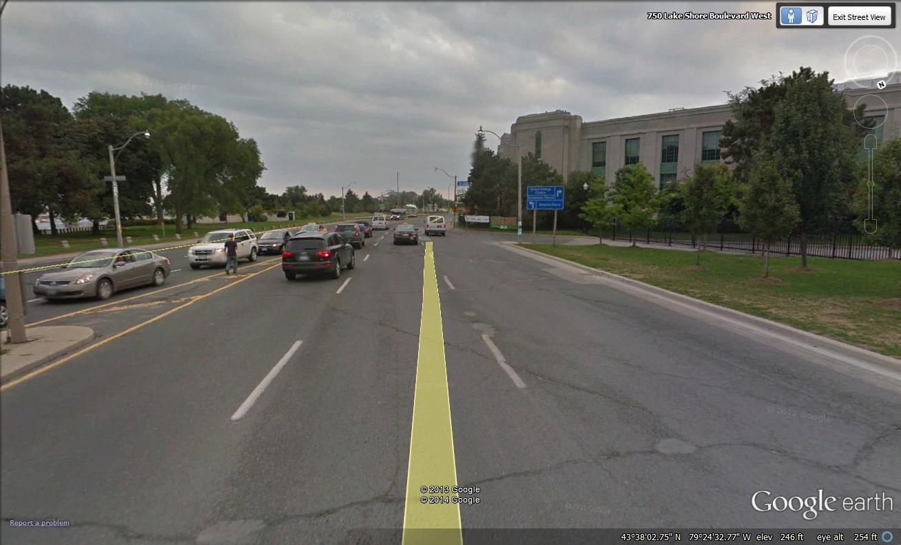
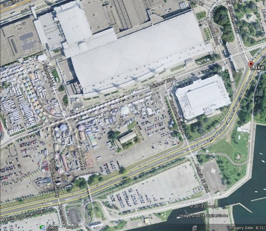
Today (not the exact alignment; Garrison Road probably ran through what is now the Automotive Building):

1924 Goad:

Today (not the exact alignment; Garrison Road probably ran through what is now the Automotive Building):


Last edited:
the lemur
Senior Member
1924 Goad:


Good find. I have a few questions:
The 'New Fort' encompasses the Stanley Barracks, right?
And the 'scenic railway' and apparent track loop near the building marked 'station' - how long was that around for?
Is the building marked ' hydro-electric station' now the Municipal Licensing and Standards building near the NW corner of Strachan and Fleet?
M II A II R II K
Senior Member
Though I love looking at old photos of Toronto, I suggest we need to remember that this thread is "Toronto photographs : Then and Now"
But they are selected pictures of specific places that we already know what they look like now.
thecharioteer
Senior Member
Good find. I have a few questions:
The 'New Fort' encompasses the Stanley Barracks, right?
And the 'scenic railway' and apparent track loop near the building marked 'station' - how long was that around for?
Is the building marked ' hydro-electric station' now the Municipal Licensing and Standards building near the NW corner of Strachan and Fleet?
Thanks! Stanley Barracks is the sole survivor of the New Fort (check out post #46 on the James Victor Salmon thread). Not sure about the other items.
thecharioteer
Senior Member
Another photo from the New Fort, apparently after an auto accident in 1922:

A half-tone block after the print is in The Globe, Toronto, 5 December 1922, p. 13, with letterpress t.: VICTIM'S COMRADES GIVE WARNING; b.: Summary justice for speed fiends is forecast in this placard-/ one of two placed yesterday near the entrance to Stanley Barracks, / where Corporal Taylor was injured last week. Taylor's comrades / give due and sufficient warning to careless drivers.
One of my favourite pics of the New Fort, when worlds were colliding, so to speak:
Attachments


Last edited:
ToroTO
Active Member
Good find. I have a few questions:
The 'New Fort' encompasses the Stanley Barracks, right?
And the 'scenic railway' and apparent track loop near the building marked 'station' - how long was that around for?
The Stanley Barracks is marked by the red coloured rectangle beside the word "New" on the Goads map.
The track loop shown with the "Station" building I believe would be for the TTC Exhibition streetcar stop which existed on this spot until construction of the the Direct Energy conference centre and TTC operations moving to the north of the Coloseum. Odd that they didn't show tracks heading east towards Bathurst. I think the "scenic railway" would have been the dotted line to the left of the yellow coloured building indication.
Goldie
Senior Member
Garrison Road 1927, looking SW from west of Strachan to the New Fort (TPL):


If the date of this photo is correct, the Princes' Gates (opened in 1927) would off to the right of the above photo.
Attachments

Last edited:
Mustapha
Senior Member
Then and Now for April 29, 2013.
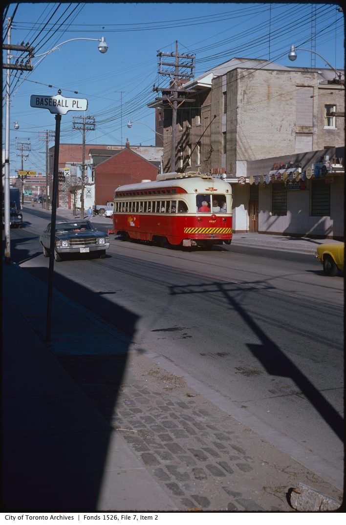
Then. Queen Street looking E from Baseball Place. December 26, 1954.
The place of baseball alluded to in this long gone laneway was Sunlight Park.
Before Rogers Centre, before Exhibition Stadium, before Maple Leaf Stadium, before Hanlan's Point Ballpark, there was Sunlight Park.
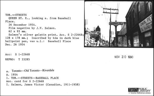
http://en.wikipedia.org/wiki/Sunlight_Park
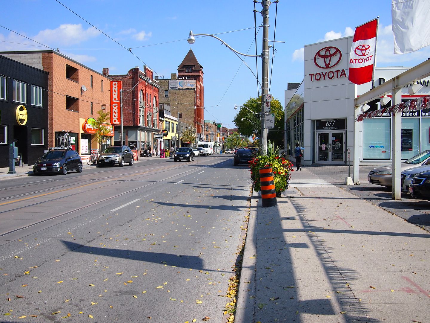
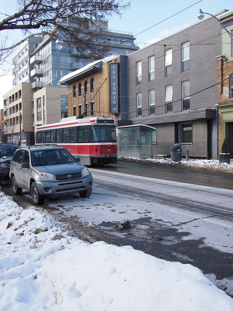
Now. September 2012.
The Baseball Place sign lasted up until - I think - about 1990 or so, I used to be intrigued by it.
Heya gang,
I replying to my own post here. The purpose is to add a pair of new Then and Now perspectives - the Then pictures come from the Toronto Archives online resource.
Then. May 11, 1977.
Now. February 2014.
May 11, 1977 again.
Now. February 2014.
Mustapha
Senior Member
Hi gang,
Back when I posted more often I would post non-Toronto material or links; usually links, on weekends.
I bookmarked this link last fall then forgot about it. I know it's not the weekend either but there you go.")
Sorry about the delay.
"The Places That Defined JFK's Assassination, Then and Now."
http://www.theatlanticcities.com/ne...defined-jfks-assassination-then-and-now/7635/
Back when I posted more often I would post non-Toronto material or links; usually links, on weekends.
I bookmarked this link last fall then forgot about it. I know it's not the weekend either but there you go.
Sorry about the delay.
"The Places That Defined JFK's Assassination, Then and Now."
http://www.theatlanticcities.com/ne...defined-jfks-assassination-then-and-now/7635/
Mustapha
Senior Member
These pictures bring back a lot of great memories! Seeing the pinball spot arcade. Spent many a day in there growing up and the fact we knew the owner Starvin Marvin . He lived in my building, he was pretty good to us kids even watched out for us.
In the 80s and 90s there was a pinball arcade at 247 or perhaps it was 249 Yonge.
Part of the basement area could be seen from from the entrance.
Often there were youngsters - teens - sleeping or just sitting in the basement. The owner had put benches down there.
I was working downtown at the time; did give it a moments thought whenever I passed but kept moving along.
Now that my own children are well out of their teens, it affects me when I see a new generation of youngsters in straitened circumstances on Yonge.
I suppose Yonge is a magnet for them and it'll ever be thus.
DSC
Superstar

blixtex
Active Member
In the 80s and 90s there was a pinball arcade at 247 or perhaps it was 249 Yonge.
Part of the basement area could be seen from from the entrance.
Often there were youngsters - teens - sleeping or just sitting in the basement. The owner had put benches down there.
I was working downtown at the time; did give it a moments thought whenever I passed but kept moving along.
Now that my own children are well out of their teens, it affects me when I see a new generation of youngsters in straitened circumstances on Yonge.
I suppose Yonge is a magnet for them and it'll ever be thus.
I know that. They closed it around mid-90s due to a fire that occurred. It might have been called Twins. But don't remember. That place was massive. Yup. Somewhere central, easy access, alot of people. Magnet for them.
Although I remember the 'Queen Street Kids' in the 90s. Basically 'bums' who used to just hang out on the street. Alot better than the 80's when prostitution and rampant drug use was going one. All gone now that the whole area has been gentrified.