News   GLOBAL  |  Apr 02, 2020
 8.4K     0 
News   GLOBAL  |  Apr 01, 2020
 39K     0 
News   GLOBAL  |  Apr 01, 2020
 4.7K     0 


I would strike-through "garage" and write in "storage space", and have the motor vehicles parked on the driveway.
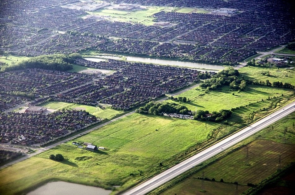
Honestly redundant considering the way suburban houses are still designed to this day in many parts of North America:

1593901933411.png

You don't need metaphorical diagrams when the streetfront shows what's the priority!

And doady's Snout House thread: https://urbantoronto.ca/forum/threads/snout-houses.30128/
 
car_congestion_final.0.jpg


How to end traffic
European cities offer a roadmap for life with fewer cars

From link.

...the average auto commuter spends an extra 54 hours in his or her car every year on top of the time it should actually take to get to the office.

If you live in a city like Los Angeles, San Francisco, or New York, that figure doubles. In Los Angeles, for example, commuters spend 119 hours each year delayed in their cars—that’s almost three full weeks spent idling. Sure, there are podcasts, and catching up on phone calls, and dozens of other tips and tricks for convincing yourself it isn’t a waste of time, but the truth is that if the 128 million Americans who drive to work only spent one extra week in their cars every year, that would mean, collectively, that we waste nearly 2.5 million years annually stuck in traffic...

...It can be easier to imagine European cities car-free because for so much of their histories—whether they are 300 or 3,000 years old—they were. Streets evolved as pedestrian thoroughfares, and cars still seem like interlopers. If you are a city with actual medieval walls, like York in the U.K.—a pioneer in pedestrianizing its old city—those walls can offer easy templates for vehicular “no-go” zones. This is true in large cities, too, such as London and Madrid. It’s no coincidence that the Madrid Central plan, which keeps older vehicles out of the center of Spain’s largest metropolis, covers the 1.8 square miles once surrounded by the ancient city walls or that London’s Ultra Low Emission Zone is rolling out in the densest and oldest part of that city...

...While American cities can seem new when compared to European counterparts, every major U.S. city—with the exception of Las Vegas—was founded before the introduction of the automobile. Although many have grown up so symbiotically with cars that it seems impossible to disentangle motor vehicles from the urban framework, urban planning in America is rooted in pre-car, mostly European models.

New York, for example, didn’t extend much beyond Chambers Street (a mile from Manhattan’s southern tip) until after 1810. As recently as 1850, most of Boston remained within walking distance of Boston Common. Even by the time of the 1893 World’s Columbian Exposition—the first public introduction of the automobile in the U.S.—when Chicago was growing rapidly, street cars and pedestrian thoroughfares linked its neighborhoods.

Today, those three cities—along with Washington, D.C., and Los Angeles—are the most congested in America. Each has made (sometimes token) efforts toward improving traffic, but there’s a lot more work to be done...

car_congestion_spot.jpg


...On the streets of Amsterdam, bikes whizz by and walkers step blithely in front of cars (often with no demarcated crosswalk in sight). In America, we privilege automobiles to the point that pedestrians and cyclists are often considered at best secondary to urban design and at worst a nuisance. In Amsterdam, where biking is booming and multimodal transit is the norm, it’s the reverse, and I spent too many minutes at intersections waiting for some signal that it was my turn to cross. In many instances, it was always my time to cross. As an American pedestrian who expects traffic to be more segmented, it took time to get used to the fact that roads are designed to be shared. It was hard to return to the States and be shunted to the sidewalk—and I’m fortunate to live where sidewalks are the norm. In many American communities, like Austin or Atlanta, cars are so much the default that there’s little or no sidewalk at all.

This type of shared street is known in Dutch as a woonerf, which literally means “residential area” but is better translated from an urbanist perspective as “living street.” In areas that have been woonerf-ized, bikes, pedestrians, and cars intermingle without barriers. In the Netherlands and Belgium, this is frequently accomplished by having cars share the same space—at the same grade—with the pedestrians and bikers that often greatly outnumber autos. Visiting Haarlem, the city just outside Amsterdam that’s famous as the home of painter Frans Hals and for lending its name to the neighborhood in New York City, we found this type of street sharing is the norm. In the city’s core there are no sidewalks at all: pedestrians, bikes, and cars simply share the street. Forced to drive at safe speeds, cars and trucks become the exception for getting around, used for deliveries and hauling cargo, not shuttling single individuals—unlike in the United States, where “74 percent of [commuting car] trips are individuals driving alone.”

Some American cities are embracing the woonerf, but too often in the most timid manner possible. In Boston, a planned development of 18 homes and 70 apartments will incorporate living streets—but also include a massive parking garage. In Los Angeles, the Isla Connections will do better, with 54 one-bedrooms for the formerly homeless built around woonerf-ed streets, but for this type of street calming to work, it needs to be brought into larger neighborhoods.

San Francisco’s recent decision to ban cars for 1.7 miles of Market Street is a good start. The street will become the exclusive domain of buses, streetcars, bikes, pedestrians, and the occasional taxi. Uber—the headquarters of which lie just outside the new car-free street—and Lyft will only be able to operate on side streets. Manhattan’s 14th Street Busway remains a work in progress, but points toward the possibility that larger swaths of that city could begin to privilege people over cars...

...When Oslo, Norway, faced pushback for a congestion-pricing scheme, the city decided to take another approach: limit parking instead of limiting cars. In Copenhagen, often seen as Europe’s most walkable city, the government eliminated 2 to 3 percent of its parking spaces per year between 1986 and 1996, for a total of about 600 spaces over the decade. This could be a viable solution in New York, as Benjamin Kabak has argued for Curbed, and getting rid of free street parking would free up 500 million square feet of public space (though I would suggest that combined with New York’s already robust public transit system, the elimination of parking could happen in Manhattan at a much faster clip).

One advantage of many European cities is that the older the streets, the less hospitable they are for parking in the first place. On many of Padua’s ancient streets, narrow spaces accommodate one or two cars maximum—or often no vehicles at all.

By contrast, too many American municipalities enforce parking minimums, the ordinances that often “require private businesses and residences to provide at least a certain number of off-street parking spaces.” These should be eliminated entirely, and instead a sensible parking plan could follow European models: In Amsterdam, for example, the amount of parking is based on walking distance to nearby public transit stops. In Hamburg, Germany, no new parking is permitted in the central business district, and in Barcelona, all revenues from street parking go toward the city’s bike-share program...
 
Ontario Nature is running a campaign opposing some of the Planning Changes being pushed by the Ford gov't.

They have deemed several changes to be pro-sprawl and to put endangered species at risk.

Read up on it here, and if you concur, support the campaign (email)

 
So heres a fun one.

City of Hamilton has a few developers applying to expand the urban boundary under the changes to the Growth Plan and Planning Act that the Ford Government has made. The changes allow up to 40 hectares of land to be added to the urban boundary outside of the typical Municipal Comprehensive Review process - which takes years and is lead by the municipality to determine land needs to accommodate projected growth.

Thing is, the land they want to add to the urban boundary is 120 hectares. So they are simply applying for 3 separate applications!

The location is an odd one, north of the airport, as it is currently completely surrounded by the urban area. So it does sort of make sense to just fill it in. Under the current planning regulations, it would end up as farmland surrounded by housing and industry.

But still. If the act sets a limit of 40 hectares, I feel like you shouldn't be able to just apply for 3 applications to add more than that.

 
Is there a map? I can visualize something happening along Twenty Road.

I'm not inherently opposed to Hamilton sprawling densely around the airport, it always felt inevitable one day, though as you said, ideally planned and municipally-led, and hopefully coinciding with LRT expansion on the mountain.

Hamilton still has a lot of redevelopment potential downtown and on the mountain already. Adding land to the urban boundary shouldn't be a priority for the region.


It's the larger of the two "holes" in the urban boundary on the south side of Twenty Road.

I fully expect the three holes to get filled in at the next city-led urban boundary expansion anyway, so I guess it's not that big of a deal, but it still feels like circumventing the rules a bit.

This one isn't as bad as the one in Pickering though where the developer managed to convince council to ask for an MZO to add 4,000 hectares to the urban area for a new city of 60,000 people along the 407 extension. That one is just pure stupidity where a developer has won over a council with some flashy renderings.

 
Some good news from out west:

Edmonton’s New Parking Rule Is an Urban Planner’s Dream
For the first time, a major Canadian city won’t require space for cars on any property.
By: Ashley Salvador
July 24, 2020
Like almost every municipality in North America for the past fifty years, Edmonton has told businesses, developers and landowners how much parking they must provide on their property. Want to build a neighborhood café? You’ll need one parking space per 50 square feet. How about a housing development for seniors? That’ll be one space per unit. A go-kart track? Two spaces per cart. A bowling alley may require up to five spaces per lane. Parking minimums, as these policies are called, are premised on a seemingly rational theory: if businesses and residences don’t give people somewhere to put their cars, parking chaos will surely ensue.
Last month, however, Edmonton implemented a radical rule change: going forward, other than mandatory accessible spaces, no property would be required to provide any parking whatsoever.
The rule change made Edmonton the first major Canadian city to eliminate off-street parking minimums citywide. As an urban planning tweak, the move may seem arcane. But Edmonton’s policy change is a very big deal — a radical rejoinder to the notion that cities need ample parking. Its results will be closely watched by officials across the continent.
This is because, in general, parking minimums do a poor job of estimating parking demand. They’re a top-down policy tool that doesn’t accurately account for individual circumstances. Does the camping gear retailer whose customers mostly arrive on mountain bikes need as many parking spaces as the furniture store? According to parking minimum rules, it very well might. Rather than letting property owners decide how much or how little parking they need based on their context, location, or target market, parking minimums forcibly decide for them. This type of inefficiency comes at a significant cost.
 
Probbaly unlikely that a developer would severely underestimate commercial parking requirements as that would impact their ability to find a tenant (ie if the camping gear store goes bankrupt and a supermarket or fitness centre moves in).
On the other hand, if the commercial space is strata-titled (condominiumized) then they may underestimate parking and tell unit purchasers that parking is not available (the developer will sell the units and get out since it doesn't have an interest in the long term viability of the space).
 
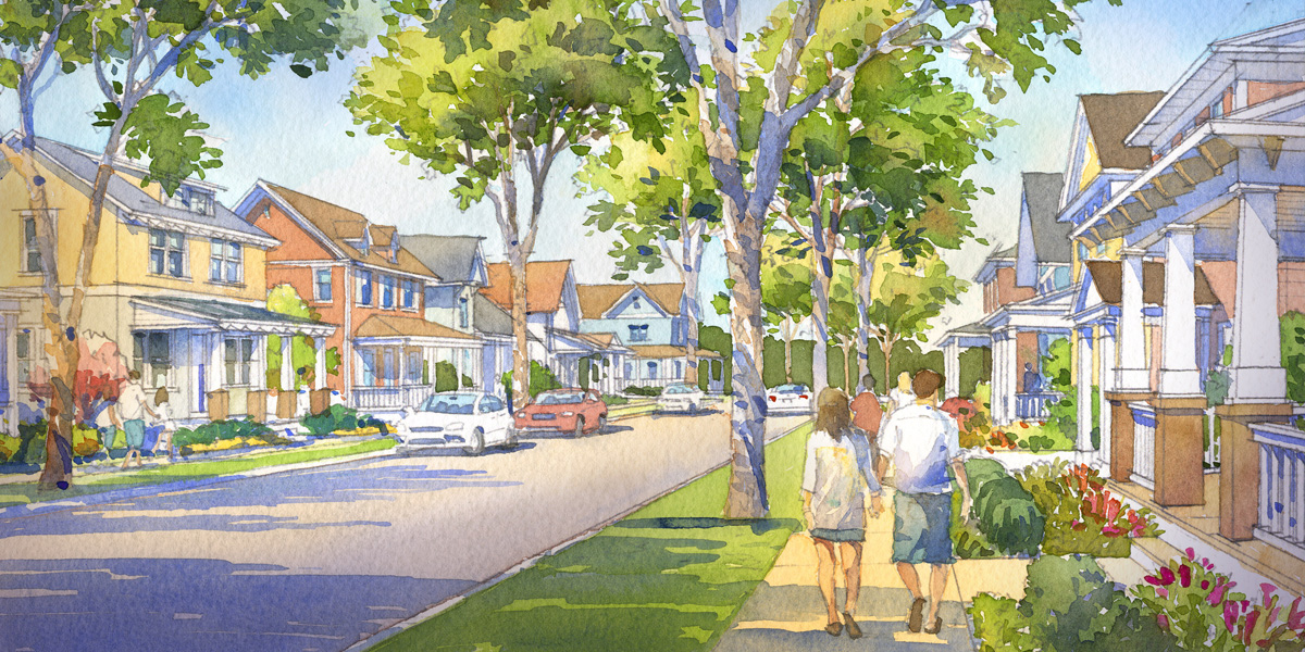
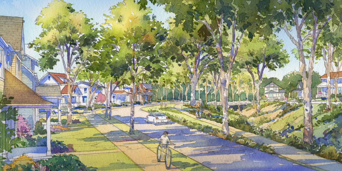
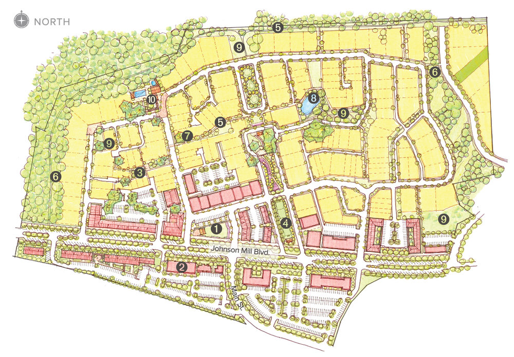
Any thoughts on Johnson Square as an alternate model of suburban growth?

JohnSq-T4.jpg
JohnSq-T3.jpg

image-asset.jpeg


Unfortunately still remotely situated, but I can see this community able to sustain a bus stop along Johnson Mills Bvld.
ISzjhmnp8a98gz0000000000.webp

 
Last edited:
I find it interesting that Springdale, AR is having a New Urbanist neighbourhood.

Arkansas (excluding Little Rock, which has an operating heritage streetcar system) is a state not exactly known for socially progressive urban planning, despite being home to Bill Clinton.
 
Last edited:

Back
Top